 Hiking
Peekaboo Trail
Hiking
Peekaboo Trail
Needles District
Overview
I think the Peekaboo Trail is a work of art. The trail goes from Loop A at the campground to Peekaboo Trailhead in Salt Creek over about 5.4 miles one way. The entire trail is excellent, but the section between Lost Canyon and Salt Creek, to my eye, is elegant, exposed, improbable, and spectacular. One of the nicest sections of trail I've hiked.
Given the exposure, minor scrambling obstacles, and extensive cairn following, this is probably not a great choice for beginner hikers or those with a fear of heights. I would recommend it for those with at least a little desert experience, especially the section from Lost Canyon to Peekaboo Trailhead.
Visiting Options:
Most do this as an out-and-back from the campground trailhead to the Peekaboo trailhead, then back. Doing it as an out-and-back is a fairly strenuous 10.5 to 11-ish mile hike with a fair bit of elevation change. There are several rock art sites about a mile up Salt Creek from Peekaboo. If visiting these as well, the round trip distance becomes 13+ miles round trip. A long day for most.
If you have a high-clearance four-wheel drive and a Peekaboo/Horse Canyon permit (https://www.nps.gov/cany/planyourvisit/dayusepermits.htm) from NPS, you can start at the Peekaboo Trailhead and go as far as you want, returning the same way. This allows you to visit the most dramatic section of the trail without having to do the whole thing and provides easier access to the rock art just upstream from the Peekaboo Trailhead.
On our visit, we camped in the campground, reserved a permit to drive to Peekaboo Trailhead and started there. We checked out the rock art near Peekaboo and hiked back to the campground in a leisurely 4.5 hours, and then I walked back to Peekaboo Trailhead to get the car. This allowed me to do the trail twice and the less motivated members of the group to do it once. It worked great. At a fairly fast pace, it took me a bit under 2 hours to walk the trail back to Peekaboo from the campground.
Since most will hike this from the campground, that is what is described below, but you can start at Peekaboo Trailhead if you have a permit and high-clearance four-wheel drive.
Getting There
The two closest towns to the Needles District are Monticello and Moab. Monticello is closer, but Moab is larger and has more services.
From Moab to the Visitor Center - Total Drive Time: Approx. 1 hour 15 minutes and ~75 miles from Moab
- From Moab, head South on US-191 S (Main Street).
- Stay on US-191 S for 39.6 miles. Keep an eye out for the junction with UT-211.
- Turn Right onto UT-211 W. This is the scenic road that leads directly into the Canyonlands area.
- Follow UT-211 W for 34.4 miles.
- As you approach the park entrance, follow the signs and turn Right into the Needles Visitor Center parking area.
From Monticello to the Visitor Center - Total Drive Time: Approx. 1 hour and ~50 miles
- Head North on US-191 N (Main Street) toward Moab.
- Follow US-191 N for 14.4 miles.
- Turn Left onto UT-211 W. You’ll see signs for Canyonlands National Park.
- Stay on UT-211 W for 34.4 miles.
- As you approach the park entrance, follow the signs and turn Right into the Needles Visitor Center parking area.
If starting at Campground Loop A Trailhead - From the Visitor Center
- Head into the park on the main road.
- Drive for 2.8 miles to the signed junction for the Campground/Elephant Hill.
- Go left, then left again in a short distance toward Campground Loop A.
- Drive about a mile to the trailhead on the left. This is just before the end of the Loop A Campground. There is a pit toilet at the trailhead.
If DRIVING to Peekaboo with a permit - From the Visitor Center
- Head into the park on the main road.
- Drive for 0.7 miles, then turn Left onto Wooden Shoe Loop (County Rd 1301).
- Follow the road for about 0.7 miles, then bear Left at the fork (following signs for Cave Spring).
- Continue 0.8 miles to a final junction and turn right signed Salt Creek. The traihead and gate is s short distance.
- Once through the gate, continue up Salt Creek for about 2.2 miles to a signed junction with Horse Canyon on the left, and Salt Creek on the right. Go right.
- Follow the Salt Creek road to its end in about 1.1 miles. The Peekaboo Trailhead is on the right and signed.
Route Description
Rock art and historic sites are fragile, non-renewable cultural resources that, once damaged, can never be replaced. To ensure they are protected, please:
- Avoid Touching the Petroglyphs: Look and observe, BUT DO NOT TOUCH!
- Stay on the Trails: Stay on the most used trails when visiting sites, and don't create new trails or trample vegetation.
- Photography and Sketching is Allowed: Do not introduce any foreign substance to enhance the carved and pecked images for photographic or drawing purposes. Altering, defacing, or damaging the petroglyphs is against the law -- even if the damage is unintentional.
- Pets: Keep pets on a leash and clean up after them.
- Artifacts: If you happen to come across sherds (broken pottery) or lithics (flakes of stone tools), leave them where you see them. Once they are moved or removed, a piece of the past is forever lost.
To Wooden Shoe Canyon (1.1 miles)
From Needles Campground Trailhead A (which is in Loop A of the campground), follow the trail just a minute or two to where it splits. Be sure you take the trail to Peekaboo (left). You don't want to take the right toward Big Spring Canyon!
The trail is well-cairned on slickrock sections, but do keep an eye out. It is 1.1 miles to Wooden Shoe Canyon and a junction. Go left at the junction toward Lost Canyon.
To Lost Canyon (1.5 miles from Wooden Shoe)
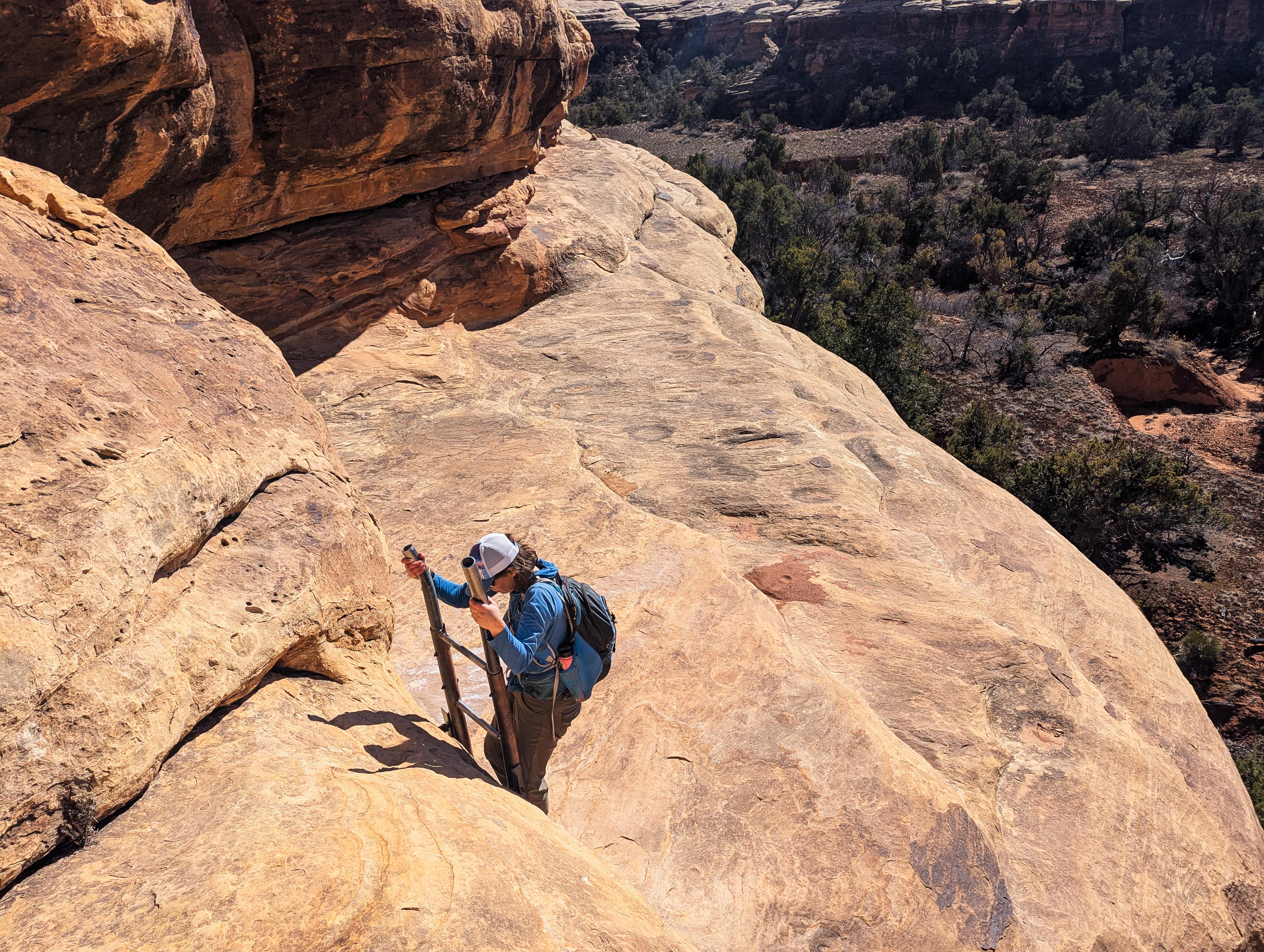
The trail heads up toward a slickrock pass. This is the pass to Lost Canyon. Follow cairns up to the pass, then down and left along slickrock to the first ladder. This short vertical ladder allows you to descend from the slickrock to the bottom of a tributary of Lost Canyon.
Follow the tributary down to Lost Canyon and a junction. Be sure to continue left from the Lost Canyon/Peekaboo Junction toward Peekaboo.
To Peekaboo (2.4 miles from Lost Canyon)
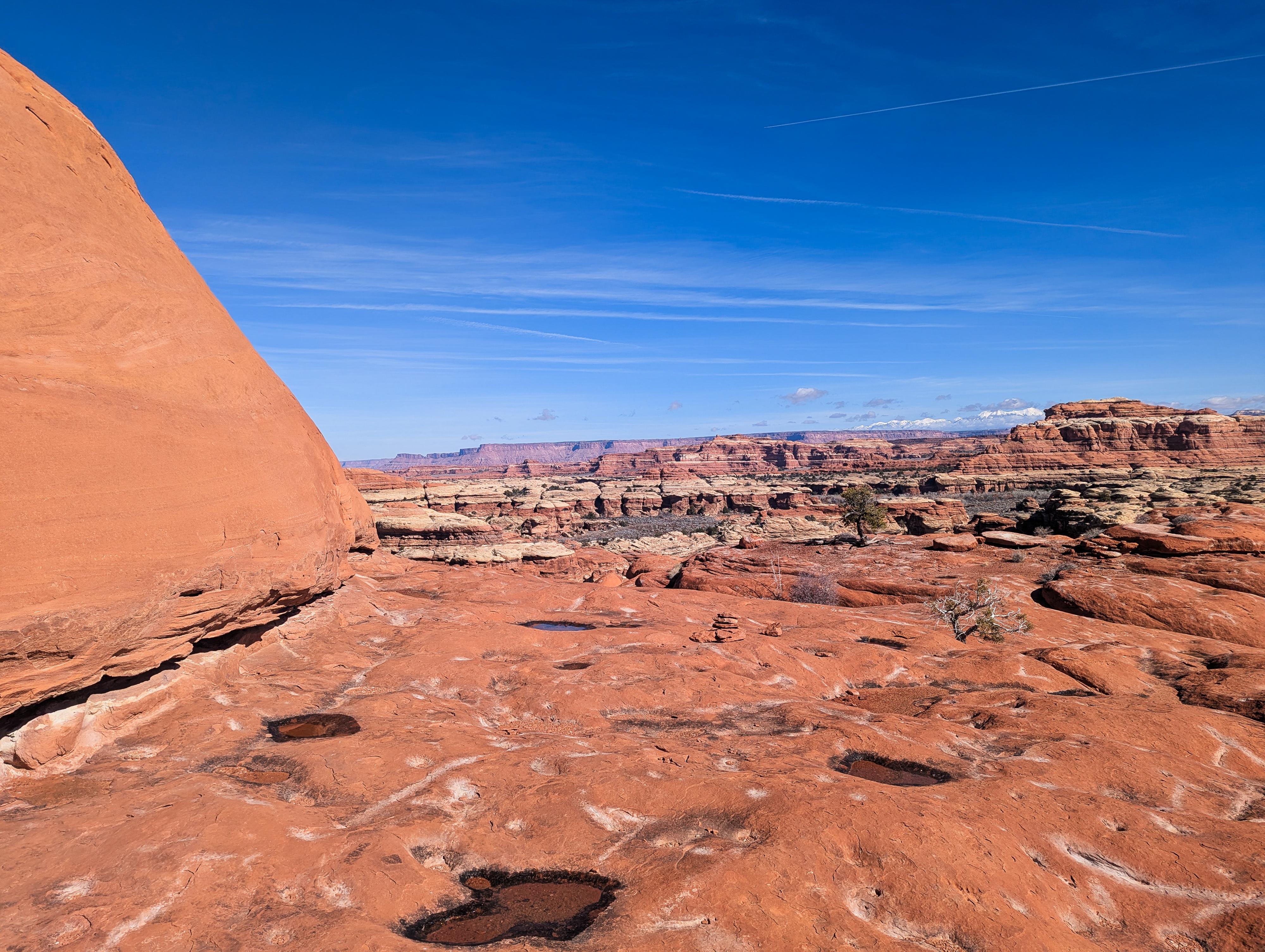
The trail climbs fairly steeply out of Lost Canyon to slickrock, then up slickrock, gaining views and elevation. This section requires a close eye for cairns to keep on track.
Once up high, the trail begins a high traverse, mostly staying on the white layer for the first two side canyons it traverses above, then bumping up to the red layer with even more exposure and bigger views.
On the red layer, the first corner is probably the most exposed of the hike. It is easy but exposed. Be sure you see cairns and are careful. The next corner, farther on, has a small window you go through before the trail follows a ridge back down to the white layer.
The trail soon comes to a second, taller ladder in a narrow crack. It looks a bit intimidating, but is easy enough!
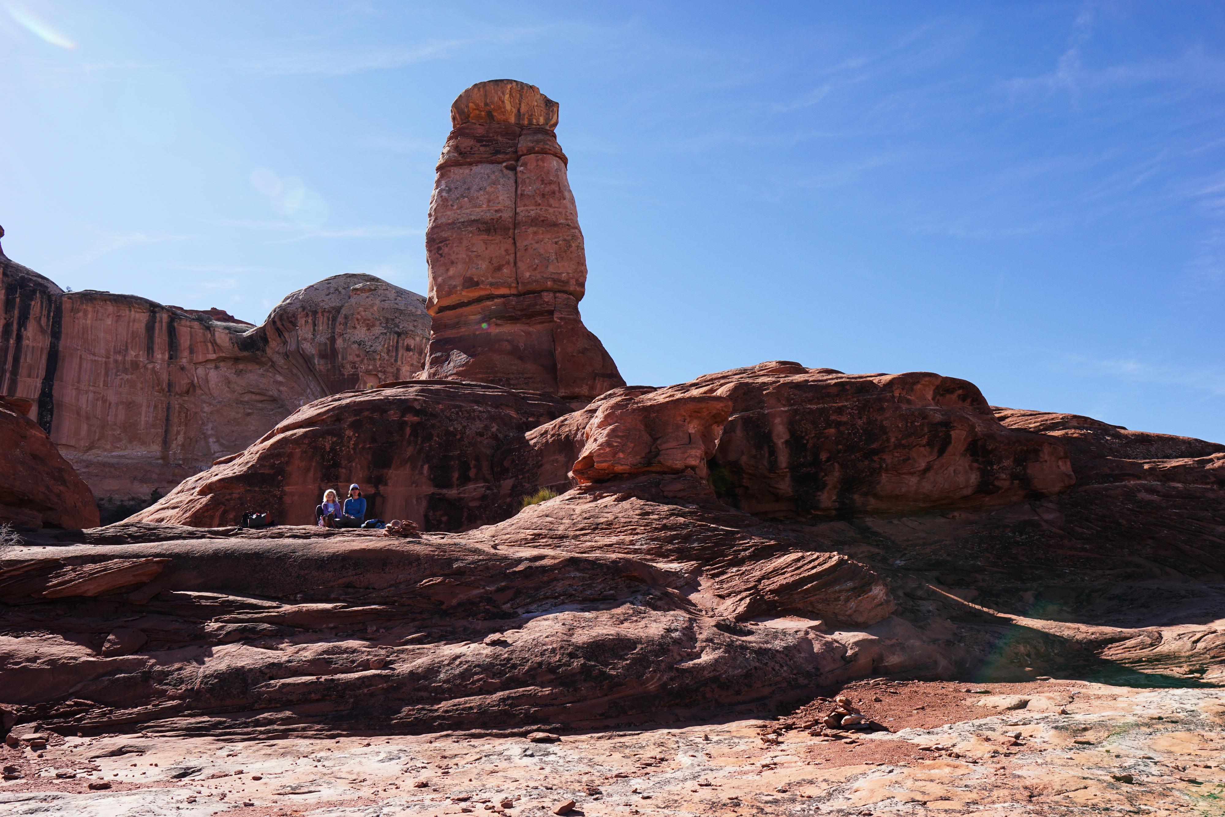
Down the steep ladder, the trail becomes dirt and traverses south to the window above the Peekaboo Trailhead. There is an excellent pictograph panel at the window. If you are doing the hike as an out-and-back from the campground, this is a good spot to turn around.
Peekaboo Area Rock Art (2-ish miles round trip)
In addition to the exceptional panel at the window, there are several more panels less than a mile up Salt Creek from the window.
From the window, hike up Salt Creek. There is generally a pretty good social trail. On our trip, it seemed easiest to be at the bottom of the wash rather than try to cut corners.
Shield Petroglyph
About 1/3 of a mile up from the window, a side canyon comes in on the right; stay left in the main canyon. A few minutes up from this confluence, there is a petroglyph high on the right. It is in the shape of a shield and visible from the wash bottom with a close eye.
Large Pictograph Site
Continue hiking up Salt Creek; just a few minutes up from the confluence, you will notice a steep, short side drainage coming in on the right. On the downstream side of that drainage is a beautiful red stripe of varnish coming down. Head to the stripe; there is an excellent pictograph panel right near it. On our visit, there were a few minor social trails heading up there.
Corner Panel
From the pictograph panel, look east across the canyon. There are giant boulders at the base of the cliff, and beyond those, a sandstone corner. There is a small pictograph panel in that corner that you can see easily with binoculars from the red stripe panel or walk over to for a closer look. A good social trail goes by the large boulders to the corner.
Return the same way.
Photos
Videos
Views along the Peekaboo Trail - Needles District - Canyonlands National Park
Maps
12S 604838E 4222418N
38°08'37"N 109°48'13"W
12S 604831E 4222360N
38°08'35"N 109°48'13"W
12S 605613E 4221231N
38°07'58"N 109°47'42"W
12S 606434E 4220345N
38°07'29"N 109°47'08"W
12S 607169E 4220026N
38°07'18"N 109°46'38"W
12S 608007E 4219405N
38°06'58"N 109°46'04"W
12S 608474E 4219498N
38°07'01"N 109°45'45"W
12S 609033E 4219651N
38°07'05"N 109°45'22"W
12S 609083E 4219590N
38°07'03"N 109°45'20"W
12S 608562E 4218893N
38°06'41"N 109°45'42"W
12S 608456E 4218718N
38°06'35"N 109°45'46"W
12S 608898E 4218758N
38°06'36"N 109°45'28"W
12S 609131E 4219247N
38°06'52"N 109°45'18"W
12S 609185E 4219272N
38°06'53"N 109°45'16"W