
 Heughs Canyon
Salt Lake
Overview
One of the things I love about living in Salt Lake City is all of the easy access to hiking. From 10,000+ foot peaks in the canyons to the many trails in the foothills, it seems there is always something new to do to meet my motivation level for the day.
At about 3 miles and a bit over a 1000' of gain, the Heughs Canyon trail is, in my opinion, an excellent length for an after work or early morning hike. The trail starts nondescriptly in a neighborhood and then quickly begins ascending through scrub oak. 15 minutes up the path and you may forget you are only minutes away from a big city!
The hike is charming, with the destination for most being a waterfall that is the perfect place to visit on a hot day. Dogs are allowed in Heughs Canyon, making it a nice outing for the whole family.
Getting There
The designated trailhead is at Wasatch Blvd and Canyon Cove Drive. To reach the trailhead, take exit 5 /4500 South off of I-215 on the east side of the Salt Lake Valley. Go east, toward the mountains, then south on Wasatch Blvd. Follow Wasatch Blvd about 2.7 miles to Canyon Cove Drive. The official trailhead parking area is signed here, just south of Canyon Cove Drive on Wasatch Blvd.
Route Description
To Heughs Canyon Trail (0.4 miles / 15 minutes)
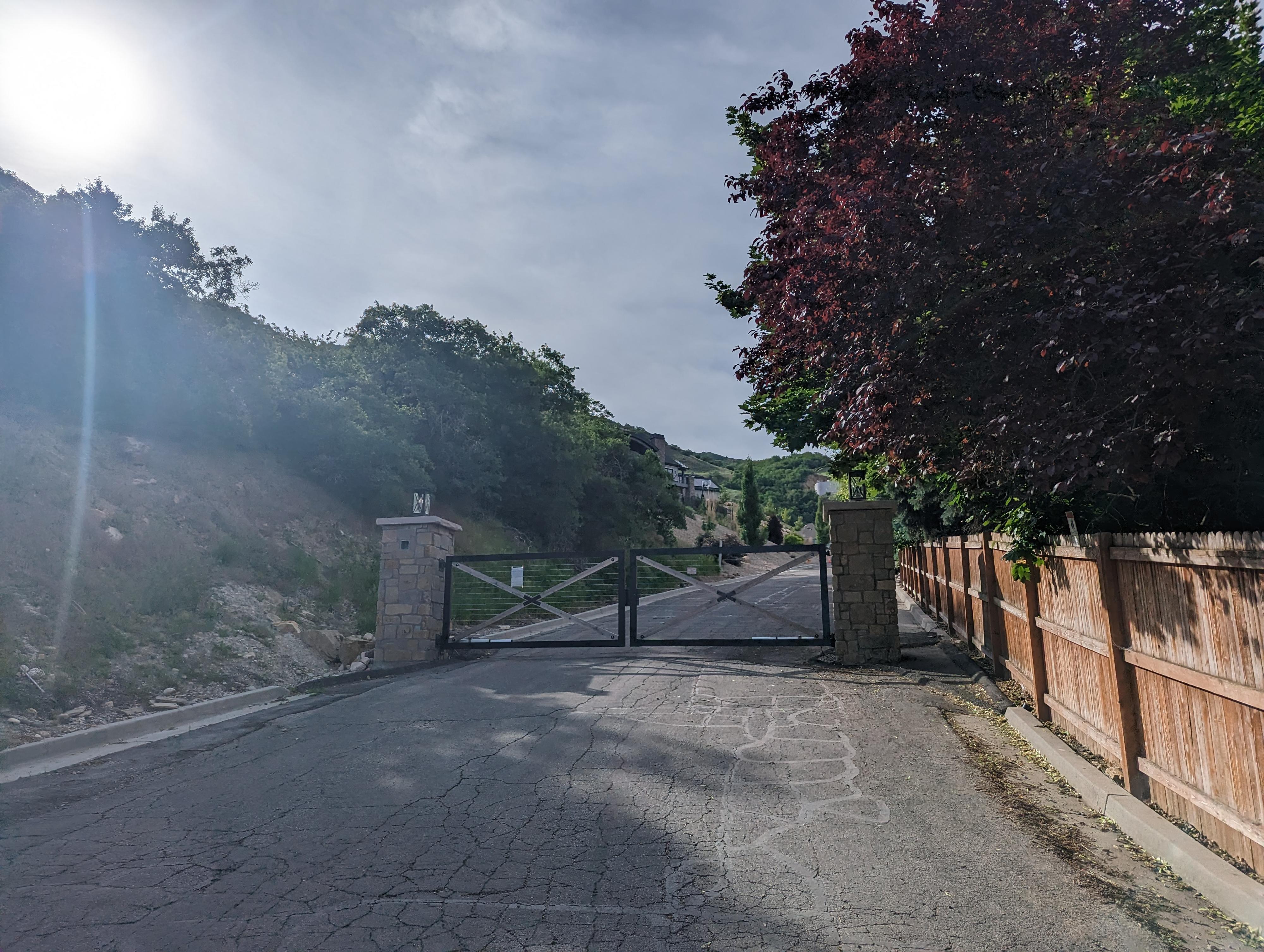
From the trailhead, walk up Canyon Cove Drive, taking the second left onto Oak Canyon Drive. Once on Oak Canyon Drive, take the next right onto Canyon Winds Lane, a private lane that has public access. There is a gate here, but pedestrains are allowed via the open spot on the right. Follow the paved road up past the gate.
At the top of Canyon Winds Lane, the road (as of 2023) turns to a dirt road, then makes a hard left not too far up from pavement. The Heughs Canyon Trail leaves at this left hand turn on the right side of the road. It can be a little hard to notice as it appears to just go to the stream. If you make the left hand curve and are still hiking on the dirt road, you have gone too far.
To Bonneville Jct (0.65 miles)
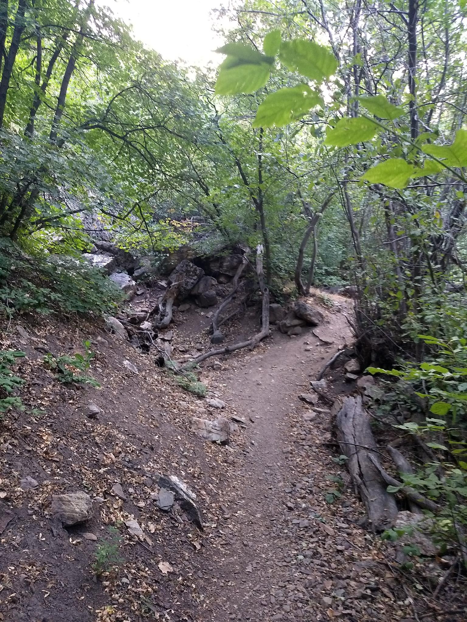
The dirt trail meanders through scrub oak as it climbs Heughs Canyon. It is about 0.7 miles from the start of the dirt trail to a major junction. Left is the relatively newly created Bonneville Shoreline connector. It goes north to the Mount Olympus trail. Stay in the canyon bottom to the right.
To The Falls (0.65 miles)
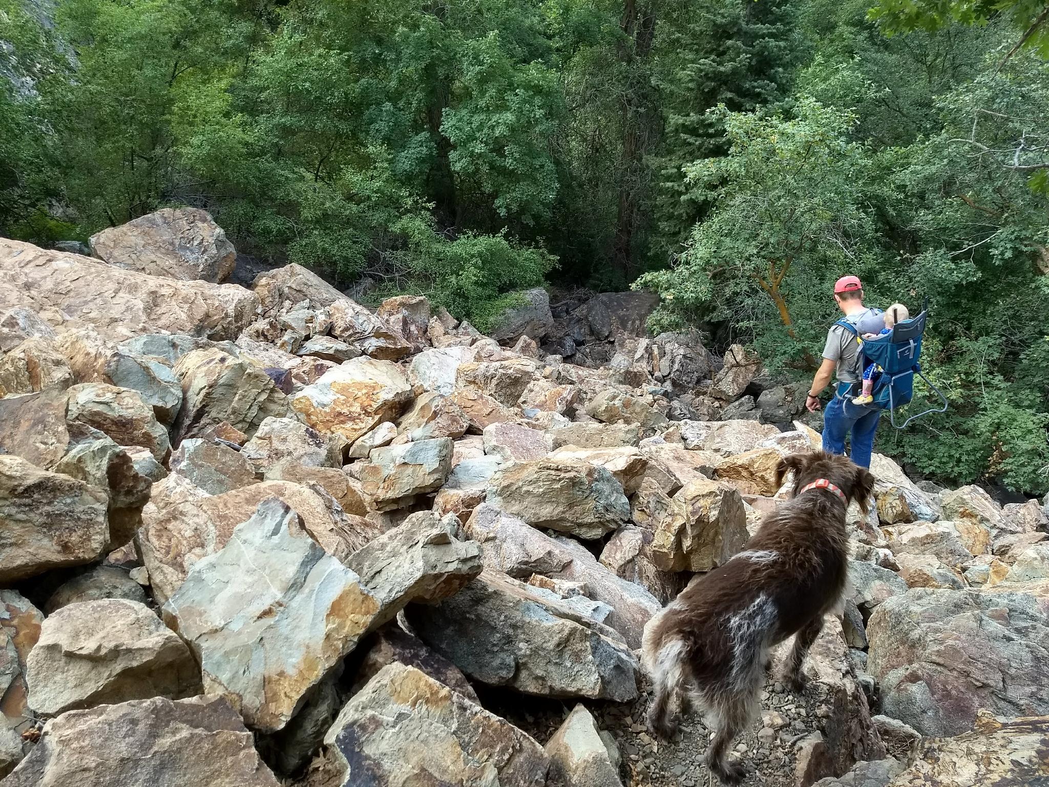
The trail crosses the creek on a primitive log bridge and continues ascending Heughs Canyon. More open views of the quartzite rock outcroppings that make up the area come into view. Keep an eye out about 0.5 miles from the Bonneville Jct for an interesting log structure/camp on the left. Just after the structure, the trail crosses the creek again and makes a quick ascent to a boulder field.
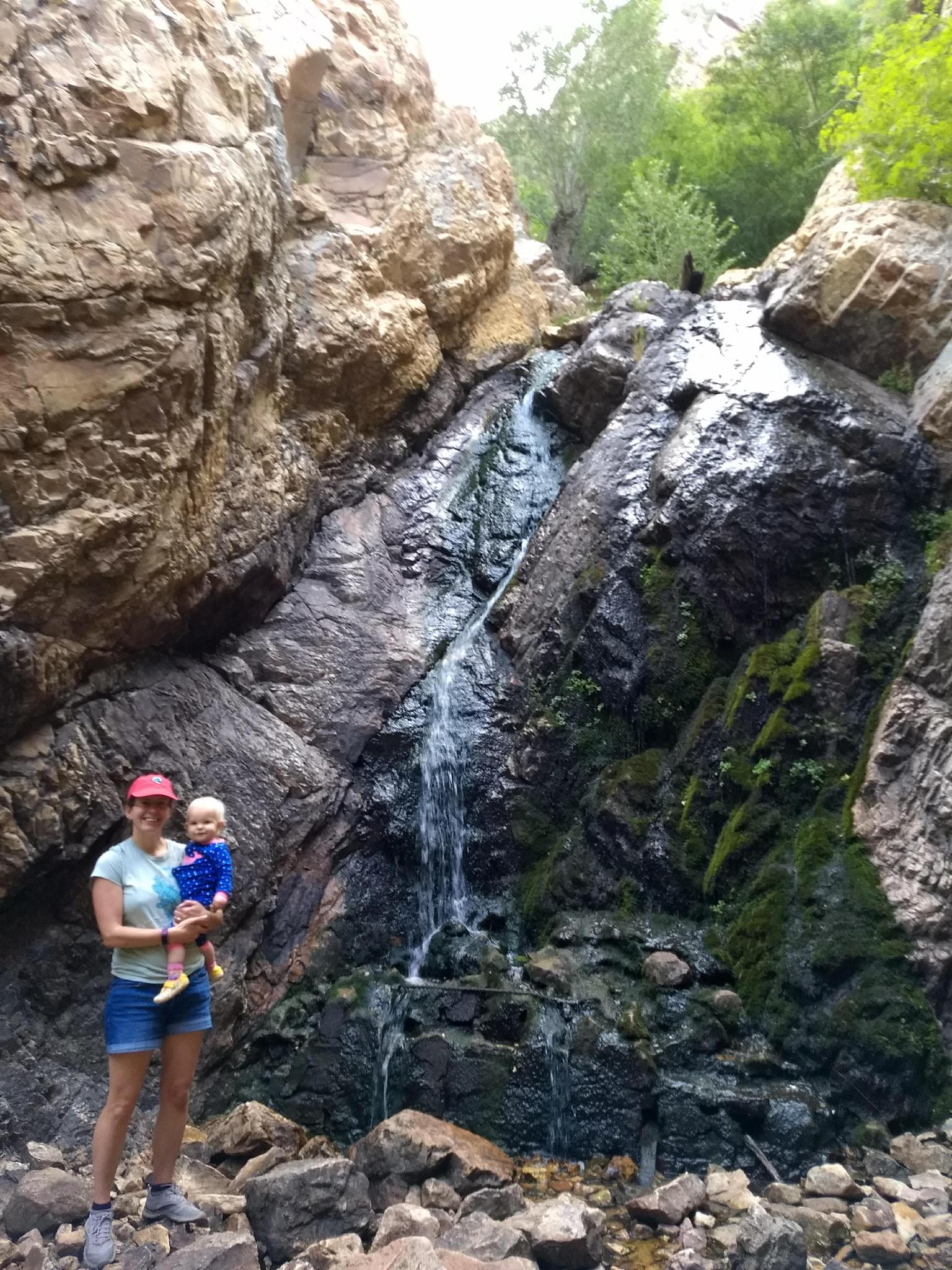
At the boulder field, stay low following cairns across the boulders to the base of a cliff face. Go right at the cliff face a short distance to the bottom of the falls and a cool paradise on a hot day!
Canyoneering Route: The trail continues above the falls by staying high across the boulder field. Follow the path through the boulder field as it crosses it directly. A minute or two after the boulder field, a side trail goes down to the right to a large flat area and campfire ring. Go down here, following a faint social path along the cliff base to the stream.
The first rappel is right below where you enter the stream. A 7 m ( 23 ft. ) rappel leads to a short walk, and second 9 m ( 30 ft. ) rappel over the falls where most visit from below. These rappels can be broken up into two, but be sure to find a solid anchor for the second drop.
I recommend doing both rappels as one, the circling around and cleaning the rope and anchor from above to avoid leaving anything behind.
Photos
Videos

Heughs Canyon Waterfall
Maps

12T 432523E 4498754N
40°38'13"N 111°47'53"W
12T 432867E 4498919N
40°38'18"N 111°47'38"W
12T 433640E 4499207N
40°38'28"N 111°47'05"W
12T 434019E 4499618N
40°38'41"N 111°46'49"W
12T 434060E 4499754N
40°38'46"N 111°46'48"W
12T 434099E 4499747N
40°38'45"N 111°46'46"W