 Hiking
Academy Mill Reservoir
Hiking
Academy Mill Reservoir
Joes Valley
Overview
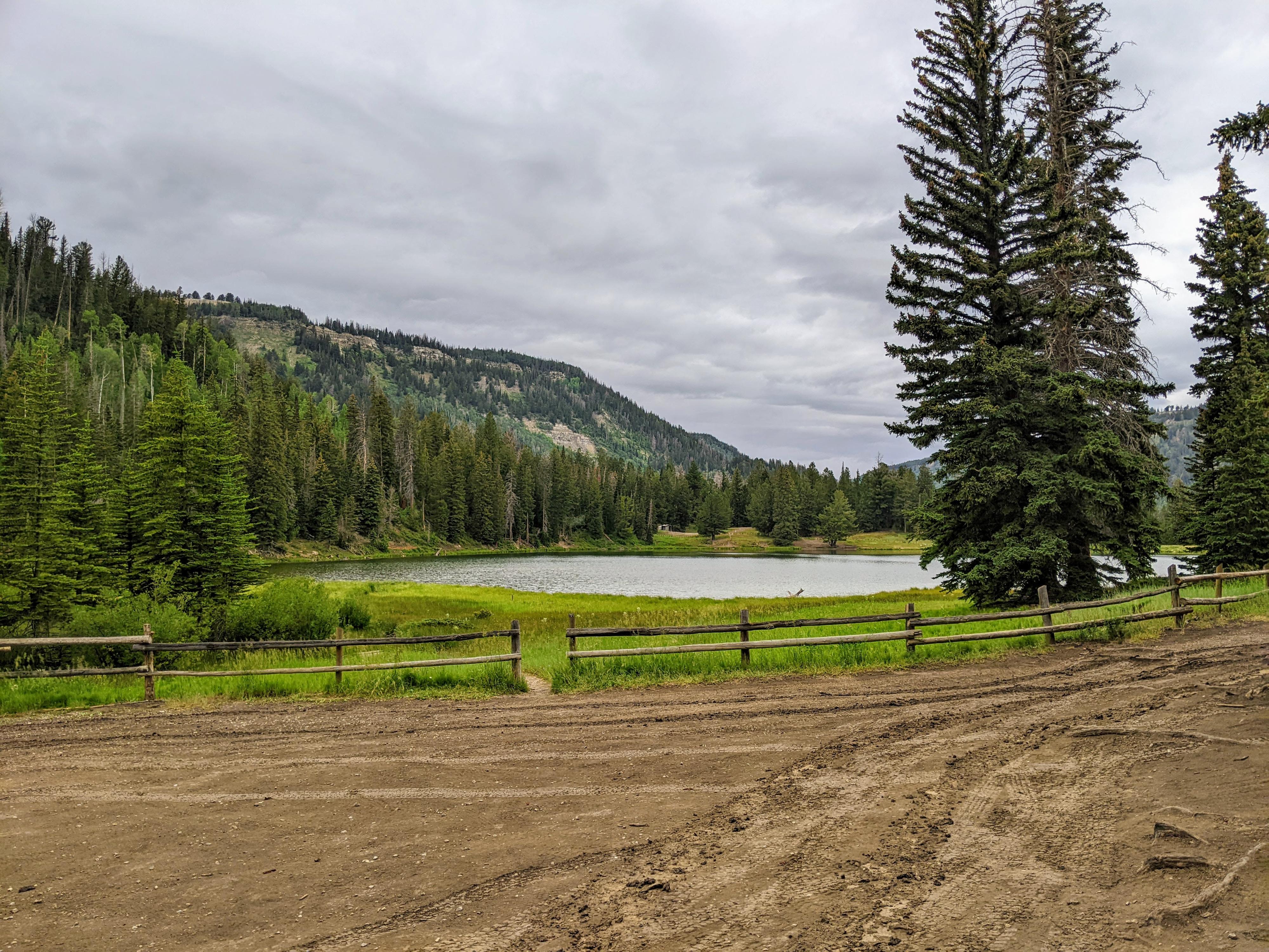
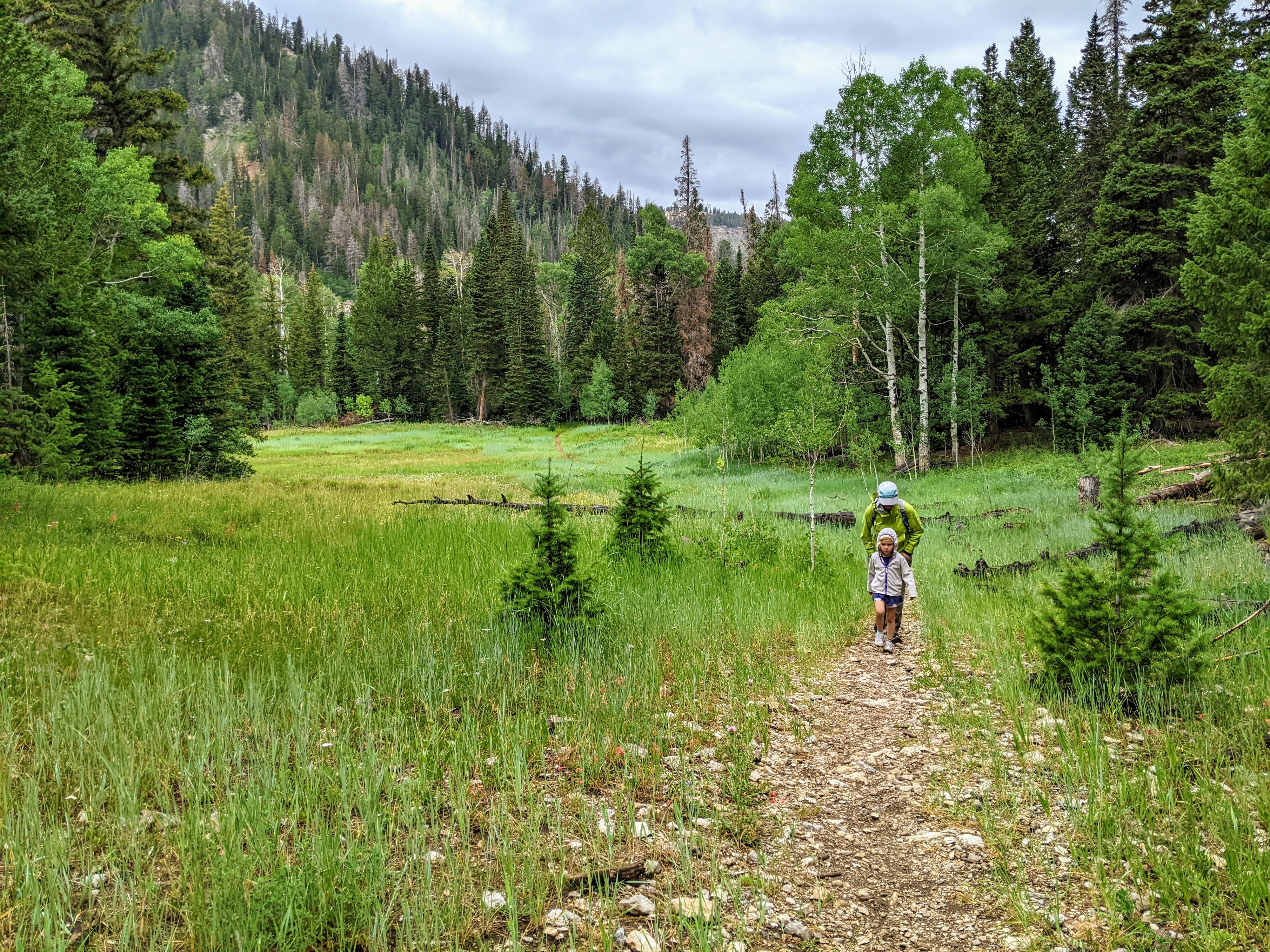
On a rainy summer day, we were looking for a short hike in case the clearing in the sky turned out to be short-lived, which it did. Academy Mill Reservoir turned out to be an absolute gem of a hike! Easy hiking along an old road through idyllic meadows to a crystal clear reservoir. What’s not to love? This makes an excellent short hike to a scenic reservoir. The easy terrain worked great for our 5-year-old, and I enjoyed the scenery along the way as well.
Petes Hole Reservoir, where the hike begins, has several small primitive campsites available. Both Petes Hole Reservoir and Academy Mill Reservoir seemed teaming with fish the day we visited. The reservoir surfaces were awash with ripples from fish jumping. Bring a fishing pole. This would be an excellent place to spend a few hours fishing.
Those with more ambition can continue along the Josephite Point trail, visiting several more lakes along the way before reaching the other end of the trail and Marys Lake. It is about 4.5 miles one way from the trailhead to Josephite Point, and about 7.5 miles one way to Marys Lake.
Getting There
The trailhead is west of Joes Valley Reservoir. On the west side of the reservoir, the paved UT-29 splits. Left goes to Joes Valley Campground and the marina. Stay straight, signed for Ephraim. The road turns to dirt at this junction. Reset your odometer as the road turns to dirt.
Follow this dirt road as it climbs steeply and switchbacks up the hillside. Stay on the main dirt road, there are many smaller roads that leave it and offer excellent primitive camping.
About 4.7 miles from when the road turned to dirt is a major junction. Go left here. The road heads northwest, then makes a sharp turn and heads south before heading west again. 2 miles from the last major junction (6.7 from when the road turned to dirt), is a side road on the left signed Petes Hole. Go left onto this side road. It descends steeply, makes a creek crossing, then climbs up to Petes Hole and the roads end in about 1.8 miles on the southeast side of Petes Hole Reservoir. The trailhead is at the end of the road. .
9 miles from when the road turned to dirt is Rock Creek Falls. There is a small pullout here next to the falls.
Route Description
Navigation is easy on this hike. From the trailhead, follow the well-worn trail that appears to have been an old road. It ambles along through open meadows for about a mile to a junction. Go right at this junction. The trail goes down to Academy Mill Reservoir in about 0.25 miles.
Maps

12S 466744E 4349046N
39°17'25"N 111°23'08"W
12S 467784E 4348518N
39°17'08"N 111°22'25"W
12S 467907E 4348293N
39°17'00"N 111°22'20"W