
 Jurassic National Monument
Price
Overview
Cleveland-Lloyd Dinosaur Quarry is known to have the largest concentration of Jurassic dinosaur fossils ever found. The quarry is located miles down a dirt road in a relatively remote location. I have visited several times and have never seen more than a few other visitors. If you are a dinosaur enthusiast, this is a place you want to visit.
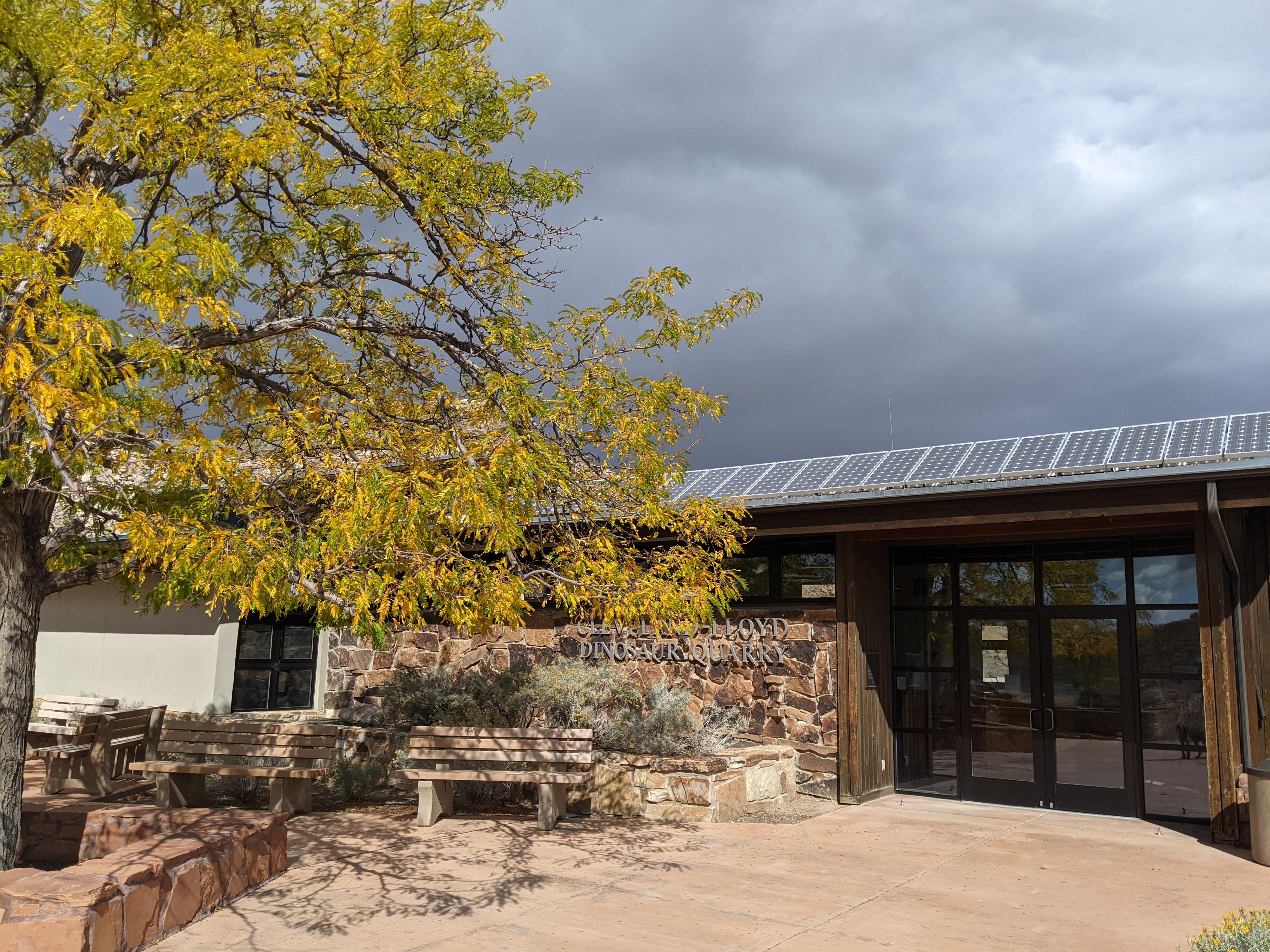
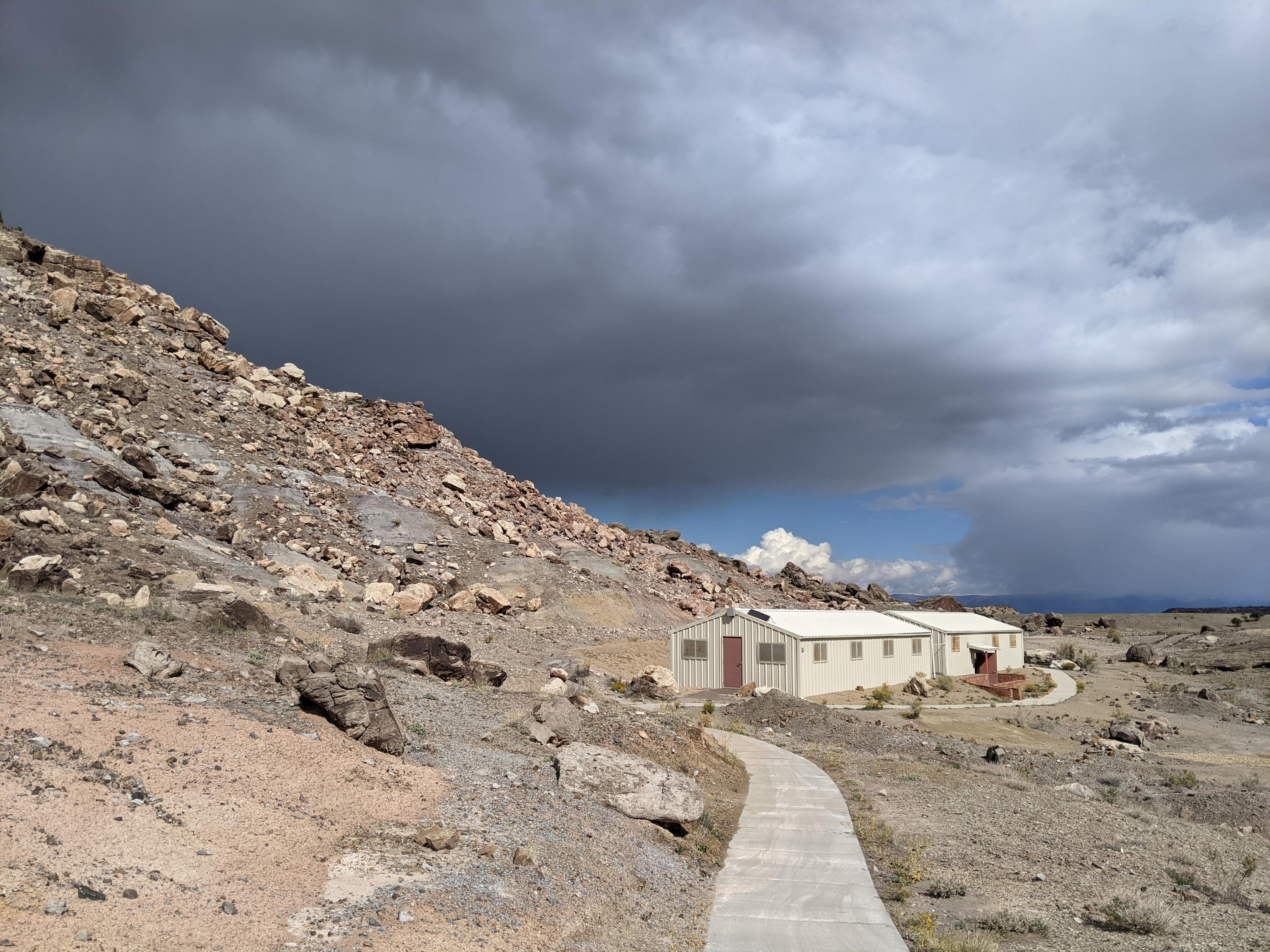
The quarry has a small visitor center that has numerous examples of the types of fossils found at the quarry, and a wealth of information. Near the visitor center are two large metal buildings showing how the quarrying is carried out. Though the visitor center and quarry buildings are interesting, we enjoyed the several hiking trails also available at the quarry as much or more than the exhibits.
In 1965, the area was designated a National Historic Landmark. In 2019, the Cleveland-Lloyd Dinosaur Querry became the Jurassic National Monument.
There is a fee to visit the monument of $5 per adult (in 2021). Kids are free, and a National Park Pass also works for admission. Dogs are allowed on the trails as long as they are on leash.
Getting There
There are many variations to get to Jurassic National Monument. The area is a bit of a maze of county roads. The way described below is signed, but still requires paying a bit of attention as the signs can be small and widely spaced.
From Price, head south on UT-10 toward Huntington. About 10 miles south of Price, turn onto UT-155 signed Cleveland/Elmo. Follow UT-155 for about 2.3 miles to Elmo Road. Turn left onto Elmo Road.
Follow Elmo Road 1.9 miles to the town of Elmo. Once in Elmo, go south on Center Street to Main Street and turn left (east) onto Main Street. About a half mile or so after leaving Elmo, turn right on Desert Lake Drive. The road turns to dirt here but is a good road that should be passable by all vehicles unless very wet. Reset your odometer as you turn off Main Street.
The road heads south, passing the Desert Lake WMA. Though there are many side roads through this section, stay on the main road. It heads south, travels along the west side of the WMA, then turns and heads east. At 3.5 miles a major junction is reached.
Go right (south) at the junction at 3.5 miles, it is signed Jurassic National Monument. Follow the road south 1.5 miles (5 miles total from the paved road) to a junction. Go left here, signed Jurassic National Monument. The road descends off the ridge, and heads through a stark but scenic desert for 5.1 miles to a final junction just before the monument. Go left at this final junction to reach the visitor center in about a mile.
Route Description
The monument has 3 trails:
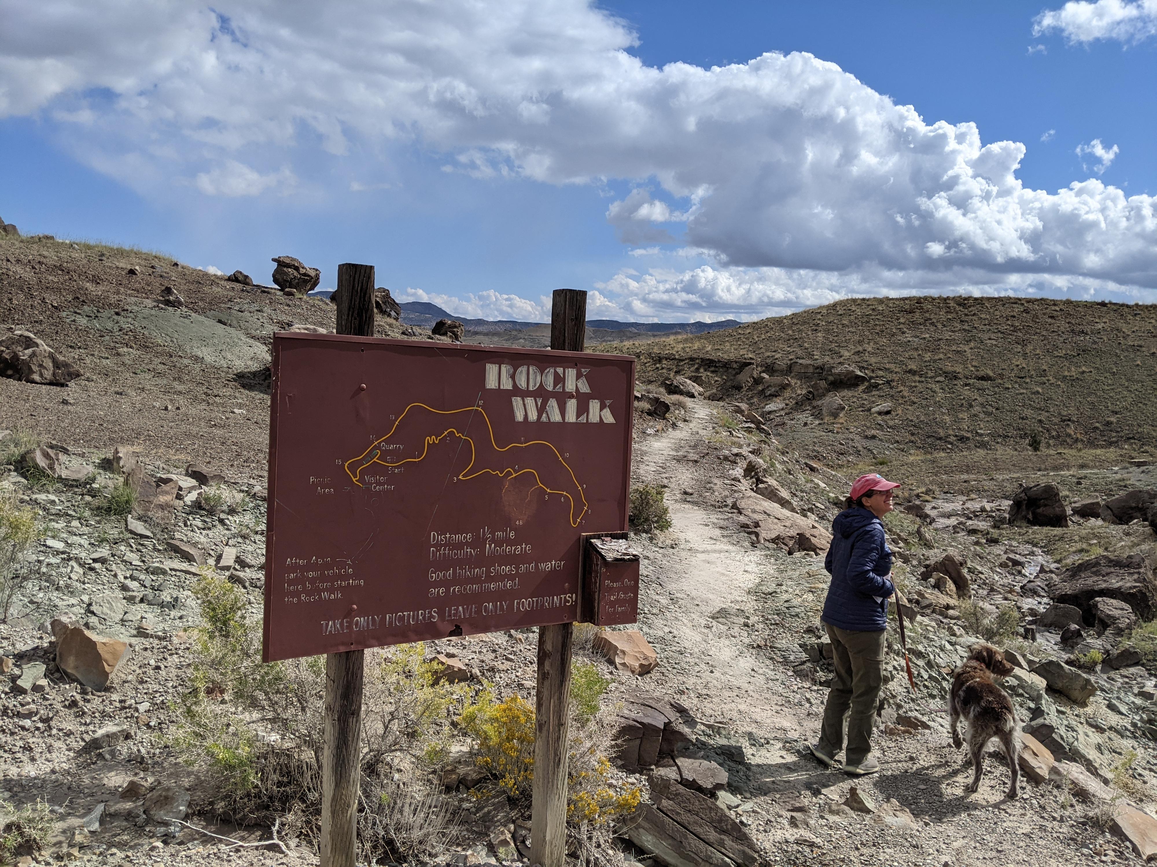
The Rock Walk (about 1.5 miles round trip from the visitor center): This is the closest trail to the visitor center. An informational brochure is available in the visitor center that has information on the numbered signs along this 1.5-mile trail. Of the three trails at the quarry, this was my favorite. The information, views, and ease of the trail made it very enjoyable for the whole family.
Raptor Point (about 1-mile round trip from the visitor center): This trail begins north of the metal quarry buildings and climbs to an overlook over the visitor center and surrounding area. The trail is steep in sections, with an excellent view at the top.
Rim Trail (about 2.6 miles round trip from the visitor center): This trail leaves the Raptor Point trail just before reaching Raptor Point. It is an excellent amble with wide views of the surrounding desert landscape. Because it is the longest of the three, it sees the least number of visitors.
Photos
Maps

12S 526921E 4352647N
39°19'22"N 110°41'16"W
12S 526937E 4352761N
39°19'26"N 110°41'15"W
12S 526820E 4352854N
39°19'29"N 110°41'20"W
12S 526748E 4352871N
39°19'29"N 110°41'23"W