Rock Creek Falls |

Joes Valley

Hiking Rock Creek Falls - Joes ValleyRoadside Attraction Rock Creek Falls - Joes Valley Rock Creek Falls

Joes Valley

Overview

RATING: Roadside Attraction / Short Hike
MAPS: DANISH KNOLL, UT

Wed

Sunny, with a high near 59. West southwest wind around 12 mph.

59 | 35

Thu

A chance of snow showers before noon, then rain showers likely. Partly sunny, with a high near 51. West southwest wind 14 to 22 mph, with gusts as high as 32 mph. Chance of precipitation is 60%.

51 | 33

Fri

Snow showers before noon, then showers and thunderstorms between noon and 3pm, then snow showers and a chance of thunderstorms. Cloudy, with a high near 41. Chance of precipitation is 100%. New snow accumulation of around one inch possible.

41 | 32

Sat

Snow showers likely. Mostly cloudy, with a high near 39. New snow accumulation of 1 to 3 inches possible.

39 | 28

Sun

A chance of snow showers before 3pm, then a chance of rain showers. Mostly sunny, with a high near 45.

45 | 24

View Full Weather Details
SEASON: Late Spring through Fall.
NOTES: The trailhead requires high clearance. This area can quickly become muddy during afternoon thunderstorms and impassable even to 4-whee drive vehicles. Snow and mud can linger into late spring making the road impassable, depending on the year.

Wed

Sunny, with a high near 59. West southwest wind around 12 mph.

59 | 35

Thu

A chance of snow showers before noon, then rain showers likely. Partly sunny, with a high near 51. West southwest wind 14 to 22 mph, with gusts as high as 32 mph. Chance of precipitation is 60%.

51 | 33

Fri

Snow showers before noon, then showers and thunderstorms between noon and 3pm, then snow showers and a chance of thunderstorms. Cloudy, with a high near 41. Chance of precipitation is 100%. New snow accumulation of around one inch possible.

41 | 32

Sat

Snow showers likely. Mostly cloudy, with a high near 39. New snow accumulation of 1 to 3 inches possible.

39 | 28

Sun

A chance of snow showers before 3pm, then a chance of rain showers. Mostly sunny, with a high near 45.

45 | 24

View Full Weather Details
Rock Creek Falls

Rock Creek Falls

While camping in Upper Joe’s Valley, we saw a forest service sign with a map of the area that had points of interest marked on it. Rock Creek Falls was one of those points. Having not heard of Rock Creek Falls, it piqued my interested and it proved irresistible. We visited on a stormy Saturday in the summer.

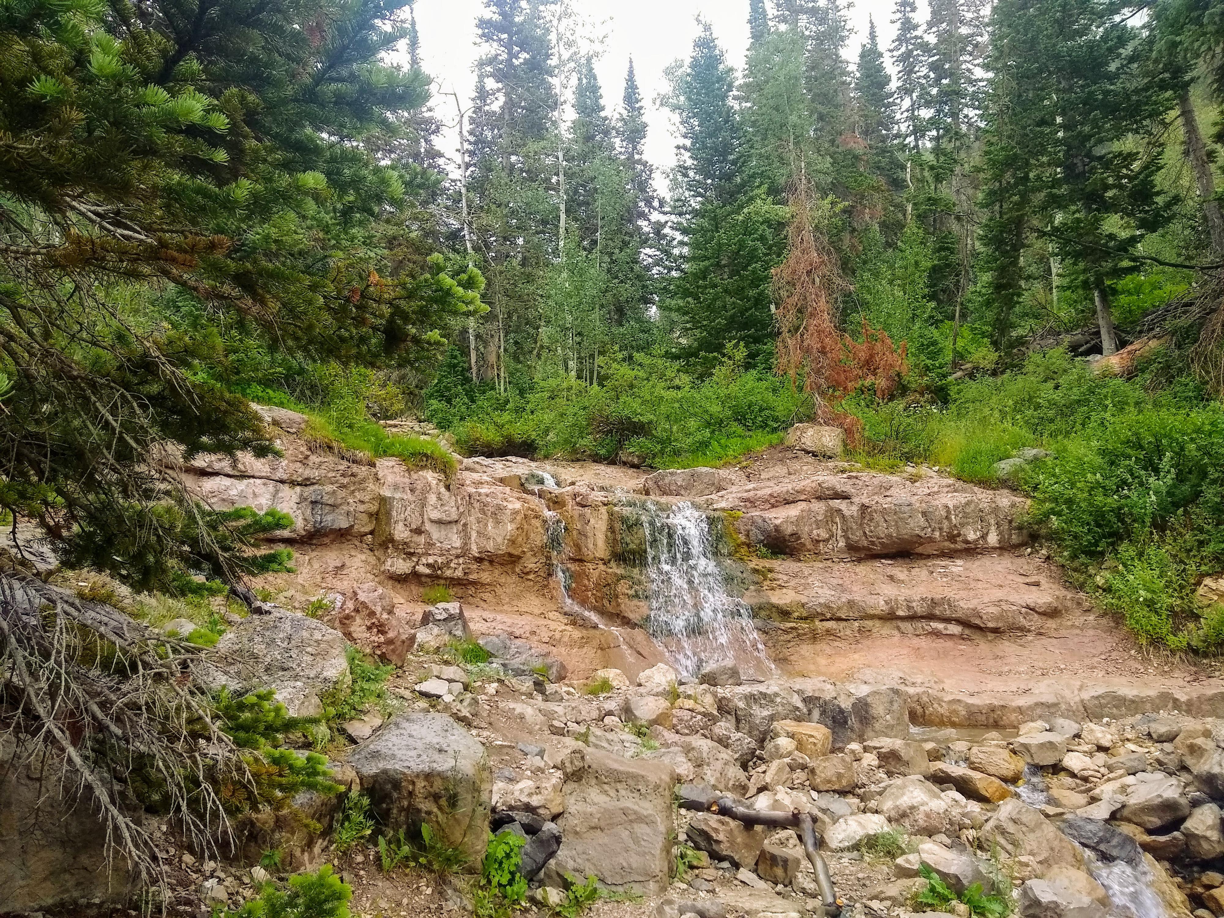
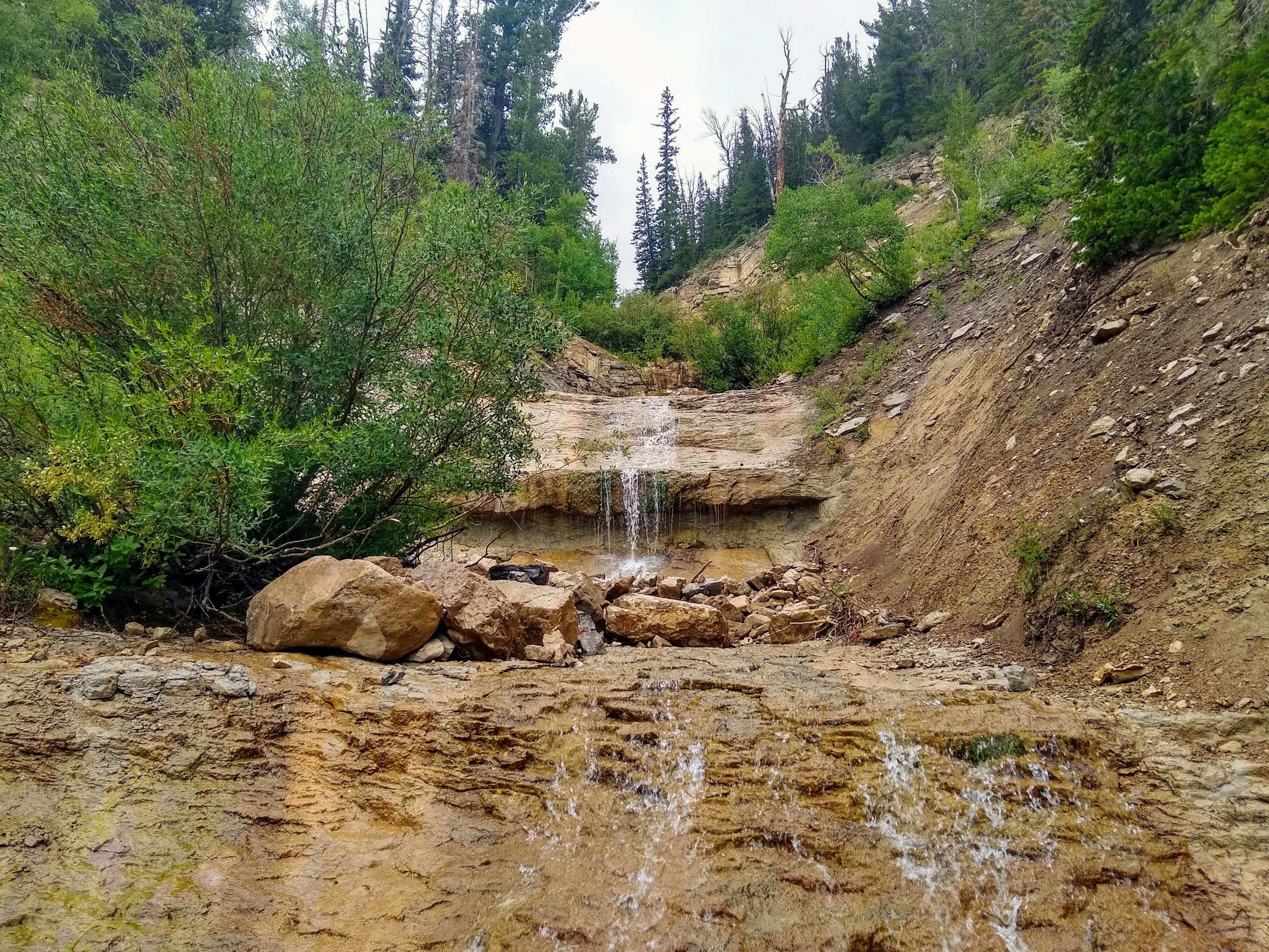
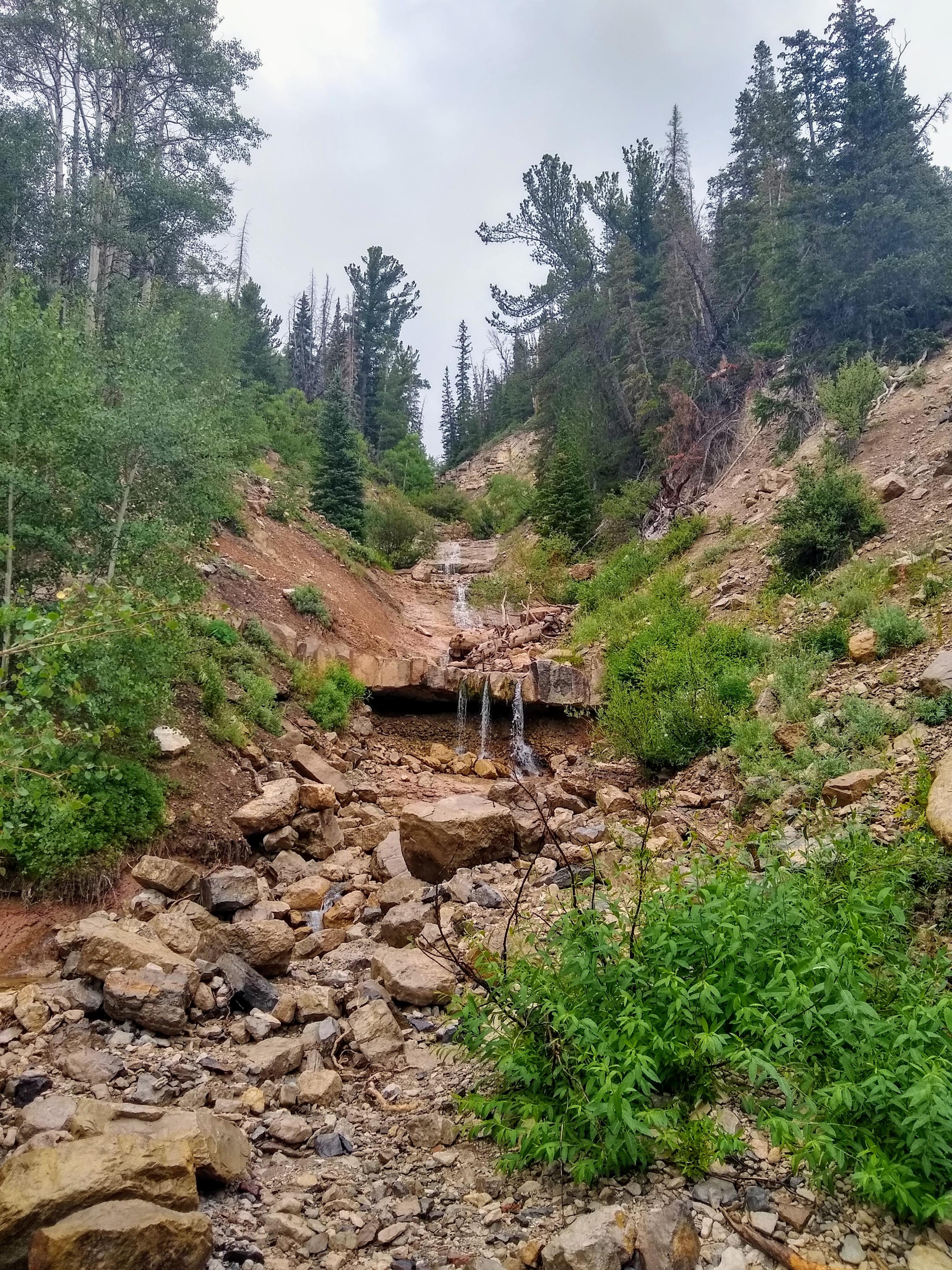
When we pulled up to the Rock Creek Falls pullout, I will admit to being disappointed! The small falls were indeed a waterfall, but not much taller than I am! Fortunately, motivated prevailed, and we hiked up Rock Creek. Not far above the pullout are a series of several cascades/waterfalls that are much more scenic than the small falls at the pullout!

All that being said, I probably wouldn’t recommend a special trip just to see the falls, but it is a pleasant side trip if you are camping in the area.

Some of the cascades above Rock Creek Falls

Some of the cascades above Rock Creek Falls

Getting There

The trailhead is west of Joes Valley Reservoir. On the west side of the reservoir, the paved UT-29 splits. Left goes to Joes Valley Campground and the marina. Stay straight, signed for Ephraim. The road turns to dirt at this junction. Reset your odometer as the road turns to dirt.

Follow this dirt road as it climbs steeply and switchbacks up the hillside. Stay on the main dirt road, there are many smaller roads that leave it and offer excellent primitive camping.

About 4.7 miles from when the road turned to dirt is a major junction. Go left here. The road heads northwest, then makes a sharp turn and heads south before heading west again. Stay right at the Pete's Hole side road.

9 miles from when the road turned to dirt is Rock Creek Falls. There is a small pullout here next to the falls.

The rugged Rock Creek drainage.

The rugged Rock Creek drainage.

Upper Rock Creek

Upper Rock Creek

Route

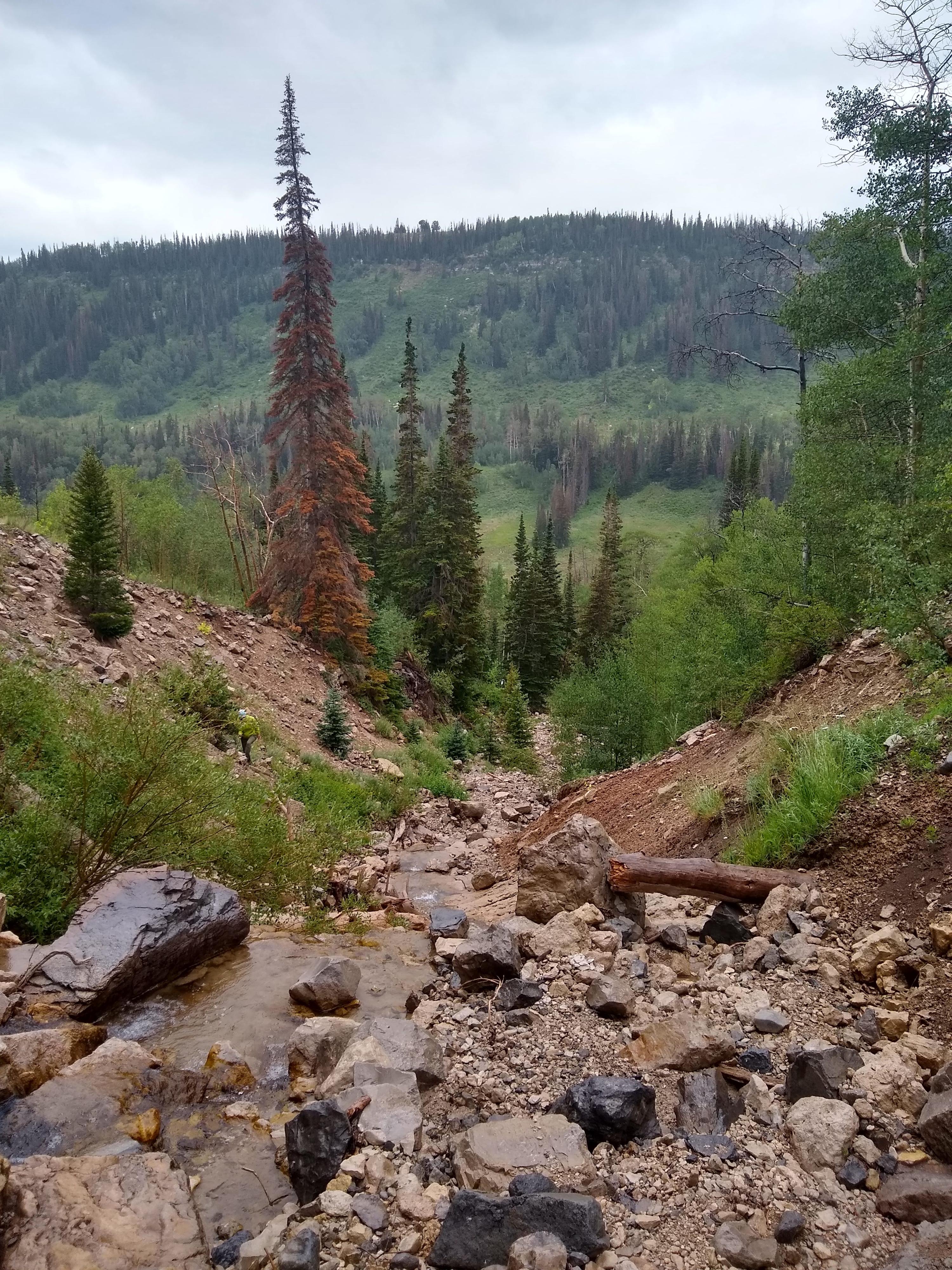
From the pullout, follow a social trail on the left side of the first falls. The terrain above is rocky, and can be slippery if wet. Proceed with caution. Going up the drainage, however, visits three to four more cascades and waterfalls. The first couple of cascades are easy to climb around, but the higher you get in the drainage, the more difficult continuing up becomes.

Return the same way.


Maps

Route / 0.84 miles / Elevation Range 9,295 - 9,860 ft.
Printable Maps:
Rock Creek Falls TH

12S 464764mE 4352291mN

N39° 19' 10" W111° 24' 32"

Top Falls

12S 465150mE 4352764mN

N39° 19' 25" W111° 24' 16"

Comments

Want to make a comment? Login and let yourself be heard.