

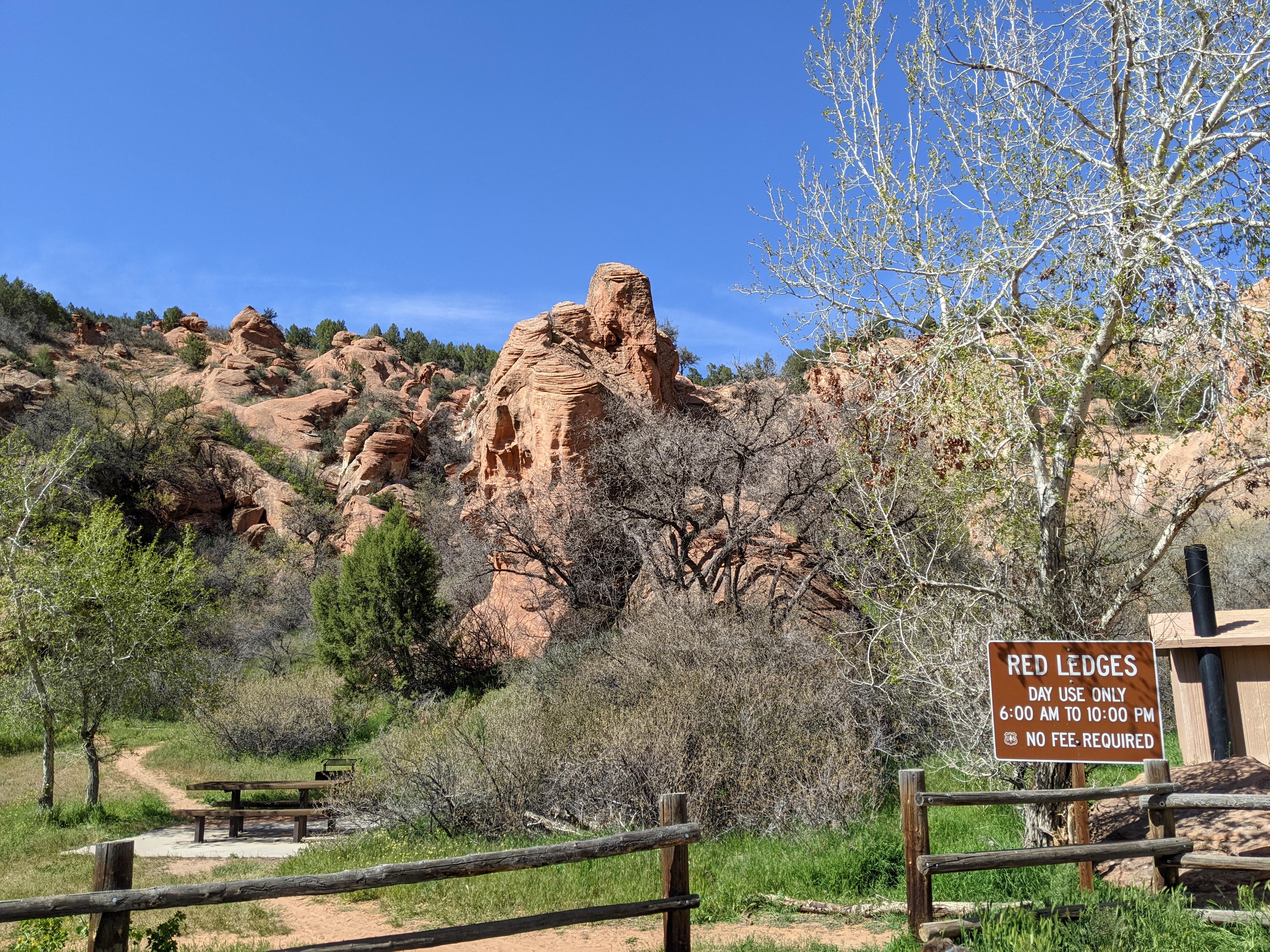
 Red Ledges
Diamond Fork
Overview
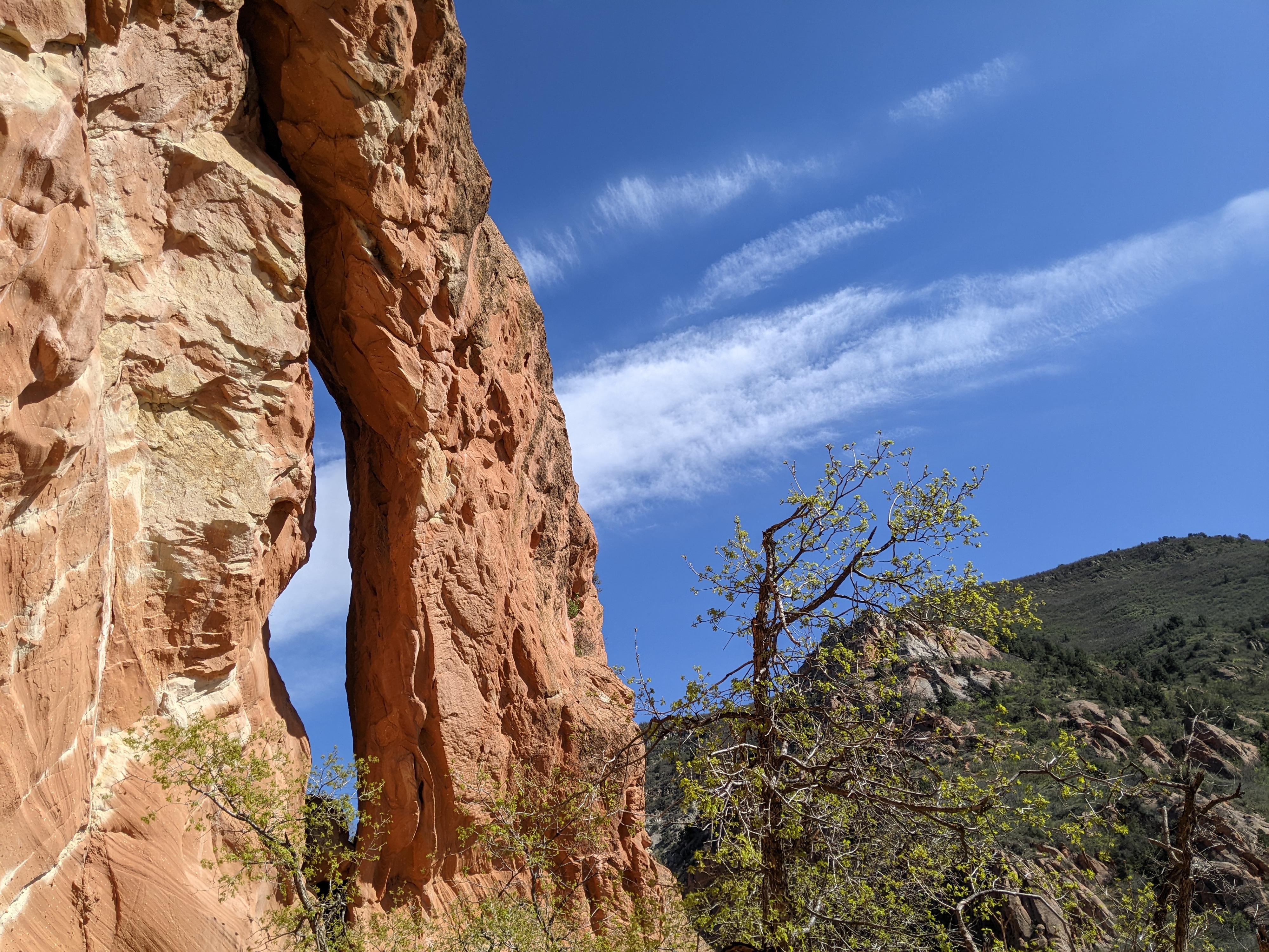
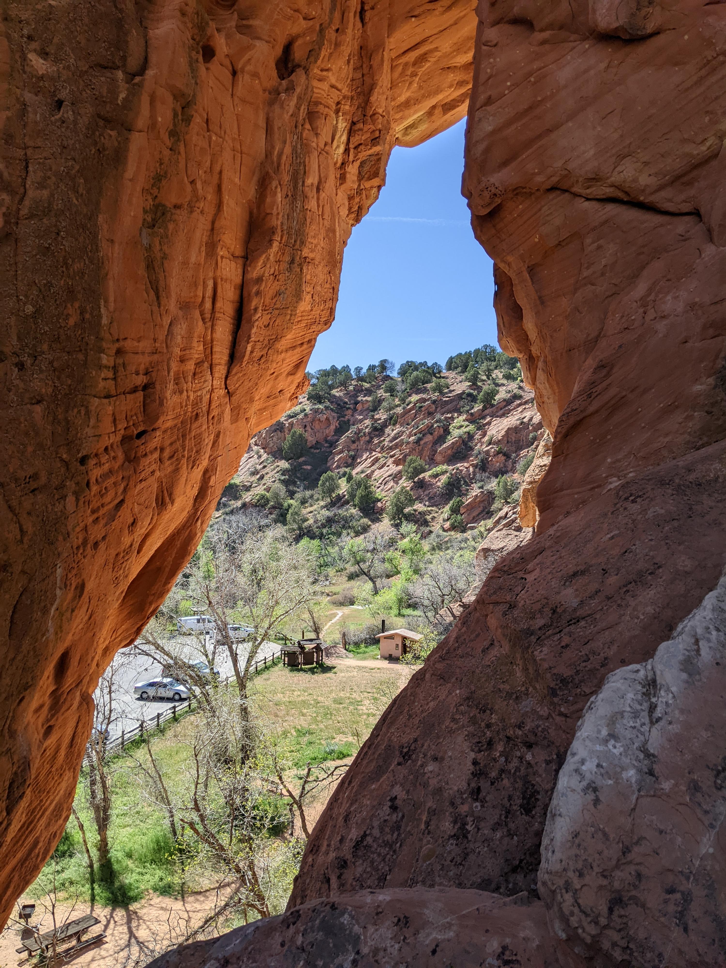
Red Ledges Picnic Area, in Diamond Fork Canyon, is a very popular spot. Many come to see the Diamond Fork Arch, a dramatic sandstone arch just a stone’s throw from the parking area. Many come to have a picnic and wander among the sandy social trails and red cliffs and ledges. Finally, some come to practice rappelling. The red cliffs and sand floored areas make for a delightful family stop to wander a bit, play in the sand a bit, and have a picnic or do some rappelling.
This is a spot I have driven by many times, but never took the time to stop and visit. When I finally stopped, it turned out to be a lovely place to spend a couple of hours.
Getting There
From Spanish Fork, take Highway 6 to mile marker 184.1 (about 11 miles from Spanish Fork) Here, go north on the paved/signed road Diamond Fork.
Follow this road 6.8 miles to the trailhead on the left. There is a large parking area, picnic tables, and pit toilet.
Route Description
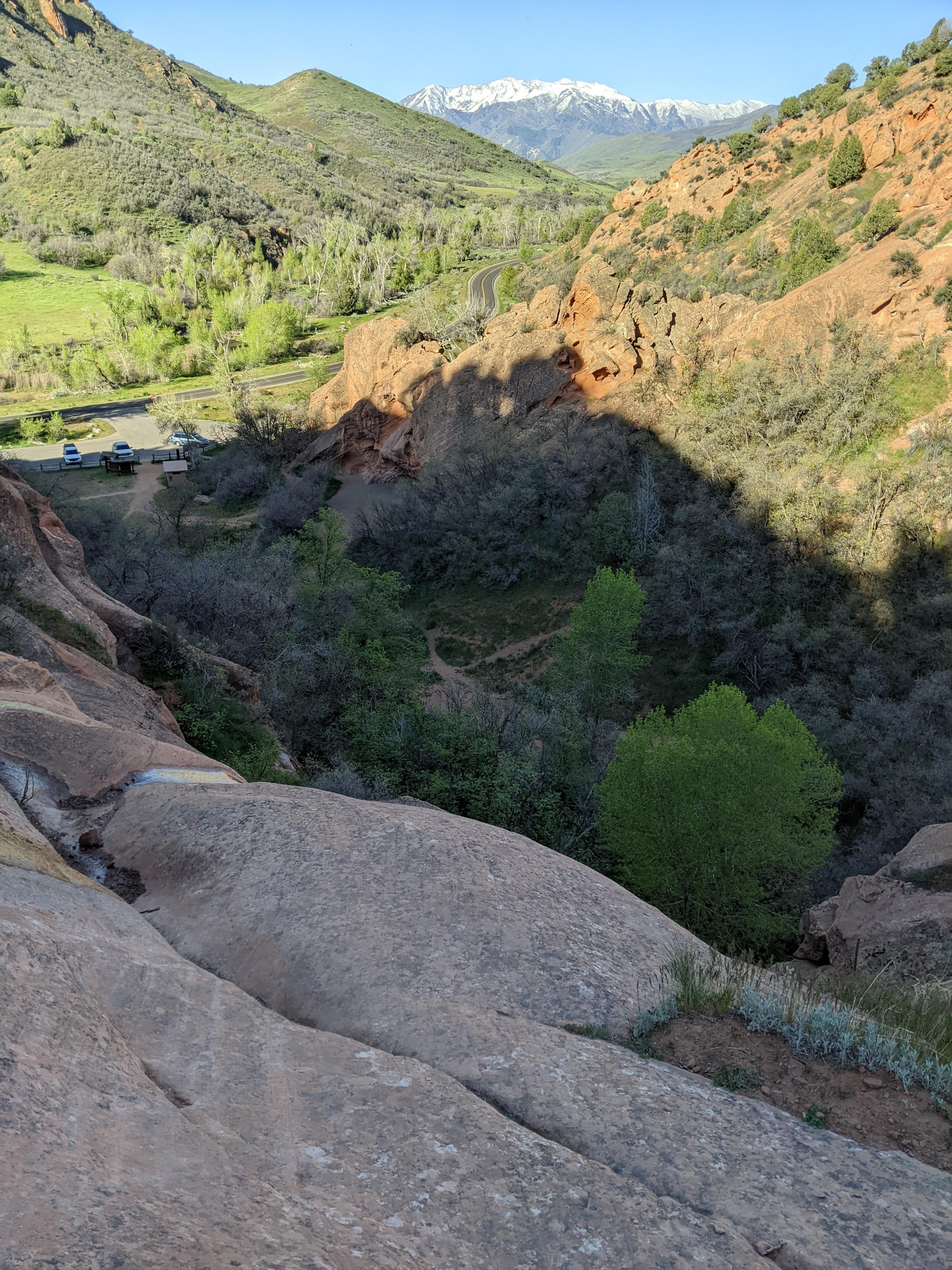
From the parking area, the Diamon Fork Arch is visible and just a minute or two walk from the parking area. Other social trails head north up the wide valley area, visiting several cliff bottoms.
Rappelling Notes:
There were two sets of anchors on the left side, looking north from the parking area, on the first cliff behind the bathroom. This requires a small bit of easy scrambling to reach. Climb up on the east (right when facing the bathroom) side of tthe formation up a steep ramp.
Rappelling Diamond Fork Arch can be done either by scrambling up a social trail on the east (back side from the parking area), or by following the social trail north up the valley to the rim and working back along the rim to the top of the arch. Going up the east side is much shorter, but has a section of easy 5th class climbing with exposure. Not recommended for beginners. Taking the social trail north and then working back to the arch is much longer and requires a bit of route finding to find the arch from the top, but is less exposed. The rappel from the first bolts encountered at the top of the arch is about 25 m ( 83 ft. ), though another set is available higher on the arch that is likely a few meters longer.
Finally, as you head up the valley, on the right, there is a dry waterfall with a tree on top. If you walk to the base of this dry fall, you are likely to find a fixed rope helping surmount the first small cliff band (4 m ( 14 ft. )). If you can surmount this first obstacle, a social trail cuts north and circles up to the top of the dry fall. There are a couple of sets of bolts here for rappelling the dry fall. Aside from the small tricky section on the approach, this rappel seems well suited to beginners with an easier start and rappel line than many of the others. It can be reached from the social trail that goes all the way to the rim as well with no climbing, but requires a bit of route finding to find from the top.
On my wanderings, I found many additional sets of bolts along the top of the cliffs. There are quite a few rappelling options.
Maps

12T 465593E 4436703N
40°04'48"N 111°24'13"W
12T 465681E 4436816N
40°04'51"N 111°24'09"W
12T 465598E 4436753N
40°04'49"N 111°24'13"W
12T 465666E 4436706N
40°04'48"N 111°24'10"W