
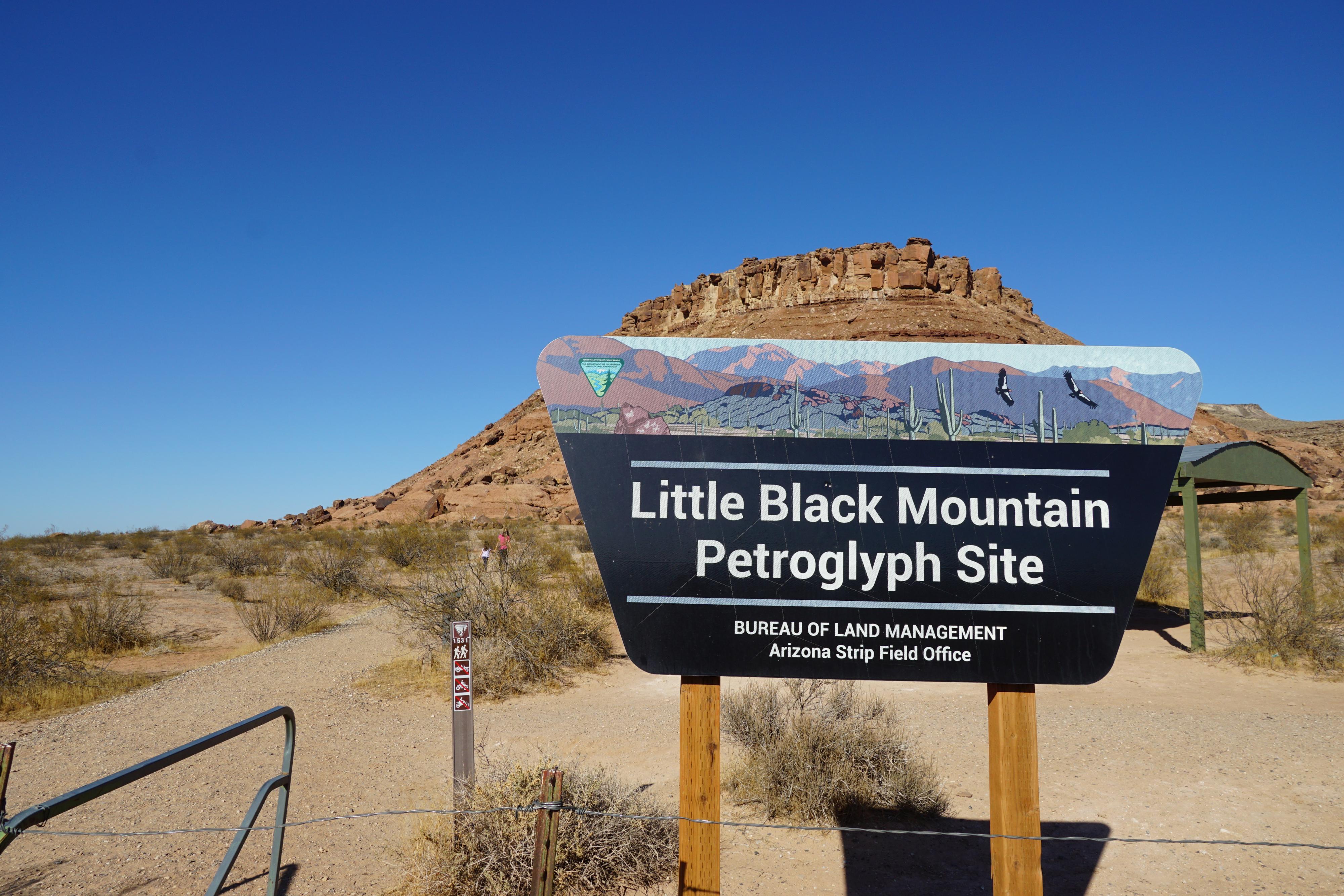
 Little Black Mountain
St. George
Overview
Tucked just south of the Utah State line, Little Black Mountain is a treasure of hundreds of petroglyphs nestled against the base of the basalt and sandstone peak. The peak sits on a boundary. To the north, butting up against the Utah/Arizona border is the bustling and expanding city of St. George. To the south is the vast mostly undeveloped desert of the Arizona Strip. It is a bit striking to have a large concentration of rock art so close to a thriving and growing city.
BLM has created a trailhead with pit toilets, a picnic table, and informational sign to help promote visitation to the area. For rock art lovers, this is a easy stop and must see if in the area. On a winter weekend, when we visited, there were quite a few groups visiting the site.
From the BLM information about the site:
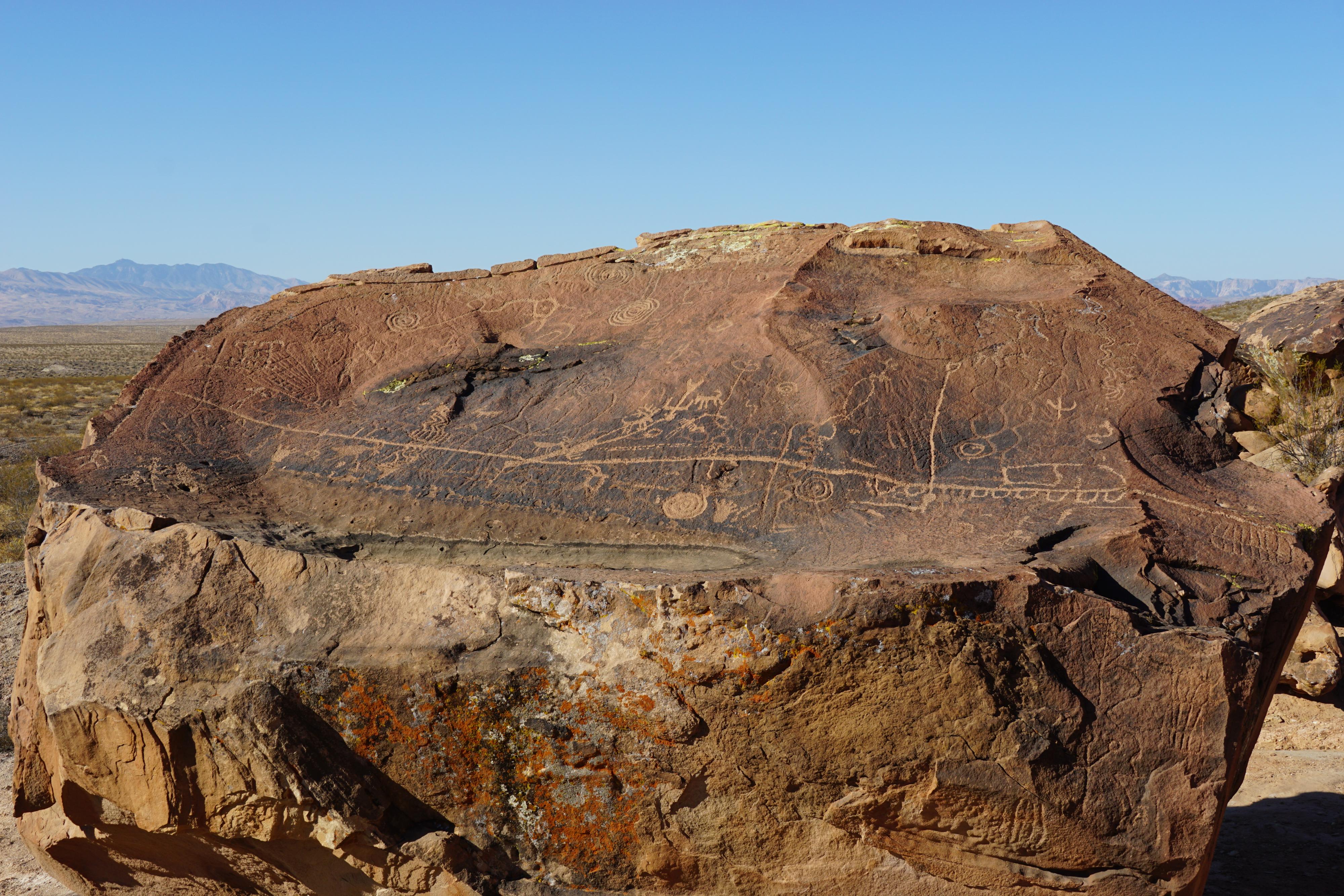
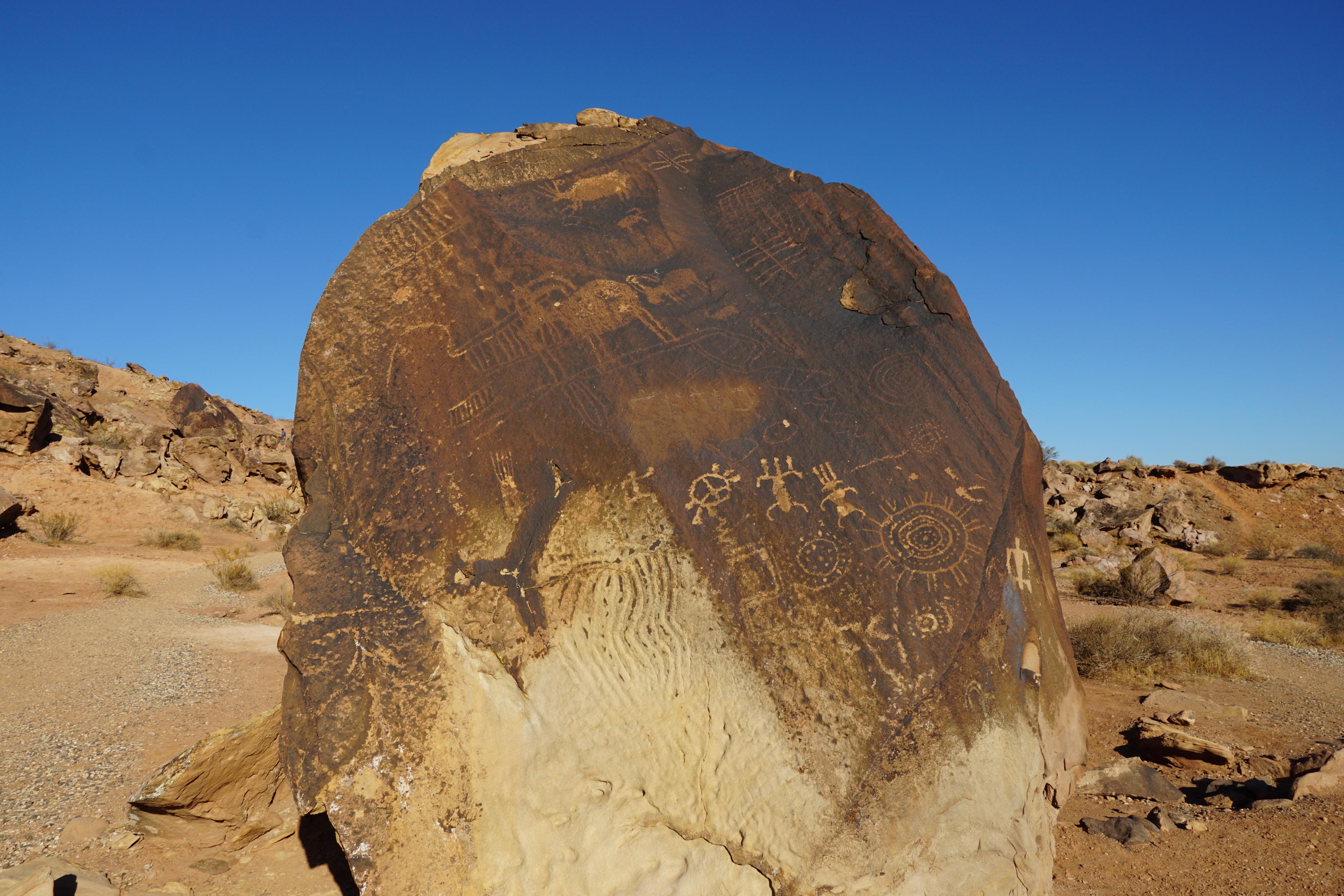
“The Little Black Mountain Petroglyph Site is comprised of over 500 glyphs made by members of several different American Indian groups over an 8,000-year period.
The site was used for several purposed including religious, ceremonial, and season observations. Petroglyphs deliberately placed on boulders use the interplay of light and shadow to show seasonal changes. The glyphs that might indicate calendar observations include spirals, circles, bisected circles, plants, baskets, and constellations.
Petroglyphs
How are petroglyphs made? Three general methods were used: pecking, abrading, and scratching. These techniques removed the dark desert varnish exposing the natural rock’s surface. Pecking was accomplished by striking a sharp rock directly on the boulder’s surface or by using a hammer stone and pointed bone to produce a line of shallow indentations. Abrading was done simply by repeatedly rubbing or scratching the desert varnish, until there was enough contract to produce the design.
What is desert varnish? Desert varnish is a product of an arid or semi-arid land. A little rain and lots of wind and sun are required. Desert varnish is a thin red to black coating composed of clay minerals, oxides, and hydroxides of manganese and/or iron. It is produced by the physiological activities of bacteria living on the rocks surface. The microorganisms extract manganese from the environment, oxidize, and attach it onto rock surfaces. Desert varnish forms very slowly- it takes hundreds to thousands of years to form the very black color. “
Getting There
The trailhead is just south of the St. George. From I-15, take exit 2, the Southern Parkway. Go east on Southern Parkway for 3 miles and take Exit 3.
Route Description
Rock art and historic sites are fragile, non-renewable cultural resources that, once damaged, can never be replaced. To ensure they are protected, please:
- Avoid Touching the Petroglyphs: Look and observe, BUT DO NOT TOUCH!
- Stay on the Trails: Stay on the most used trails when visiting sites, and don't create new trails or trample vegetation.
- Photography and Sketching is Allowed: Do not introduce any foreign substance to enhance the carved and pecked images for photographic or drawing purposes. Altering, defacing, or damaging the petroglyphs is against the law -- even if the damage is unintentional.
- Pets: Keep pets on a leash and clean up after them.
- Artifacts: If you happen to come across sherds (broken pottery) or lithics (flakes of stone tools), leave them where you see them. Once they are moved or removed, a piece of the past is forever lost.
From the trailhead, the BLM has created a path that goes up to the boulders and branches. Be sure to visit both sides of the site. I though both sides were fascinating. This is an excellent family outing, bring a picnic and enjoy lunch at the site.
Photos
Maps

12S 277216E 4095892N
36°58'58"N 113°30'11"W