King Top |

Confusion Range

Hiking King Top - Confusion Range Hiking King Top

Confusion Range

Overview

RATING: Moderate/Strenuous Hike
MAPS: KING TOP, UT; BULLGRASS KNOLL, UT

Fri

Snow showers likely before 3pm, then a chance of rain showers. Mostly cloudy, with a high near 45. East southeast wind 6 to 13 mph. Chance of precipitation is 60%. New snow accumulation of less than half an inch possible.

45 | 31

Sat

A chance of snow showers before noon, then rain showers likely. Mostly cloudy, with a high near 47. Chance of precipitation is 60%.

47 | 36

Sun

Snow showers before 3pm, then rain showers. Mostly cloudy, with a high near 44. Little or no snow accumulation expected.

44 | 32

Mon

A chance of snow showers before 3pm, then a chance of rain showers. Partly sunny, with a high near 46.

46 | 31

Tue

Sunny, with a high near 53.

53 | 32

View Full Weather Details
SEASON: Spring or Fall. Winter if there is no snow and the trailhead can be reached.
GEAR: Standard Hiking Gear
WATER: None

Fri

Snow showers likely before 3pm, then a chance of rain showers. Mostly cloudy, with a high near 45. East southeast wind 6 to 13 mph. Chance of precipitation is 60%. New snow accumulation of less than half an inch possible.

45 | 31

Sat

A chance of snow showers before noon, then rain showers likely. Mostly cloudy, with a high near 47. Chance of precipitation is 60%.

47 | 36

Sun

Snow showers before 3pm, then rain showers. Mostly cloudy, with a high near 44. Little or no snow accumulation expected.

44 | 32

Mon

A chance of snow showers before 3pm, then a chance of rain showers. Partly sunny, with a high near 46.

46 | 31

Tue

Sunny, with a high near 53.

53 | 32

View Full Weather Details
Looking north from the summit. Bonny Stairs Canyon in the foreground and Notch Peak in the distance on the left.

Looking north from the summit. Bonny Stairs Canyon in the foreground and Notch Peak in the distance on the left.

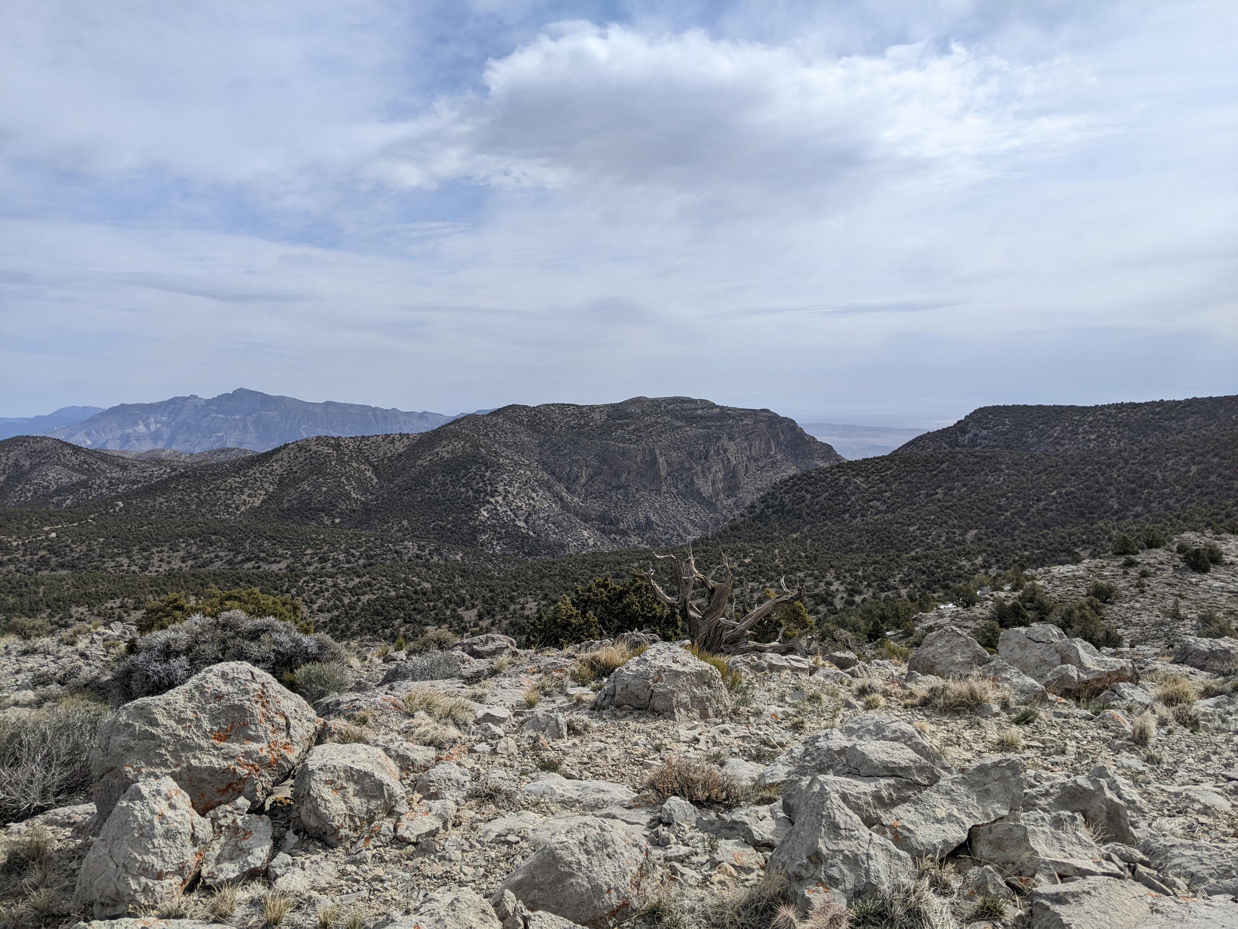
The West Desert is full of isolated mountain ranges. King Top Wilderness Study Area, encompassing much of the Confusion Range, is one of those very isolated and seldom visited ranges. The range has no springs or streams, making it incredibly arid. Once you wander the Confusion Range, it is easy to understand where the name comes from. Wide valleys criss-cross the range and make for a confusing area to traverse.

King Top, at 8350 ft / 2545 m, is the high-point of the range, and a worthy goal for those interesting in exploring the area. Some reach King Top from the east, via Bonny Stairs Canyon. This description uses an old gas exploration road that comes in from the north. Using this route, the hike is about 11.5 miles, but easy hiking on an old road with little route finding or brush to contend with.

View west from the summit.

View west from the summit.

Getting There

Note: Reaching the trailhead will require high clearance. Four-wheel drive is helpful for a long rough section, but likely not required.

Head west out of Delta on US-50 W/US-6 W toward Baker, NV. About 62 miles from Delta, after driving through Kings Canyon, look for a good side road on the left that climbs the mountain to the communication towers seen in the distance. This is at about mile post 24.3.

  • Reset your odometer as you turn off the highway. ( 12S 274309mE 4328774mN / N39° 04' 44" W113° 36' 33" )
  • 3.6 miles - Easy to miss road on the left just before the communications towers. If you reach the towers, backtrack a few hundred feet. The road heads south and is a bit rocky and rough at the start, but gets better. ( 12S 276384mE 4326147mN / N39° 03' 21" W113° 35' 03" )
  • 6.0 miles - T-Junction. Go left here, heading east. Road is better from here on, but a bit overgrown in spots. ( 12S 275383mE 4322975mN / N39° 01' 37" W113° 35' 41" )
  • 8.9 miles - The road goes around a bend and heads south with a very faint side road on the left. This, according to the BLM map, is the WSA boundary. This is the trailhead. The two track road heads south and becomes a bit more overgrown. It does have signs of use, but vehicles are not allowed in a WSA. ( 12S 278515mE 4324582mN / N39° 02' 32" W113° 33' 33" )
The easy walking two-track.

The easy walking two-track.

Route

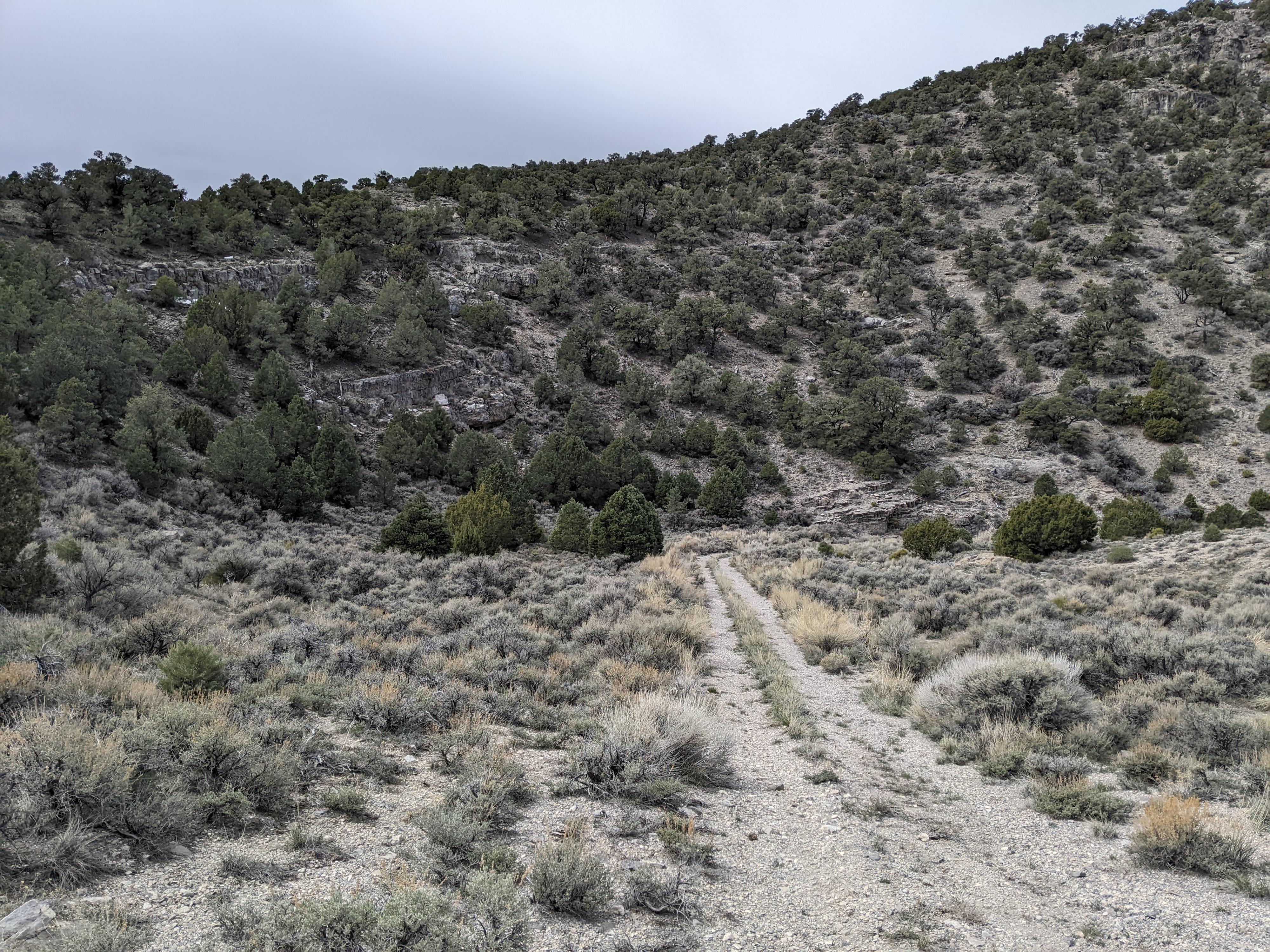
From the trailhead, continue south on the old two-track road. It is easy hiking in a wide valley. After about 4 miles (1.5 hours), the two-track ends.

When the two-track ends, continue up the ATV track that ascends the gully. Near the top if the gully, the ATV track turns left. Follow it. From this point on, the route is to follow the wide old gas exploration road. There isn’t much of the old road visible, except that it is a wide swath with no trees or tall vegetation. It is easy walking. On my trip, ATV tracks continued along here.

The old road curves around and heads southwest, high above Bonny Stairs canyon. As the road descends to the floor of Bonny Stairs Canyon, you will come to a major junction, with a wide valley coming in on each side. Go left. The old road is less distinct here, but you are heading southwest with King Top visible soon as the highest point on the left.

As the valley opens into a large open area, and King Top is visible a short distance to the south, leave any remains of the track you are following and head up to the summit. The easiest route, to me at least, was to head directly to the ridge, then follow the ridge to the summit.

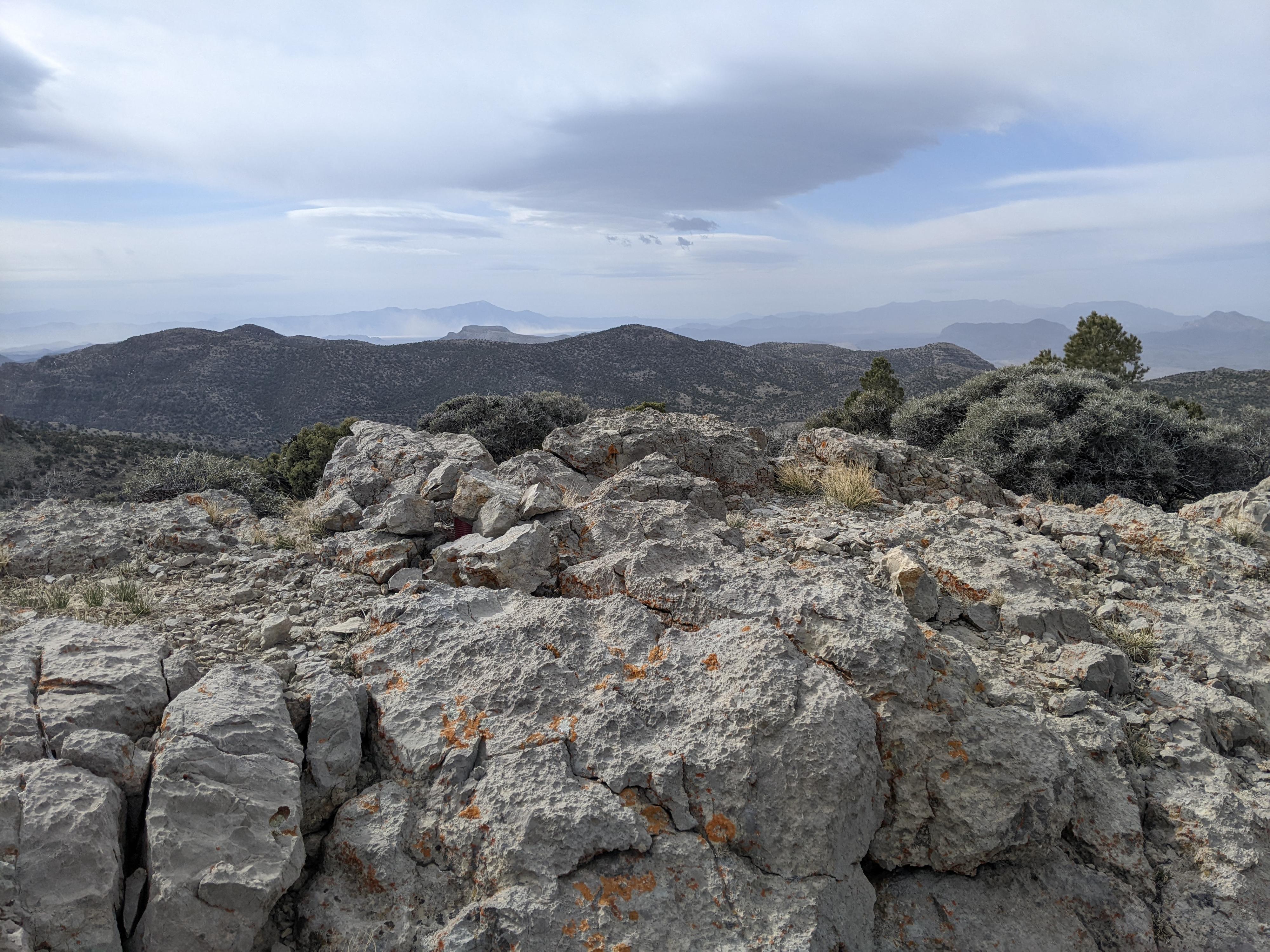
From the summit, the Tule Valley and Notch Peak are visible far to the north. Views in all directions of the wide open desert are expansive. Return the same way.


Maps

Route / 12.35 miles / Elevation Range 6,571 - 8,284 ft.
Printable Maps:
Trailhead

12S 278516mE 4324583mN

N39° 02' 32" W113° 33' 33"

End of Two Track

12S 281601mE 4319777mN

N38° 59' 59" W113° 31' 19"

Old Road

12S 281541mE 4319414mN

N38° 59' 47" W113° 31' 21"

Left (South) Wash

12S 280819mE 4318925mN

N38° 59' 31" W113° 31' 51"

Leave Track

12S 280511mE 4318669mN

N38° 59' 22" W113° 32' 03"

King Top

12S 280809mE 4317706mN

N38° 58' 51" W113° 31' 50"

Comments

Want to make a comment? Login and let yourself be heard.