 Hiking
Lime Butte 6485
Hiking
Lime Butte 6485
Cedar Mesa
Overview
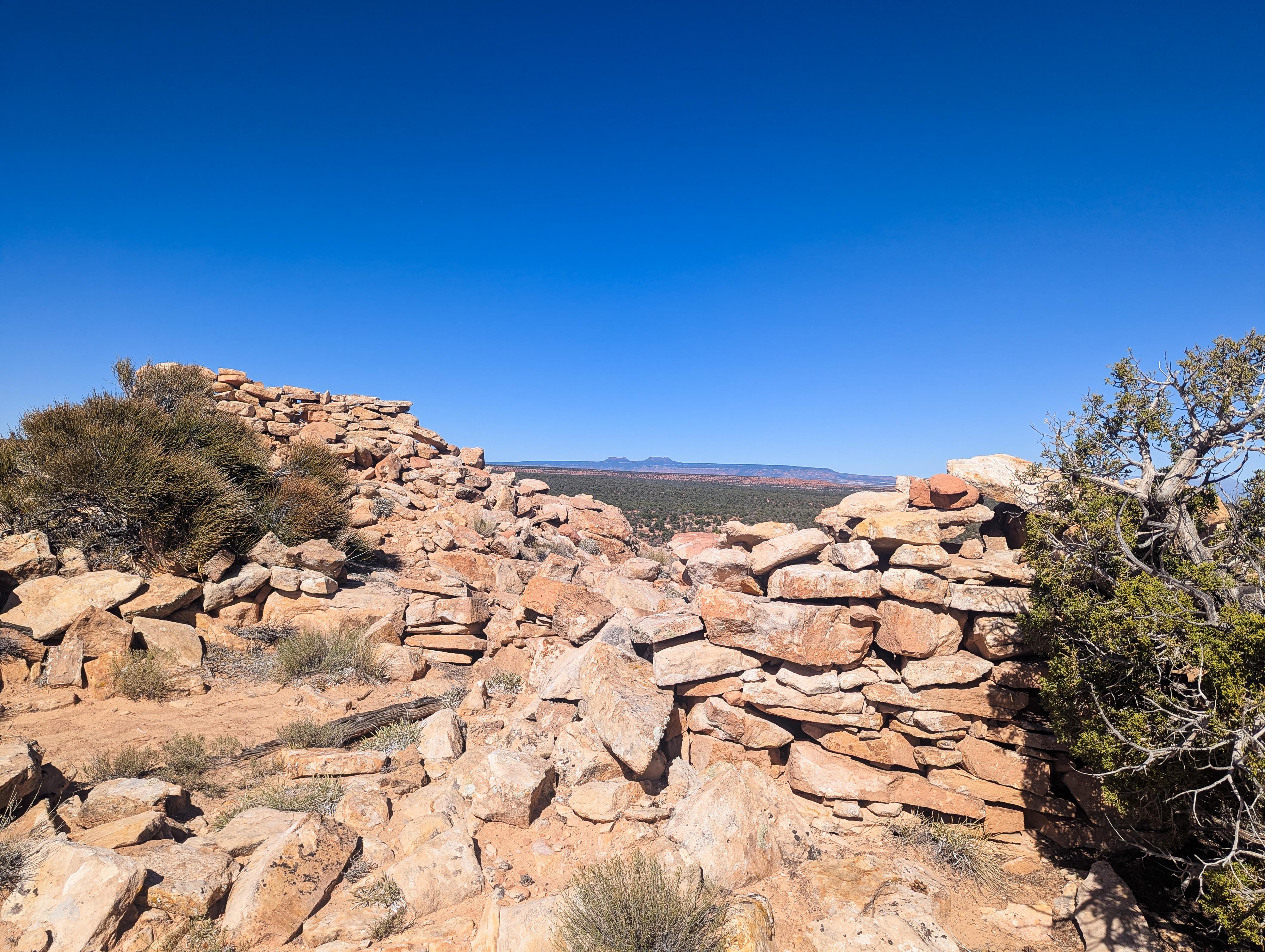
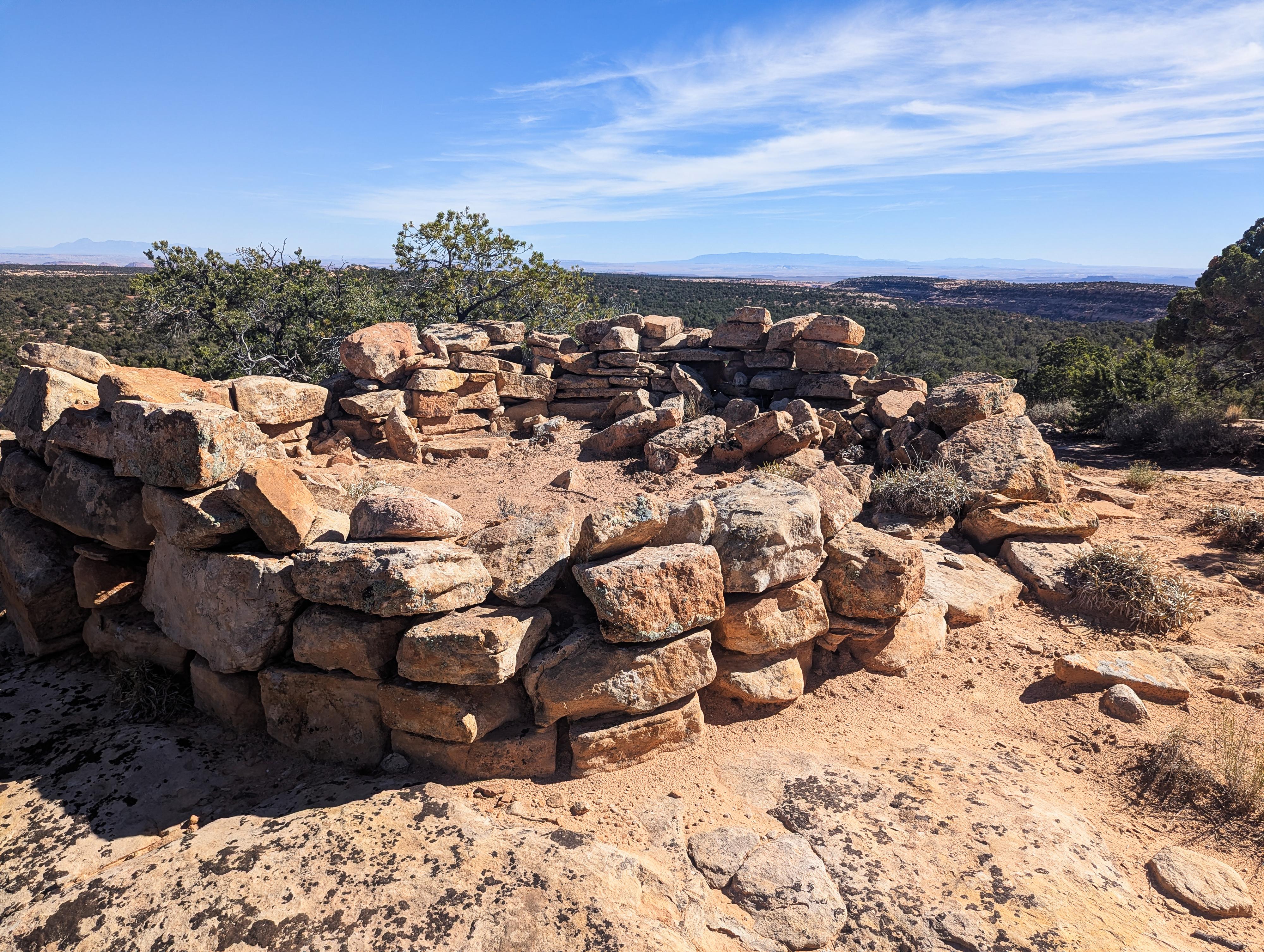
Just south of Lime Creek, on Cedar Mesa, is a small rock bump that stands out above the surrounding flats with an elevation of 6,485'. From a distance the small outcropping looks pretty, but if you take the time to make the short hike to the summit, you will find small tower structures.
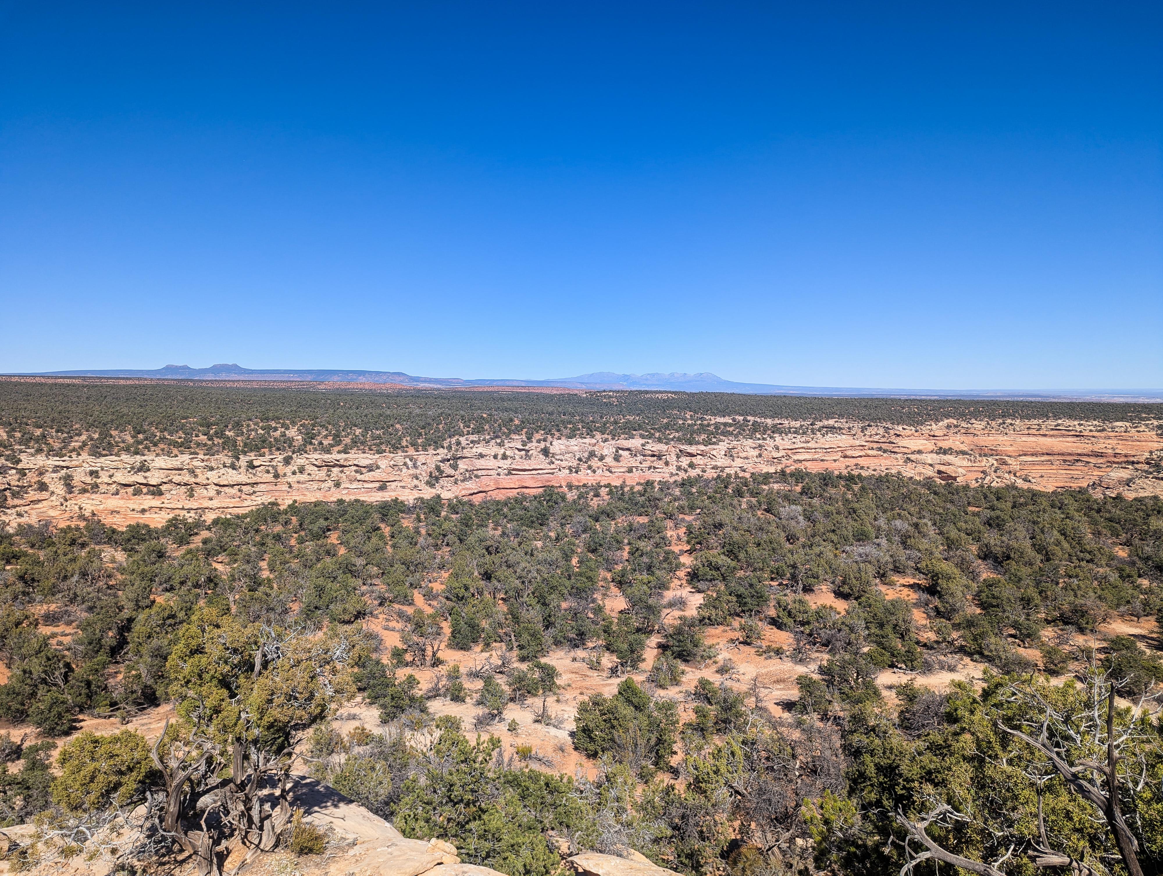
This area is often referred to as Lime Ridge or Lime Butte. Though the ruins are small, the perch is an obvious lookout onto the surrounding flats and Lime Creek Canyon just to the north. The views in all directions seem limitless. It is at this ridge that some of the oldest artifacts on Cedar Mesa have been found: Clovis Points. These are believed to date back to the Paleoindian Period from 12,000-6000 BC.
This is a short, easy hike if you are in the area. I thought the views were outstanding, and the history and structures very interesting. This is not one I would recommend to make the focus of a trip to the Bears Ears. If you are passing by, however, it is a short side trip that I think is very worthwhile and takes less than an hour to visit.
Getting There
From Blanding, head south on US-191. In about 4 miles, turn right onto UT-95 North toward Hanksville. Follow UT-95N for about 28.4 miles to it's junction with UT-261. Head south on UT-261 toward Bluff/Mexican Hat for about 16.6 miles to just before mile marker 16 where a side road leaves on the east (left) side of UT-261.
The side road requires high clearance but is not too bad. There are a few small, primitive campsites and side roads along the way. Stay on the main dirt road as it heads east. Follow the dirt road for about 1.4 miles to a major junction. The junction is the trailhead, with the butte just to the north and a touch east from the trailhead.
Route Description
From the junction, many social trails head toward the rock butte just to the north and a touch east. All seem to coalesce and head to the butte, but for ease of a description, walk to the dirt road that heads north from the junction for a short distance.
There is a side road less than a minute down this road that is signed closed to vehicles on the right (east) side. On my visit, it seemed to have the most defined social trail. Follow the social trail(s) as they head north and east to the base of the butte. The trails go to the east side of the butte, where it is an easy walk to the summit.
Once on the summit, the ruins are on the north end. The canyon visible to the north is Lime Creek, with the Bears Ears visible way off in the distance to the north. It is a stunning perch.
Return the same way.
Photos
Maps

12S 597688E 4136542N
37°22'14"N 109°53'48"W
12S 597746E 4136810N
37°22'22"N 109°53'46"W