 Hiking
Lower Muley Twist Canyon
Hiking
Lower Muley Twist Canyon
Notom Road
Overview
I think of Upper Muley Twist as the hike to do to see arches, and Lower Muley Twist as the hike to do to see undercuts. This amazing hike offers views of some of the deepest alcoves and undercuts I have seen. Throw in big views, an old cowboy camp, and a lot of miles and you have an excellent big day deep in the backcountry of Capitol Reef National Park.
At about 16 or 17 miles (depending on if the last 1/2 mile of the approach road is passable), Lower Muley Twist is often done as a backpack. If doing it as a backpack, there may be water in the bottom part of Lower Muley Twist, but the upper sections are likely to be dry. IT IS HIGHLY RECOMMENDED TO CONTACT THE PARK SERVICE ((435) 425-3791) AND INQUIRE ABOUT WATER AVAILABILITY IF YOU ARE GOING TO BE DEPENDING ON IT!
For those that have the wherewithal, I recommend doing this as a long day hike. It avoids water availability issues and makes the hike possible with a light pack. It is, however, a long day for most. Expect 8-12 hours if doing it as a day hike, and take all the water you will need.
A final note, the loop can be done in either direction (clockwise or counterclockwise). I recommend counterclockwise, simple because it puts the good stuff in the middle of the hike and makes the exit after the good stuff shorter. I describe it counter-clockwise below.
Getting There
Travel east out of Capitol Reef National Park on highway 24. Just past the park, 0.25 miles, is the well signed Notom road.
Route Description
To Lower Muley (about 2 miles)
From the trailhead, follow the signed trail a few minutes (0.1 miles) to a junction. Go right here, crossing the flat valley on the trail, following wooden markers along the way. At the bottom of the reef, the hiking gets much more interesting! Follow cairns up to the top of the reef. This section is well cairned and easy to follow. From the top of the reef, the trail descends a side drainage, then zig-zags down to the bottom of Upper Muley Twist.
Down Muley Twist (10.3 miles)
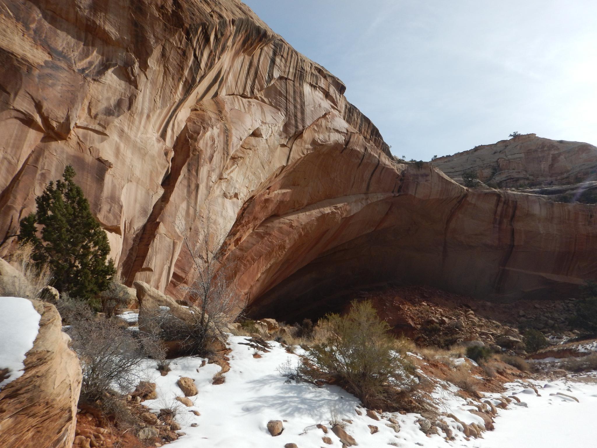
As you head down Muley Twist, it isn't initially terribly interesting, open with Wingate Sandstone walls. Ambling down, however, the canyon deepens, with Najavo walls towering on the left side. The scenery becomes more and more interesting, especially after reaching the first undercut. This impressive undercut is the first of several that will punctuate the day.
The hiking is easy and relatively fast. A stand of cottonwoods marks the first likely water. The undercuts below the cottonwoods are the best of the hike.
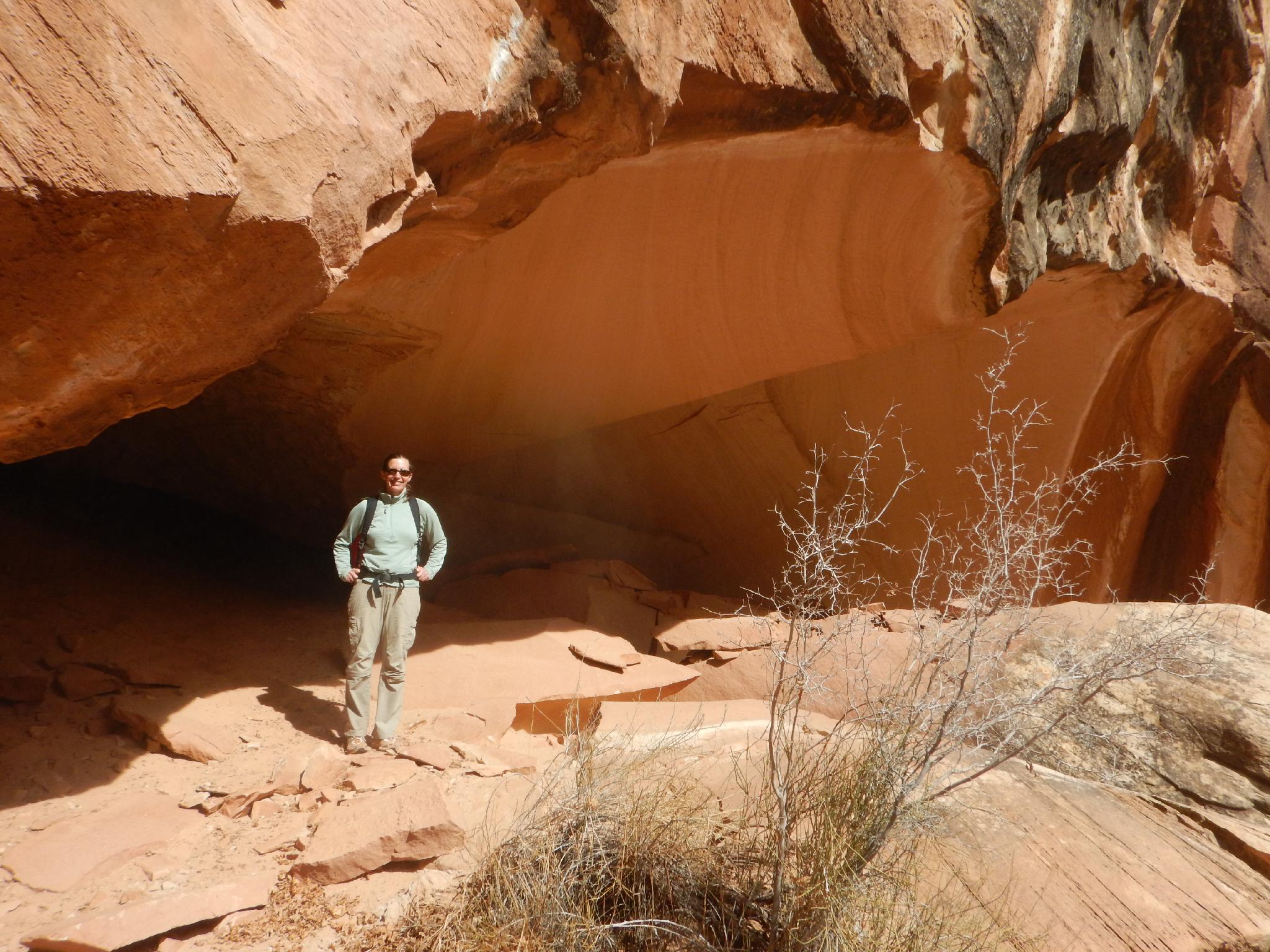
All too soon, or maybe not if your legs are starting to feel heavy, the second bunch of cottonwoods is encountered, with a huge undercut on the right a few minutes below. This is the cowboy camp, and a great spot to stop and check out the historical graffiti.
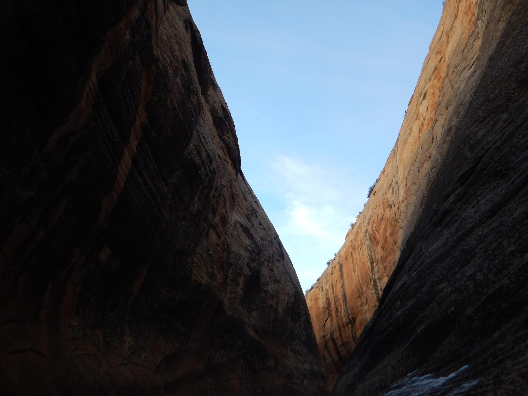
A few minutes below the cowboy camp, a side canyon comes in on the right (with flowing water when we visited), then Lower Muley Twist makes a hard left and begins cutting its way through the reef.
Once out of the reef, keep a sharp eye out on the left for a cairn and social trail.
Halls Creek Back to the Trailhead (4.5 miles)
This social trail leaves Lower Muley, ascends a small hill and joins the old Halls Creek road. The road is mostly a trail now, but evidence of road cuts are still visible in many spots if you are looking for them. Follow the trail as it heads north. It crosses Halls Creek and heads almost due north cutting off a large meander that would be encountered if staying in Halls Creek proper.
The trail descends back into Halls Creek and follows the west side of Halls Creek all the way back to the trailhead. About 3.2 miles from Lower Muley Creek, the junction to Cottonwood Tanks is reached. This junction is signed, and the short (0.5 miles or less) side trip is worthwhile. If visiting the tanks, there is some faint pioneer graffiti on the north (right) cliff wall just above the lower tanks. It is hard to see until you are right at it.
From the Cottonwood Tanks Junction, it is 1.3 miles back to the trailhead across the open plain. Be sure to pay attention when the trail crosses Halls Creek, it is mildly easy to miss where the trail leaves Halls Creek if you are not paying attention.
Maps
")
")
12S 501906E 4186538N
37°49'35"N 110°58'42"W
12S 501920E 4186410N
37°49'30"N 110°58'41"W
12S 499845E 4185823N
37°49'11"N 111°00'06"W
12S 500179E 4182665N
37°47'29"N 110°59'53"W
12S 501008E 4180256N
37°46'11"N 110°59'19"W
12S 501182E 4180020N
37°46'03"N 110°59'12"W
12S 501145E 4179972N
37°46'01"N 110°59'13"W
12S 503022E 4179762N
37°45'55"N 110°57'56"W
12S 503063E 4179892N
37°45'59"N 110°57'55"W
12S 502313E 4184423N
37°48'26"N 110°58'25"W
12S 501980E 4184601N
37°48'32"N 110°58'39"W