Bull Valley Gorge |

Bryce Area

Hiking Bull Valley Gorge - Bryce Area Hiking Bull Valley Gorge

Bryce Area

Overview

RATING: 2B
MAPS: BULL VALLEY GORGE, UT

Tue

Sunny. High near 57, with temperatures falling to around 55 in the afternoon. East wind around 9 mph.

57 | 31

Wed

Sunny, with a high near 62. Northwest wind 8 to 14 mph.

62 | 33

Thu

Sunny, with a high near 63.

63 | 34

Fri

Sunny, with a high near 62.

62 | 36

Sat

Sunny, with a high near 59.

59 | 37

View Full Weather Details
SEASON: Spring, Summer, Fall
GEAR: A short rope may be handy. < 10 m ( 33 ft. )
WATER: Can be dry, or can have some wading. If wading, be mindful that reversing the downclimbs with muddy feet will be harder. High flashflood danger, but you can see the drainage from the trailhead.

Tue

Sunny. High near 57, with temperatures falling to around 55 in the afternoon. East wind around 9 mph.

57 | 31

Wed

Sunny, with a high near 62. Northwest wind 8 to 14 mph.

62 | 33

Thu

Sunny, with a high near 63.

63 | 34

Fri

Sunny, with a high near 62.

62 | 36

Sat

Sunny, with a high near 59.

59 | 37

View Full Weather Details
Bull Valley Gorge

Bull Valley Gorge

Bull Valley Gorge

Bull Valley Gorge

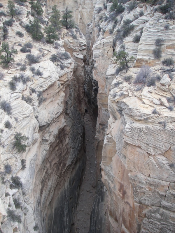
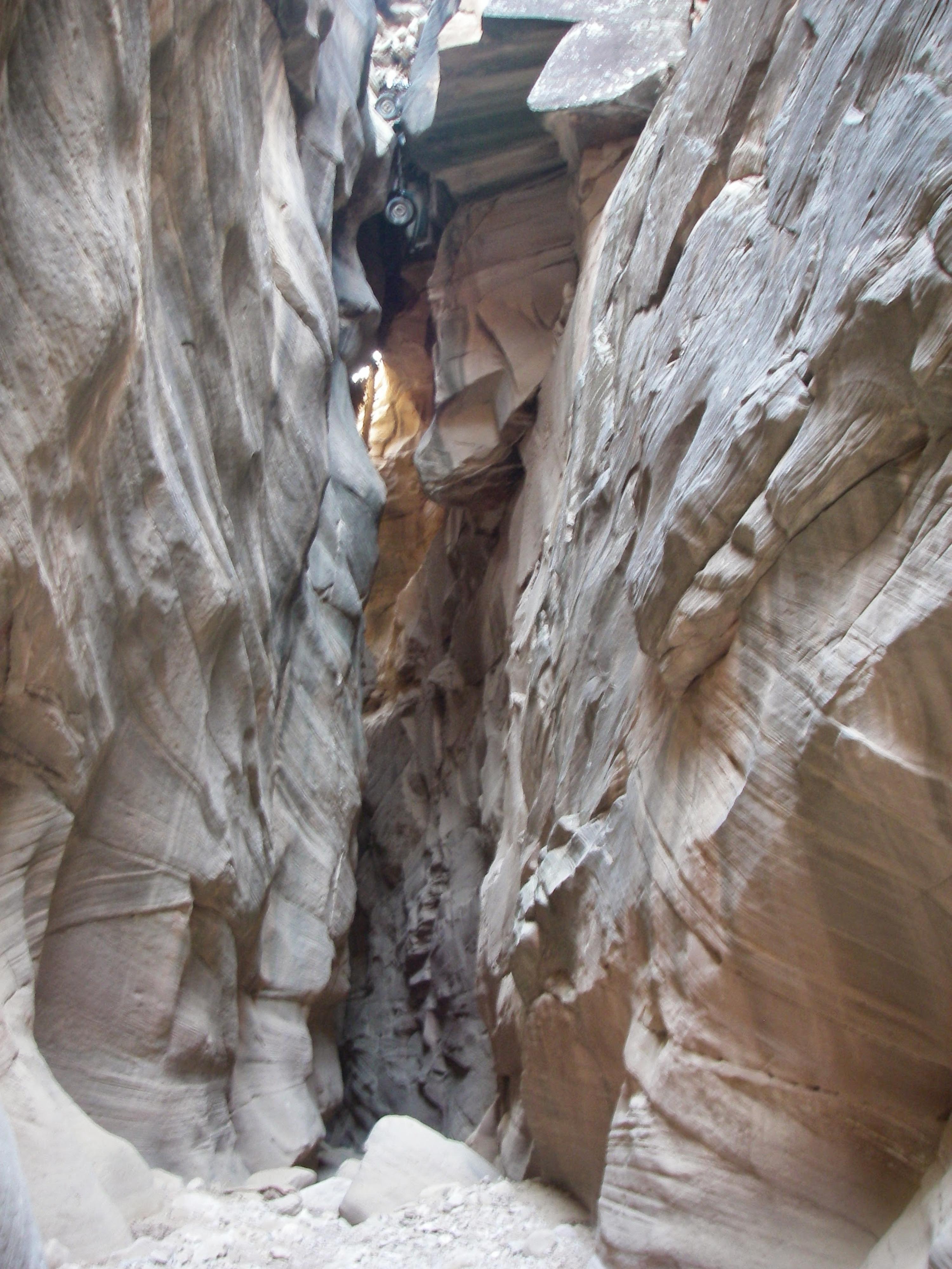
Bull Valley Gorge is an interesting place. The road goes over the gorge proper where a car accident occurred back in the 50's. The occupants of the car were killed, and their bodies recovered, but the car was left wedged into the gorge, and the road re-built on top of it.As you go under the bridge, the car is clearly, and somewhat eerily visible high above.

Bull Valley Gorge

Bull Valley Gorge

Bull Valley Gorge

Bull Valley Gorge

Getting There

Head south out of Cannonville toward Kodachrome basin on the Kodachrome Basin road for 2.7 miles to the Skutumpah Road.

  • This road is signed to Bull Valley gorge. Turn onto it and reset your odometer. ( 12S 407246mE 4154284mN / N37° 31' 51" W112° 02' 59" )
  • At 5.5 miles, stay left. (on road 500) ( 12S 403121mE 4149745mN / N37° 29' 22" W112° 05' 45" )
  • At 6.2 miles, the road crosses Willis Creek. ( 12S 402963mE 4149124mN / N37° 29' 02" W112° 05' 51" )
  • Continue past Willis Creek an additional 1.9 miles (8.1 total). This is the trailhead on the rim of Bull Valley Gorge. ( 12S 401971mE 4147839mN / N37° 28' 20" W112° 06' 31" )
Bull Valley Gorge

Bull Valley Gorge

The old car stuck in Bull Valley Gorge.

The old car stuck in Bull Valley Gorge.

Route

The trailhead is right on the edge of Bull Valley Gorge, and gives impressive views of the canyon. From the car park, walk on the well-defined trail up the canyon on the north side. There is a trail register within 100M of the trailhead. Follow the trail for 10 or 15 minutes until the canyon becomes shallow and easy to descend to the bottom.

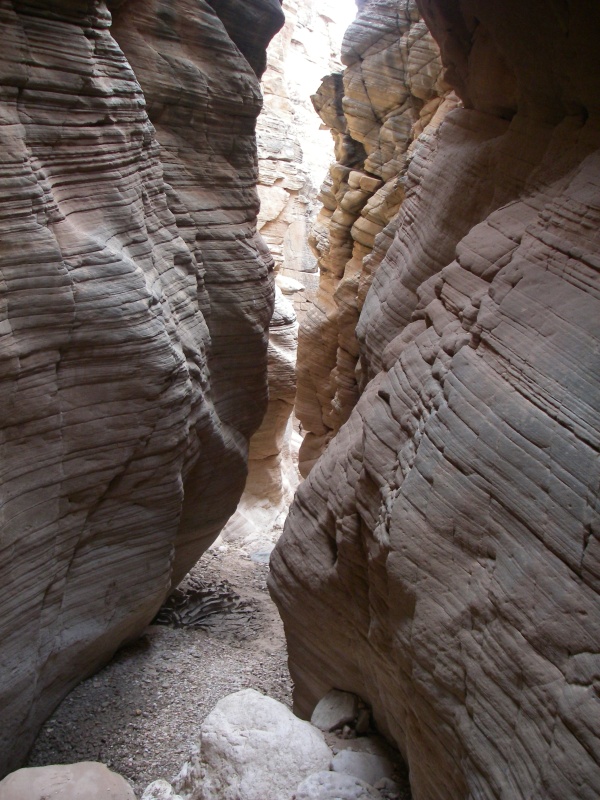
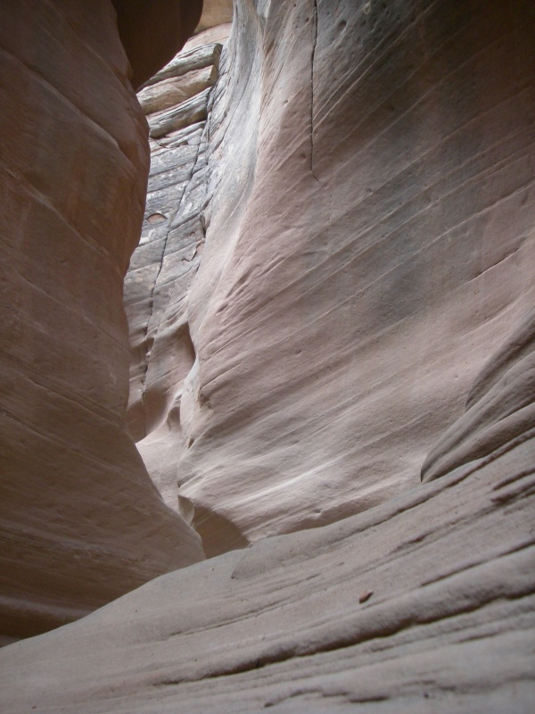
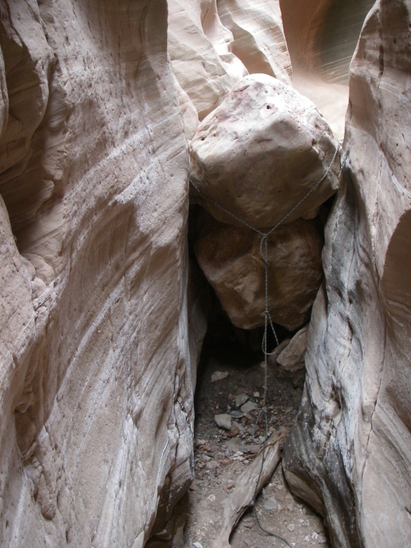
Head down the canyon. The best park of Bull Valley Gorge is right above and under the bridge. Before getting there, however, you will be faced with several downclimbing challenges. These likely change with every flood, but in 2007, all were fairly reasonable to downclimb and reverse. The most difficult, a 3 m ( 10 ft. ) chimney downclimb had a fixed rope when I visited. Be careful not to downclimb anything you cannot reverse unless you plan on taking the optional exit mentioned below.

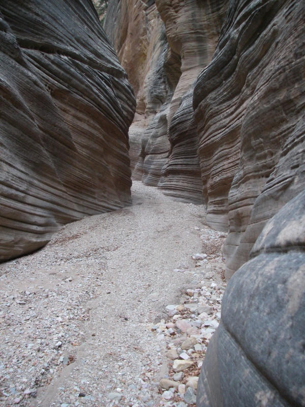
Just after going under the bridge, the canyon begins to open. From here down, the canyon is a beautiful deep canyon, but you have passed the narrowest section. You can turn around here and reverse the canyon back to your car whenever you feel inclined.

Optional Exit: If you continue down the canyon, about 35-45 minutes below the bridge a dirt gully comes in on the right (looking down canyon).The gully is the first obvious, easy hike out of the canyon. It has large trees, and an indistinct trail going up it. Hike up this to the rim, and follow an intermittent trail back up the canyon along the rim to the road. This is a great loop that allows you to see Bull Valley Gorge from many angles. In 2007, this gully and the trail along the rim were easy to find and cairned.

Videos

Bull Valley Gorge richardpattison

Maps

Route / 1.98 miles / Elevation Range 5,778 - 6,327 ft.
Printable Maps:
Trailhead

12S 401904mE 4147823mN

N37° 28' 20" W112° 06' 34"

Exit

12S 402580mE 4147288mN

N37° 28' 02" W112° 06' 06"

Comments

Want to make a comment? Login and let yourself be heard.