
 Lisa Falls
Wasatch Front
Overview
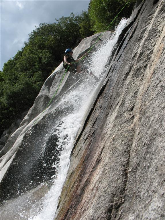
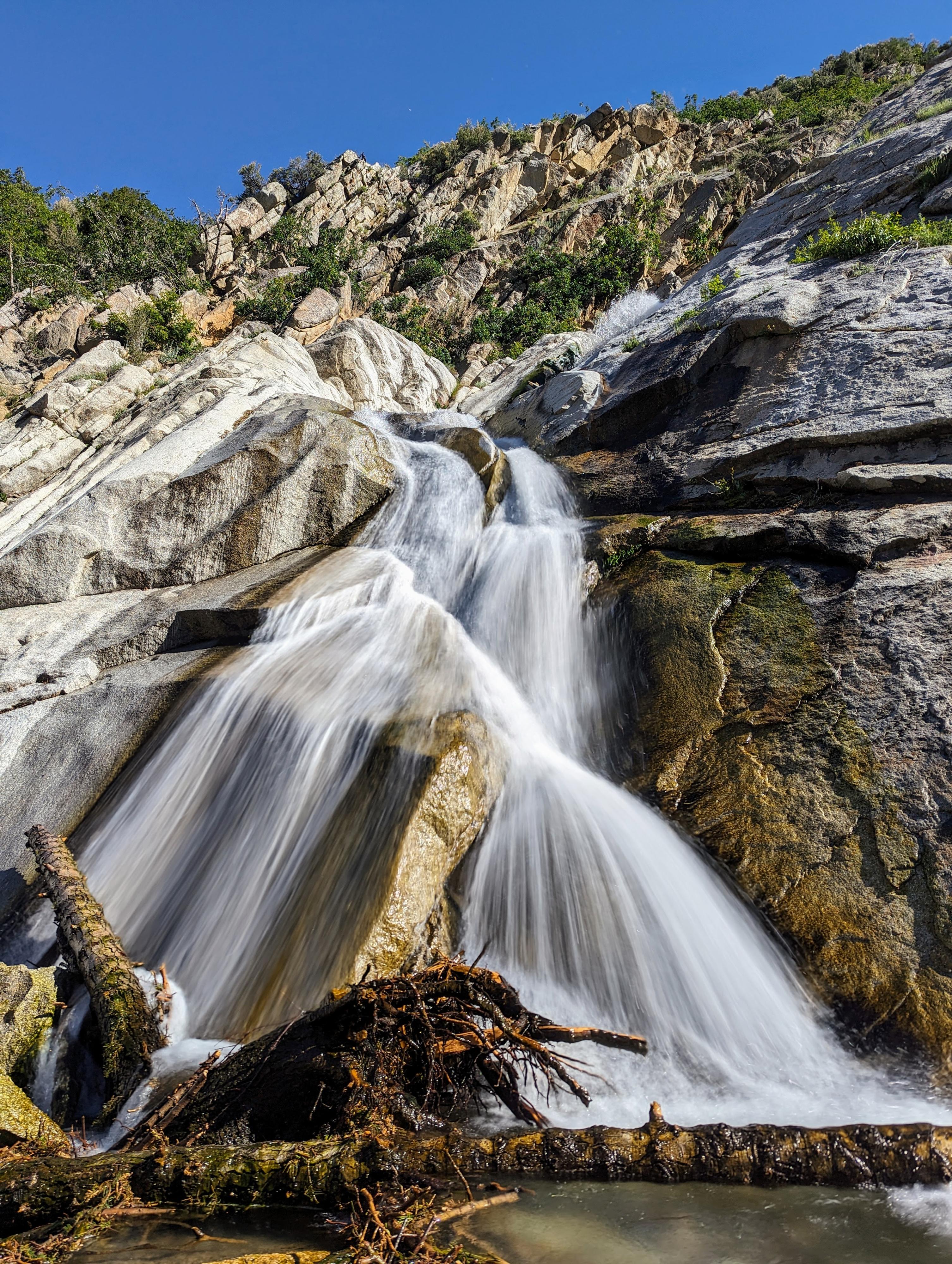
Close to Salt Lake City, with a short approach, makes Lisa Falls a great place to visit. The hike is very popular with families, and a great place to hang out on a hot day. The short hike should be accessible to most. There are some excellent moderate climbs near the falls, as well as large boulders to hang out on and enjoy the view. For the technically inclined, rappelling the waterfall on a hot day is guaranteed to cool you off and a lot of fun!
Update Summer 2013
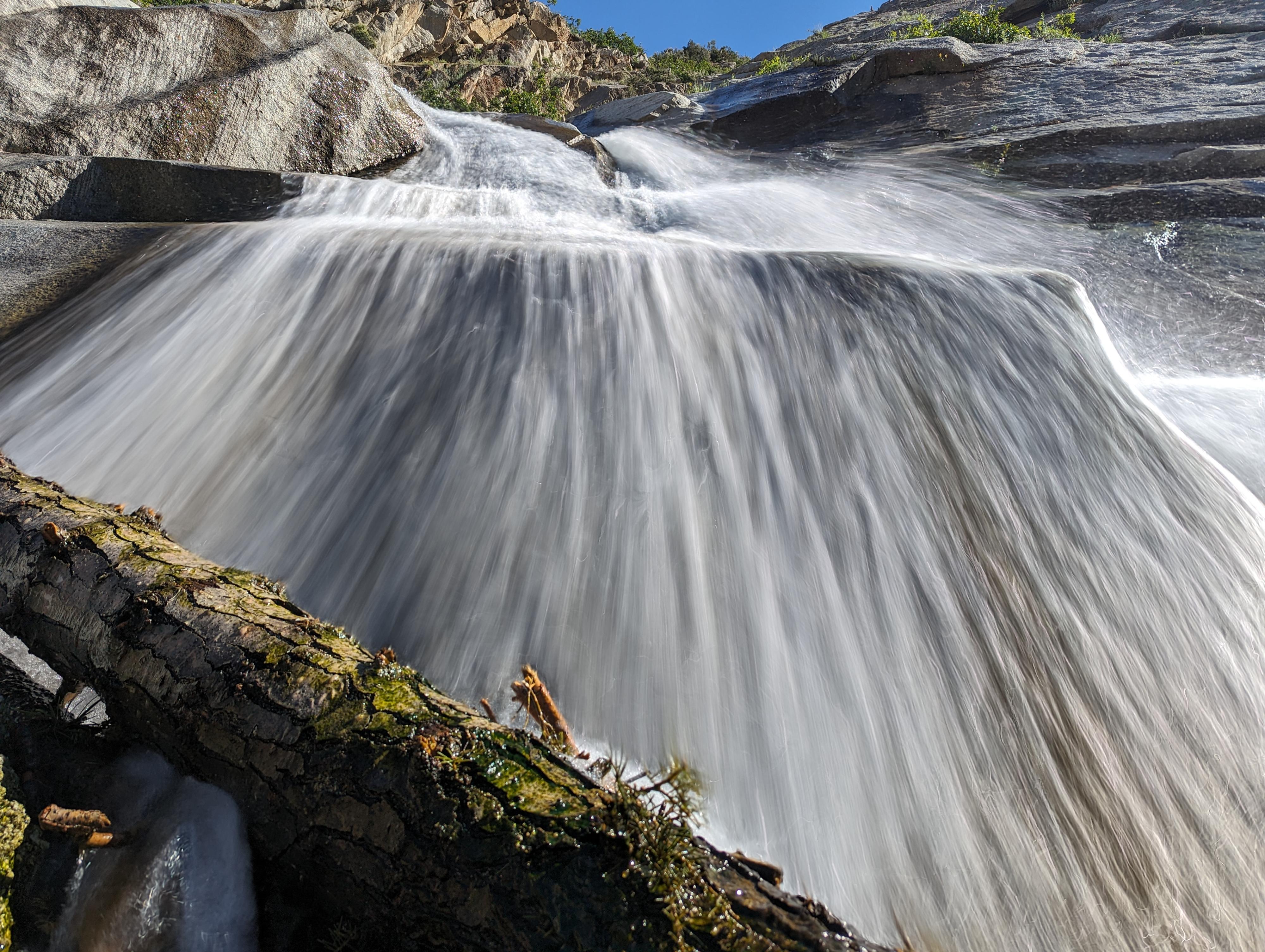
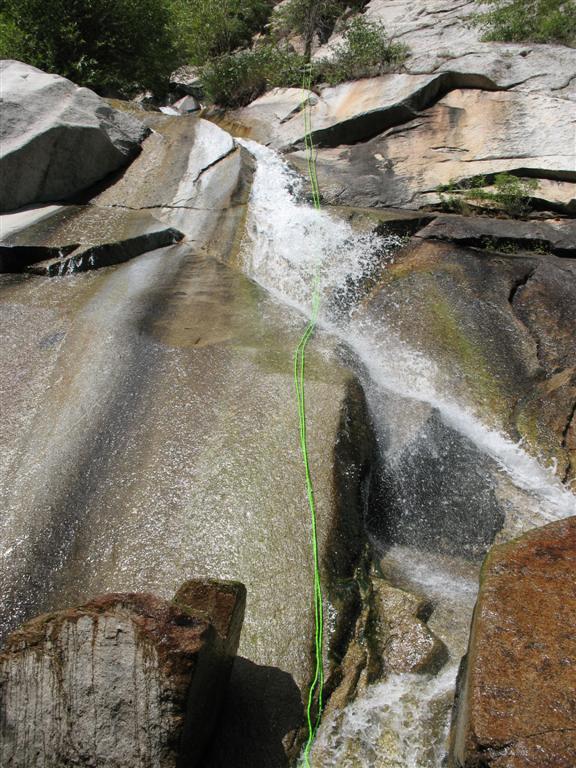
A big flood/rock slide hit the area in early July. It has completely changed the base of the falls. You used to be able to find anchors mid-way up off trees/boulders. As blakemalan points out below, they are now gone. You have to do the falls in one big rappel (about 60 m ( 197 ft. )).
Getting There
Little Cottonwood Canyon is on the east side of the Salt Lake City Valley. Get there by following I-215 to the east, taking exit 6 off the interstate and heading east toward the mountains.
Follow 6200 South which becomes Wasatch Blvd for 1.8 miles to the stop light and signs for Big Cottonwood Canyon. Continue south (straight) through the light an additional 2.3 miles to a junction and light. Stay left here, reaching the mouth of Little Cottonwood Canyon in an additional 1.6 miles.
From the mouth of Little Cottonwood Canyon, and park and ride lot, drive 2.8 miles up canyon to a pullout on the left (north) side of the canyon. This is on a bend, just past a large pullout on the right.
Route Description
From the trailhead follow the well-traveled dirt trail north about 10 minutes to the base of the falls. It is rocky in places, but I have seen even young children able to toddle up it!
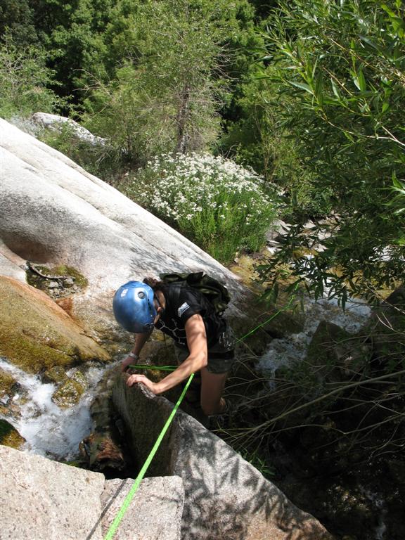
For those wishing to rappel the falls, follow the dirt trail as it climbs steeply up the left (west) side of the waterfall. The Falls used to have boulders/trees for a mid-way anchor, but they are gone. There is a bolted station at the top on the right (looking up canyon), inspect it thoroughly as it was subject to the major flood as well. The rap is almost exactly 60 m ( 197 ft. ), make sure your rope reaches.
From the top, it is a two stage rap to the base of the falls. Since the flood has cleaned out the middle level, it as an even better adventure than before.
Return the way you came.
Photos
Videos

Lisa Falls
Maps

12T 438515E 4491587N
40°34'22"N 111°43'35"W
12T 438416E 4491706N
40°34'26"N 111°43'39"W