 Canyoneering
Garden Balcony
Canyoneering
Garden Balcony
Dirty Devil
Overview
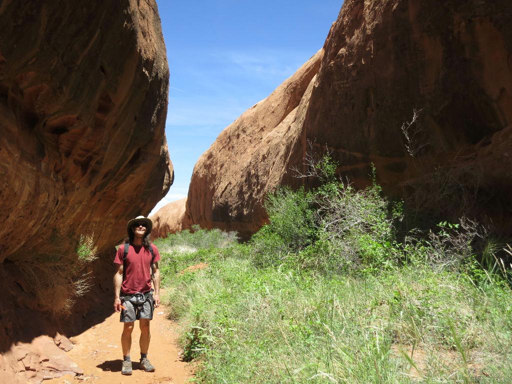
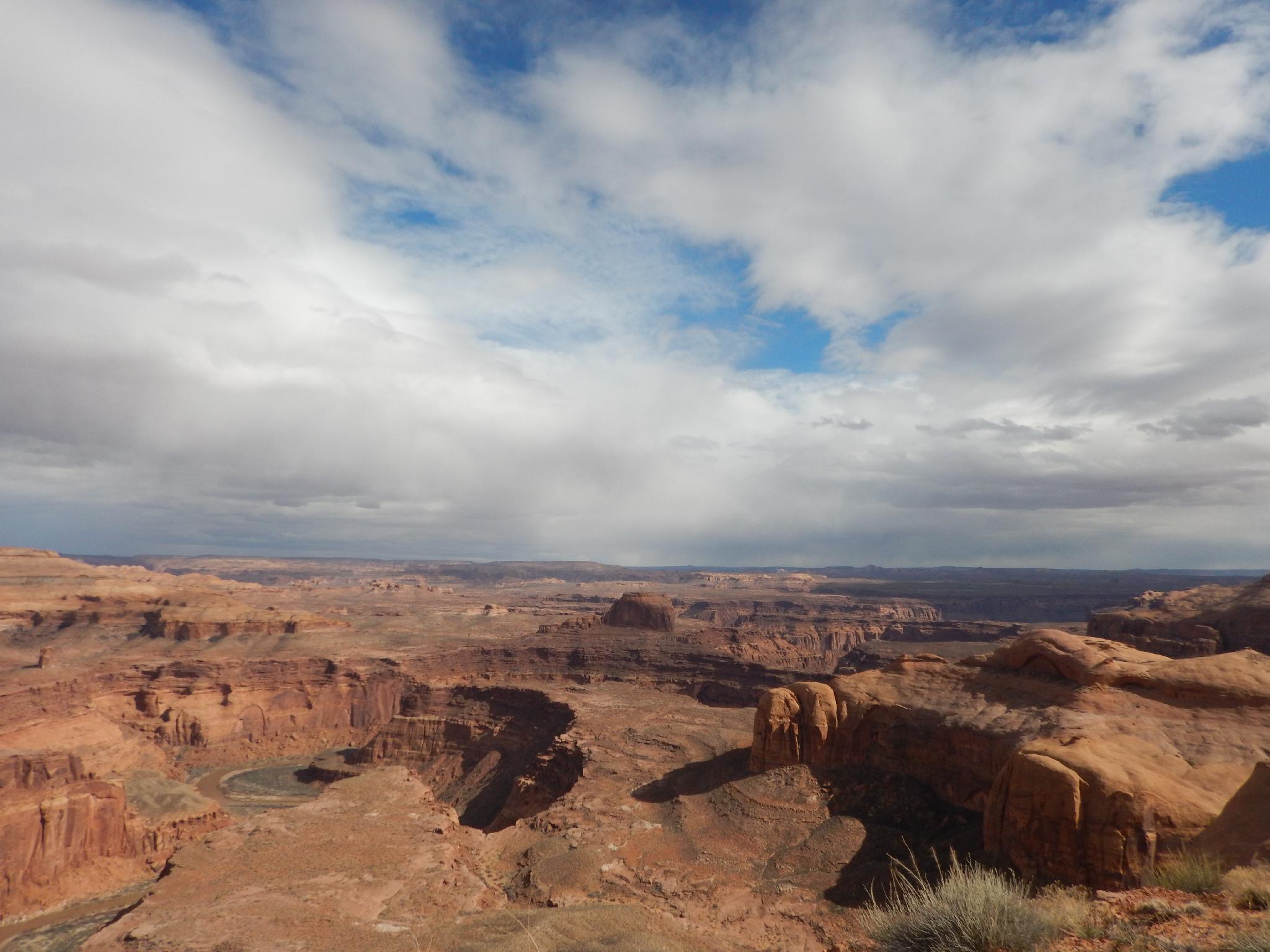
Garden Balcony is a short, easy canyon that offers some short narrows, a few easy downclimbs, and a neat patch of vegetation in an otherwise rocky landscape. The biggest attraction is the spectacular views of the Dirty Devil River and the sporting approach. It could be combined with Tumbleweed Balcony to the North to make a full day.
This route was originally contributed by user tacovan. Several people had commented the climbing was a bit trickier than they expected. I finally visited in the spring of 2016, and have updated the description.
Getting There
From Hanksville drive south on the Hwy 95 to Mile 10 and then turn left (east) onto the road to Angel Point.
Route Description
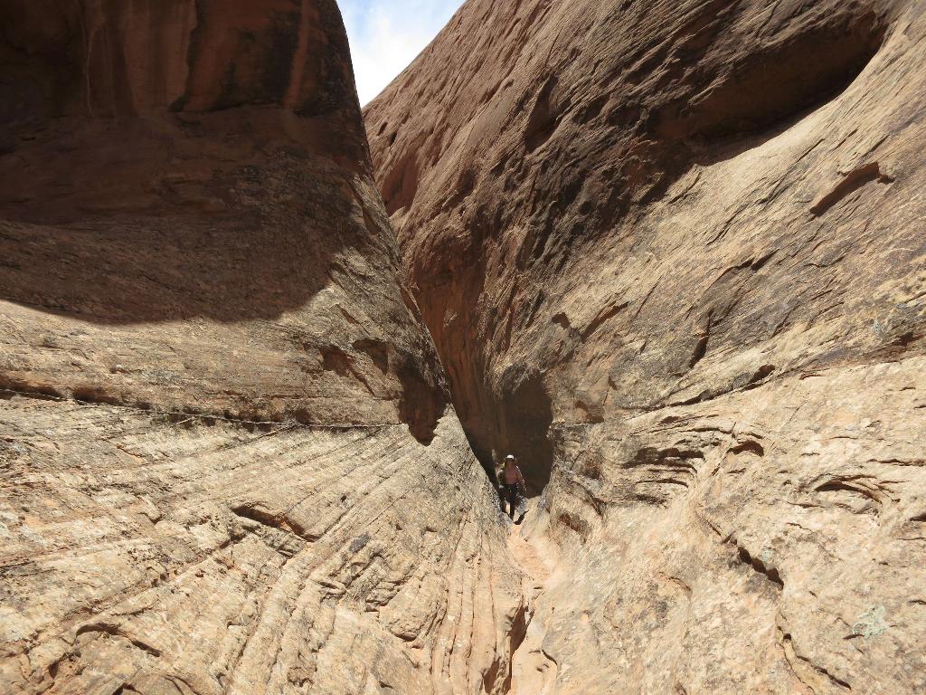
You have two options for doing Garden Balcony. Both will require some exposed easy 5th class slab climbing. The first option is to fix a short rappel and head directly down to the canyon. This is recommended, but will require both a 27 m ( 89 ft. ) and a 25 m rope. The second option is to downclimb the ridge and circle back to the canyon. Though easy 5th slab climbing, this approach offers exposure and requires good route finding. The ridge approach is recommended for climbers and offers a very elegant route.
From the drill hole, follow the old and mostly washed out road northeast toward the Dirty Devil River. When the canyon on the left comes close to the road, it is decision time.
Option 1:
Fix the rope down the drainage proper. Leave your rope, downclimb to the second rappel, then re-ascend out both. If using this option, there are several natural anchor near the head of the canyon that can be used.
Option 2:
The climber route continues along the road to the end. Keep going and work down and off the point. A couple of exposed but easy downclimbs lead to easier terrain. Circle around the ridge and work west and down toward the head of the canyon.
Both:
The rappel into the canyon bottom uses a rock pile in a depression as an anchor. Reaching this spot requires a bit of skill and slab route finding. Once there, LEAVE YOUR ROPE! You will need to re-ascend the rope to get back out. Rappel the 25 m ( 83 ft. ) to the canyon bottom.
Heading down canyon are a few short downclimb problems before the final plunge down to the Dirty Devil River. Return the same way and re-ascend your ropes.
Maps

12S 543795E 4230932N
38°13'31"N 110°29'59"W
12S 544400E 4231836N
38°14'00"N 110°29'34"W
12S 544143E 4231701N
38°13'56"N 110°29'44"W
12S 544215E 4231406N
38°13'46"N 110°29'41"W