 Hiking
Flagstaff Peak (Mountain)
Hiking
Flagstaff Peak (Mountain)
Little Cottonwood Canyon
Overview
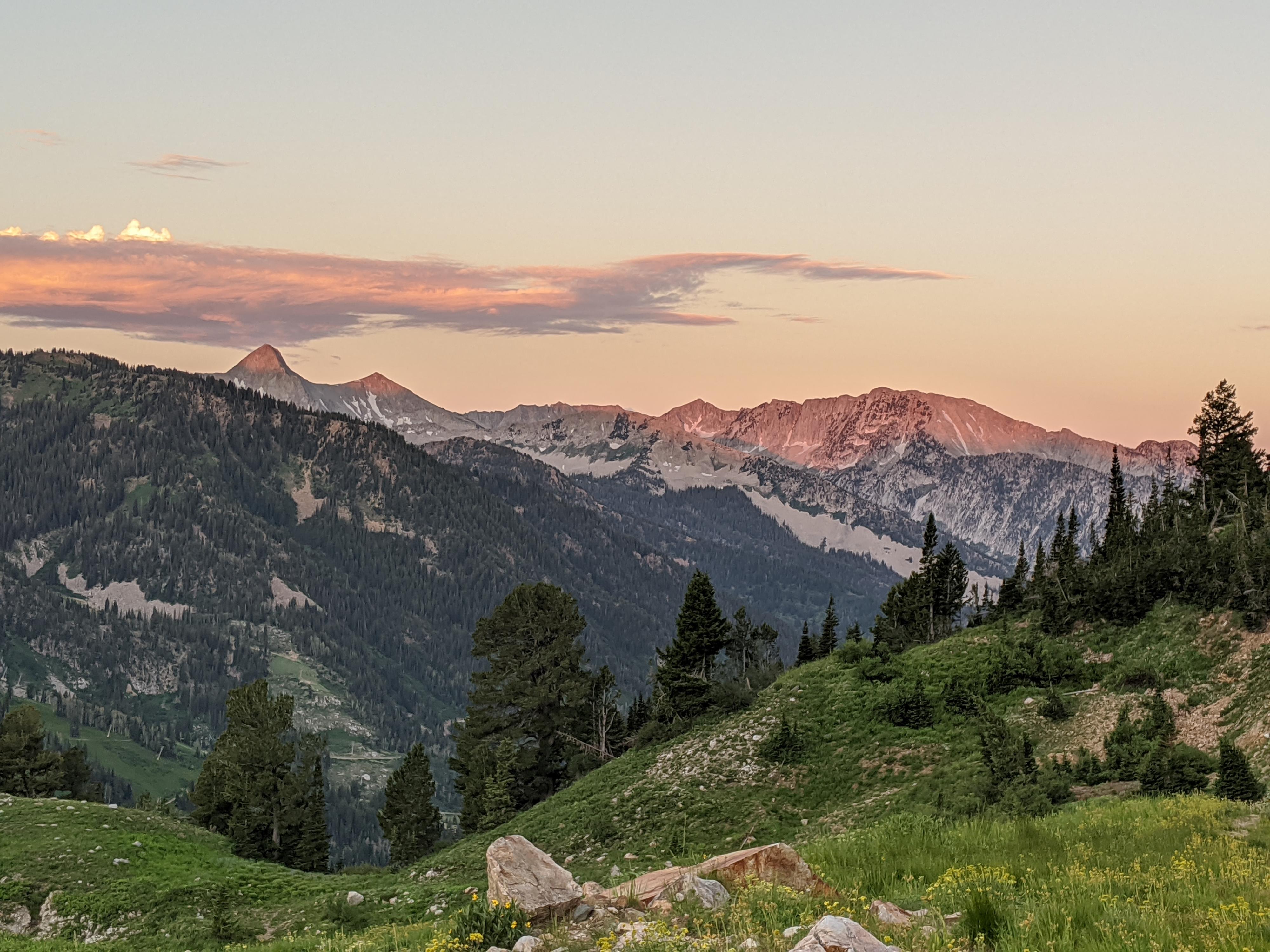
Flagstaff Peak to Grizzly Gulch is one of my favorite sections of ridges to hike in the canyons. Getting to the summit of Flagstaff is not technical but is steep! It will get the heart pounding and test your cardio. Once on the ridge, it is a lovely amble with excellent views of Big and Little Cottonwood Canyons along the way. Doing the loop up Flagstaff, along the ridge, and down Grizzly makes for a solid half day hike. Just make sure to be aware of afternoon thunderstorms, to avoid being caught on the ridge during lightning.
For less motivated groups, hiking up Flagstaff and returning the same way is a nice shorter outing that will still test your cardio. The grassy slopes of the south face of Flagstaff can be quite colorful in wildflower season. There is not much left of the old mine but seeing the tailing pile and road makes for an interesting bit of history.
Getting There
Little Cottonwood Canyon is on the east side of the Salt Lake City Valley. Get there by following I-215 to the east, taking exit 6 off the interstate and heading east toward the mountains.
Follow 6200 South which becomes Wasatch Blvd for 1.8 miles to the stop light and signs for Big Cottonwood Canyon. Continue south (straight) through the light an additional 2.3 miles to a junction and light. Stay left here, reaching the mouth of Little Cottonwood Canyon in an additional 1.6 miles.
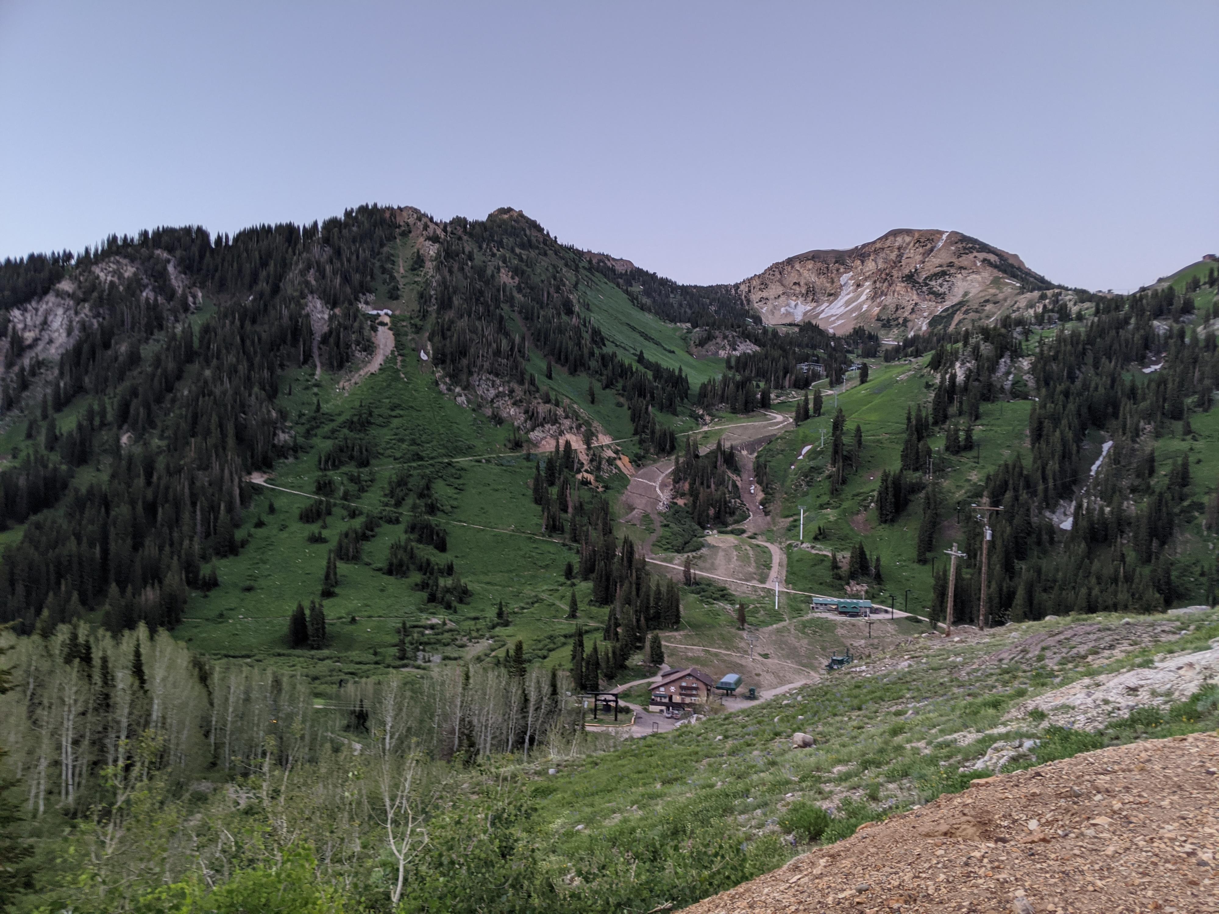
From the mouth of Little Cottonwood, travel up the canyon 8.1 mile, where Our Lady of the Snows Center is on the left. (Across from the Alta Lodge, just before the Shallow Shaft Restaurant.) Park here, just after a dirt road leaves on the left.
Route Description
To The Summit (1.9 miles / about 2000’ of gain / 2 hours)
From the trailhead, follow the road north and east as it climbs up through a small neighborhood. At the third switchback is trail junction. Right goes toward Grizzly Gulch. Go left toward Cardiff Pass as the trail steepens. About 4 switchbacks after the first junction is a second less defined junction with an old mining road leaving on the right. Take this less road as it climbs and zig zags up to an old mine tailing pile. The road ends here at the mine. The path? Straight up the grassy slope! Work up the slope, trending a bit west to the obvious low point on the ridge.
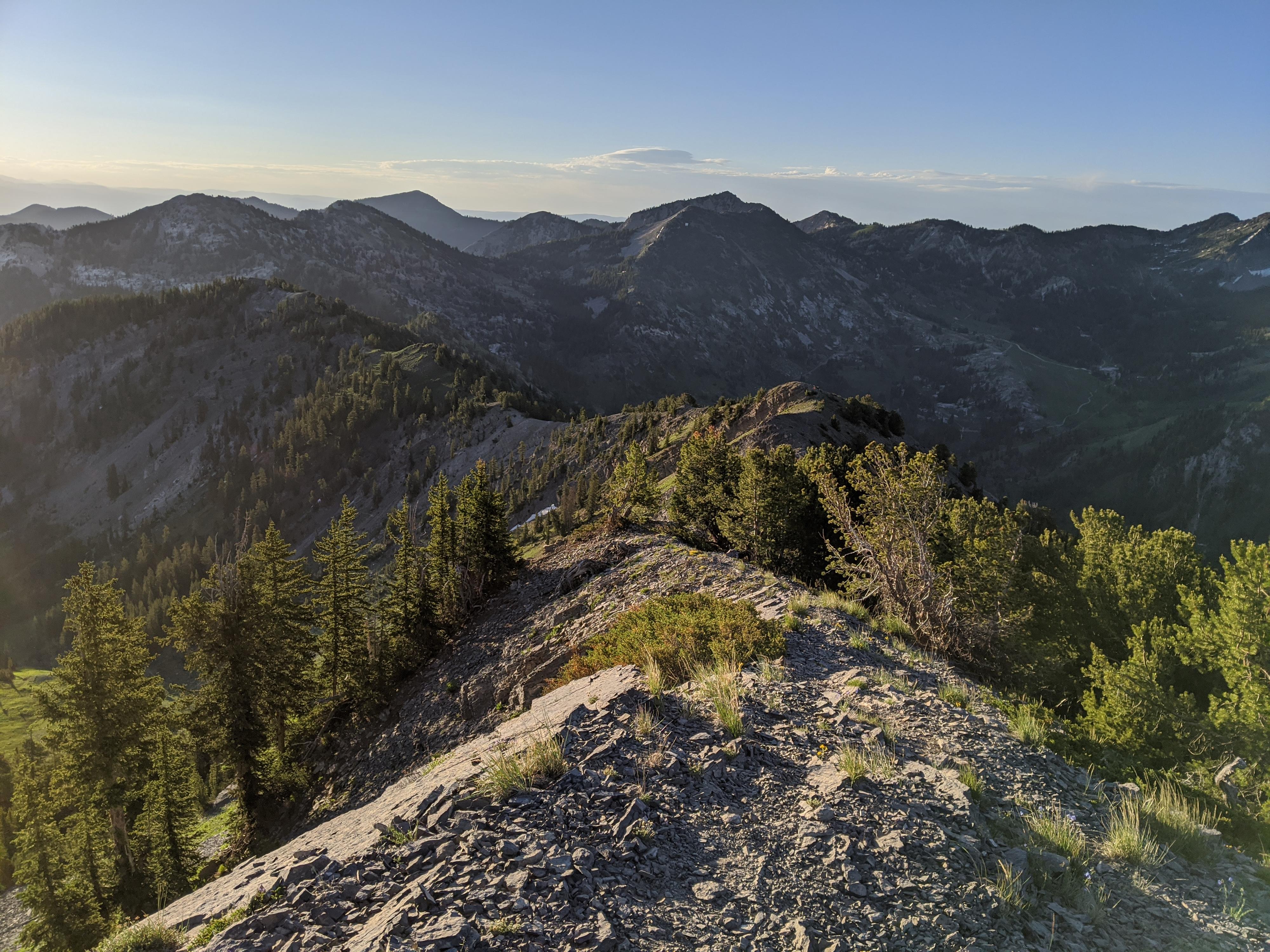
Once you reach the ridge, a good social trail heads east (right) up to Flagstaff Mountain. The USGS maps mark the top as near where the trail reaches the top. The highest peak, however, is the peak north of the ridge. A lesser used social trail goes down on the east side around a rock outcropping, then continues to the true summit. (for the purists!)
Ridge to Grizzly Gulch (1.9 miles / 1 hour)
If making the ridge run, head east from the peak along the well-defined social trail. It meanders around Days Fork, and both forks of Silver Fork before reaching Davenport Hill. There are a few social trails leaving the ridge, stay on the most used trail near the ridgeline. It is never away from the ridge for more than a few minutes.
At Davenport Hill, a more prominent junction is reached. Go right, on the south side of Davenport Hill. Left descends into Silver Fork. At first, right does not look as well travelled, but soon becomes well defined. Once around Davenport, the trail drops to a saddle at the top of Silver Fork. Continue east a few minutes to where the trail climbs out of the saddle and meets the old mining road to Prince of Wales Mine / Grizzly Gulch.
Down Grizzly Gulch (1.75 miles / 40-60 minutes)
Go right on the old mining road. As it passes through the upper meadows, wildflowers are likely to abound. Stay on the old road that becomes more defined as you descend toward the bottom of Little Cottonwood. It reaches a stream, and bends east, descending a very rocky old section of road.
Shortly after the ruins of the Michigan Utah Mine are on the right. Keep on the old road, going straight when you reach a gate and junction. Past the gate, the road is very well travelled. A sign shows the trail junction where it leaves the road. If you descend this single track, you reach the Little Cottonwood Canyon road about 0.2 miles above where you parked. This is likely the fastest way back. Or, stay on the road and go left at the next junction. This route re-traces a bit of the first part of the hike.
Photos
Maps
 - Hiking Map")
12T 446062E 4493462N
40°35'25"N 111°38'15"W
12T 446036E 4493596N
40°35'29"N 111°38'16"W
12T 445491E 4493811N
40°35'36"N 111°38'39"W
12T 445407E 4494227N
40°35'49"N 111°38'43"W
12T 445227E 4494505N
40°35'58"N 111°38'50"W
12T 445330E 4494646N
40°36'03"N 111°38'46"W
12T 447786E 4494516N
40°35'59"N 111°37'02"W
12T 447792E 4494673N
40°36'04"N 111°37'01"W
12T 447854E 4494892N
40°36'12"N 111°36'59"W
12T 447884E 4495049N
40°36'17"N 111°36'58"W
12T 447597E 4494130N
40°35'47"N 111°37'10"W
12T 446880E 4493887N
40°35'39"N 111°37'40"W
12T 446850E 4493876N
40°35'38"N 111°37'41"W
12T 446431E 4493804N
40°35'36"N 111°37'59"W