 Hiking
Delicate Arch
Hiking
Delicate Arch
Arches National Park
Overview
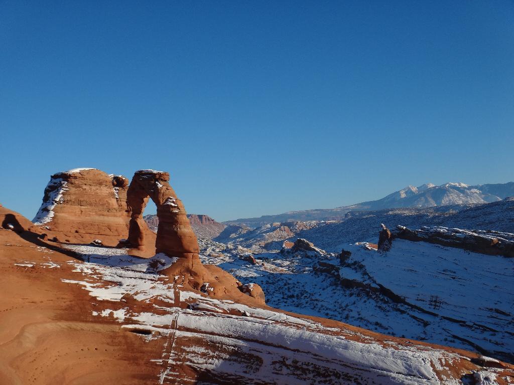
Delicate Arch is one of the quintessential symbols of Utah, and southern Utah in particular. The arch is uniquely perched in an Entrada sandstone bowl high on the cliffs and stands about 20 m ( 66 ft. ) high. Delicate Arch is one of the most popular places to visit in Arches, and probably the top of my list for any first-time visitor. A must do.
For non-hikers, there are a couple of viewpoints where you can see the arch from a distance with very little hiking. Not nearly as good as visiting the arch up close and in person, but worthwhile if you are unable to make the hike up, or as a good pre/post hike visit.
Getting There
From the Arches visitor center, follow the scenic drive 11.5 miles to the Delicate Arch turnoff on the right. The main Delicate Arch trailhead is 1.2 miles down this road. For the viewpoint, continue on an additional mile.
Route Description
Viewpoint (0.5 miles round trip, 30 minutes)
The lower viewpoint is a few hundred feet from the trailhead and gives good, but distant views of Delicate Arch. For those with a little more ambition, the upper viewpoint is 0.25 miles each way up the trail. This is a good, short hike to get a view of the arch that is suitable for most.
Arch Trail (3 miles round trip, 1.5 - 3 hours)
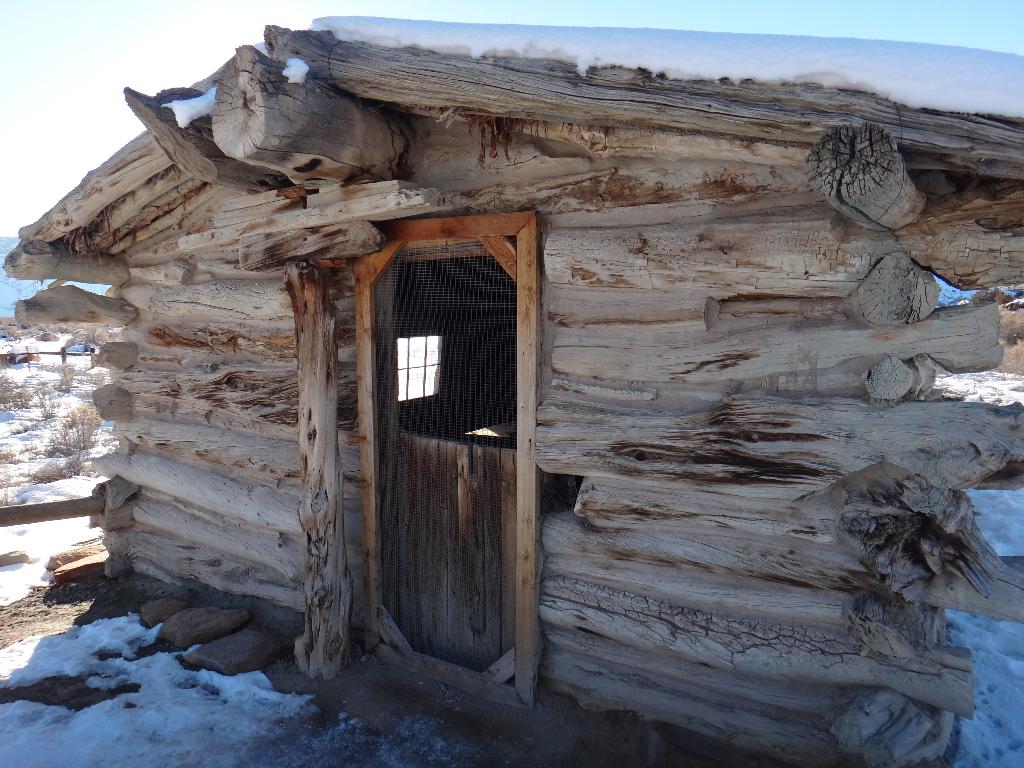
From the trailhead, the first stop is the Wolfe Ranch, an old settlement by John Wesley Wolfe from the late 1800s. Amazing to think of how remote the area must have been back then.
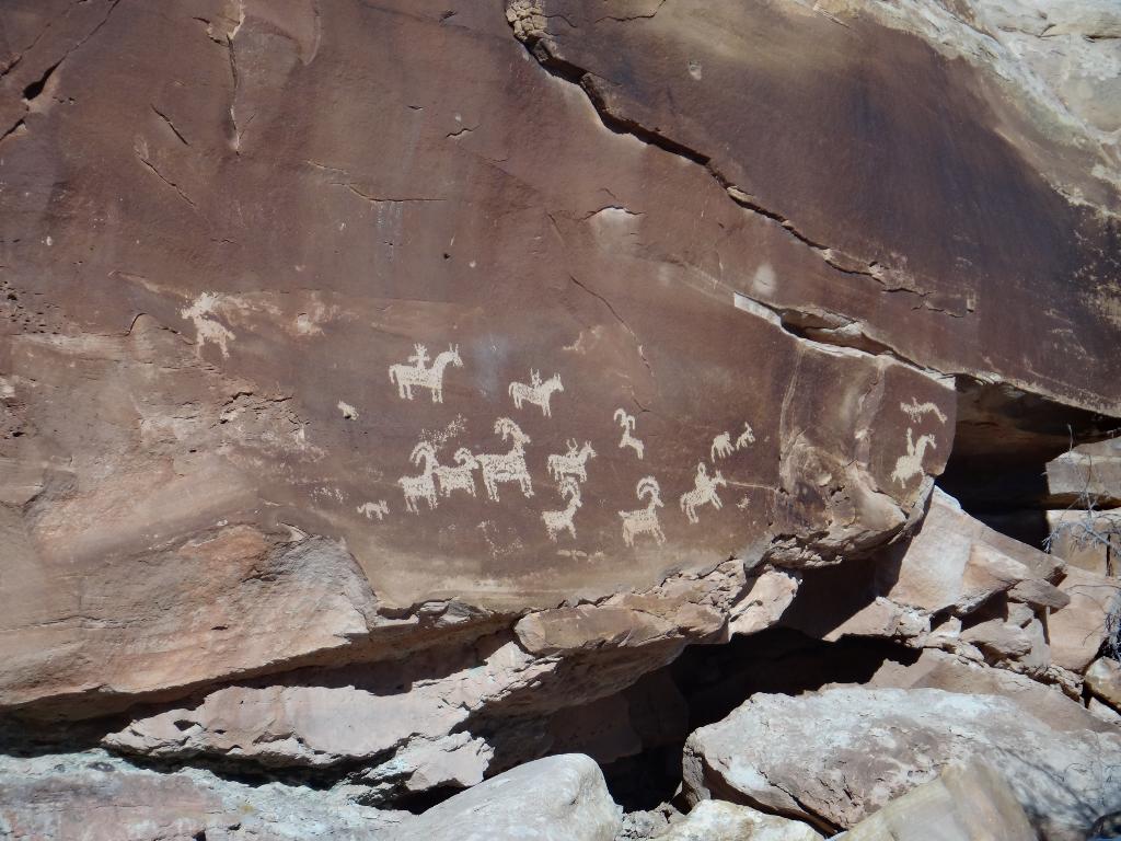
Just past the cabin a short side trail visits a petroglyph panel. The panel dates from 1650-1850 and is worth the short side trip. From the panel, the trail begins climbing to the arch. Expect about an hour to the arch from the trailhead. Return the same way.
Maps

12S 630267E 4288336N
38°44'03"N 109°30'04"W
12S 630286E 4288729N
38°44'16"N 109°30'03"W
12S 628580E 4288473N
38°44'08"N 109°31'14"W
12S 628746E 4288688N
38°44'15"N 109°31'07"W
12S 630407E 4289387N
38°44'37"N 109°29'58"W