Rex Peak |

Crawford Mountains

Roadside Attraction Rex Peak - Crawford Mountains Roadside Attraction Rex Peak
Crawford Mountains

Overview | Getting There | Route | Photos | Maps | Comments

Overview

RATING: Roadside Attraction
LENGTH: 1 hour
MAPS: REX PEAK, UT

Sun

Snow likely, mainly before noon.  Mostly cloudy, with a high near 30. Wind chill values as low as 9. West wind 11 to 15 mph.  Chance of precipitation is 60%. New snow accumulation of less than a half inch possible.

30 | 20

Mon

Snow.  High near 26. Northeast wind 7 to 10 mph.  Chance of precipitation is 90%. New snow accumulation of 2 to 4 inches possible.

26 | 21

Tue

Snow likely.  Mostly cloudy, with a high near 23. Chance of precipitation is 70%. New snow accumulation of around an inch possible.

23 | 15

Wed

A chance of snow showers.  Partly sunny, with a high near 24.

24 | 9

Thu

A slight chance of snow showers.  Mostly sunny, with a high near 28.

28 | 5

View Full Weather Details
SEASON: Spring, Summer, Fall
WATER: None

Sun

Snow likely, mainly before noon.  Mostly cloudy, with a high near 30. Wind chill values as low as 9. West wind 11 to 15 mph.  Chance of precipitation is 60%. New snow accumulation of less than a half inch possible.

30 | 20

Mon

Snow.  High near 26. Northeast wind 7 to 10 mph.  Chance of precipitation is 90%. New snow accumulation of 2 to 4 inches possible.

26 | 21

Tue

Snow likely.  Mostly cloudy, with a high near 23. Chance of precipitation is 70%. New snow accumulation of around an inch possible.

23 | 15

Wed

A chance of snow showers.  Partly sunny, with a high near 24.

24 | 9

Thu

A slight chance of snow showers.  Mostly sunny, with a high near 28.

28 | 5

View Full Weather Details
Heading to the base of the Crawford Mountains

Heading to the base of the Crawford Mountains

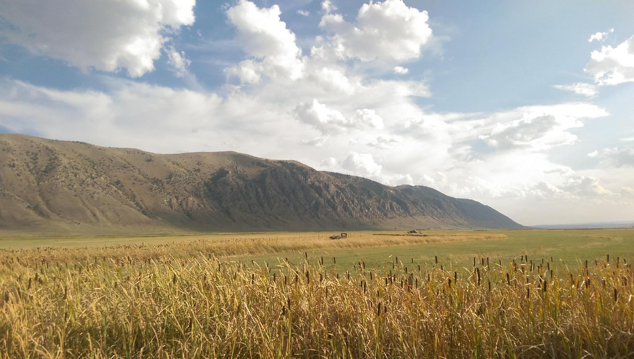
Tucked in the northeast corner of Utah, the Crawford Mountains rise steeply above the farmland that surrounds the Bear River as it lazily meanders its way to Idaho and eventually the Great Salt Lake. The mountains are infrequently visited today, but where home to extensive phosphate mining, particularly from the mid-1900's to the 1970s. Phosphate has a number of uses, but the majority is used in fertilizers.

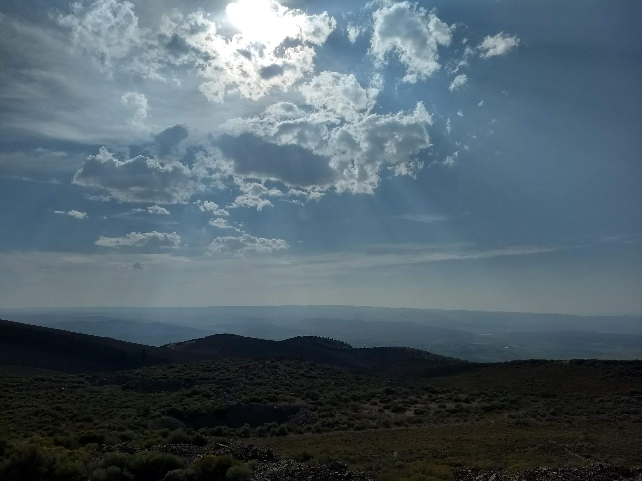
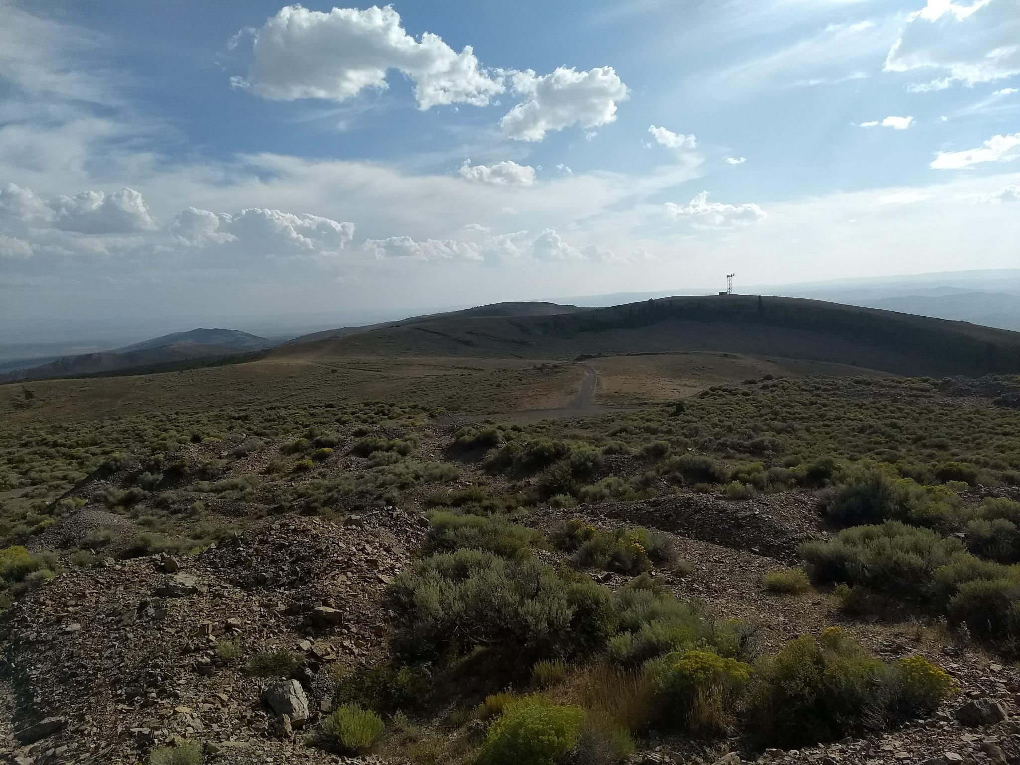
Rex Peak is the highest peak in the Crawford Mountains and has a road leading to its summit. The views from the top, all the way to the Uinta mountains, are quite good and the ease of the peak makes it a fun family-friendly outing.

Note: The area has been heavily mined. Be aware of mining ruins, unstable cliffs, etc... There is a warning sign at the entrance to Brazier Canyon from the DNR.
Note 2: There is no water available, but scenic primitive camping on the side roads near the top of the range abounds.
Views from the summit-ish.

Views from the summit-ish.

Getting There

From Randolph Utah, travel north on UT-16. About 1.7 miles north of Randolph, turn right (east) on Crawford Mountain Road (Mile Post 22.4). Follow this road 5.1 miles as is crosses fields, the Bear River, and reaches a 4-way junction at the base of the Crawford Mountains.

  • Jct - Straight into Brazier Canyon ( 12T 492621mE 4615967mN / N41° 41' 44" W111° 05' 19" )
  • 2.1 miles - Jct - Stay Right ( 12T 493111mE 4614225mN / N41° 40' 47" W111° 04' 58" )
  • 4.0 miles - Jct - Stay Left ( 12T 491919mE 4612214mN / N41° 39' 42" W111° 05' 49" )
  • 4.2 miles - Stay Right ( 12T 491852mE 4611968mN / N41° 39' 34" W111° 05' 52" )
  • 4.9 miles - Jct - Left ( 12T 492036mE 4611459mN / N41° 39' 17" W111° 05' 44" )
  • Park ( 12T 492034mE 4611658mN / N41° 39' 24" W111° 05' 44" )
Looking south to the slightly lower other summit.

Looking south to the slightly lower other summit.

Route

From the top, pick a spot to park, and head up to whatever you think is the highest pile of gravel! The point marked on the map seemed closes to the USGS high point when we visited, though to be sure, we climbed up several small piles in the area that all seemed to be competing for the highest spot.


Maps

Printable Maps:
Park

12T 492034mE 4611657mN

N41° 39' 24" W111° 05' 44"

Summit-ish

12T 492131mE 4611592mN

N41° 39' 22" W111° 05' 40"

Comments

Want to make a comment? Login and let yourself be heard.