 Hiking
Ben Lomond Peak
Hiking
Ben Lomond Peak
North Skyline Trail
Overview
At 9,716, Ben Lomond Peak is a popular peak to summit in the northern Wasatch. There are many routes to the summit. Of the two I have done, Cutler Basin and this one, North Skyline Trail, this one is my favorite. Both Skyline and Cutler gain about the same amount of elevation, so the difference comes down to how steep of a hike you want.
This route is longer but has a ridge section with big views of the surrounding area. Though longer, I enjoyed the hiking more than the Cutler Basin approach.
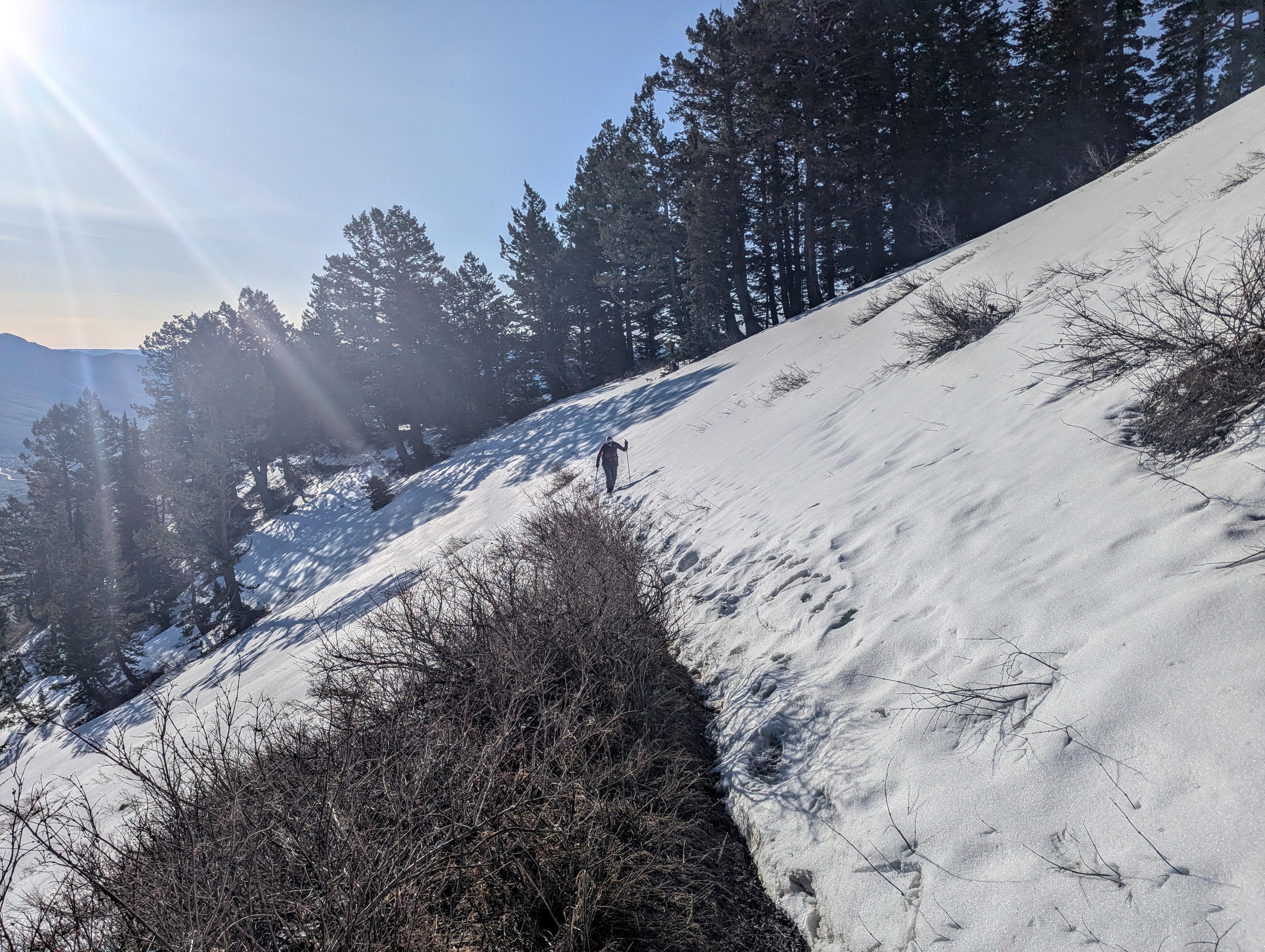
Diane and I attempted this in late April 2026 after a very light snow year and had to turn back at the Cutler Basin junction. The upper portion of the route was still buried in heavy snow. Depending on the snow year, the peak may not be snow-free until July. I re-visited via Cutler Basin in late May of the same year, and the snow was much more patchy and manageable.
The peak is equally famous for inspiring the iconic Paramount Pictures "Majestic Mountain" logo. In 1914, Ogden native and movie theater pioneer William W. Hodkinson doodled the original design on a scrap napkin during a studio meeting, drawing the star-circled, snow-capped peak entirely from his childhood memories of Ben Lomond. While modern CGI updates have since stylized the logo to closely resemble sharper peaks like Peru's Artesonraju, the cinematic icon's DNA belongs firmly to the Utah landmark.
Getting There
From I-15, take exit 349 for UT-134/2700 and head east toward the mountains once off the highway.
Follow 2700 North, which becomes 2600 North for 4 miles, then turn left on 1050 E. Follow 1050 E for about 0.7 mile and turn right on 3100 N/E N Ogden Canyon Road and follow it for 3 miles to the large parking area and trailhead on the right side of the road.
Route Description
From the parking area, cross the highway to the north side and trailhead proper. Start up the trail. It gains about 1,000' in the first 1.5 miles via a series of big switchbacks. At about 1.5 miles, the trail eases a bit and traverses along the east side of the range.
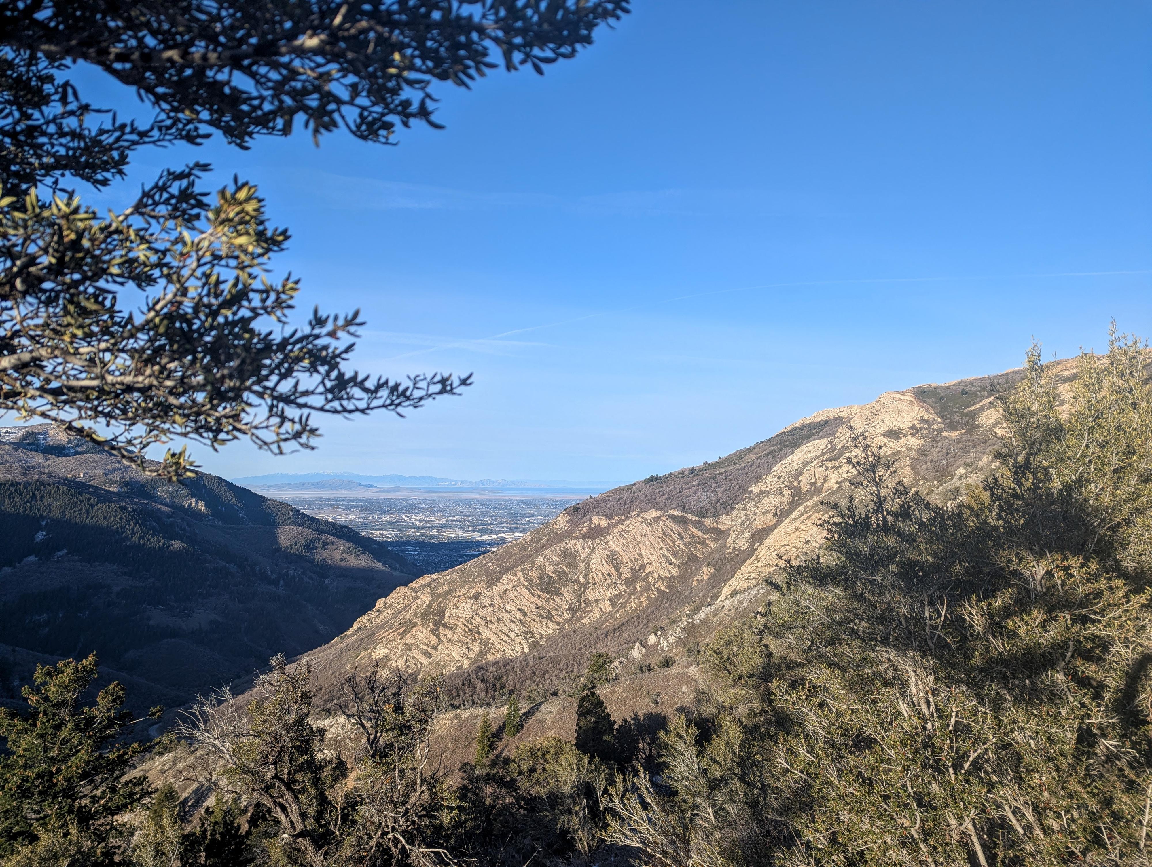
At a little over 4 miles, the trail crosses to the west side of the range with the first views of Ogden and the Great Salt Lake.
It is about 6.5 miles to the base of the peak where the trails from North Fork Park join up from the right (east).
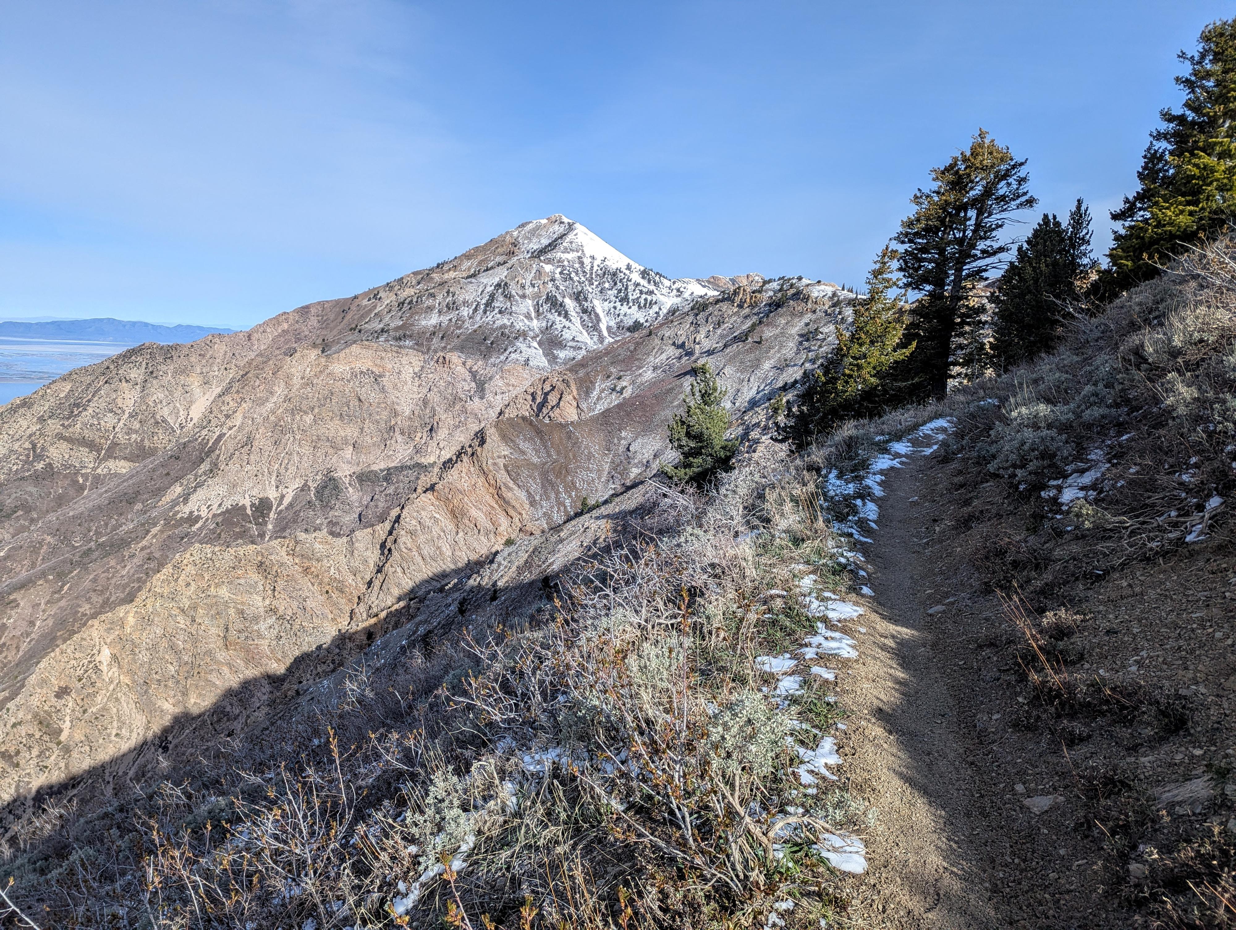
As you've seen for the last bit, Ben Lomond is the prominent peak just northwest of the trail.
The trail heads up to the summit via numerous sweeping switchbacks. As a hiker, the switchbacks seem a bit overdone, but remember it is a multi-use trail! The summit, on a clear day, has big views all around.
Return the same way.
Photos
Maps

12T 424768E 4574737N
41°19'14"N 111°53'56"W
12T 420592E 4579426N
41°21'45"N 111°56'58"W
12T 420710E 4579473N
41°21'46"N 111°56'53"W
12T 419644E 4579522N
41°21'48"N 111°57'39"W