
 Cathedral Valley
Capitol Reef National Park
Overview
Cathedral Valley, in the northern part of Capitol Reef National Park, is a mesmerizing geological wonder. The area gets its name from the towering rock formations that resemble Gothic cathedrals, with massive monoliths and intricate sedimentary layers creating a surreal landscape. Capitol Reef itself is known for its diverse and stunning red-rock scenery, but Cathedral Valley stands out as an extraordinary highlight within the park. It is an area I have visited many times over the years, and always enjoy. We did an overnight trip when our daughter was 5, and it was a trip she absolutely loved.
VISITING NOTES
SEASON: Spring and Fall are my preferred seasons for visiting. You can visit in the summer, though it can be hot if you intend to do any hiking. Winter can bring impassable roads if there is any snow, ice, or mud. I've done several October/early November trips that have been really lovely, especially with fall colors on Thousand Lake Mountain.
TIME: This CAN be driven in a half day if you are not interested in side hikes and are just hurrying through. My recommendation is at least a full day, and preferably as an overnight camping trip. Sunrise and sunsets are dramatic along the route, and camping helps you see these beautiful times of day.
ROAD CONSIDERATIONS: The common route, described here, is over 50 miles of dirt road. Though generally good, high clearance recommended.
Be sure to bring plenty of fuel, water, and food. Though in a national park, you can go days without seeing anyone else in this area. You need to be prepared to self-rescue if you have a mechanical or other issue.
Sections of the road are made up of bentonite clay. This clay is incredibly slippery when wet, so much so it is used as lubrication when drilling wells. Stay out of the area if precipitation has recently occurred or is in the forecast. Even the most off-road worthy vehicle will not make it far in bentonite if the road is wet.
The route requires crossing the Fremont River. This crossing is usually fairly straightforward, but can be impossible during spring runoff or after recent rains. Call the park's automated phone system at (435) 425-3791 and press 1 for visitor information; 4 for road conditions. This is updated regularly with information and depth of the ford. The USGS also maintains a stream guage near the ford ( https://waterdata.usgs.gov/monitoring-location/09330230/#parameterCode=00060&period=P7D&showMedian=true ). I recommend less than 50 CFS on the guage for easy crossing though you can go a fair bit higher in high clearance vehicles.
You can drive the route in either direction. The common direction, described below, gets the river ford out of the way early in the drive and is generally how most people drive the route.
CAMPING: There is no camping inside of Capitol Reef National Park, except at the Cathedral Valley Campground. This small, primitive campground is first come/first serve and does not have water or trash pickup. It does have fire pits, tables, and pit toilets.
You can camp on the BLM and National Forest land that surrounds the National Park. Keep an eye on the map to be certain you are outside of National Park boundaries if camping on BLM or National Forest land. There are many EXCELLENT primitive camping opportunities on the non-National Park sections of the drive.
Getting There
From the Capitol Reef Visitor Center, head east on UT-24 towards Hanksville for 12 miles through the park to milepost 91. This is outside the national park. Turn left (north) here on a signed dirt road to the river ford. Reset your odometer as you turn off the pavement.
Route Description
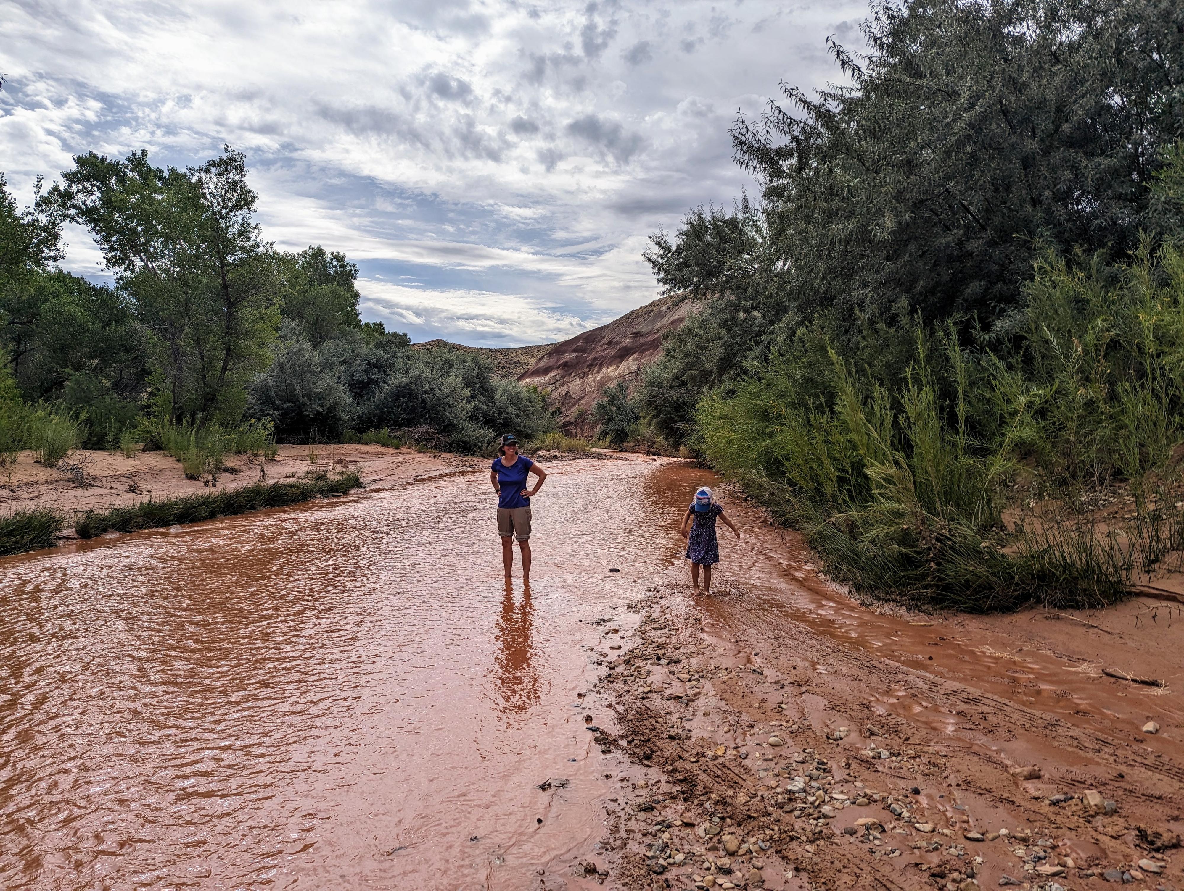
Checking out the river ford. This was after a flashflood, so a bit muddier than usual.
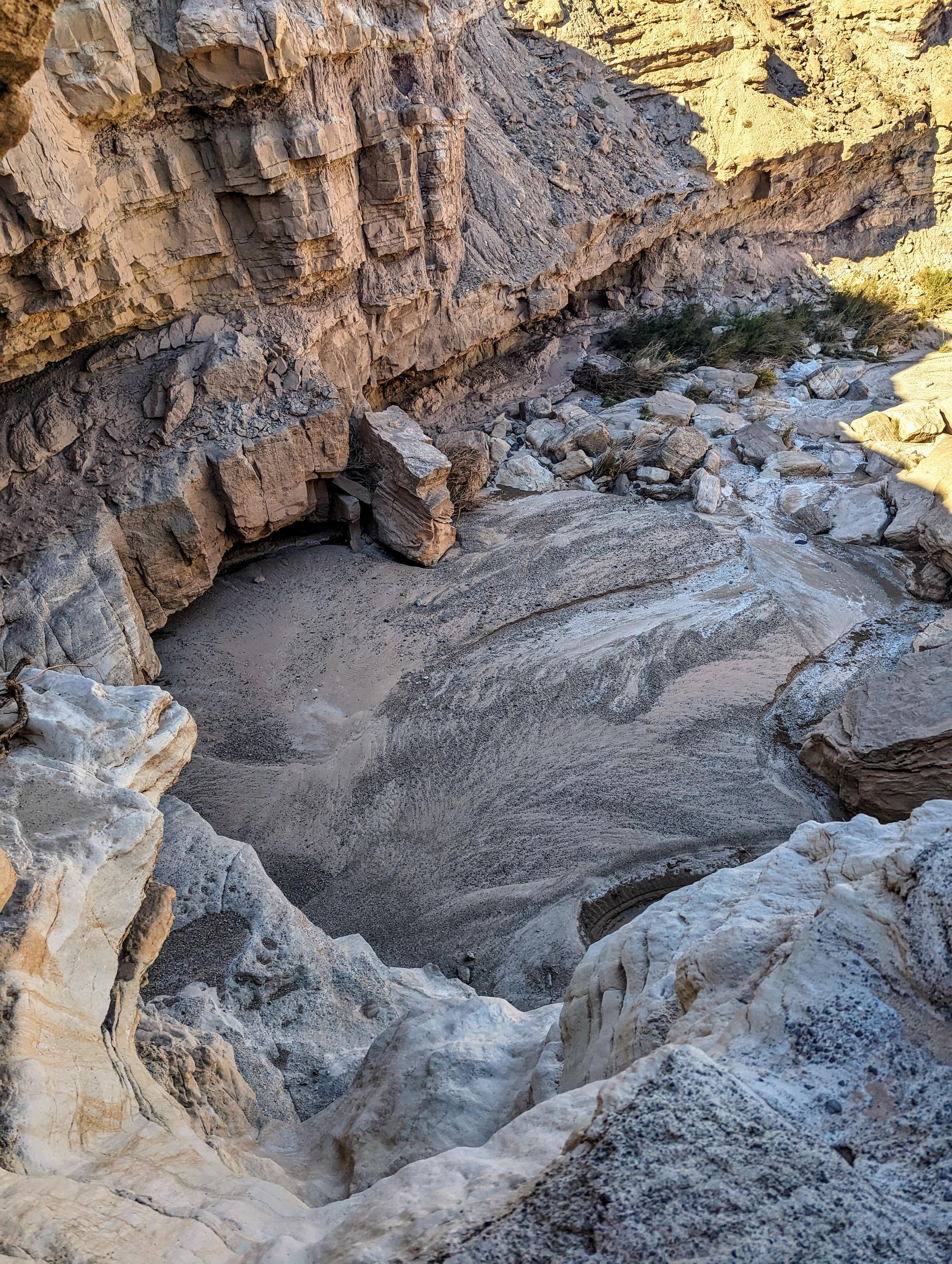
Dryfall at mile 2.9
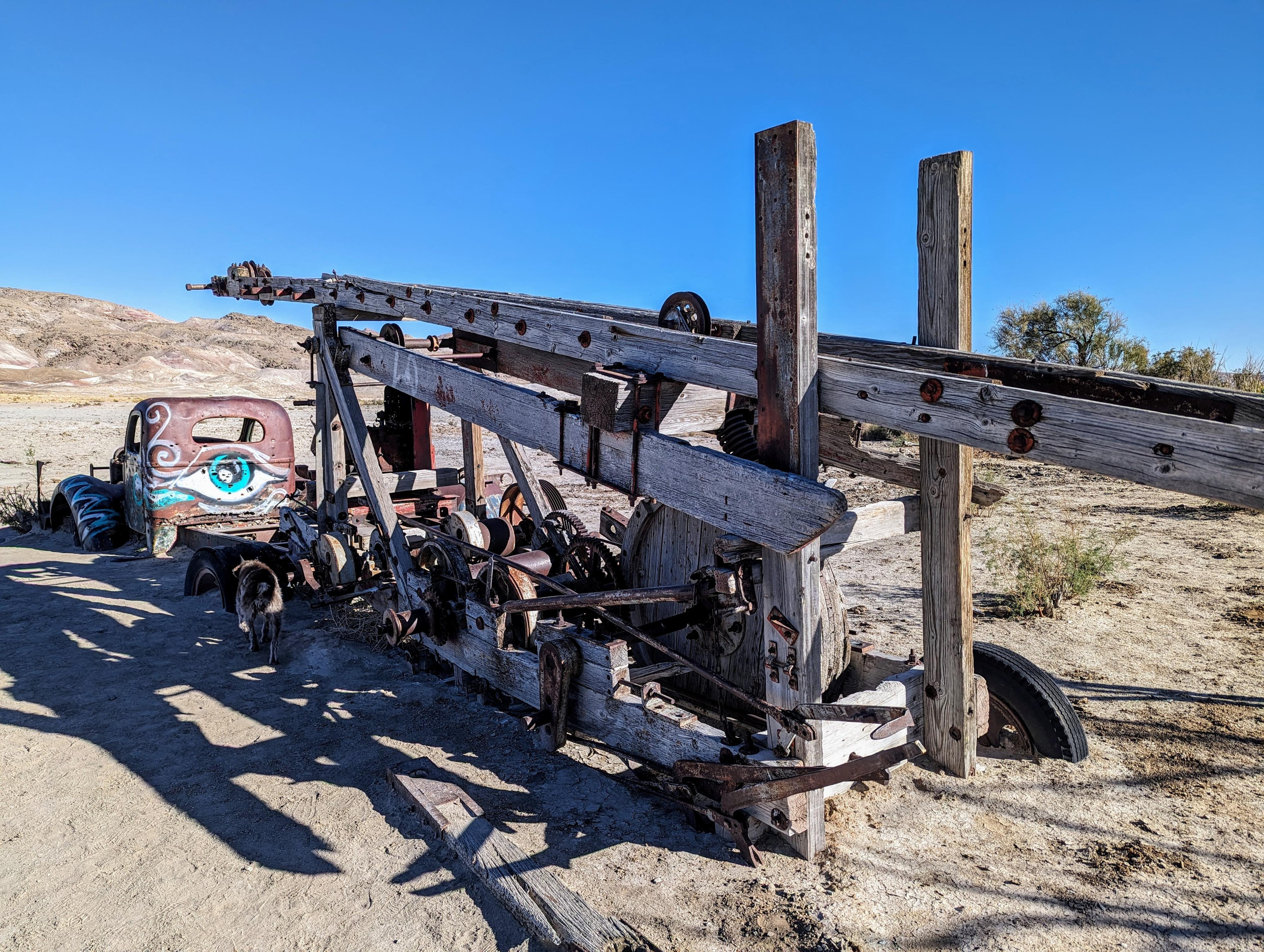
The old well drilling truck. What a relic!
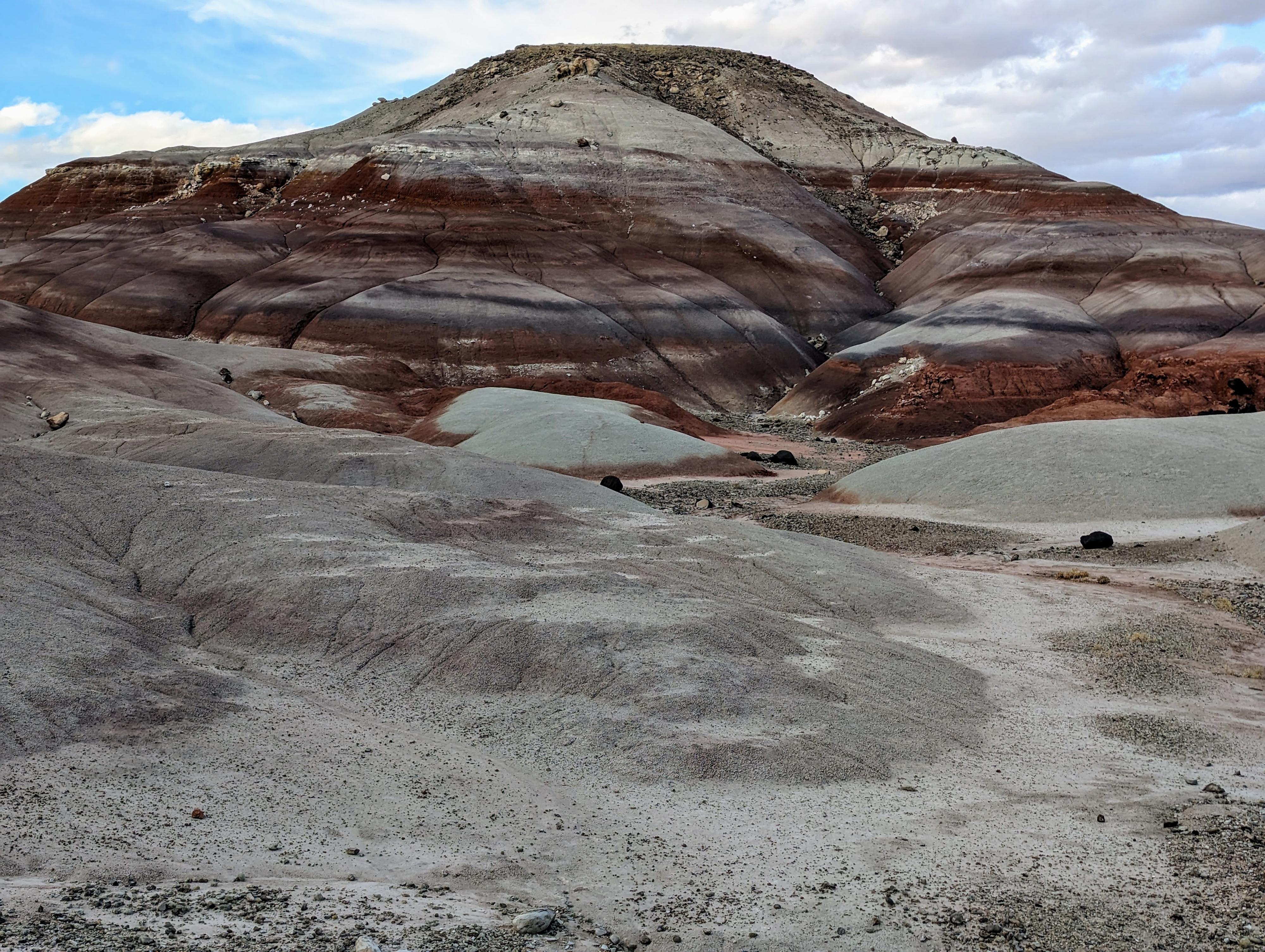
The colorful Bentonite Hills
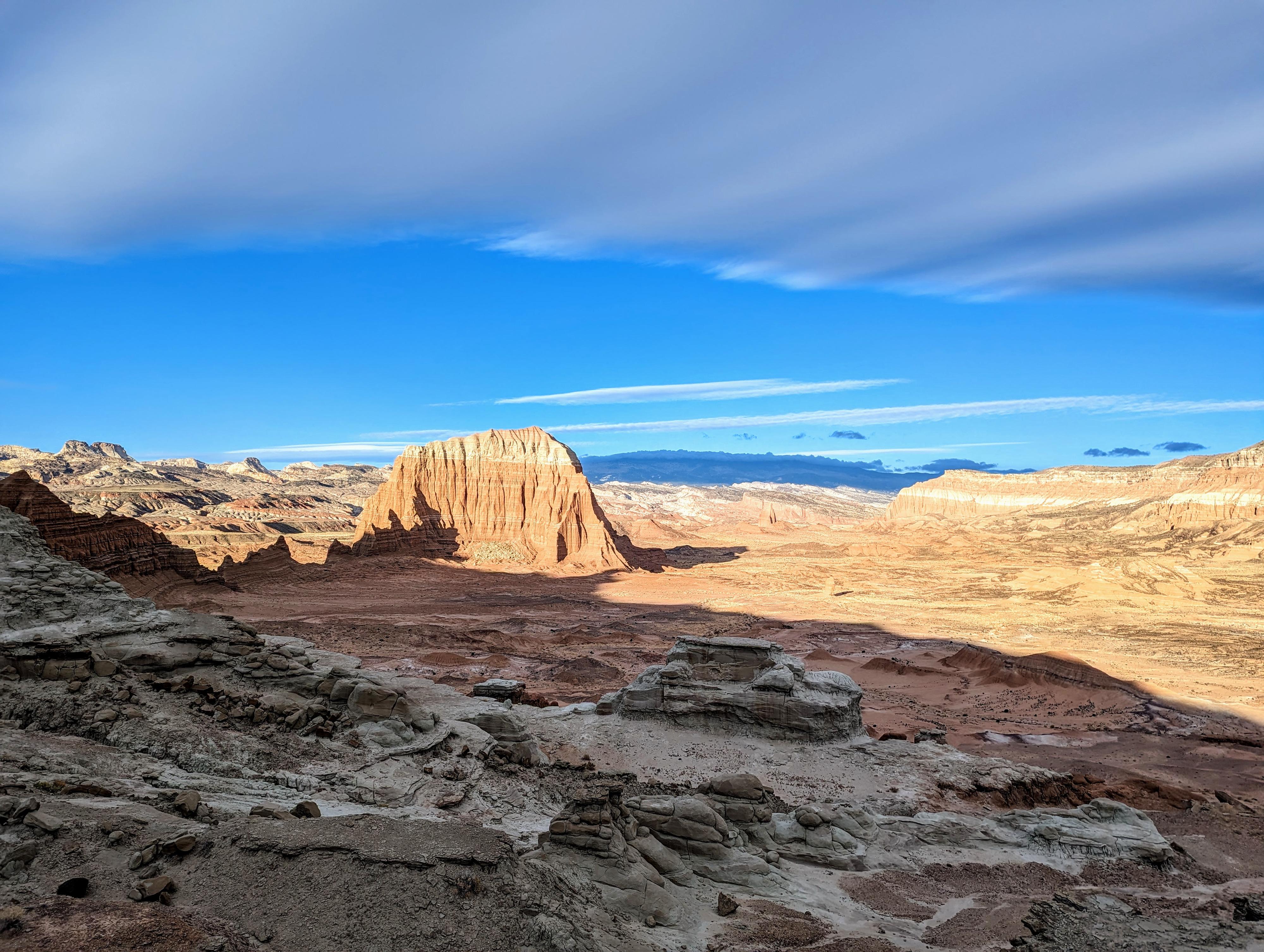
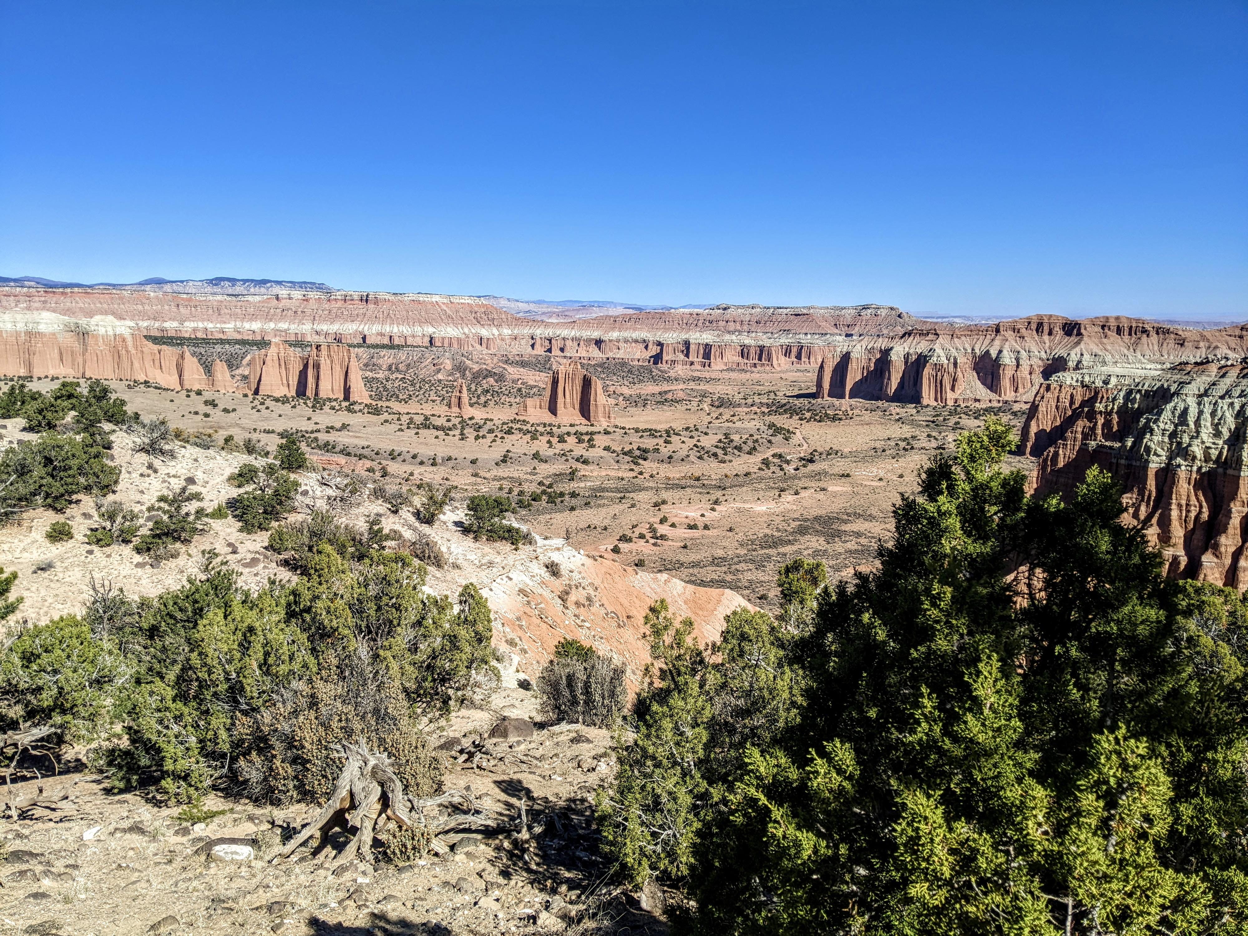
Views of the Lower South Desert
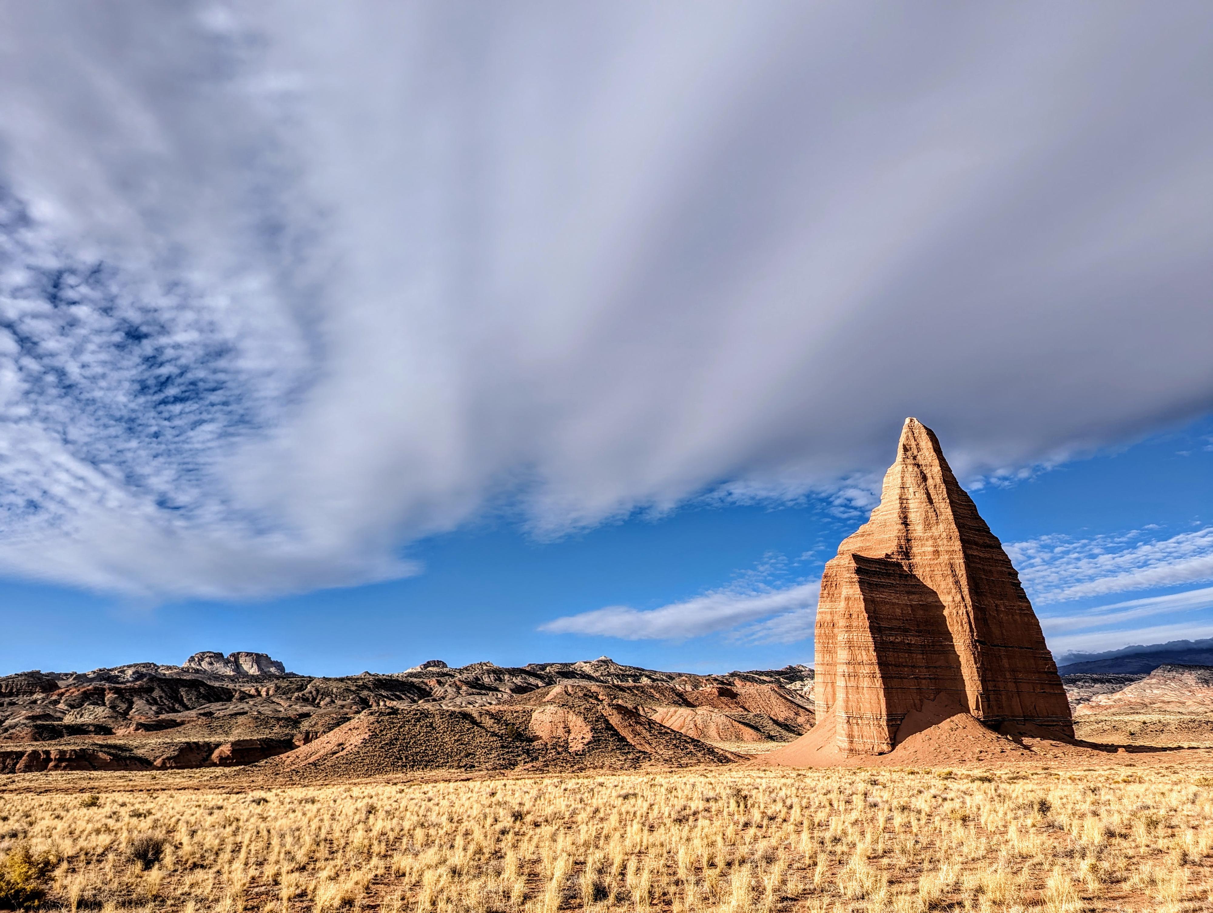
Temple Rock in the South Desert
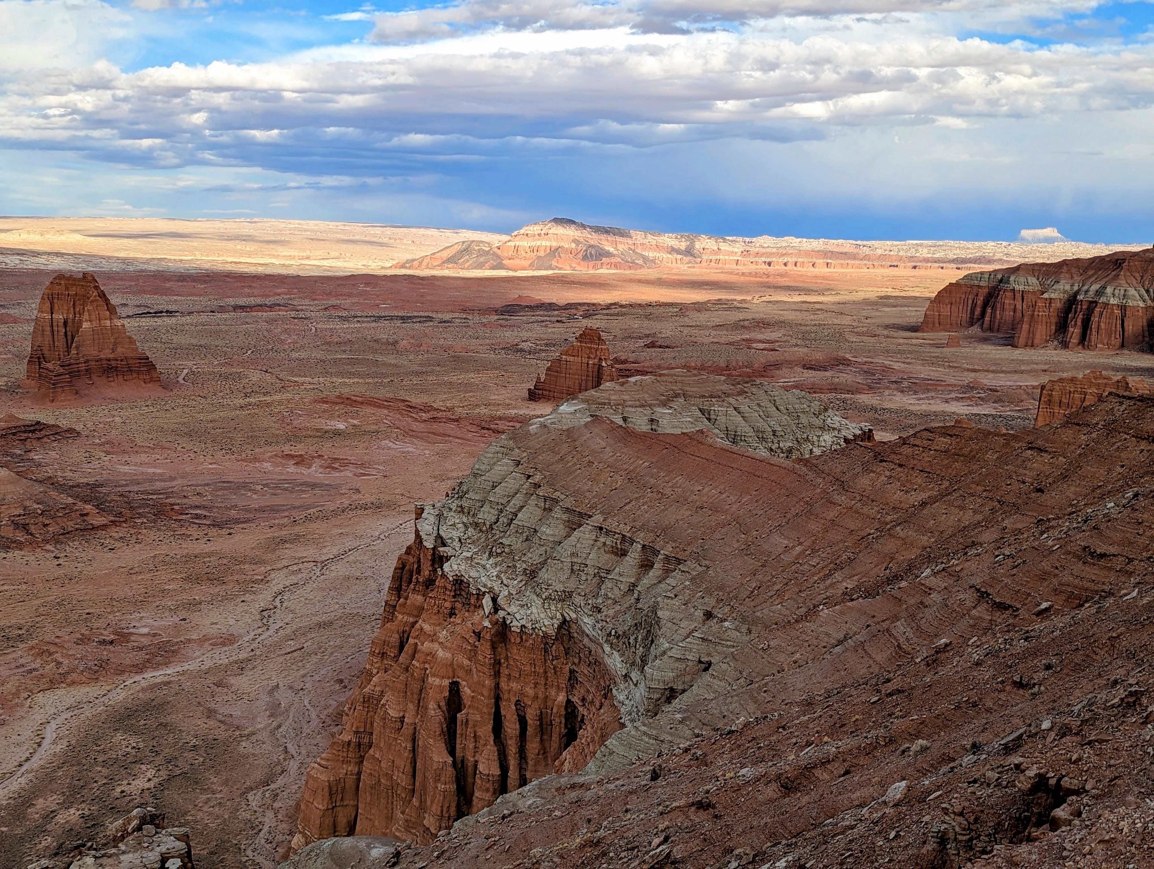
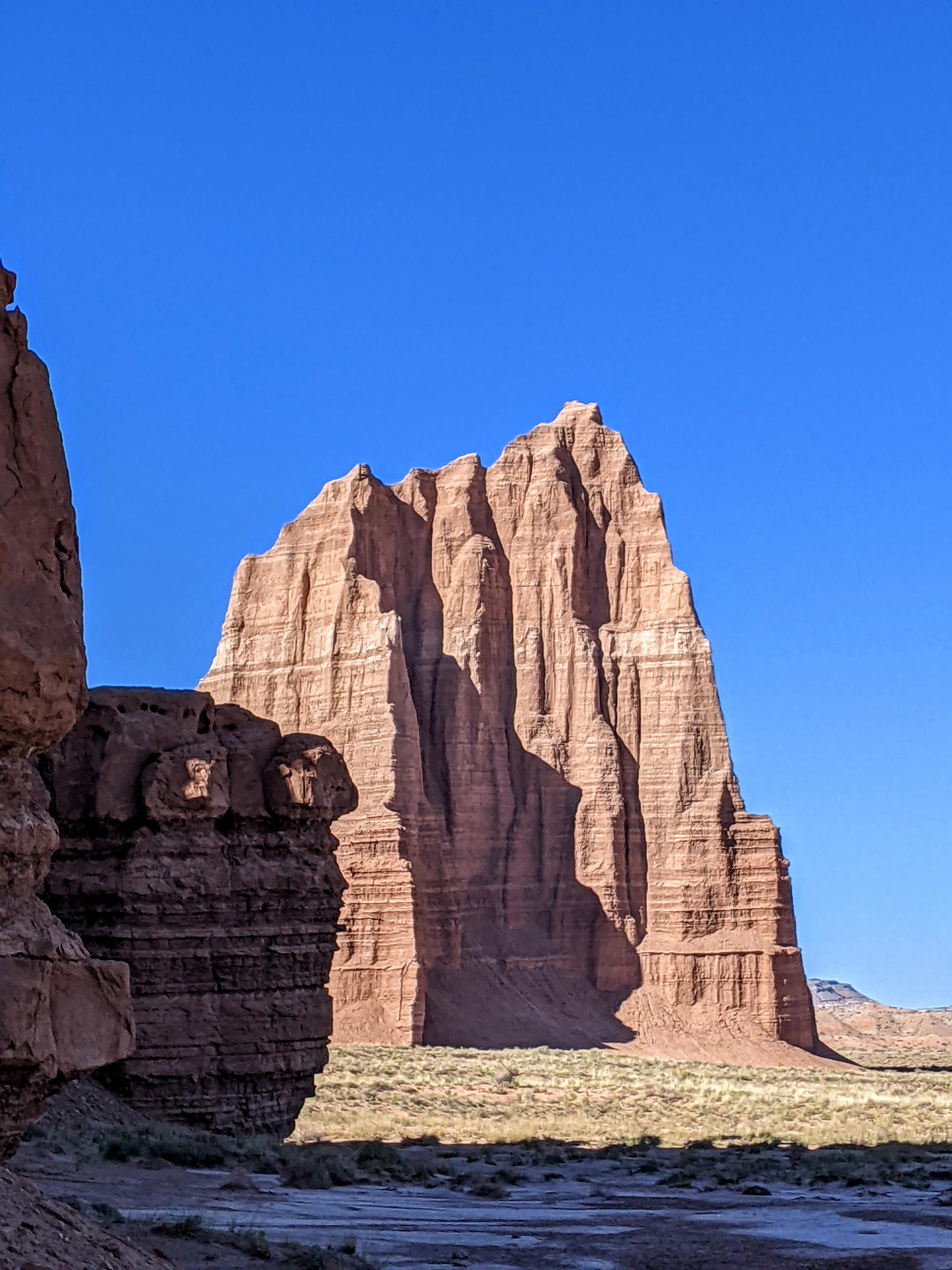
Temple of the Sun and Temple of the Moon from the overlook.
Upper South Desert Overlook
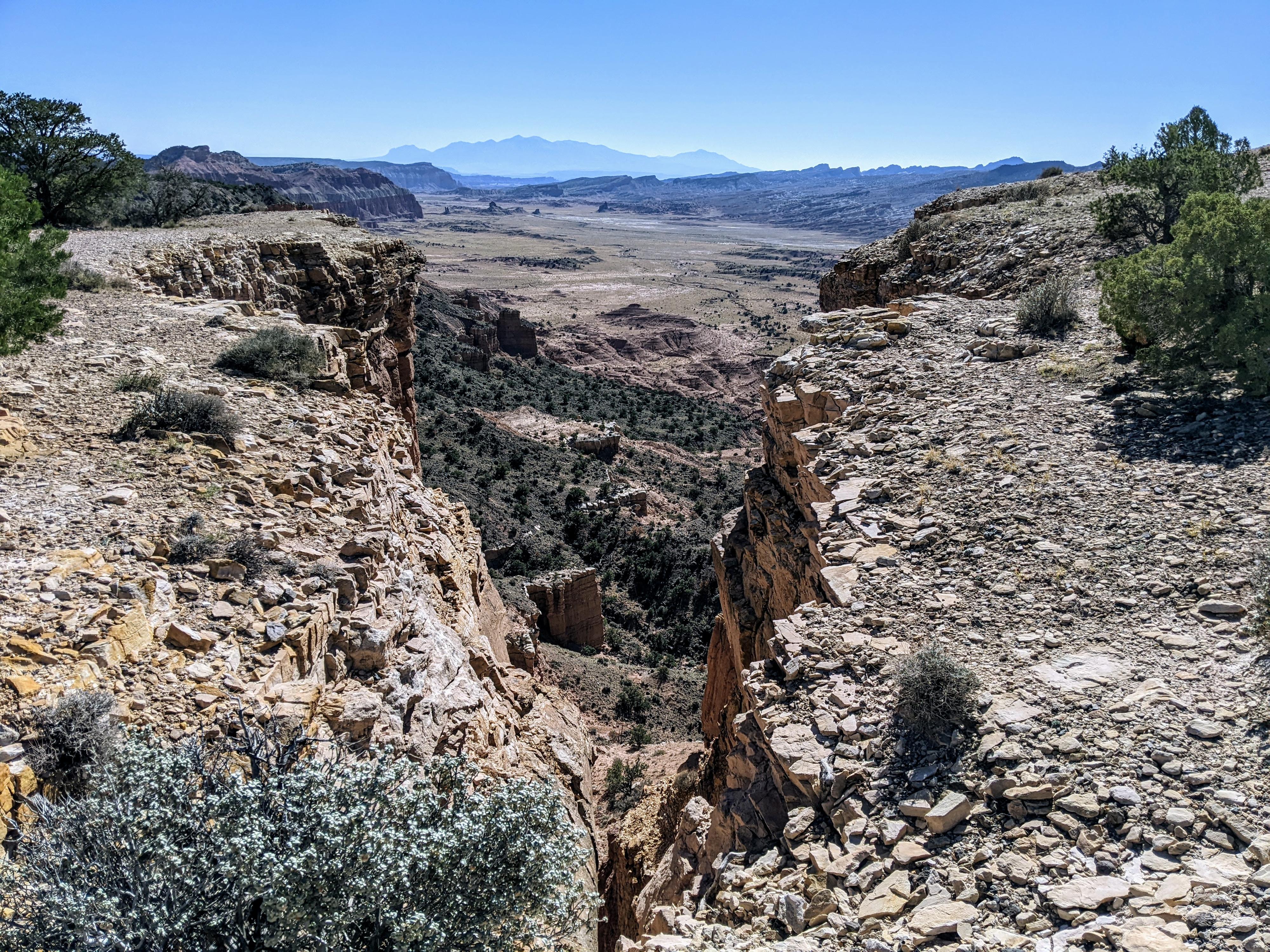
Upper Cathedral Valley Overlook
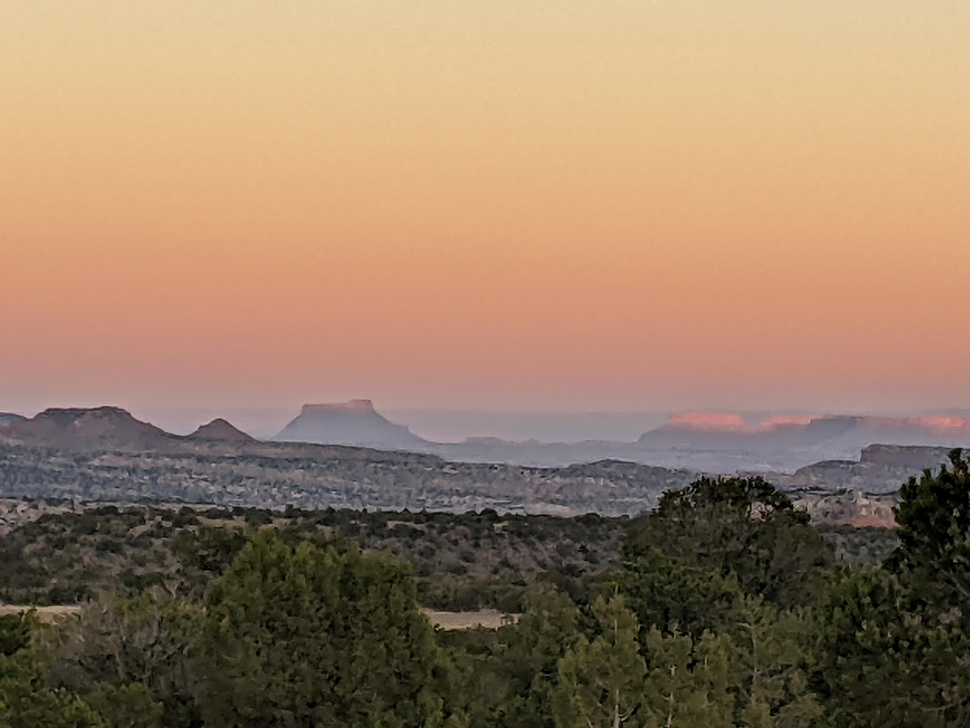
Looking toward Factory Butte during a smokey sunset from the campground.
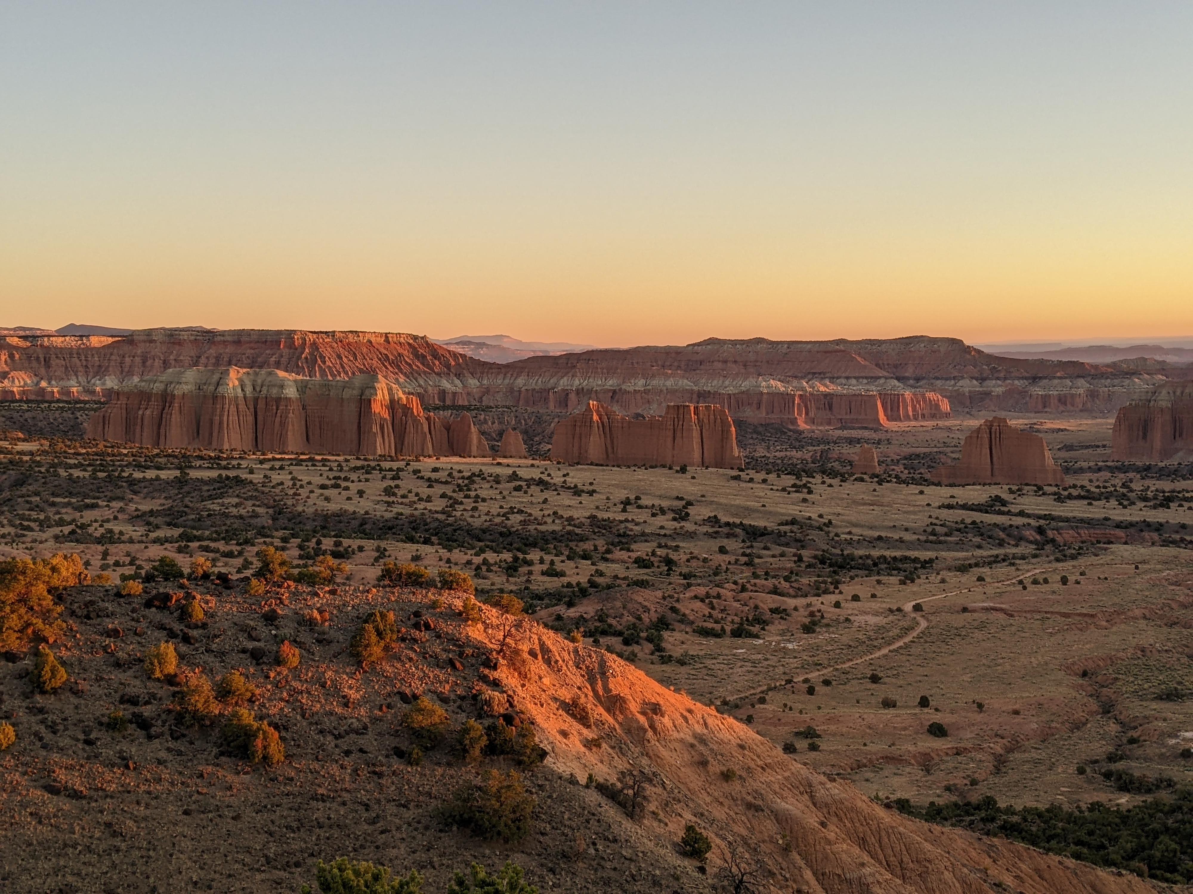
Sunrise over Cathedral Valley from the Campground.
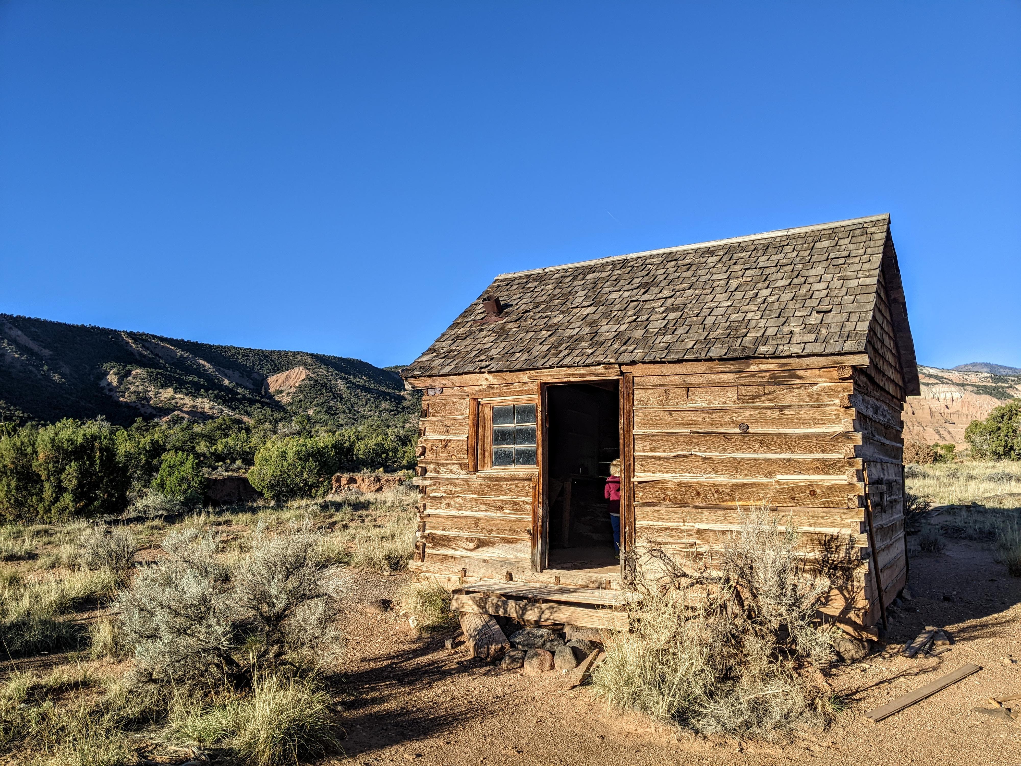
Morrell Cabin
Cathedrals Trail
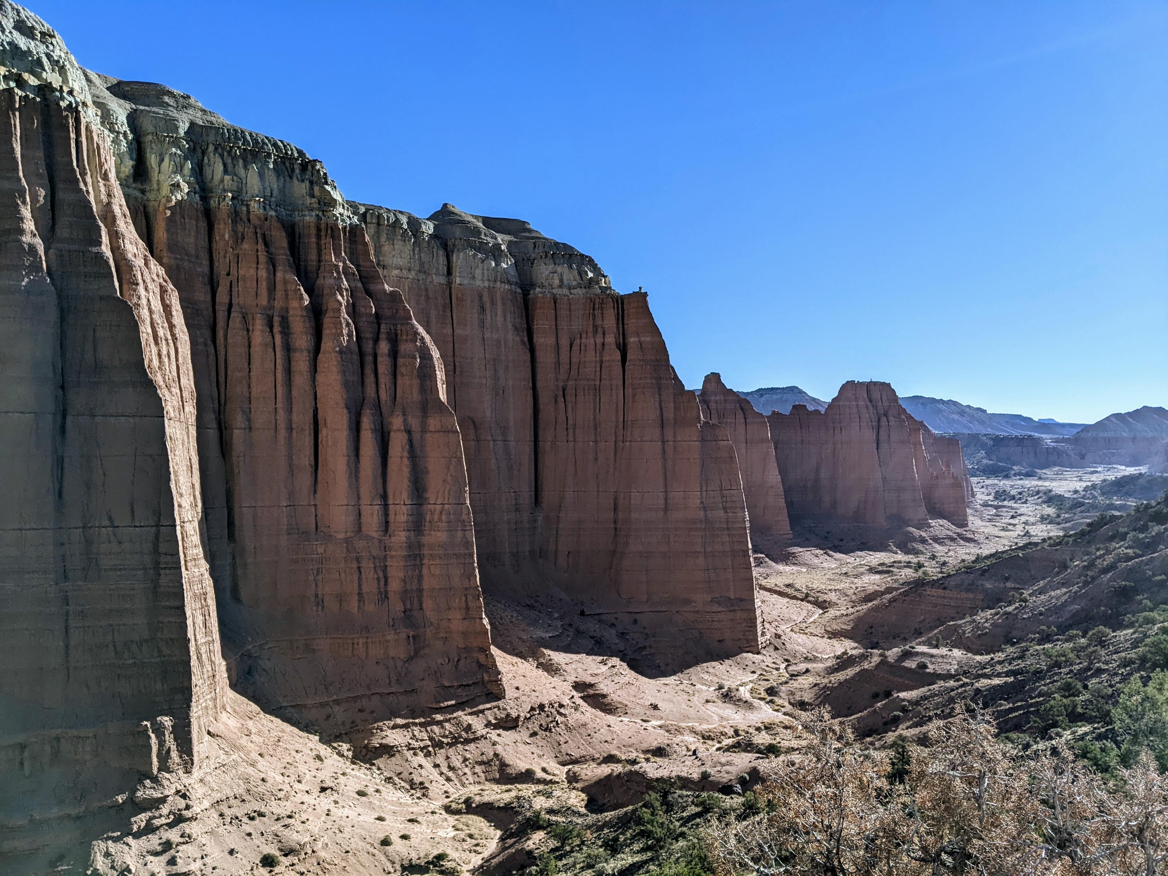
Towers in Cathedral Valley
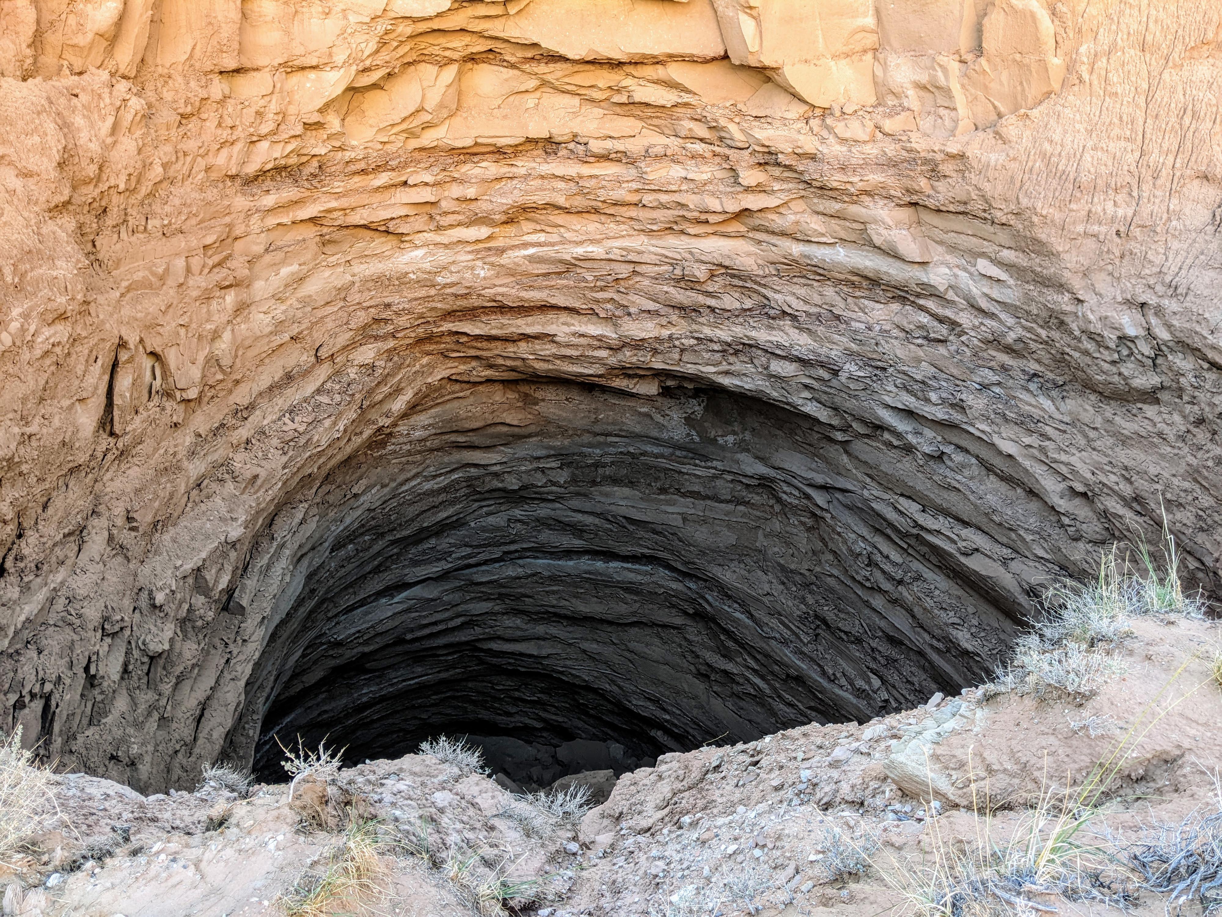
Gypsum Sinkhole
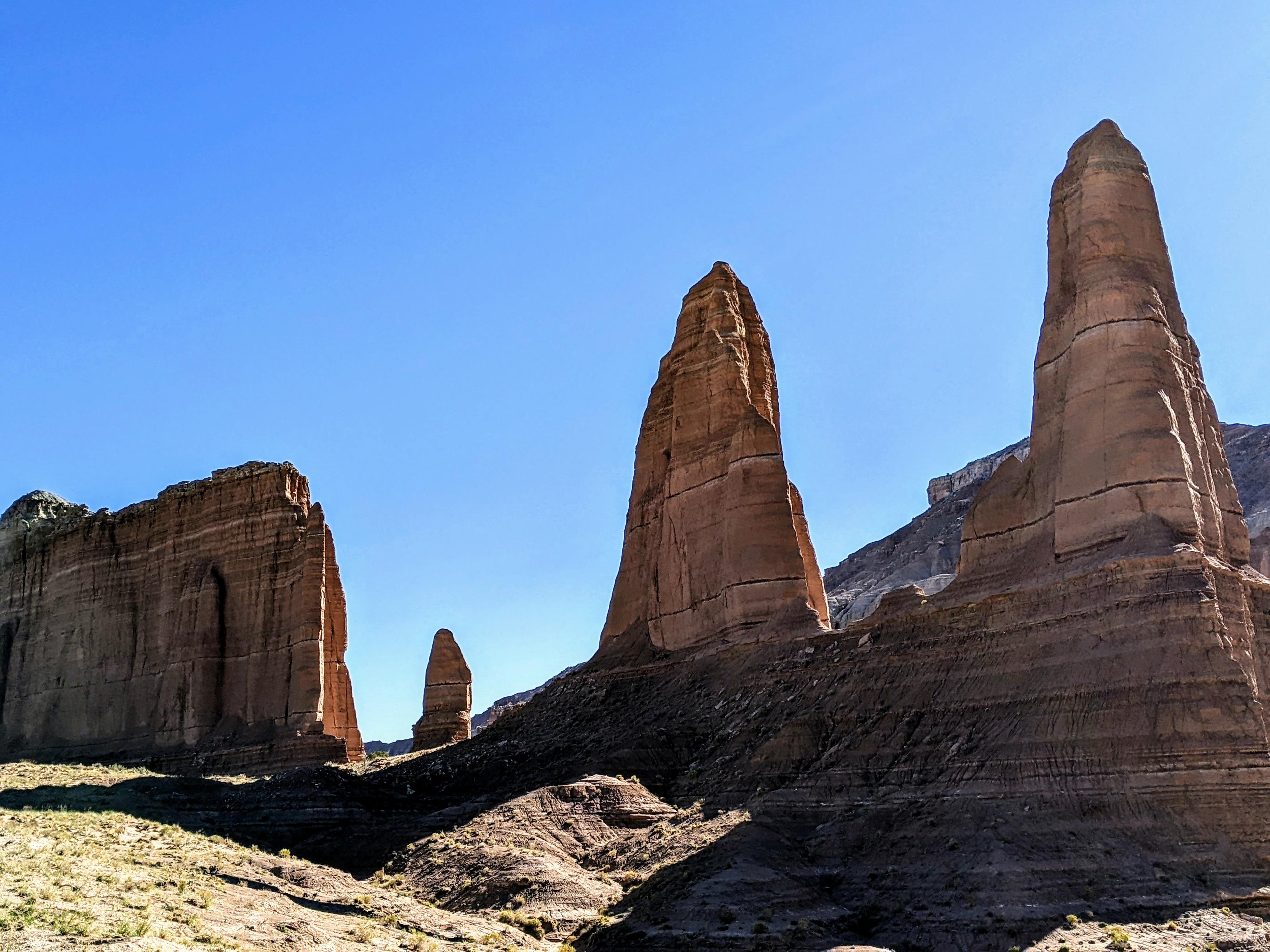
One of the temples.
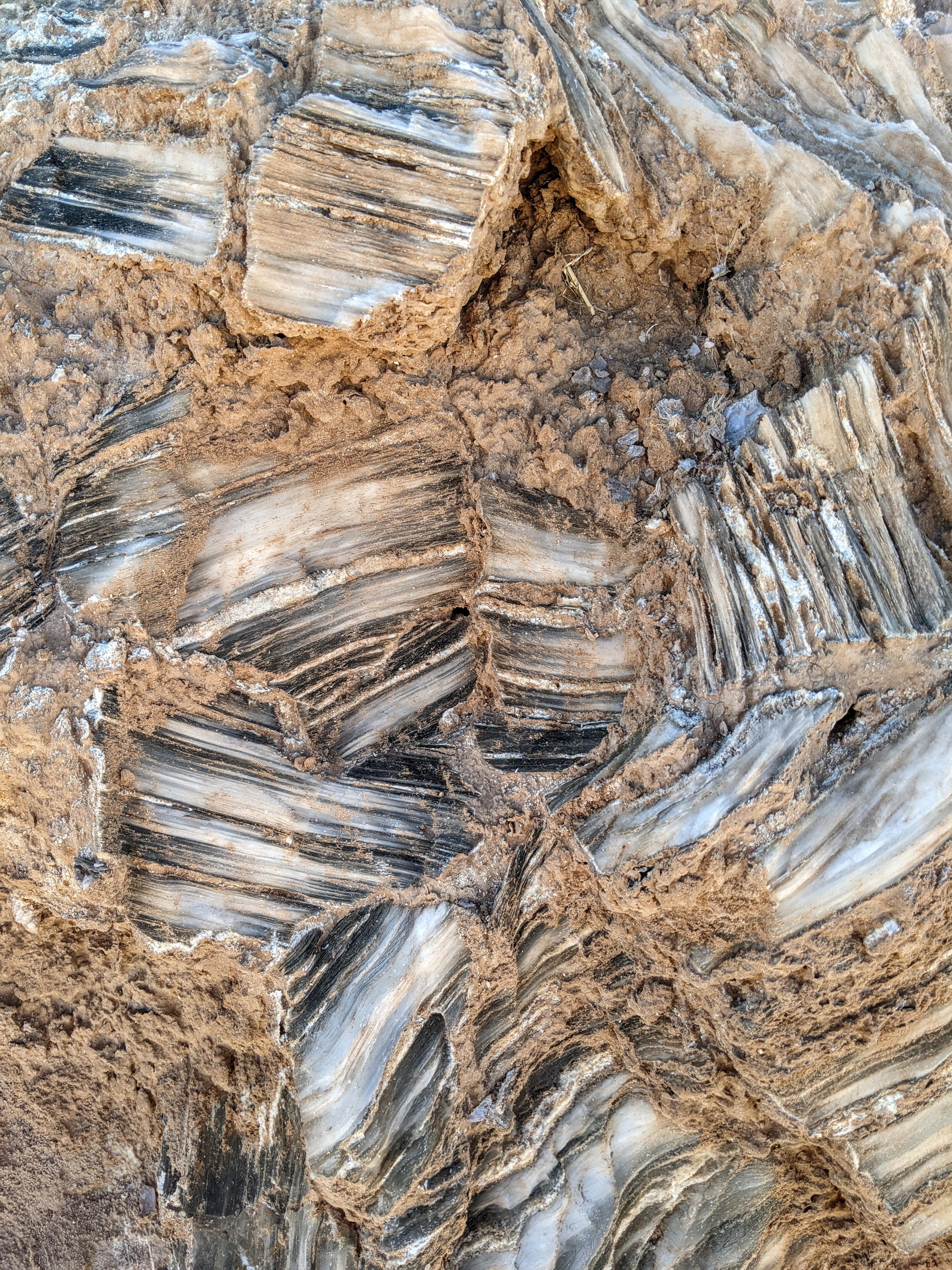
Closeup of the Glass Mountain Formation
Photos
Maps


12S 492148E 4236282N
38°16'28"N 111°05'23"W
12S 492959E 4236326N
38°16'30"N 111°04'50"W
12S 492919E 4238405N
38°17'37"N 111°04'51"W
12S 489539E 4243411N
38°20'20"N 111°07'11"W
12S 488693E 4245563N
38°21'29"N 111°07'46"W
12S 488163E 4247567N
38°22'34"N 111°08'08"W
12S 483790E 4250457N
38°24'08"N 111°11'08"W
12S 482196E 4250686N
38°24'15"N 111°12'14"W
12S 481846E 4250531N
38°24'10"N 111°12'28"W
12S 481794E 4250547N
38°24'11"N 111°12'31"W
12S 478805E 4251114N
38°24'29"N 111°14'34"W
12S 479205E 4251054N
38°24'27"N 111°14'17"W
12S 482046E 4253581N
38°25'49"N 111°12'21"W
12S 482042E 4254877N
38°26'31"N 111°12'21"W
12S 469144E 4258357N
38°28'23"N 111°21'13"W
12S 469215E 4258019N
38°28'12"N 111°21'10"W
12S 468787E 4258766N
38°28'36"N 111°21'28"W
12S 468790E 4258914N
38°28'41"N 111°21'28"W
12S 468260E 4257965N
38°28'10"N 111°21'50"W
12S 467973E 4258524N
38°28'28"N 111°22'02"W
12S 468511E 4259562N
38°29'02"N 111°21'40"W
12S 468159E 4259555N
38°29'02"N 111°21'54"W
12S 469200E 4260019N
38°29'17"N 111°21'11"W
12S 467719E 4260434N
38°29'30"N 111°22'13"W
12S 472323E 4262003N
38°30'21"N 111°19'03"W
12S 472214E 4261187N
38°29'55"N 111°19'07"W
12S 472223E 4261187N
38°29'55"N 111°19'07"W
12S 478308E 4261260N
38°29'58"N 111°14'56"W
12S 484673E 4256809N
38°27'34"N 111°10'32"W
12S 483201E 4255868N
38°27'03"N 111°11'33"W
12S 483294E 4255346N
38°26'46"N 111°11'29"W
12S 483263E 4256286N
38°27'17"N 111°11'31"W
12S 497617E 4246658N
38°22'05"N 111°01'38"W
12S 497885E 4242885N
38°20'03"N 111°01'27"W