 Hiking
Brighton Ridge Run
Hiking
Brighton Ridge Run
Big Cottonwood Canyon
Overview
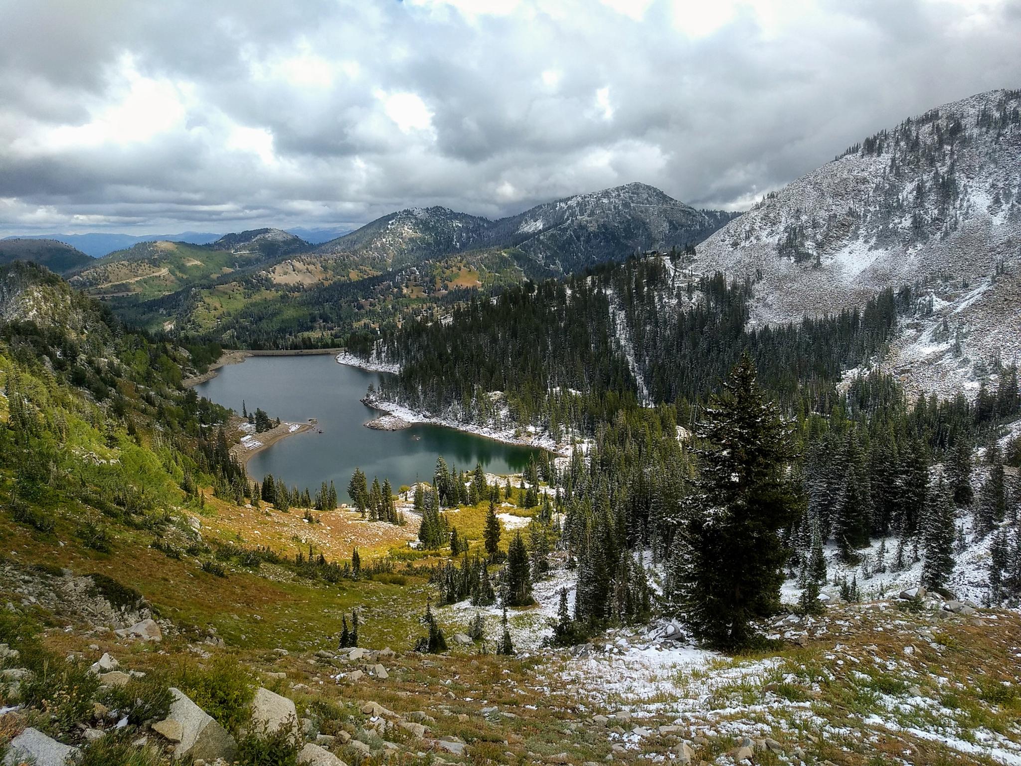
A peak baggers delight! The Brighton Ridge Run follows the ridgeline above Brighton, visiting eight summits over 10,000'. The ridge run makes for a full day of ridgeline, views, and peaks. The hiking is straightforward, with no scrambling or severe difficulties along the way. The easy access and terrain make this a good hike for intermediates looking to get some experience before moving into some of the more difficult ridge hikes in the Wasatch.
Wildflowers and fall colors make this a wonderful summer and fall hike.
The ridge can be hiked in either direction. I describe it from east to west, since that is the way I have done it.
Getting There
Big Cottonwood Canyon is on the east side of the Salt Lake City Valley. Get there by taking I-215 to the east, taking exit 6 off the interstate and heading east.
Follow 6200 South which becomes Wasatch Blvd for 1.8 miles to the stop light and signs for Big Cottonwood Canyon.
Turn left at the light and reset your odometer.
Drive up Big Cottonwood Canyon 14 miles to the small community of Brighton. At the loop, go right, with Brighton Ski resort just ahead. Parking in the large parking lot near the main Brighton Ski Resort Building.
Route Description
To The Pass - 2.4 miles
From the Brighton parking lot, go just right (south) of the main Brighton building. A path leads up the slope, then heads right and passes between large logs to become a single narrower track. The single track switchbacks up the hillside, crossing under the ski lifts, before heading more south after a short steep section. The junction to Dog Lake is reached, go left here, then almost immediately left again on the signed Clayton Peak Trail.
The trail begins ascending through the dense forest. This shaded section of trail climbs then crosses under a ski lift. After this first crossing under the ski lift, the ski resort is ever-present, as the trail meanders across the slopes and climbs alongside a ski resort maintenance road. Continue up to the ridge, where the trail joins the summer maintenance road.
From the pass, Mount Timpanogos is visible to the south, as are views to the east of the Heber Valley.
To Clayton Peak (10,721') - 1.5 miles roundtrip from the pass
Follow the maintenance road north as it goes along the ridge. Within just a few minutes, as the road begins cutting across the hillside, take the side trail that leaves the road and heads toward the summit Clayton Peak.
After a few small switchbacks, the trail crosses to the east side of the ridge. Be sure, if you lose the trail in boulders, to re-find it! On my trip up, I lost the trail and boulder hopped directly up the ridge. On the way down, the trail proved much easier!
Once on the summit, Lackawaxen Lake is the lake directly below the peak. Heber Valley is to the east and the dramatic Big Cottonwood Canyon to the west. Return to the pass the same way.
Pass To Preston Peak (10,315') - 0.35 miles
Follow the dirt road south a few minutes until it reaches the top of the ski lift. From here, the trail becomes a single track as it climbs to Preston Peak with a plaque at its summit.
Preston to 10,321' - 0.5 miles
The trail descends through forested terrain, passes the top of a ski lift, then ascends to the non-descript "summit" 10,321' which is more of a high point on the Pioneer Peak ridge.
10,321' to Pioneer Peak (10,420') - 0.65 miles
As the trail descends 10,321' an old mining track comes up from the east, and a mine is passed before climbing the ridge to Pioneer Peak. Views of Heber Valley are excellent in this section.
Pioneer Peak to Sunset Peak (10,648') - 0.4 miles
The trail descends Pioneer Peak on the Brighton side to the saddle, then crosses over to the east side for most of the climb up to Sunset Peak. Sunset if very popular with hikers.
Sunset Peak to Catherine Pass - 0.6 miles
The trail is well used from Sunset to Catherine, though with quite a few junctions. Stay on the trail near the ridge, then crosses to the south side of the ridge and descends to Catherine Pass.
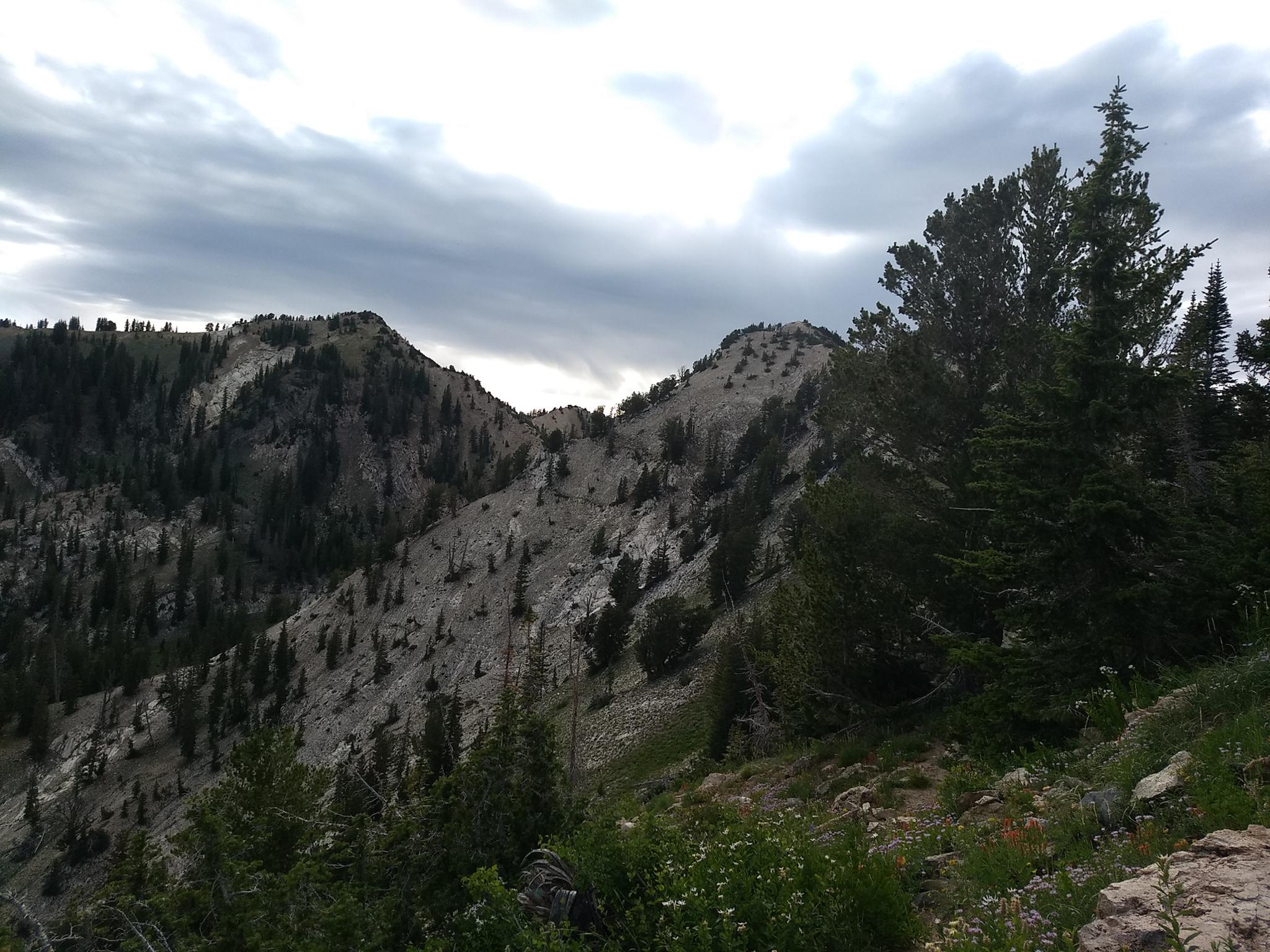
Catherine Pass To Mt. Tuscarora (10,640') - 0.3 miles
Follow the trail up the ridge from the ridge. The trail here is well used and easy to follow. As it nears Tuscarora, the views down into Brighton are excellent.
Mt. Tuscarora to Mt. Wolverine (10,795') - 0.3 miles
The summit of Mt. Wolverine is a short distance from Mt. Tuscarora. The trail stays mostly near the ridge, with little elevation loss en route.
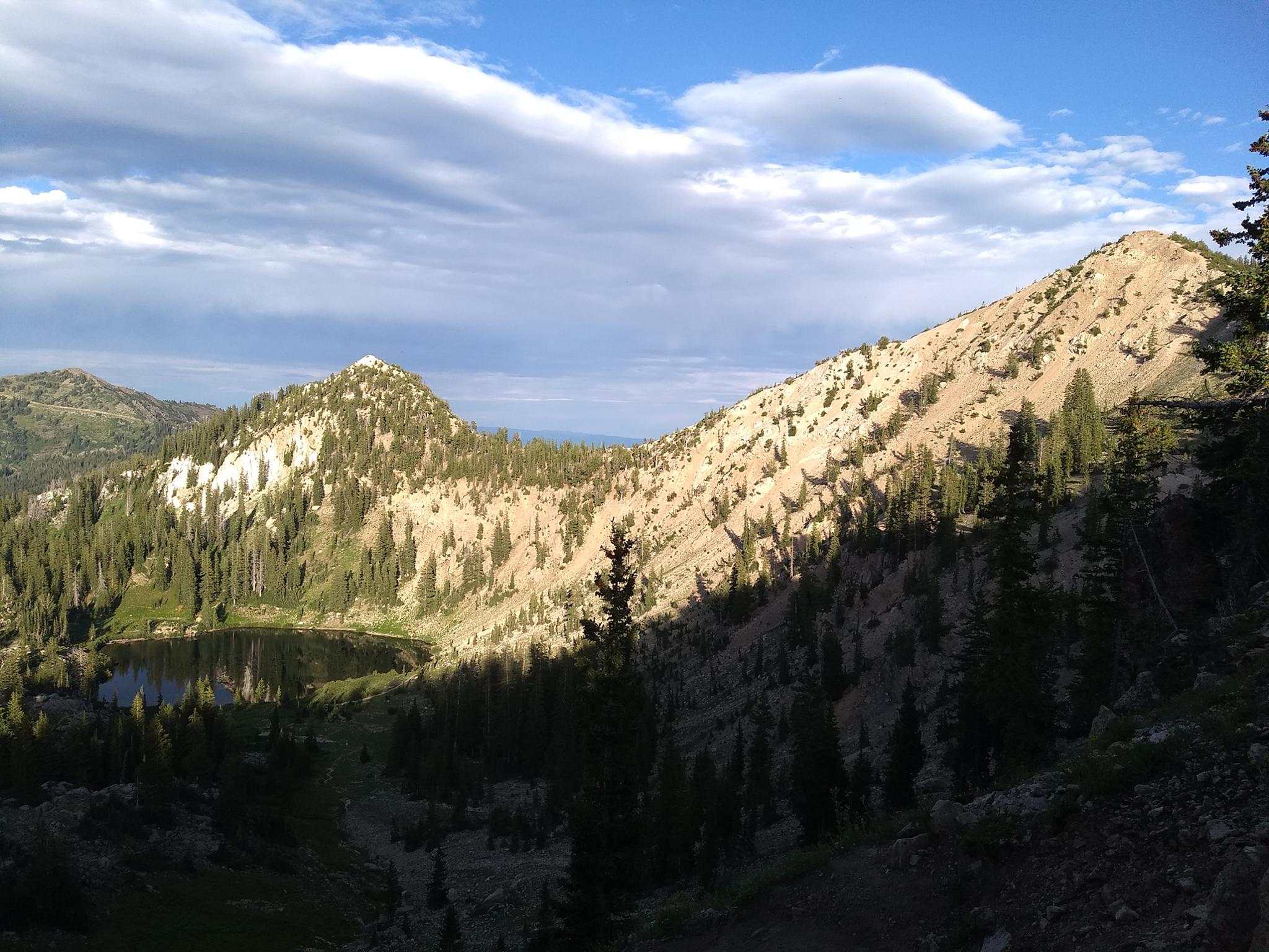
Mt. Wolverine to Twin Lakes Pass - 1 mile
From Wolverine, the trail stays near the ridge above the dramatic Wolverine Cirque. The small summit crossed en route to Twin Lakes is Patsy Marley. Unnamed officially on maps, but a popular ski run in the winter.
Twin Lakes Pass Return - 2.7 miles
When the trail reaches the 4-way junction at Twin Lakes Pass, go north on the single track that angles down toward Big Cottonwood. When the trail reaches the ski resort dirt road, follow sings right for Brighton.
The road turns to a single track again near Twin Lakes. From Twin Lakes, take the most used trail downhill. The trail merges with an old road, then splits. Go right down to a trail junction, then right again to Silver Lake. Left at Silver Lake follows the lakeshore back to the visitor center and a short walk along the road back to Brighton.
Photos
Maps

12T 450565E 4494340N
40°35'54"N 111°35'03"W
12T 450661E 4494222N
40°35'50"N 111°34'59"W
12T 450578E 4493357N
40°35'22"N 111°35'03"W
12T 450574E 4493332N
40°35'22"N 111°35'03"W
12T 452410E 4493234N
40°35'19"N 111°33'45"W
12T 452028E 4492810N
40°35'05"N 111°34'01"W
12T 452613E 4493476N
40°35'27"N 111°33'36"W
12T 451591E 4492533N
40°34'56"N 111°34'19"W
12T 450993E 4492570N
40°34'57"N 111°34'45"W
12T 450125E 4492389N
40°34'51"N 111°35'22"W
12T 449751E 4491982N
40°34'38"N 111°35'37"W
12T 449450E 4492039N
40°34'39"N 111°35'50"W
12T 449358E 4492051N
40°34'40"N 111°35'54"W
12T 449337E 4492387N
40°34'51"N 111°35'55"W
12T 449327E 4492795N
40°35'04"N 111°35'56"W
12T 448921E 4492912N
40°35'08"N 111°36'13"W
12T 448457E 4493931N
40°35'40"N 111°36'33"W
12T 449863E 4494942N
40°36'14"N 111°35'33"W
12T 450144E 4495193N
40°36'22"N 111°35'21"W