 Hiking
Crimson Trail
Hiking
Crimson Trail
Logan Canyon
Overview
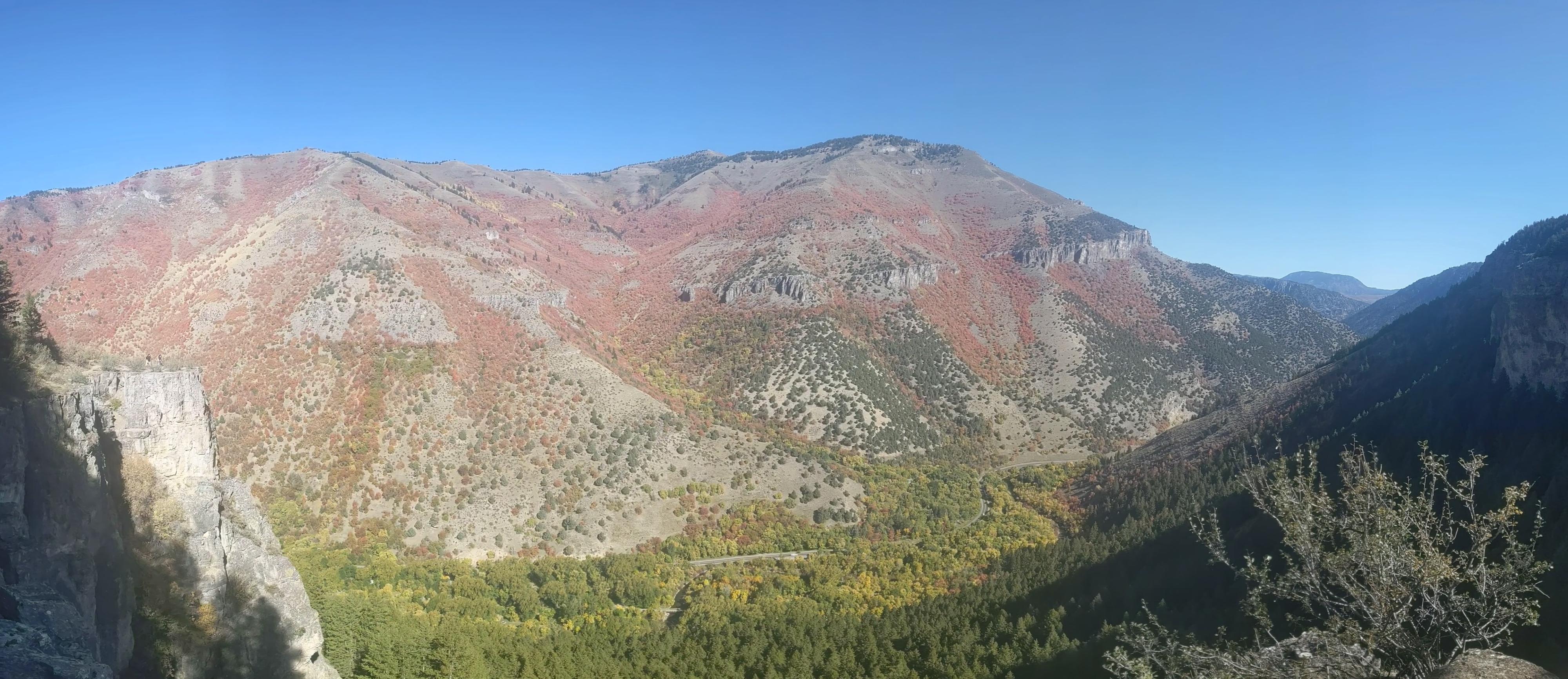
Crimson Trail is one of my favorite hikes in Logan Canyon. Particularly in fall, this is one of the best hikes to see fall foliage lighting up the canyon. When I lived in Logan, I made this hike at least once a year and often more. The trail has a steep initial climb up the canyon wall to the top of a limestone cliff where it ambles along the top of the cliff with exquisite views before descending back to the canyon floor. The trail is narrow and perched right on the edge of the cliff in spots. Those with an intense fear of heights might not enjoy this hike.
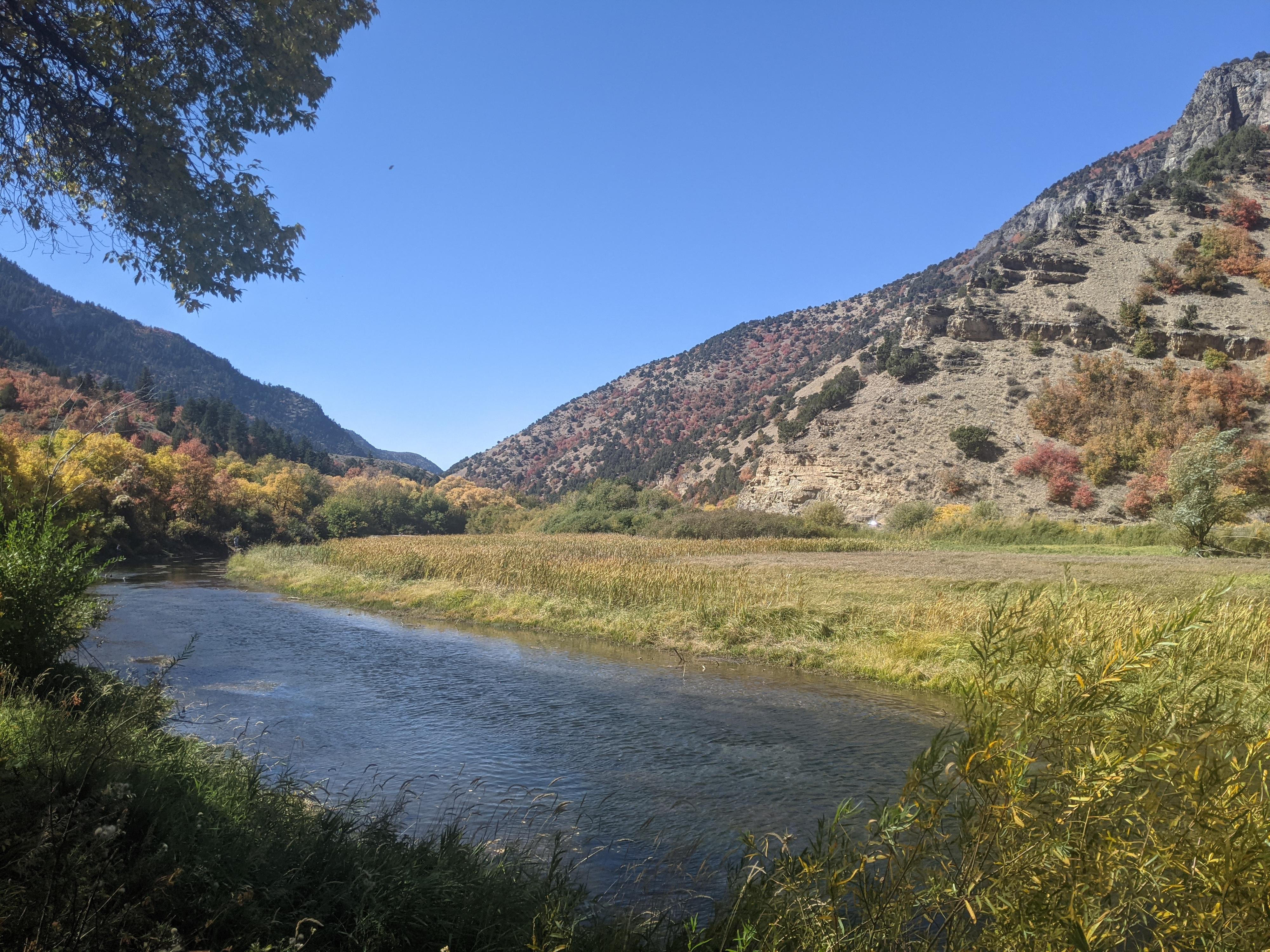
The hike goes between Spring Hollow Campground (mile post 464.85) and Guinavah - Malibu Campground (mile post 465.8, across from the Wind Caves Trailhead). If you have two cars, you can avoid hiking the Riverside Trail back, and shorten the hike. My recommendation, though, is to make the full loop. The Riverside Trail between Spring Hollow and Guinavah is lovely.
Getting There
The trailheads are up Logan Canyon at Spring Hollow and Guinavah/Malibu Campgrounds. From the mouth of Logan Canyon, take 89 east about 4 miles.
Spring Hollow is on the right. Park at the trailhead parking area and follow the Spring Hollow Road uphill to reach the trail proper.
If starting at Guinavah, continue on another mile. It is also on the right, just past the Wind Caves trailhead. Once in Guinavah, follow the campground road left as it passes through part of the campground and crosses the Logan River. Right after the Logan River crossing, go right and follow the road to a signed trailhead parking area.
Route Description
Crimson Trail Proper (4 miles / Though the trailhead sign says 3)
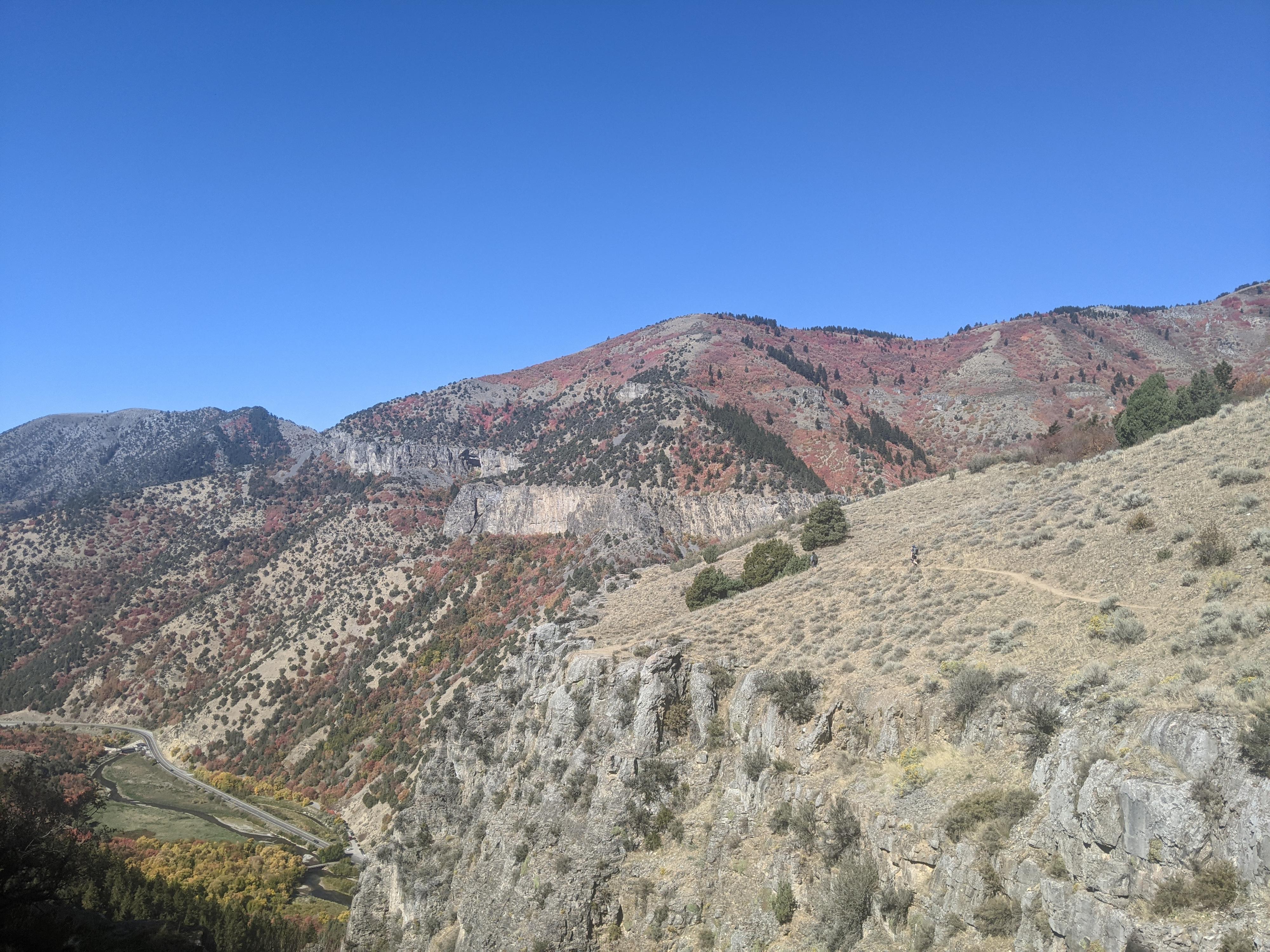
From the Guinavah trailhead, follow the signed trail. It begins climbing immediately and soon reaches the junction with the Riverside Trail. Go left here, on the Crimson Trail. The trail begins climbing in earnest with steep switchbacks climbing up the ridge. By my measure, the trail climbs about 1000 vertical feet in a little over a mile. Phew!
Once up on top of the cliff, the trail flattens out and the views open. Across the canyon, the Wind Caves is visible during much of the hike, and at about the same elevation the trail is at. Views both up and down the canyon are excellent, with the Cache Valley visible in the distance as the trail meanders further west. The limestone cliffs historic Lake Bonneville left behind make for a dramatic backdop to the canyon walls.
All too soon the trail begins its steep descent to Spring Hollow. Switchbacks lead to a wide trail and junction. Go right, down the Spring Hollow Campground. Once at the campground, either follow the main road back to the parking area and your second car.
Riverside Trail Return (1.6 miles)
If you did not spot a car, take the first major trail on the right which is the Riverside Trail. The Riverside Trail has many informational signs and it meanders along the river up to Guinavah, and is a lovely family hike on its own.
Maps

12T 442080E 4623542N
41°45'42"N 111°41'48"W
12T 441947E 4623488N
41°45'40"N 111°41'54"W
12T 440638E 4622006N
41°44'52"N 111°42'50"W
12T 440409E 4622572N
41°45'10"N 111°43'00"W
12T 440404E 4622634N
41°45'12"N 111°43'01"W