 Hiking
Jungle Trail
Hiking
Jungle Trail
Draper
Overview
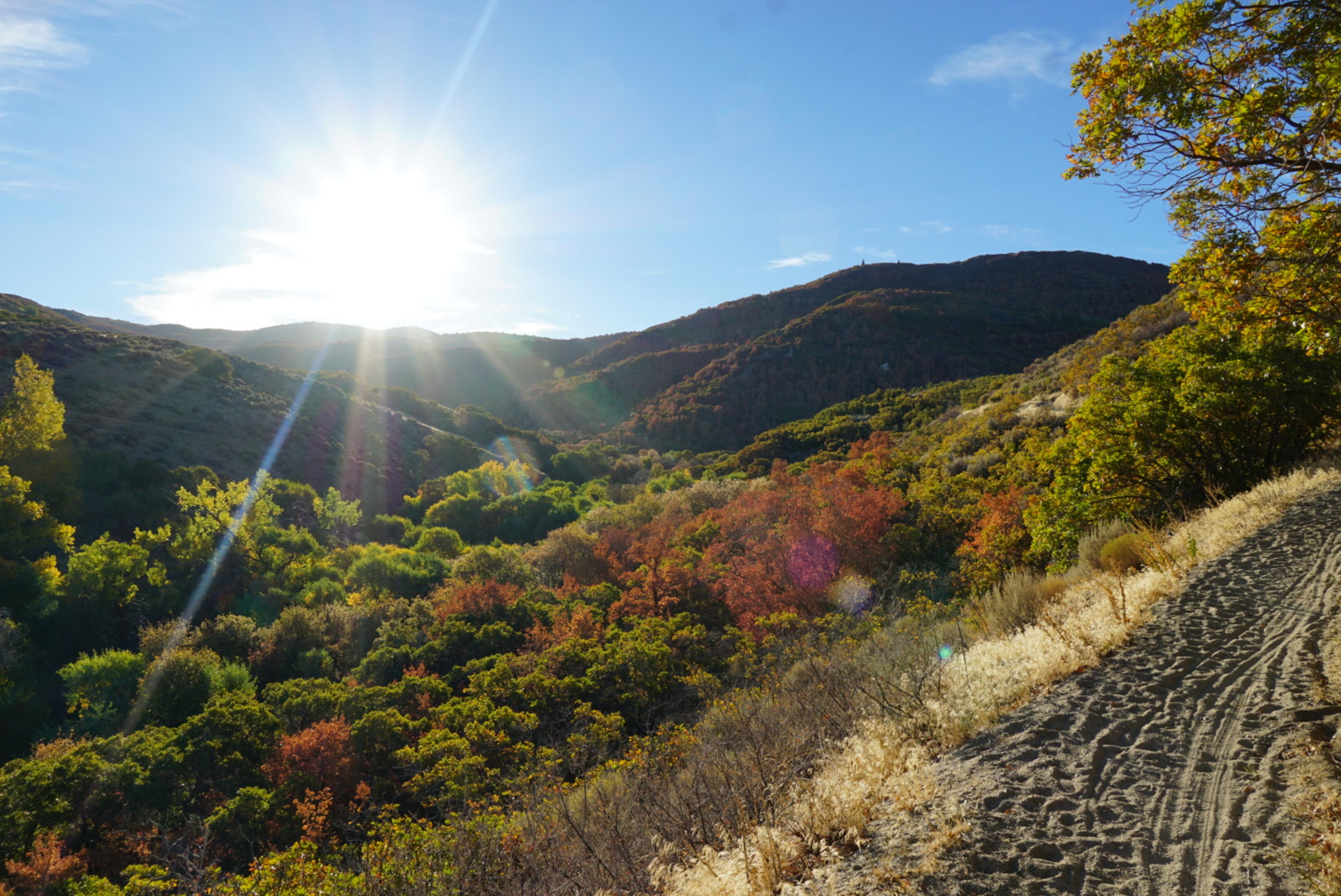
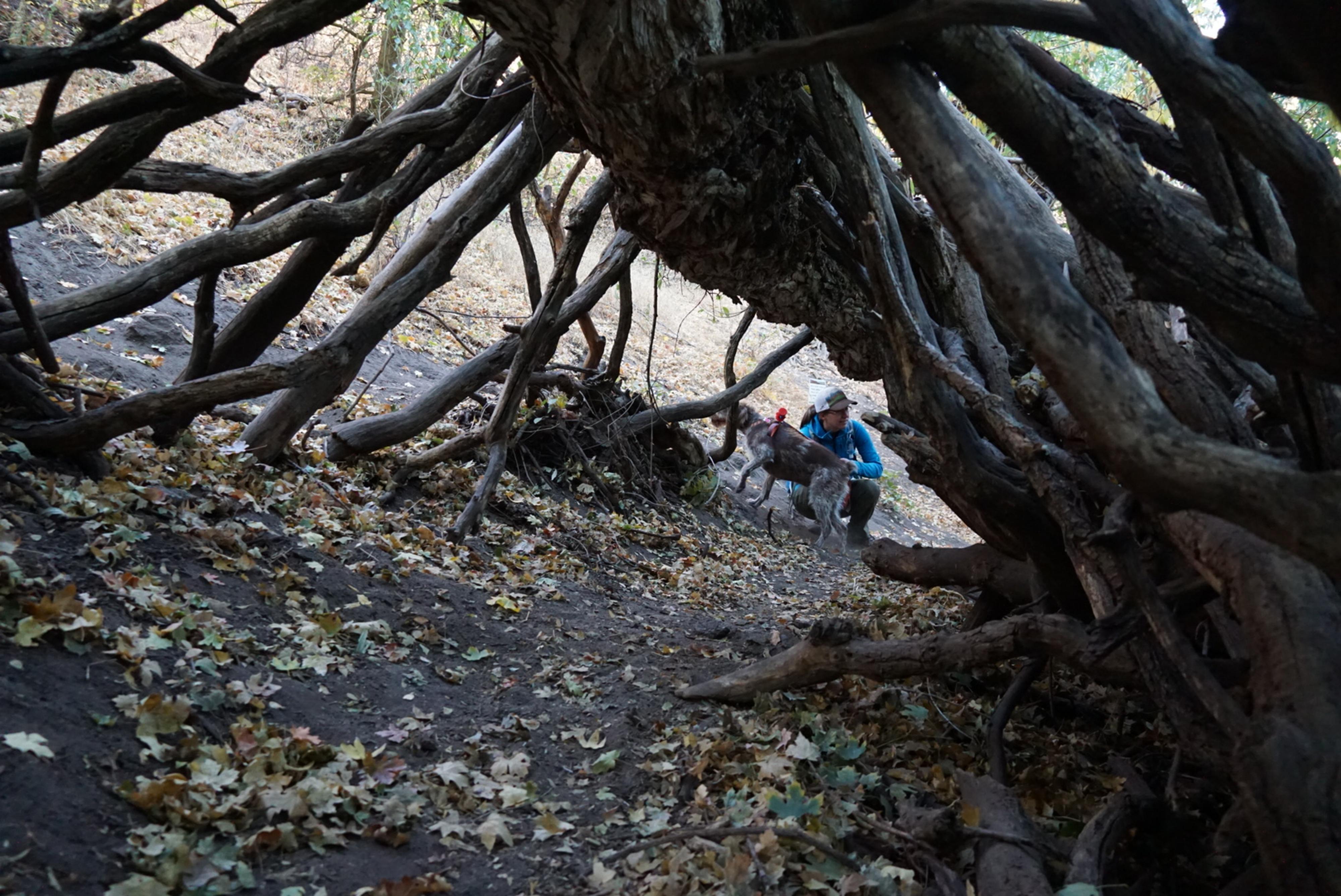
Corner Canyon, near Draper, has an extensive trail system. It is an excellent resource for hiking, mountain biking, and equestrian users to be able to get out into nature while being close to Draper and the Salt Lake Valley. It is also home to The Jungle Trail. This short trail with easy access is setup for young and old to get out and explore nature. The trail has many obstacles to climb over, under, and through. Our family, including out three-year-old, really enjoyed it. It is a fun shady place to play, particularly on a sizzling summer day.
Getting There
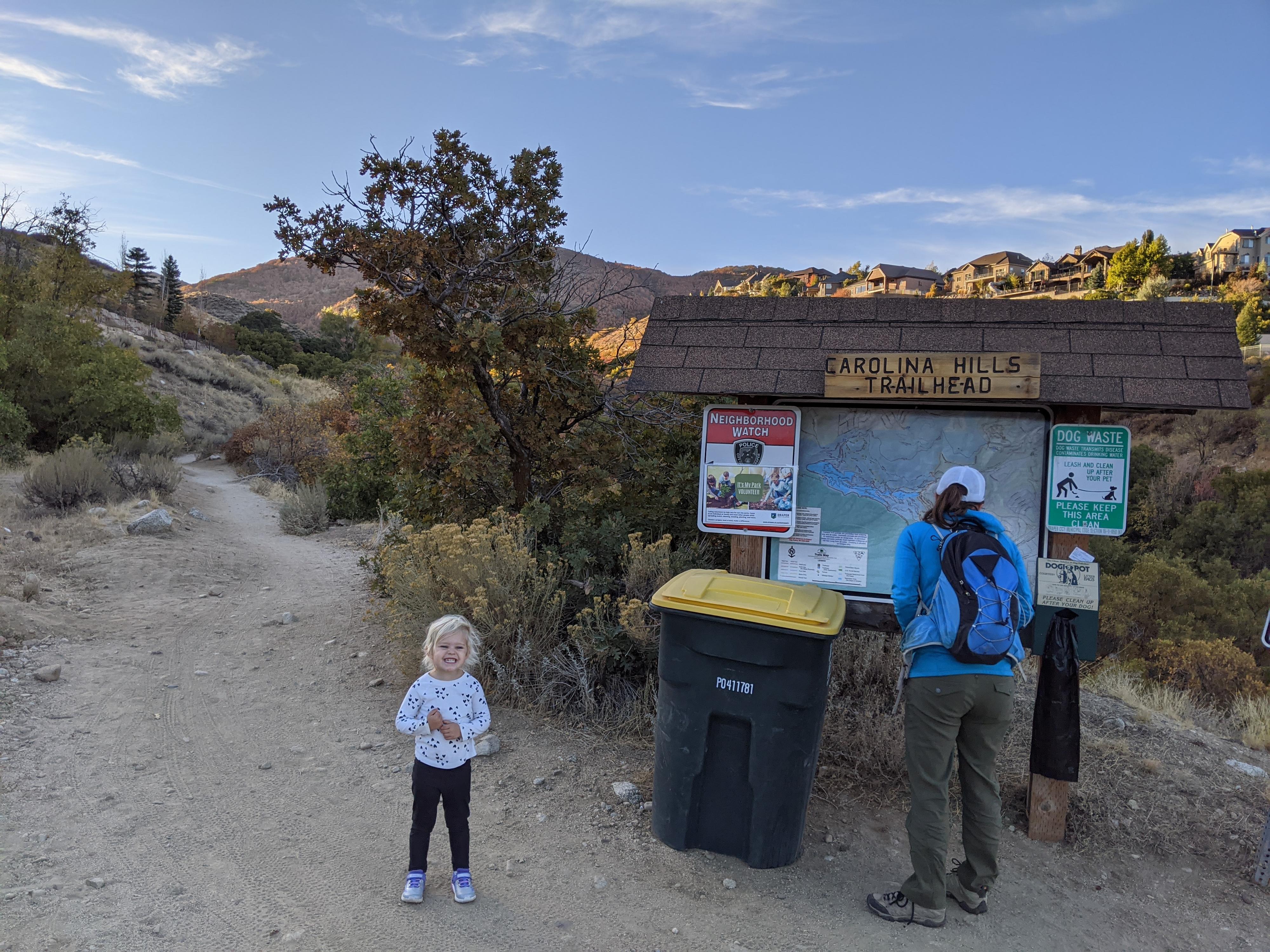
The trailhead is the Carolina Hills Trailhead on the southeast side of the Salt Lake valley. The trailhead is at 13625 Carolina Hill Ct E, Draper. The area is a bit of a maze, phone navigation recommended. Start by going east on 13800 S. When 13800 S ends, go right under the bridge, then left on Highland Drive. Follow Highland Drive for about 0.6 miles to Bechers Brook Way on the right. Go right and follow Bechers Brook Way for 0.2 miles, then take the first right at the traffic circle to Aintree Ave. Follow Aintree Ave to the next traffic circle, then go right on Tuscalee Way. Quickly take a left off Tuscalee Way onto Carolina Hill Ct. Follow it to its end and the trailhead.
Route Description
From the trailhead, follow the single-track path southeast as it heads up the canyon. In just a couple of minutes it reaches a road. Go right on the road and follow it. Stay straight at the next junction, where another road goes off on the right. Soon the road follows, then crosses the stream.
Right after the stream crossing, the signed Jungle Trail leaves the road on the right and enters the Jungle! After the jungle, stay right as the trail heads down canyon. In a few minutes, it reaches a dirt road in the bottom of the canyon. Cross the road, and bridge on the other side, then stay right at the next two junctions as the trail climbs back up to the trailhead. A lovely short hike!
Maps

12T 428832E 4483806N
40°30'07"N 111°50'24"W
12T 428930E 4483684N
40°30'03"N 111°50'19"W
12T 428970E 4483586N
40°29'60"N 111°50'18"W
12T 429078E 4483374N
40°29'53"N 111°50'13"W
12T 428943E 4483551N
40°29'59"N 111°50'19"W
12T 428654E 4483851N
40°30'08"N 111°50'31"W
12T 428683E 4483868N
40°30'09"N 111°50'30"W
12T 428719E 4483868N
40°30'09"N 111°50'29"W