 Hiking
Split Rock Loop
Hiking
Split Rock Loop
Antelope Island
Overview
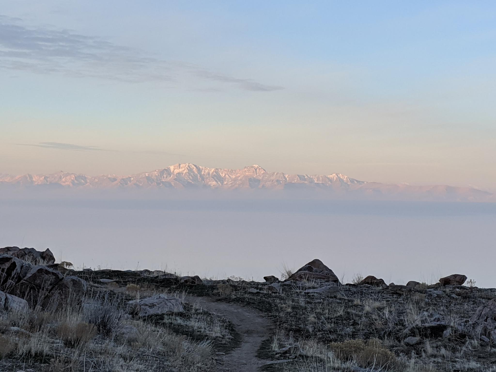
This is a long hike (about 11.75 miles), but one of my favorites! It is most popular with mountain bikers and trail runners, less so hikers. Though the first half of the hike shares the trail with Elephant Head, but once past Elephant Head, the loop gets well away from the crowds and has a deep back country feel. The views of Stansbury Island, Stansbury Mountains, the Great Salt Lake, and the distant Stansbury Range make this hike for me. Add some interesting geology, fascinating history, and an easy trail, and this is a winner!
This is a fairly long outing, be sure to bring plenty of water and supplies. Particularly if hiking with a dog, no water is available, carry all you and your companion will need!
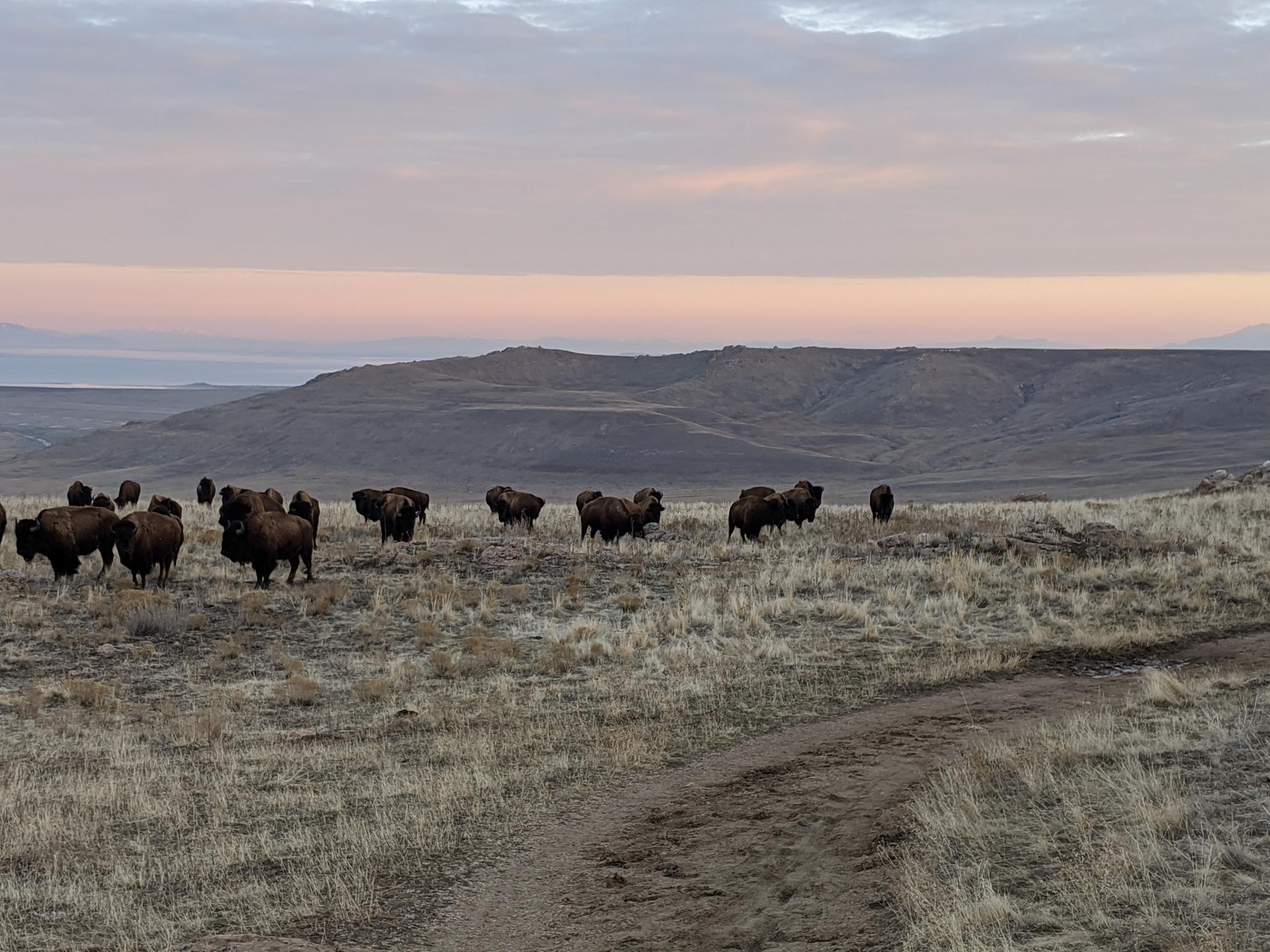
The DNR offers the following tips if you encounter bison:
- If you see a bison and it stops what it is doing and starts paying attention to you, you are too close and should slowly back away.
- If you see a bison in the distance, do not walk across the rangeland to get closer to it. Take your photos from a safe distance.
- If you are hiking and a bison is close to or on the trail, you should either back away and return the way you came, or leave the trail and give the animal a very wide berth when passing it. It is OK to go off the trail if your safety is at risk.
In my experience, most buffalo encounters require just a little patient for the animals to move out of the way. Common sense and plenty of space prevail.
Getting There
The trailhead is reached by first getting to Antelope Island. The island is off I-15, west of Layton. Take exit 332 off I-15, and head west on Antelope Drive. About 7 miles from the freeway is the entrance to the park.
From the entrance to the park, cross the causeway and go left at the first junction after the causeway. Shortly after, take the next right, toward the signed Buffalo Point/White Rock Bay Campground.
To reach White Rocks Bay, a signed road goes off on the left before Buffalo Point. Follow this, a right, then a left at well signed junctions. The road passes through the White Rock Bay Campground to a parking area at the trailhead.
Route Description
From the trailhead, follow the path to the break in the fence and information kiosk. From the kiosk, the route follows the dirt road south, staying near the lake shore. This section is amazing at sunrise and sunset!
Follow the road to near the base of the ridge. Junction Trail comes in on the left near a cedar tree. Stay right as the dirt road climbs to the top of the ridge and a trail junction. Bison often frequent this junction. Left goes to the Split Rock Loop, left makes a 1.4 mile (one way) side trip to Elephant Head. If you have time, I recommend the Elephant Head side trip. Continue left to the Split Rock Loop.
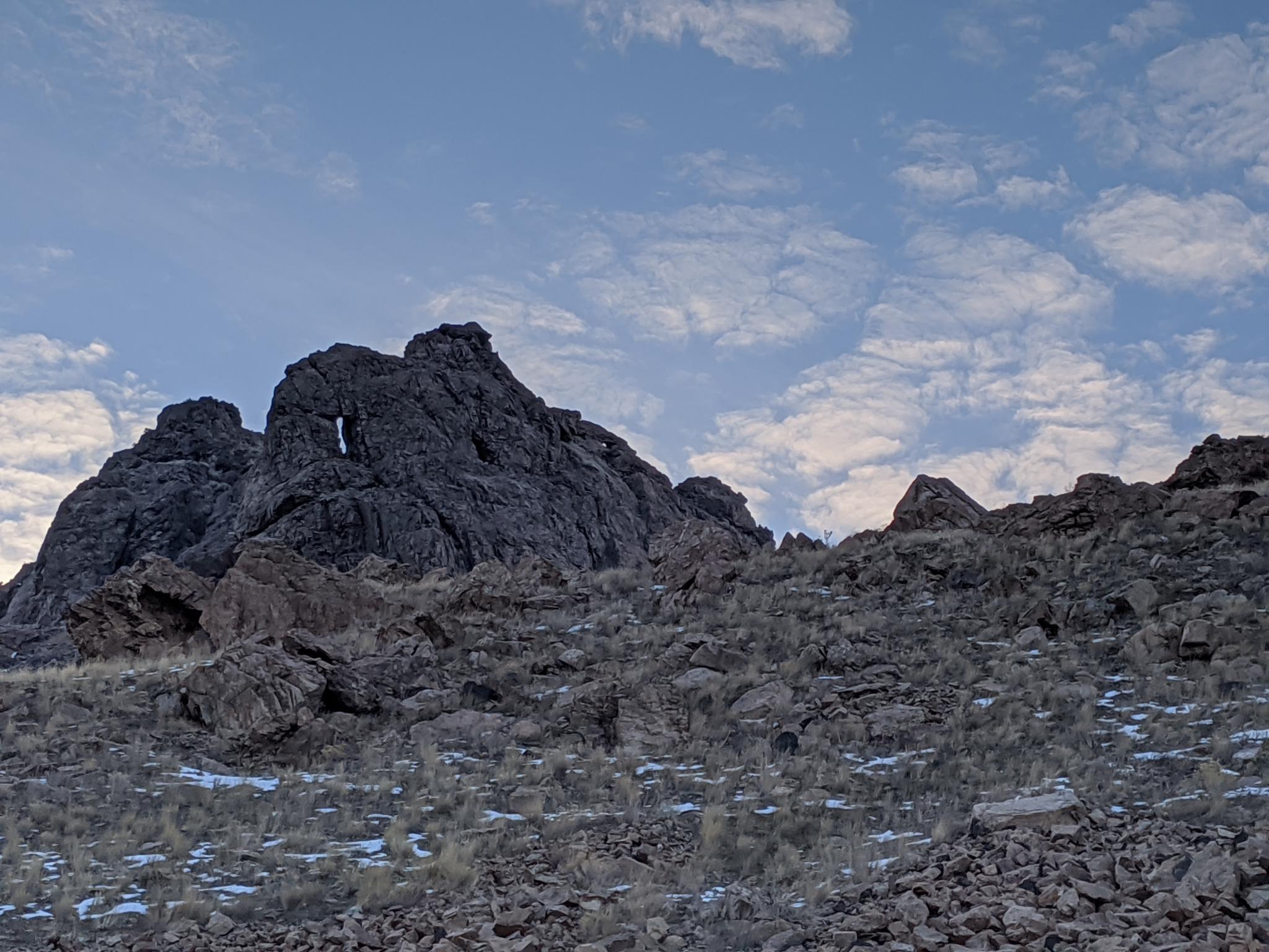
Just past the Elephant Head side trail is the loop junction for the Split Rock loop. Though it can be done in either direction, my preference is clockwise. Follow the trail as it meanders easily along the Boneville Shoreline. Views to the south are excellent. As the rock outcroppings come closer to the trail, keep an eye out for a split rock, I assume the namesake of the trail, that has a slender gap through it.
Not far past Split Rock is a historic rock horse corral and interpretive sign. The history is fascinating; it is easy to imagine wild horses roaming the hillsides. The trail makes long lazy switchbacks down to near the Great Salt Lake and heads north. After crossing around an outcropping, the trail climbs up the valley south of Elephant Head to the loop junction. Go left to return the way you came to the trailhead.
Maps
")
")
12T 395775E 4542258N
41°01'30"N 112°14'23"W
12T 395779E 4542139N
41°01'26"N 112°14'23"W
12T 397212E 4538347N
40°59'23"N 112°13'19"W
12T 397024E 4537901N
40°59'09"N 112°13'27"W
12T 395360E 4538094N
40°59'14"N 112°14'38"W
12T 395875E 4536855N
40°58'34"N 112°14'15"W
12T 395797E 4536761N
40°58'31"N 112°14'19"W