 Hiking
Graham Peak
Hiking
Graham Peak
Silver Island Mountains
Overview
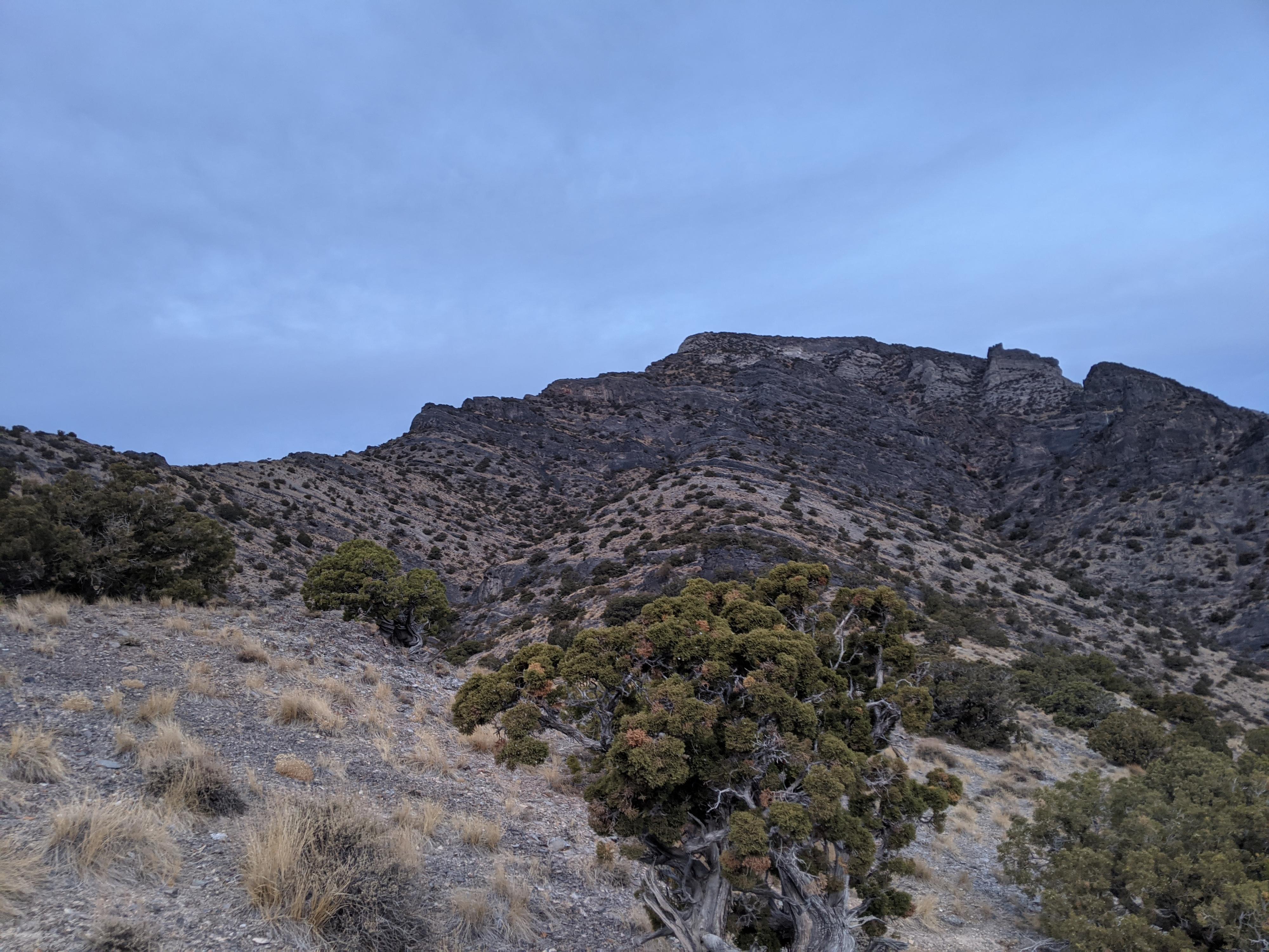
Graham Peak is the highest point in the Silver Island Mountains. The west side of the Silver Island Mountains tend to be steep slopes without many challenges. The east side is riddled with cliffs, caves, obstacles and (to my eye) much more dramatic scenery. Though the peak is most hiked from Campbell Canyon on the west side of the range, the route described here is on the east side of the range.
The route up the peak from the east is shorter than coming up from Campbell Canyon, it is also more difficult. This is an outing for experienced desert peak baggers. The route is loose in spots, and requires good route finding and/or intuition to find a path. It is rewarding to see such an imposing cliff covered face, then find a route working up through the difficulties. This was by far my favorite peak in the range I have done. The route finding and exposure are never too difficult but challenging enough to be fun!
The route described below is a loop. I recommend going clockwise. Starting by going southwest, up the ridge, through the cliffs, then back down via the north ridge. This gets the route-finding challenges done first, and it is much easier to route find from below than above on this peak. Those wanting a more straightforward and easier outing can go up via the north ridge and return the same way. This takes away the route finding through the cliffs but is still a steep and loose route in spots. Experience recommended even for the easier north ridge.
Getting There
Reaching the trailhead starts by going north off I-80 at exit 4. This is a few miles east of Wendover, UT, and about 115 miles west of Salt Lake City.
Once off the freeway, reset your odometer on the north side of the freeway and head north toward Bonneville Salt Flats.
Route Description
From the parking area, head west toward the peak. Take the first major drainage that heads south west and begin climbing west up to the ridge (elevation 6067 on the map). Once on the ridge, follow it west toward the peak. There are several small rock bands along the ridge, but all are easy to climb over directly, or go around.
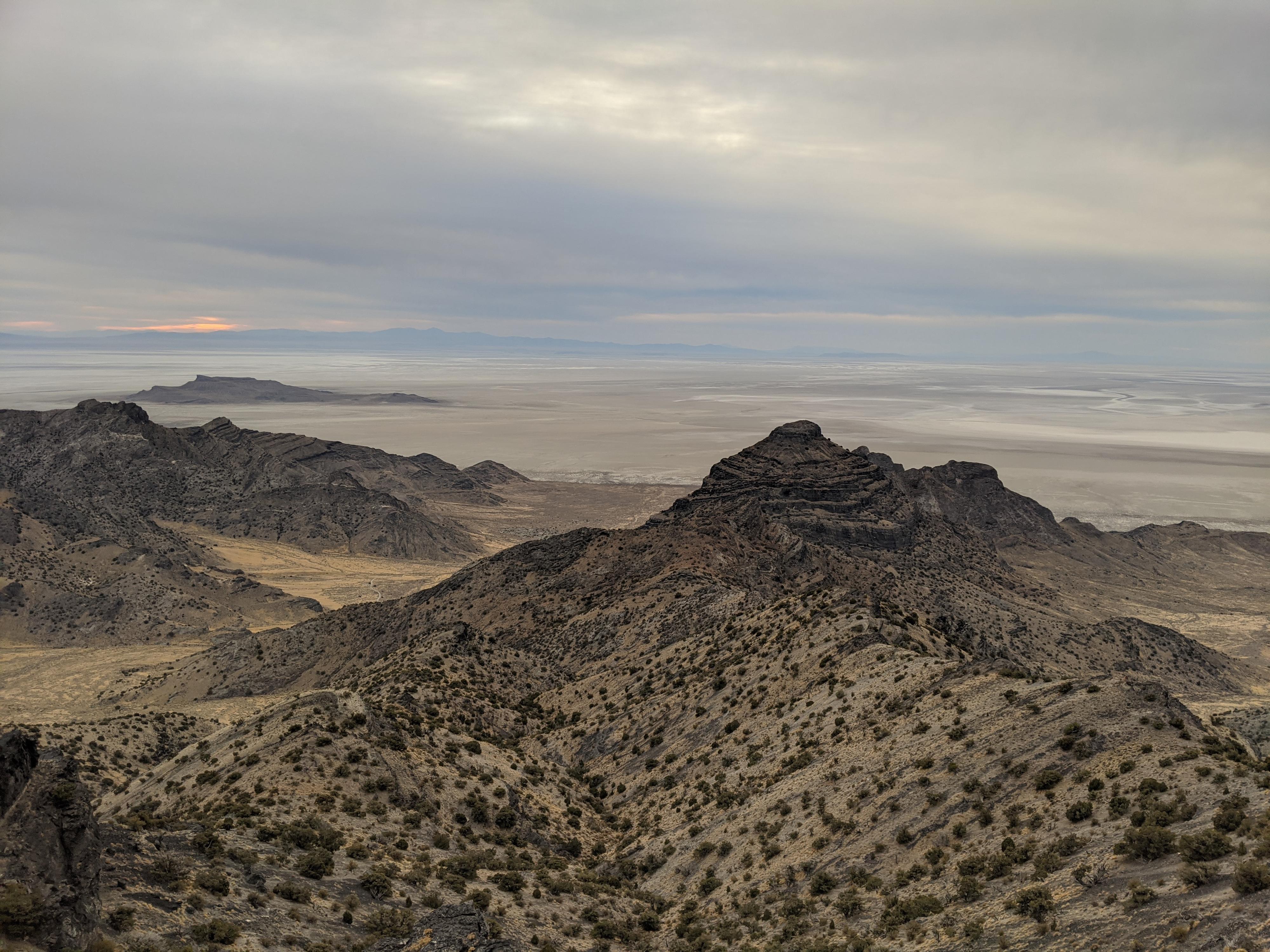
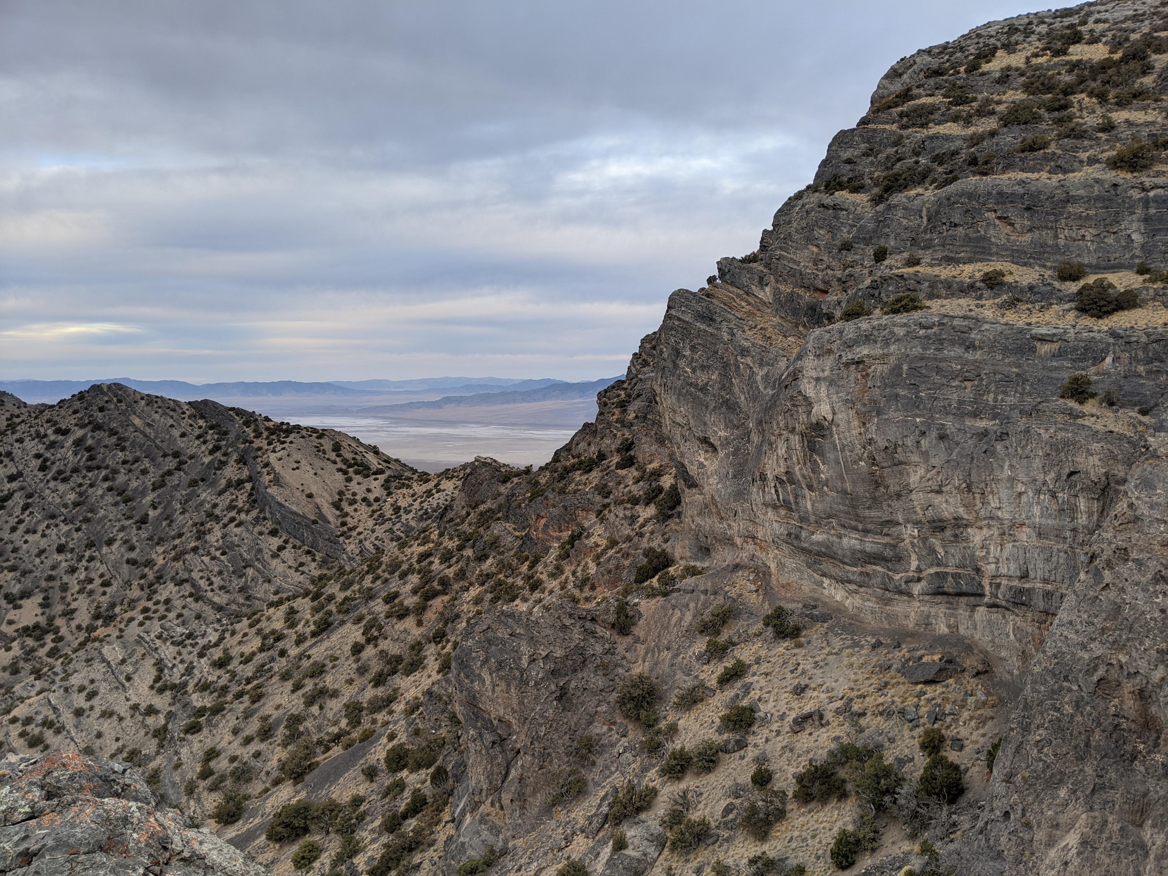
At about 6800’ a large cliff is encountered. The route finding begins here! Bypass the cliff on the left. There are a few options, it is steep and a bit loose. Work up above the large cliff on the left (south) side. Once above the large cliff, the cliff bands above become insurmountable. Traverse south, along the base of the major cliff band. This is relatively easy going with excellent views. It is generally best to stay close to the base of the cliff band.
The traverse leads around a corner and looks steeply down into Cave Canyon. Look for a steep narrow ravine just around the corner that allows upward progress through the cliff band you have been traversing below. This is not exposed or hard. If it seems difficult, look around you are likely in the wrong place. Once up the short steep ravine, the route finding becomes easy. Work up to the summit on the now open and easy slope.
North Ridge Return
To make a loop hike, I recommend following the north ridge on the return. From the summit follow the north ridge. It is narrow at first, but straightforward. It becomes easiest to stay just east of the ridge as you follow it north. Follow it until it reaches a saddle. The saddle is the first easy place to descend to the east. Though relatively easy, working down from the saddle east back to the trailhead is steep and loose in places. A dry fall about halfway down is easily bypassed on the left.
Photos
Maps

12T 267166E 4536546N
40°56'49"N 113°45'58"W
12T 265629E 4536861N
40°56'57"N 113°47'04"W
12T 265327E 4536866N
40°56'57"N 113°47'17"W
12T 265213E 4537131N
40°57'06"N 113°47'22"W
12T 265848E 4537911N
40°57'32"N 113°46'56"W