 Roadside Attraction
Brian Head
Roadside Attraction
Brian Head
Iron County Highpoint
Overview
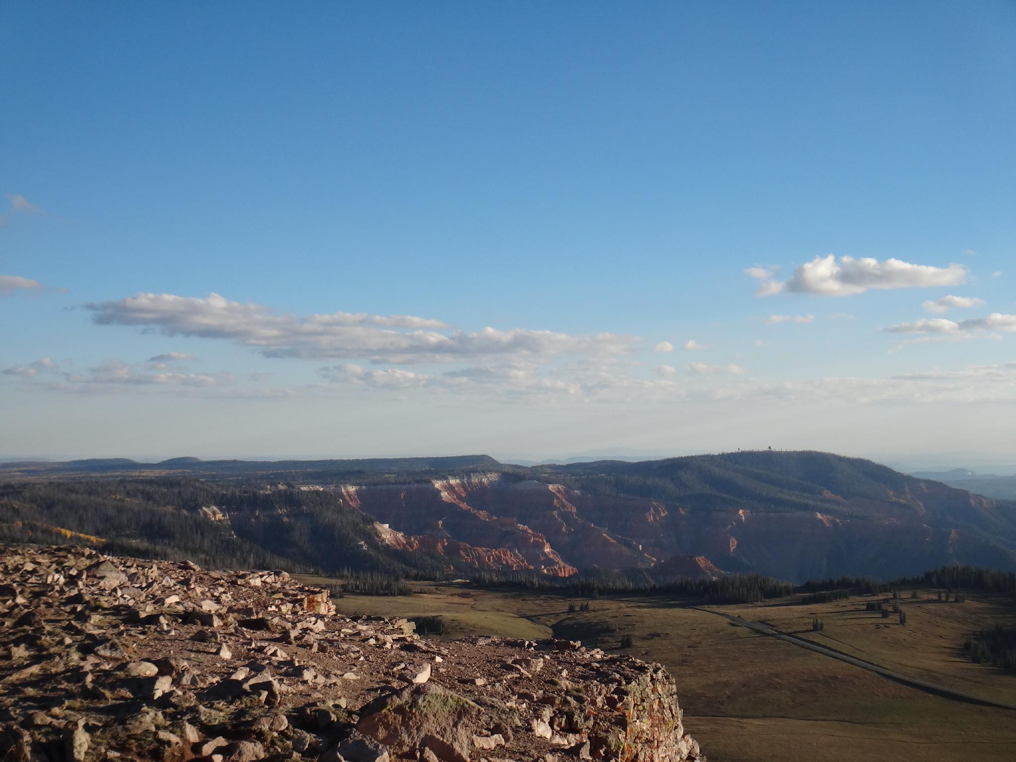
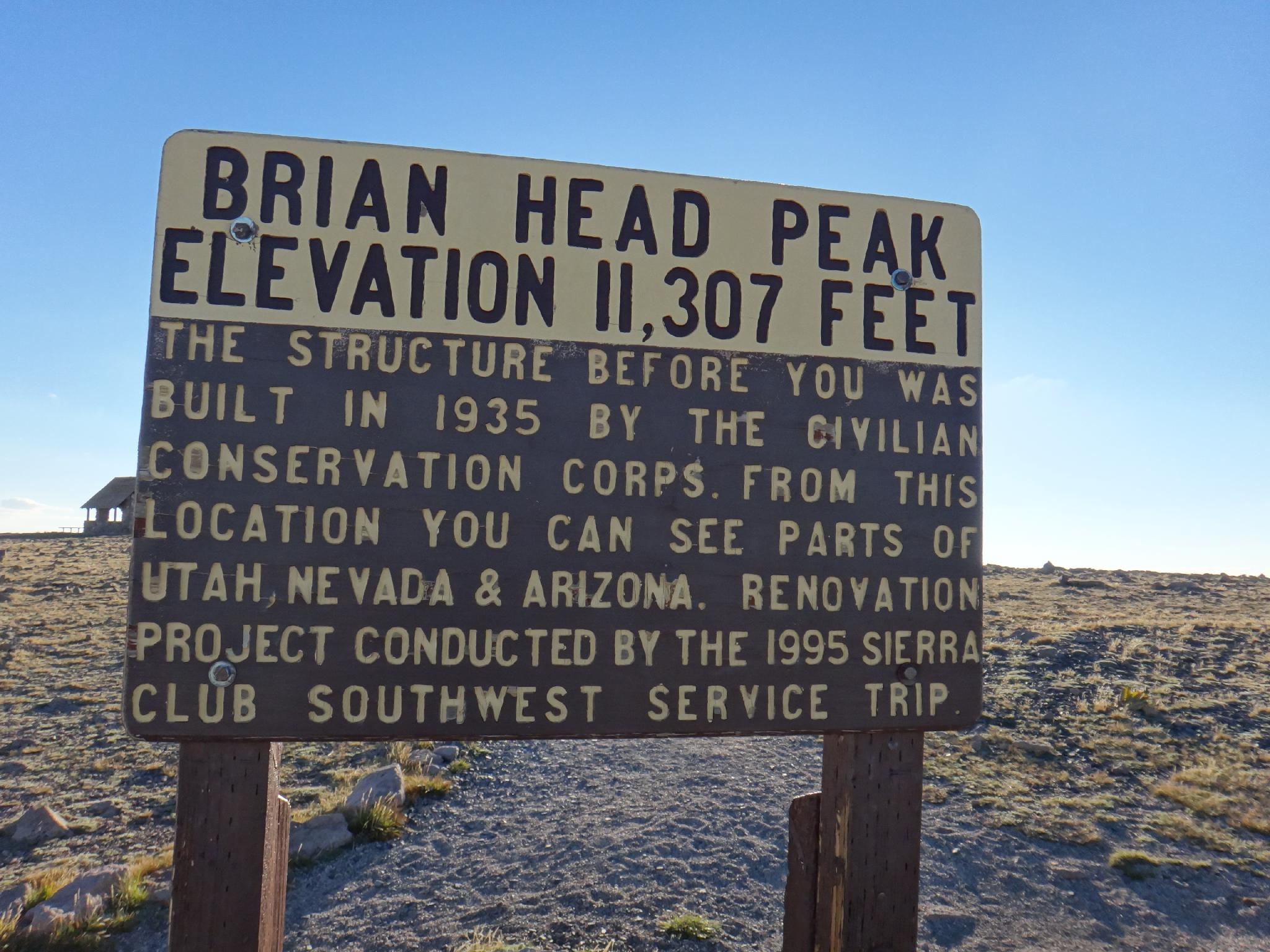
Brian Head is both the highpoint of Iron County, as well as a ski resort. This is probably the easiest highpoint in Utah to reach, with a good gravel road going right to its summit, and a small rock building to sit and enjoy the view from.
The peak is probably best visited in July when the wild flowers are out, or the end of September/early October when the leaves are in full color. Being a short excursion, this is a great peak to add on to a Kane County and/or Washington County highpoint weekend.
Getting There
Brian Head can be reached from either Cedar City via UT 14 and UT 143 through Cedar Breaks, or from Parowan, which is the shortest way from the highway. From Parowan, follow UT143, signed Brian Head, about 15 miles to mile post 17.8. A good gravel road goes off on the left (east) that is signed Brian Head Peak/Vista Point. Follow it to the summit in 2.7 miles. The road is generally passable by all vehicles.
Route Description
Summit: 3446 m ( 11306 ft. )
Trailhead: 3436 m ( 11273 ft. )
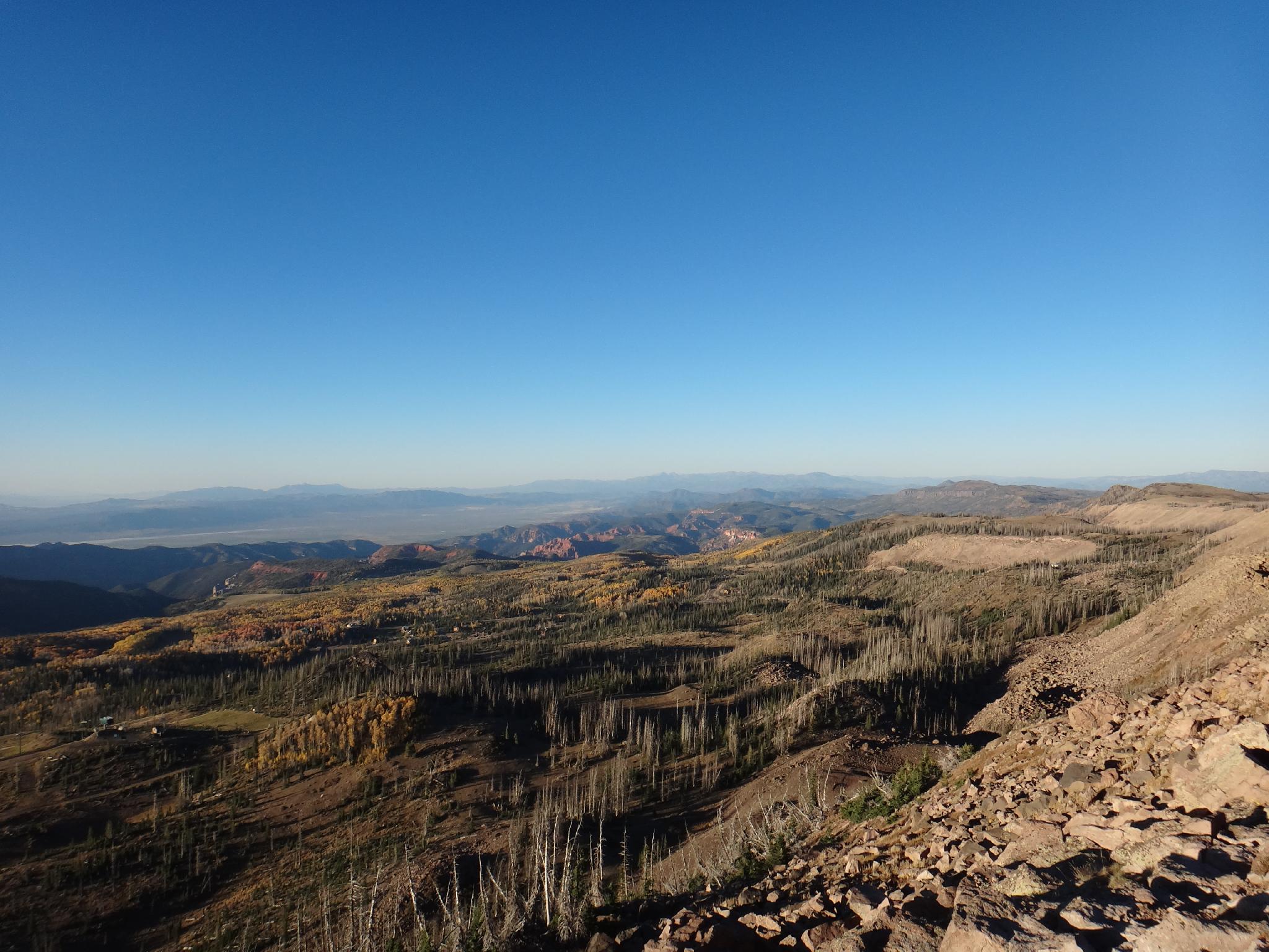
Your there! The summit offers great views of the surrounding area. To the north, off in the distance, are Mount Baldy and Mount Belknap, prominent peaks seen when driving by Beaver on I15 and are near Delano peak. To the south are great views of Cedar Breaks.
Maps

12S 338520E 4172025N
37°40'52"N 112°49'52"W