 Canyoneering
Jolley Gulch
Canyoneering
Jolley Gulch
Zion East Side
Overview
Jolley Gulch is a pretty section of canyon that is just too darn short! The canyon consists of two beautiful rappels in about 300' of canyon length, then it opens up for a casual walk back to the trailhead. Though the rappels are nice, the canyon is tough to recommend given its short length.
The canyon is generally dry or with ankle deep water at most, making it a good cooler season canyon. Be sure to bring 15 m ( 50 ft. ) of webbing, hikers usually remove any webbing left at the first rappel since it is next to the East Rim trail and a bit of an eyesore. Both rappels have pretty straightforward anchors and easy starts making this suitable for beginners with a little rappel experience.

Getting There
The trailhead is the East Rim trailhead. This is just inside the East Gate of Zion National Park. From the park visitor center, follow highway 9 about 12 miles east through the tunnels to just before the east gate. Turn left here and follow the side road a short distance past the ranger residences to the East Rim Trailhead. This is signed when coming from the west, but not singed if coming in from the east gate. If coming in from the east gate, take the first right.
Route Description
Approach (1-1.5 hours / 3 miles)
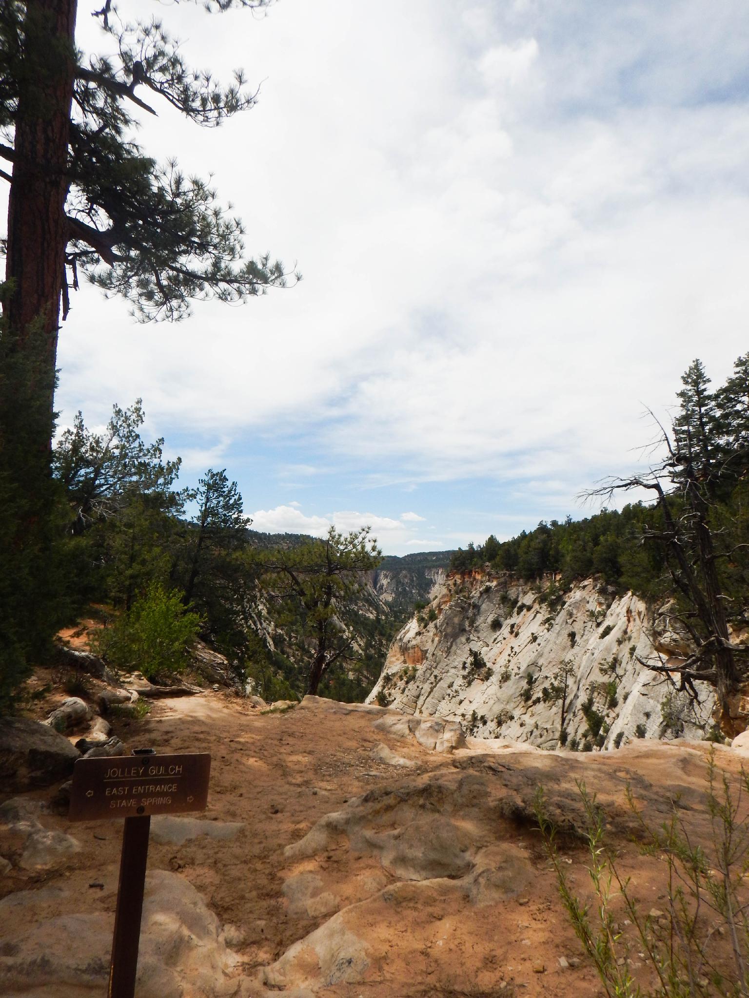
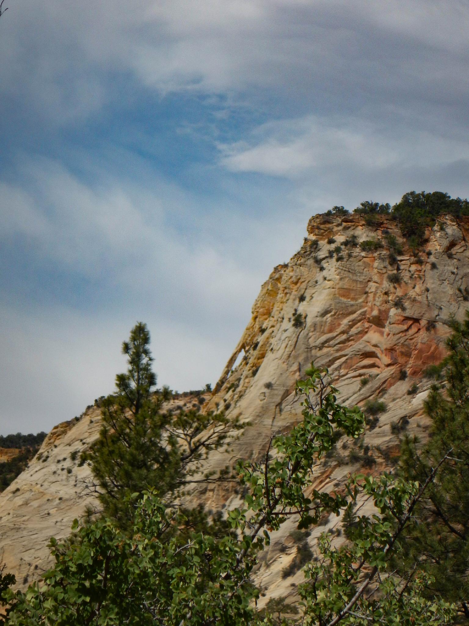
Follow the East Rim trail. About 5 minutes from the trailhead, look left to see the aptly named Hidden Arch on the skyline of the Navajo slope in the distance. It is hard to spot from any angle,living up to its name. Continue on the East Rim trail as it heads up Clear Creek, then leaves Clear Creek and ascends Cave Canyon to a more level path along the rim and heads back west.
After about 1 to 1.5 hours (3 miles) from leaving the East Rim Trailhead, the trail passes the head of Jolly Gulch. This is the obvious deep canyon to the left of the trail. If in doubt, read the NPS sign that says matter of factly "Jolley Gulch" right at the head of Jolly Gulch.
Canyon
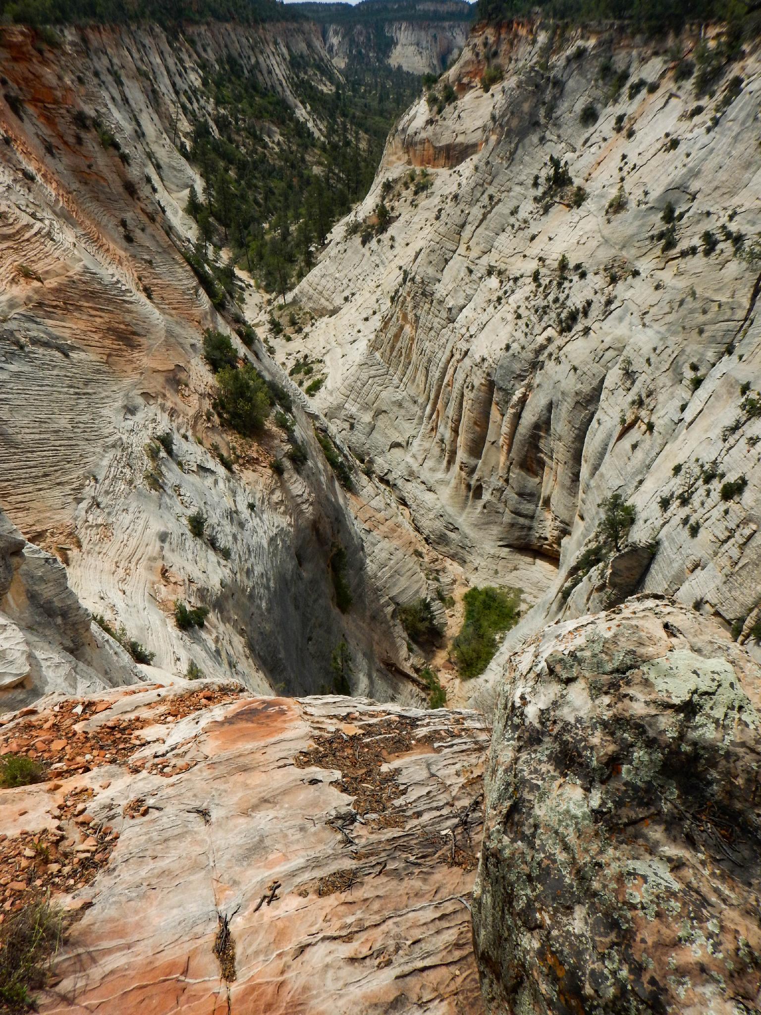
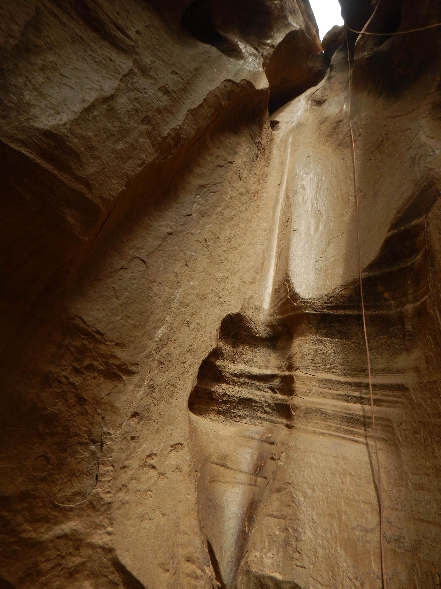
The canyon drops immediately about 48 m ( 158 ft. ). Numerous large trees offer anchor possibilities but make sure they are healthy and well rooted. I would recommend the tree just back and on the right of the head of the canyon (looking down canyon). Rappelling here sends the rappeller down a well-sculpted water groove and seems the most scenic path. Extend the webbing to the edge to facilitate rope pull.
30 seconds down from the first rappel is rappel 2. This is a two stage 27 m ( 89 ft. ) rappel. There is sometimes an anchor at the bottom of the first stage, but I would recommend rappelling both stages from the first anchor. This makes for a better rope pull, and (at least on my trip) the mid-level anchor was quite light and poorly done.
You are done! After the second rappel, you can take off harnesses and coil ropes. It is just a hike from here.
Exit (45 minutes / 1.2 miles)
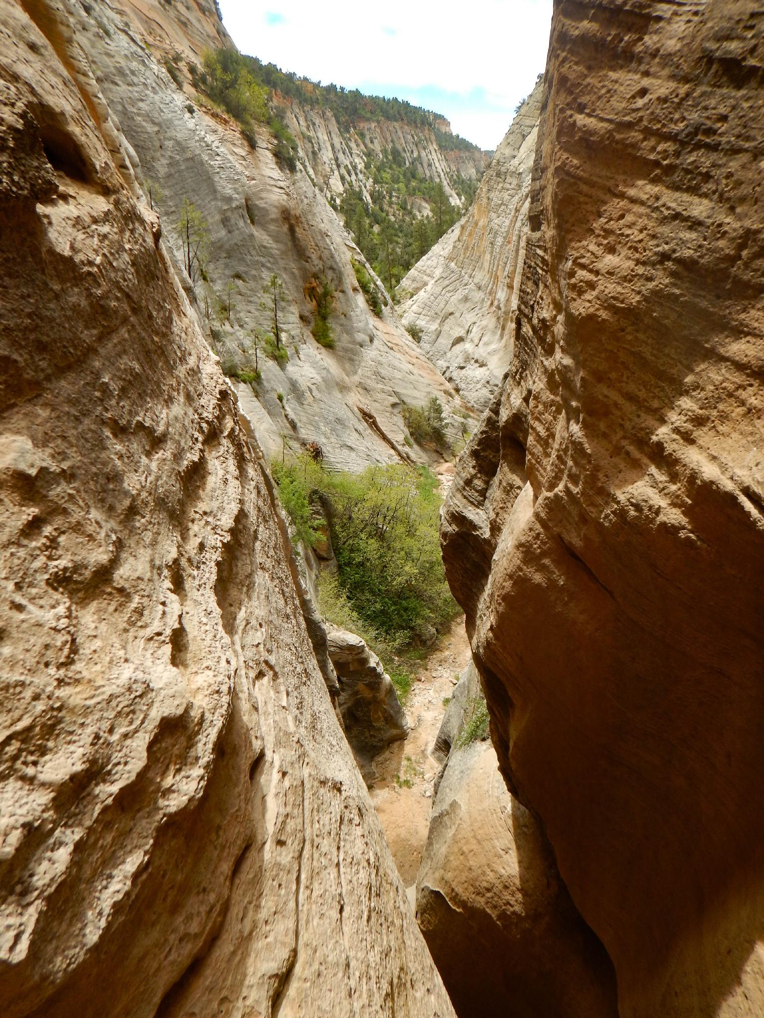
Walk down Jolly Gulch. It is easy going, with an emerging social trail in spots. 20-30 minutes or so down from the last rappel, keep an eye out for a cairn or two on the slickrock bank to the left. If you spot it, follow it two minutes and you'll reach the East Rim trail right at the large wooden bridge you crossed on the way in. If you miss the cairns (or someone knocked them over) just continue down to the obvious confluence with Clear Creek. Go up Clear Creek a minute until it is easy to scramble up to the culvert that goes under the East Rim Trail.
Follow the East Rim trail back down to the trailhead.
Photos
Maps

12S 333458E 4122511N
37°14'03"N 112°52'39"W
12S 333509E 4122851N
37°14'14"N 112°52'37"W
12S 333520E 4124461N
37°15'07"N 112°52'38"W
12S 333574E 4123381N
37°14'32"N 112°52'35"W