 Hiking
Black Mountain Lookout
Hiking
Black Mountain Lookout
Bighorn Mountains
Overview
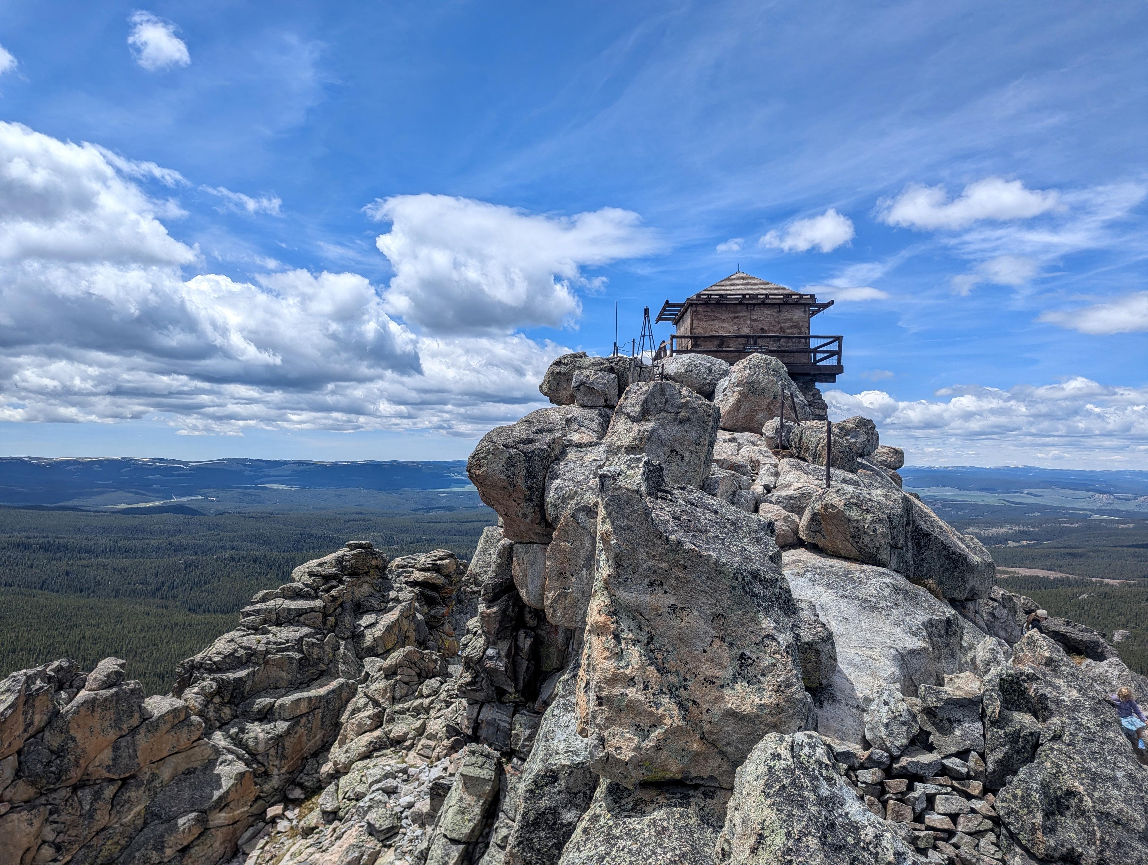
The Black Mountain Lookout Tower was built in 1939 by the Civilian Conservation Corps (CCC). The 14'x14' two-story cabin sits atop a craggy peak at about 9,500' elevation and was used to monitor the surrounding mountains for forest fires by the National Forest Service during the dry season. By about the 1960s, satellite imagery and other techniques came into use that were more cost-effective and/or efficient, and the lookout tower was no longer manned.
Today the tower is boarded up, and you can't visit the inside of it, but the hike to the tower and views from it are outstanding and worth the effort to visit it. It is a neat piece of history.
A couple of notes on visiting:
- With high clearance 4-wheel drive, the hike is a little under 3 miles round-trip and about 800 feet of elevation gain by my device. If you have a low clearance vehicle, the distance becomes a little under 5 miles round-trip and a little over 1,000' feet of gain.
- The final section of the hike is rocky with a little exposure. Not a problem for most, but if you are afraid of heights, this might not be a great hike choice.
FIRE LOOKOUTS
Fire detection and suppression have been priority work for the United States Forest Service from its beginning in 1905.
In the 1920s and 1930s, the Forest Service began building access roads, communication systems, and received equipment and manpower to effectively control fires. Suppression however, still depended on early detection. In the technology of the time, this required manned lookout stations on most National Forests.
The Civilian Conservation Corps built several fire lookouts in the Big Horn Mountains. Three of these remain today, but are only manned in seasons with the highest fire danger levels.
This is one such station. The lookout was the summer home of an individual or couple who kept watch for and reported signs of fire. They also had time for wildlife watching, and during summer storms watched spectacular natural "fireworks" as lightning struck the surrounding peaks. The station stood protected by grounded points that drained the static electricity from the lookout.
Getting There
From Dayton, head west on US-14 for about 16 miles to where Black Mountain Road (FR16) leaves on the left (south) side of US-14 at about mile post 67.2. This is a good, graded dirt road that should be passable by most vehicles when dry.
Follow FR16 for 3.5 miles to a side road on the left, and turn onto this side road that descends and crosses the stream.
Follow the rougher 4x4 road for about 1 mile to its end at the trailhead.
Route Description
If parking just off the main road, cross the stream and follow the rough 4x4 road (FR222) as it heads uphill, rounds a bend, crosses a stream, and then continues up to the trailhead, about 1 mile from the main dirt road.
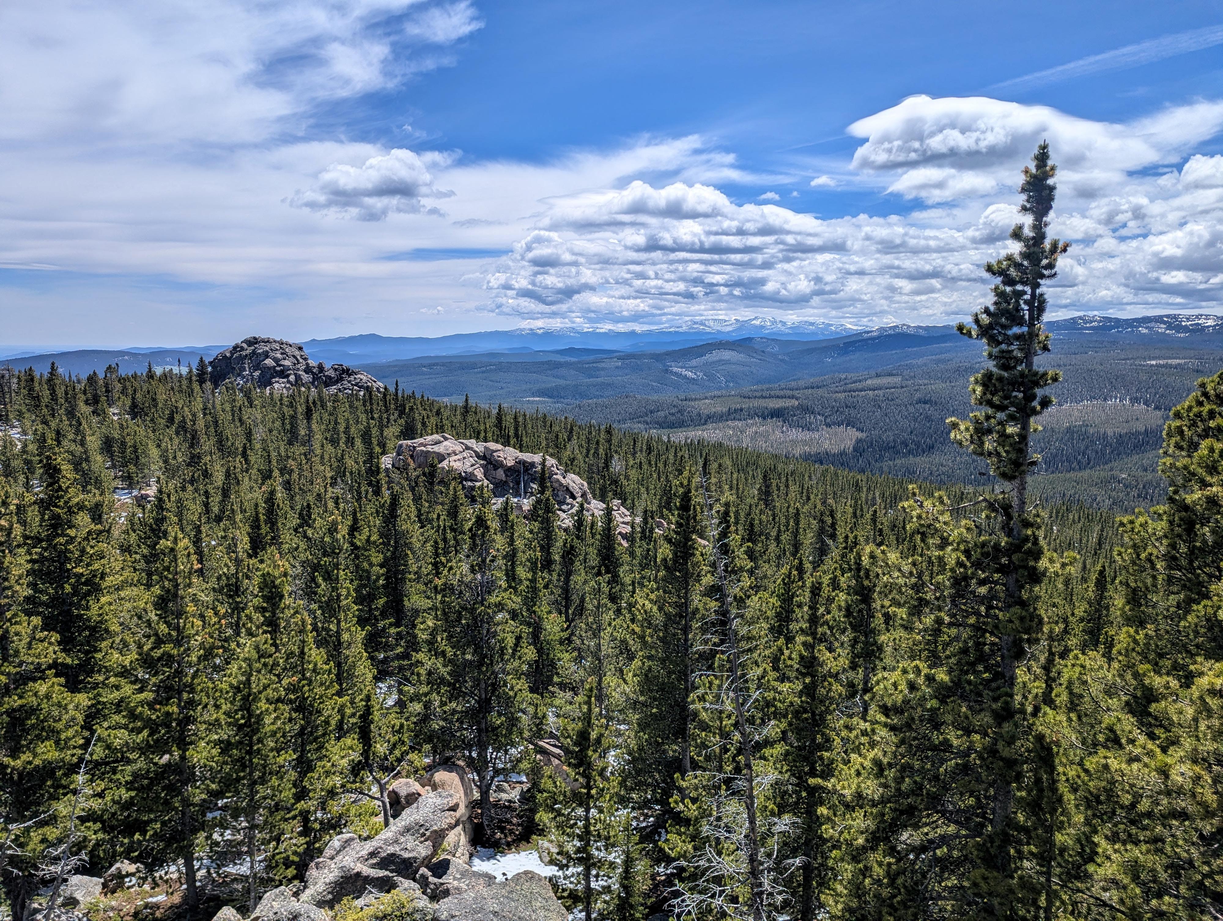
From the end of the road, the trail (#011) is easy to follow. Follow it as it meanders up in the trees via a couple of long switchbacks at first that become tighter switchbacks as you near the top of the mountain. The first part of the hike is in trees without big views, but once near the top, the trail leaves the trees and climbs the rocky top section of the peak.
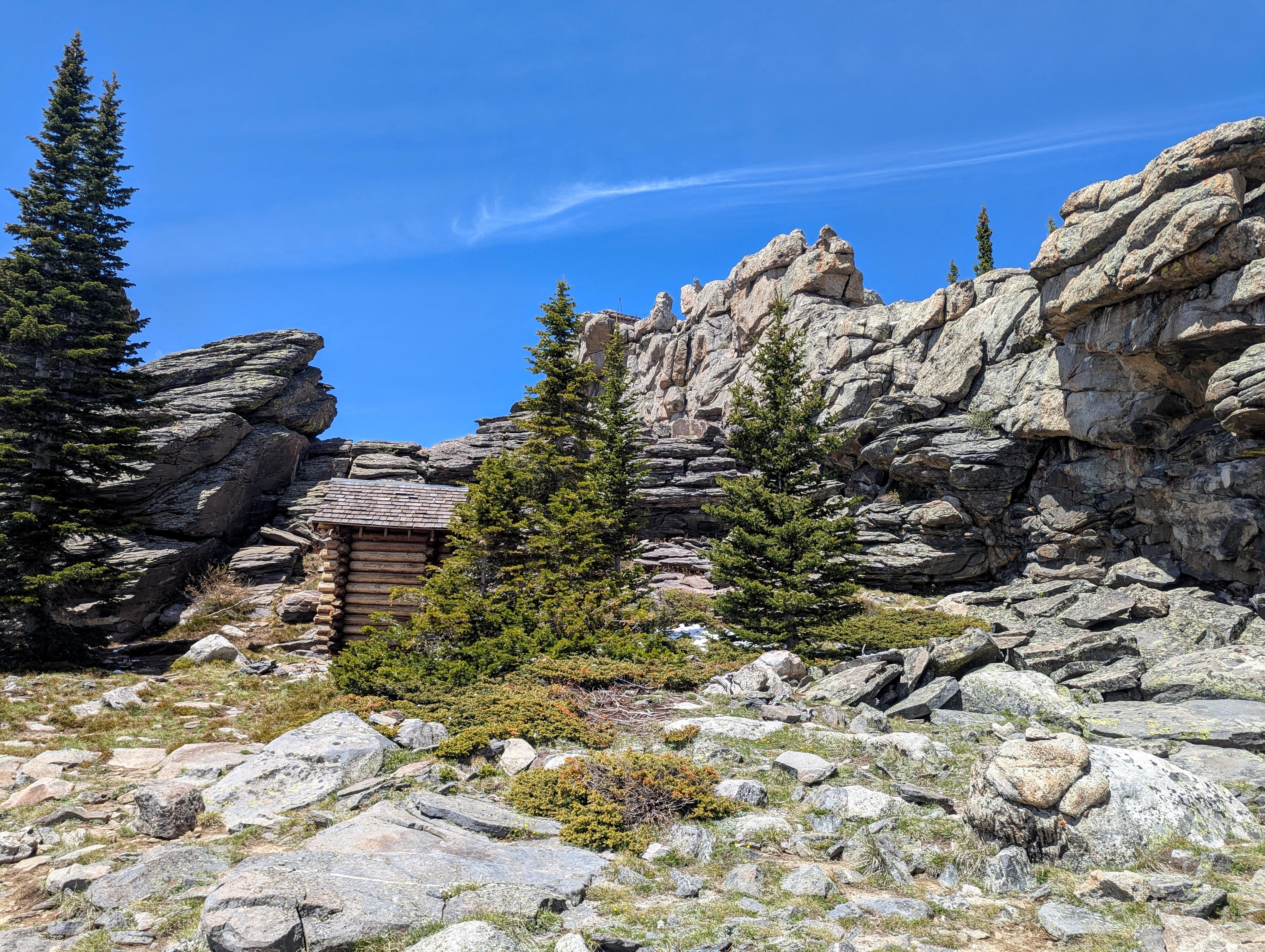
The trail levels out at a flat area with an old log outhouse and views of the lookout high above. The trail gets more rugged and dramatic from here!
Follow the trail east to the ridge, then back west as the route stays on the north side of the ridge, just below the top, and traverses to the lookout tower proper. Stunning views all around of Cloud Peak to the south, Sheridan to the east, and the plains in the distance beyond Sheridan. It must have been quite the spot to spend a summer for those that manned it!
Return the same way.
Photos
Maps

13T 310097E 4957358N
44°44'40"N 107°23'56"W
13T 310945E 4956631N
44°44'17"N 107°23'16"W
13T 311427E 4957149N
44°44'34"N 107°22'55"W
13T 311473E 4957115N
44°44'33"N 107°22'53"W