 Hiking
Devil's Kitchen
Hiking
Devil's Kitchen
Colorado National Monument
Overview
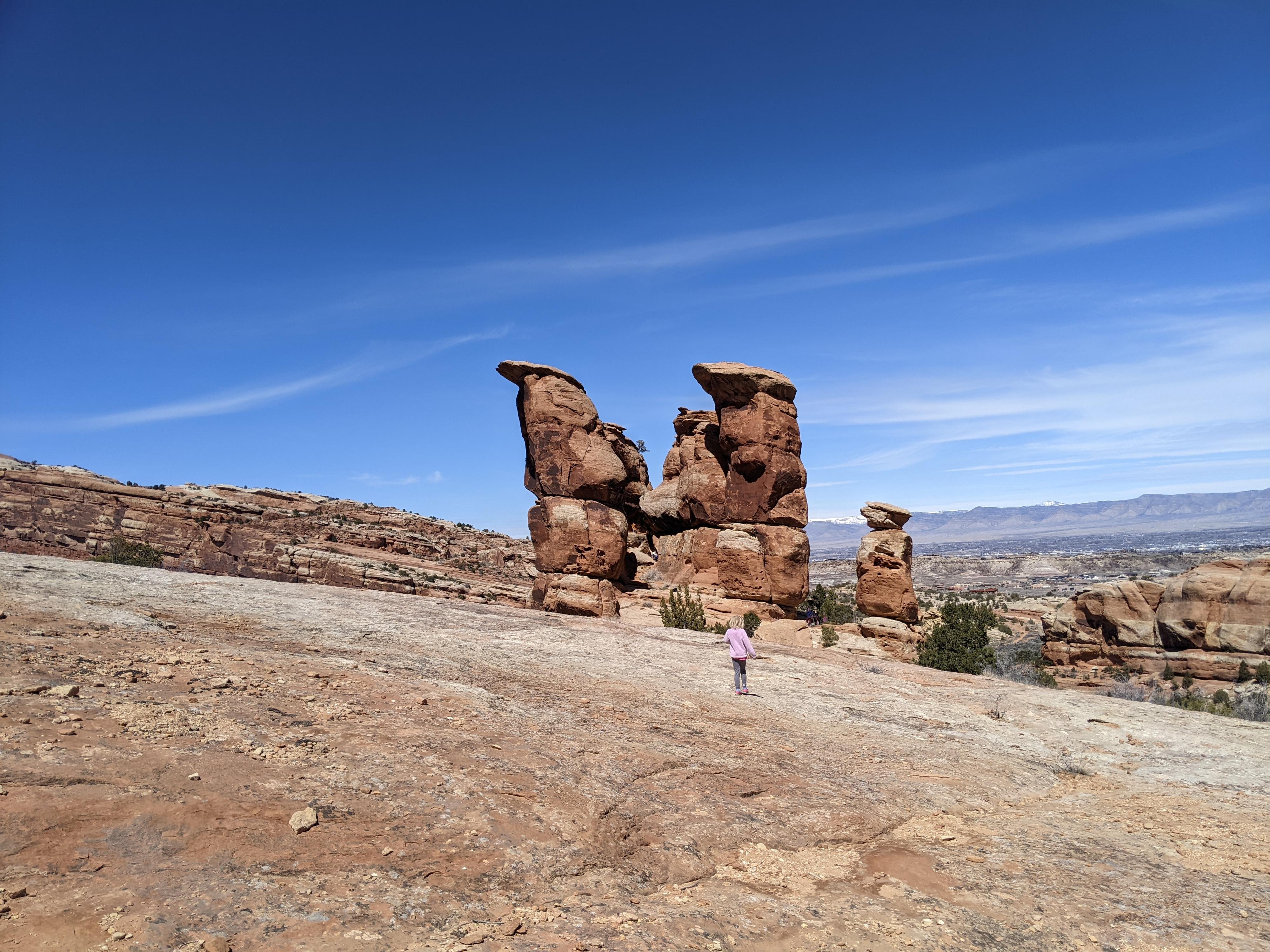
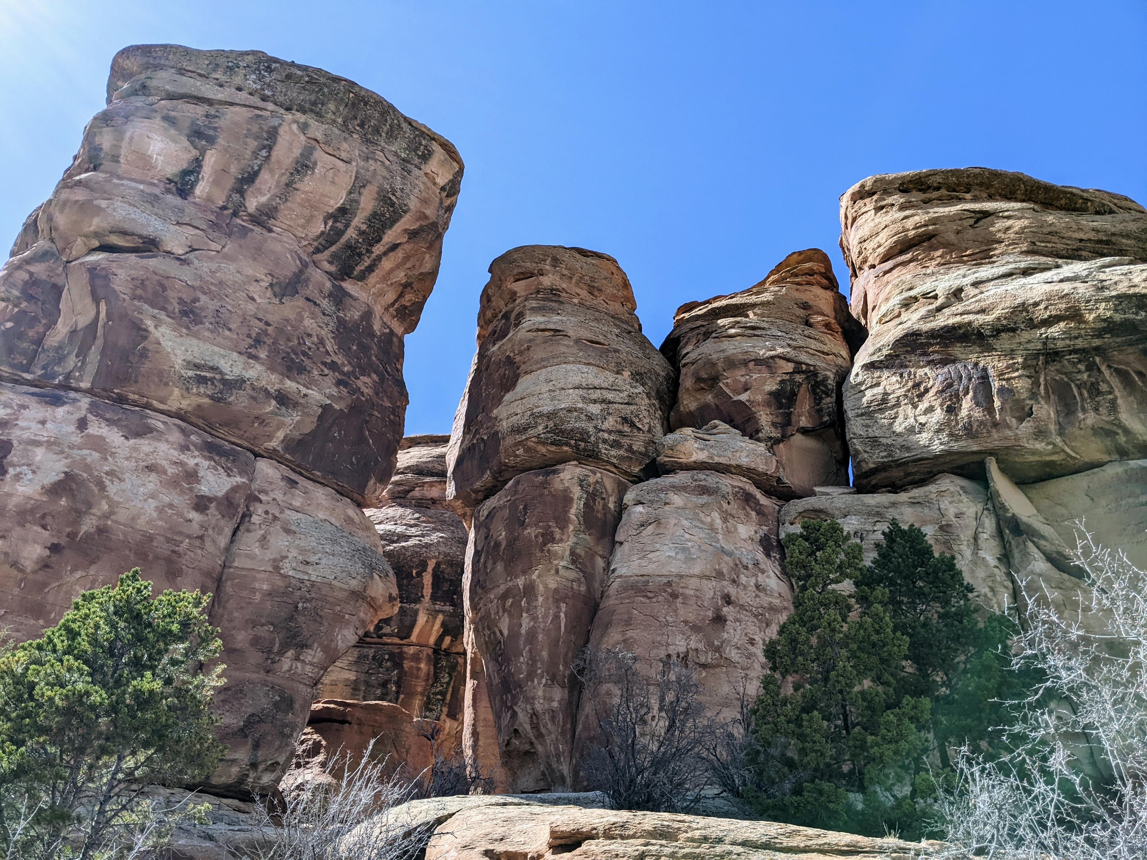
To me, Devil's Kitchen, near the east entrance to Colorado National Monument, is one of the best hikes in the monument. The hike, though short, visits a dramatic area surrounded by sandstone walls and towers. On our visit, it was delightfully filled with families climbing around and exploring the area. A playground for both young and old alike!
Those looking for a longer outing can combine this hike with the bottom end of No Thoroughfare Canyon that starts on the same trail. Doing both makes for a great, scenic half-day outing suitable for most.
Getting There
From the east side entrance to Colorado National Monument, drive 0.2 miles past the entrance fee station. The trailhead is on the left side of the road. There is somewhat limited parking. If full, there is overflow parking at the Devil's Kitchen Picnic area that is just across the road from the trailhead, where a paved road goes a short distance to a picnic area. There is a restroom at the picnic area.
Route Description
From the trailhead, follow the trail south. In just a couple of minutes is the junction with Echo Canyon/Old Gordon Trail, leaving on the left. Go right at this junction.
About a quarter of a mile from the trailhead is the second junction. Go left here to reach Devil's Kitchen. Right goes to No Thoroughfare Canyon.
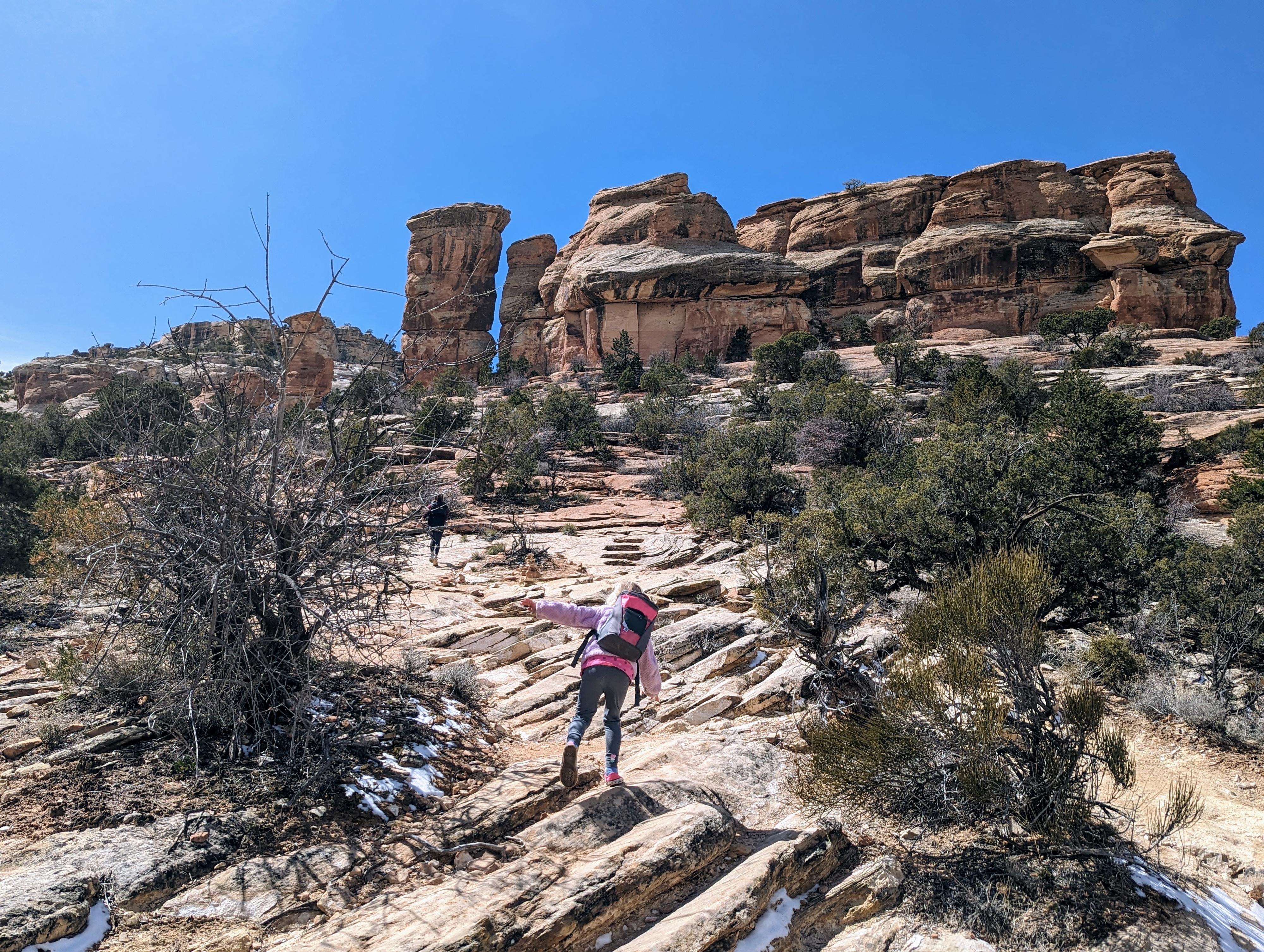
From the No Thoroughfare junction, the trail heads south on an easy-to-follow path, then crosses the shallow wash. Once across the wash, the trail becomes very braided with a variety of social trails. Head up the slope to the obvious sandstone towers that make up Devil's Kitchen.
After visiting Devil's Kitchen, the social trails continue a few minutes south to a viewpoint looking up at dry falls of the small side canyon. Return the same way.
Maps

12S 705080E 4322974N
39°01'54"N 108°37'51"W
12S 705194E 4322798N
39°01'49"N 108°37'46"W
12S 705096E 4322619N
39°01'43"N 108°37'50"W
12S 705018E 4322276N
39°01'32"N 108°37'54"W
12S 705012E 4322012N
39°01'23"N 108°37'54"W