 Hiking
Mount Olympus
Hiking
Mount Olympus
Salt Lake CIty
Overview
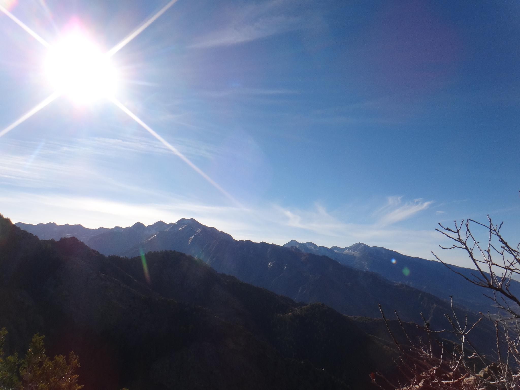
On the edge of Salt Lake CIty, Mount Olympus is one of the more popular peaks in the area. It's slabby north face is highly recognizable, and visible from many areas in the Salt Lake Valley. On a given warm Saturday, the trail is generally quite busy with hikers working up to the 2751 m ( 9026 ft. ). The south summit is the true high point of the peak, however the north summit (separated by a small saddle) is the summit visible from most of the Salt Lake Valley.
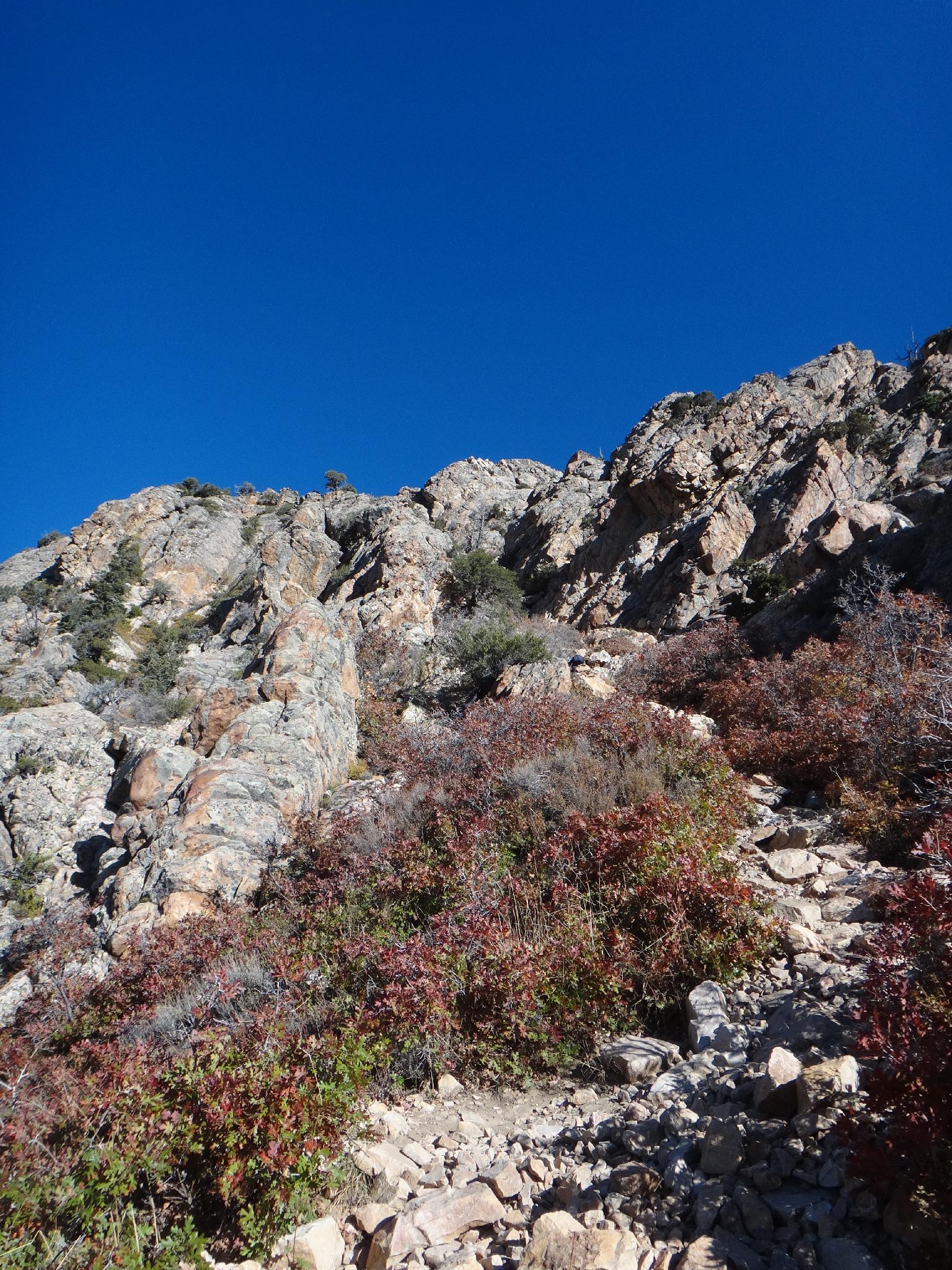
The hike to the summit is a physical one, gaining about 4000' of elevation in 3.25 miles. Expect a seemingly endless uphill hike, with a particularly steep section known as "Blister Hill" coming midway. No matter the shape I am in, Mount Olympus always makes me realize I could be a bit stronger. (My current best is 1:56 to the summit, just under 3 hours car-to-car, which is slow by trail runner standards.) The final 600' of elevation is an easy scramble. No problem for most, but be careful if its wet. The quartzite is slick when dry, and very slick when wet.
A few cautions:
- The lower section of the trail can be unbearably hot in the summer. If hiking in the summer, an early start will keep most of the trail in the shade during the way up.
- The lower section of the trail often has rattlesnakes in warmer seasons. Be very careful and keep an eye out for snakes. (Especially if bringing dogs on the hike.)
- The trail is well cairned and easy to follow, but surprisingly a few people a year seem to get lost on this hike. Keep an eye out and navigation is easy. This is not a route I would recommend in the winter or with snow on it unless you have visited before. The times I've done it with snow were much more difficult and challenging.
Getting There
The trailhead starts at Pete's Rock on the east side of the Salt Lake Valley. Take exit 5 from I-215 (4500 South) and go east off the highway. Turn right (south) onto Wasatch Boulevard at the light, and follow it 1.6 miles to the trailhead on the left. The small parking area for the trailhead fills up early. Parking along Wasatch Boulevard is a good overflow.
Route Description
The Mount Olympus trail is broken up into 3 distinct sections, the trailhead to the stream, the stream to the final saddle, and the summit section. Many people do just the first section, to the stream, as an evening or shorter afternoon hike.
Trailhead to Stream (1-1.5 hours / 1.5 miles)
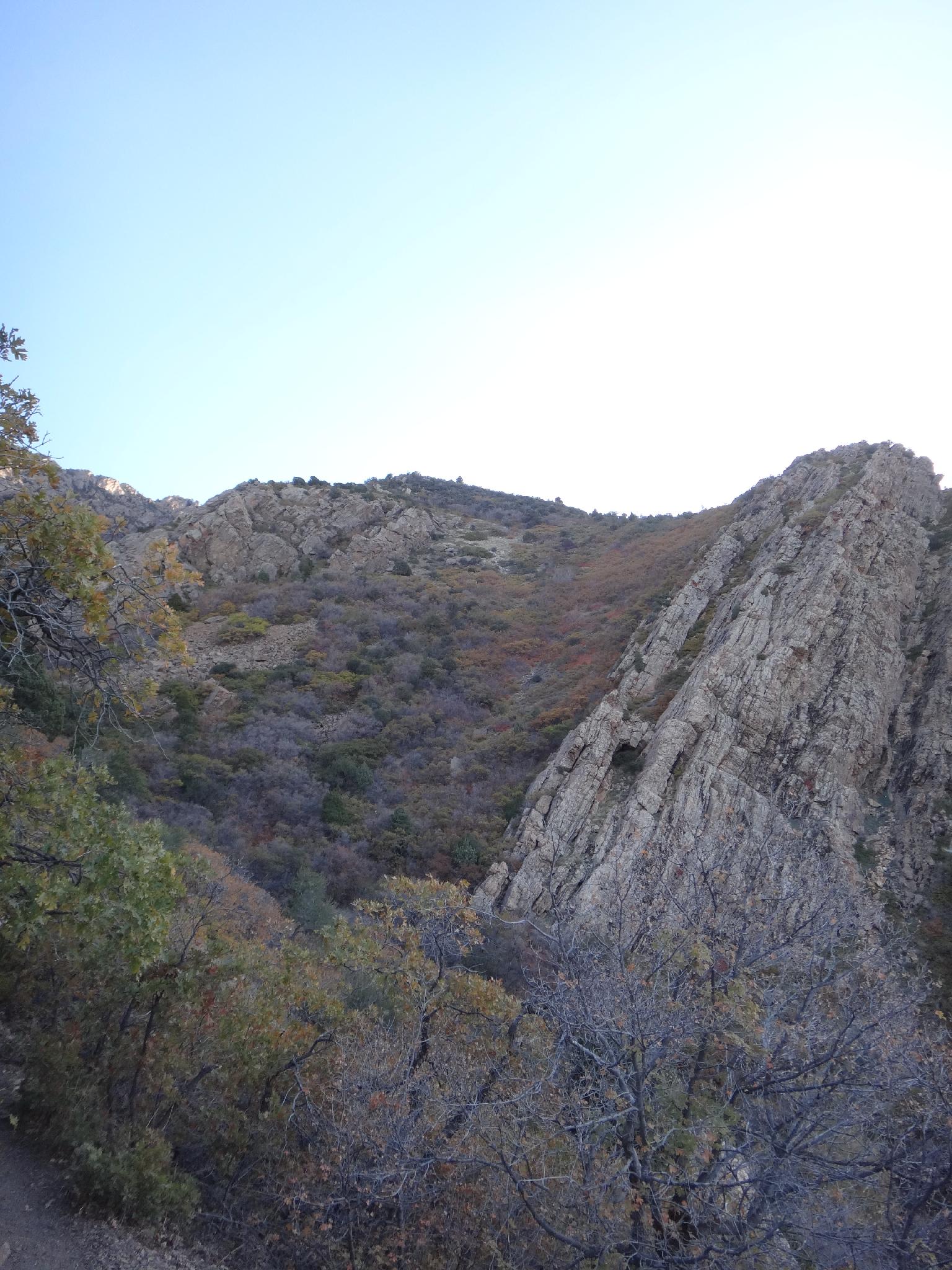
From the trailhead, follow the trail as it climbs steeply. It reaches a flatspot at the top of Pete's Rock. Stay right here as it switchbacks up. A few minutes into the trail, the Bonneville Shoreline Trail leaves on the left, stay right. Continuing up the steep trail, the Bonneville Shoreline leaves again on the left. Again, stay right. The trail rounds the corner to Tolcats Canyon and soon reaches the stream. The stream generally has at least a small flow year round, but can dry up in late fall.
Stream to Overlook (1.5-2 hours)
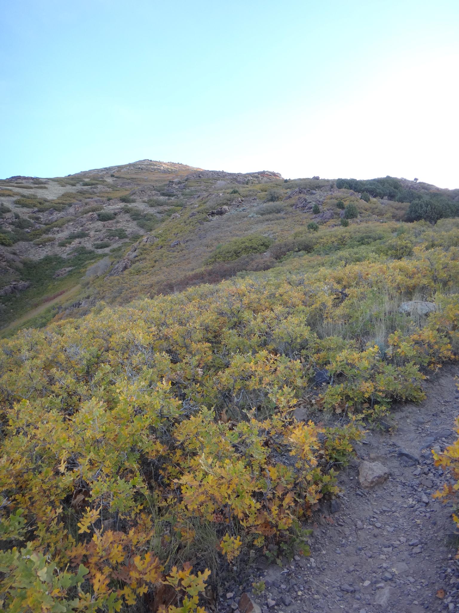
From the stream crossing, the trail begins its steep march up Blister Hill. Stay on the main trail here, avoiding the many shortcuts that are causing erosion. The trail switchbacks up Blister Hill, eases for a few minutes, then begins climbing again to the shoulder/overlook. The foliage turns from scrub oak to conifer as the elevation gain to 8400' at the shoulder.
Final Climb (30 minutes)
From the shoulder, the trail climbs a cairned route up with several scrambling and small scree sections. Once on the true ridge, a summit cairn and register are available on the highpoint to the right. Return the same way.
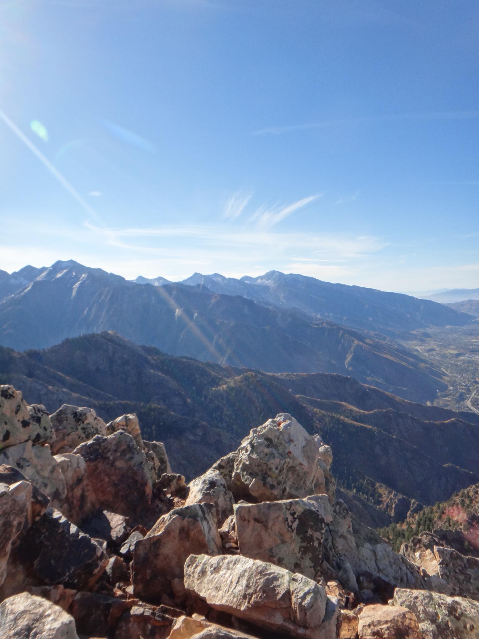
Views: From the summit, Mill Creek Canyon, Grandeur Peak, and Parleys are to the north. To the south is Big Cottonwood Canyon, Bells Canyon, Dromedary Peak is the prominent 2 summit peak with a saddle, and Lone Peak ridge far in the distance. Stunning view all around!
Maps

12T 432349E 4500383N
40°39'06"N 111°48'01"W
12T 433252E 4500529N
40°39'11"N 111°47'22"W
12T 432064E 4500570N
40°39'12"N 111°48'13"W
12T 434826E 4500933N
40°39'24"N 111°46'15"W