 Hiking
Lower Calf Creek Falls Overlook
Hiking
Lower Calf Creek Falls Overlook
Highway 12
Overview
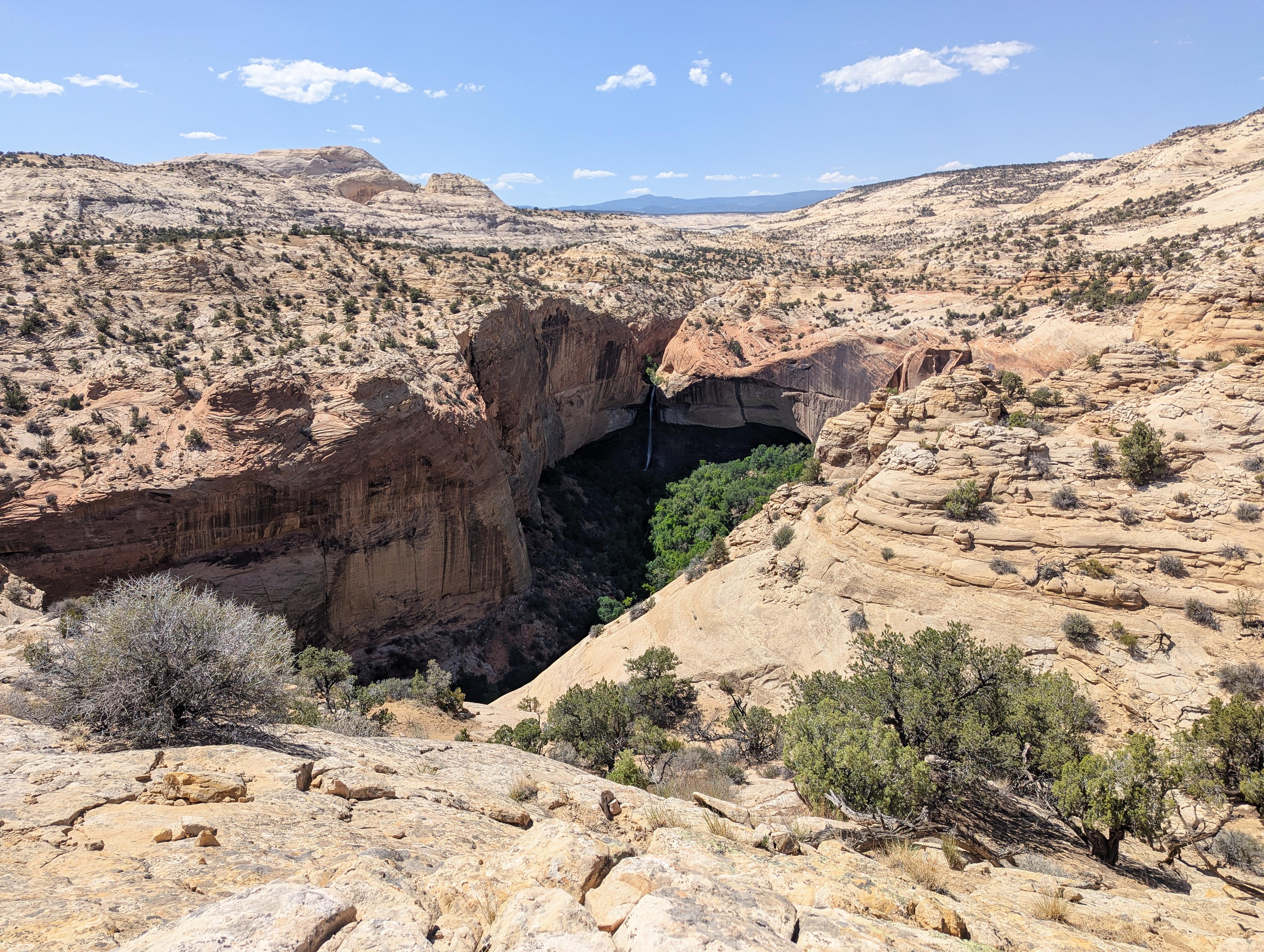
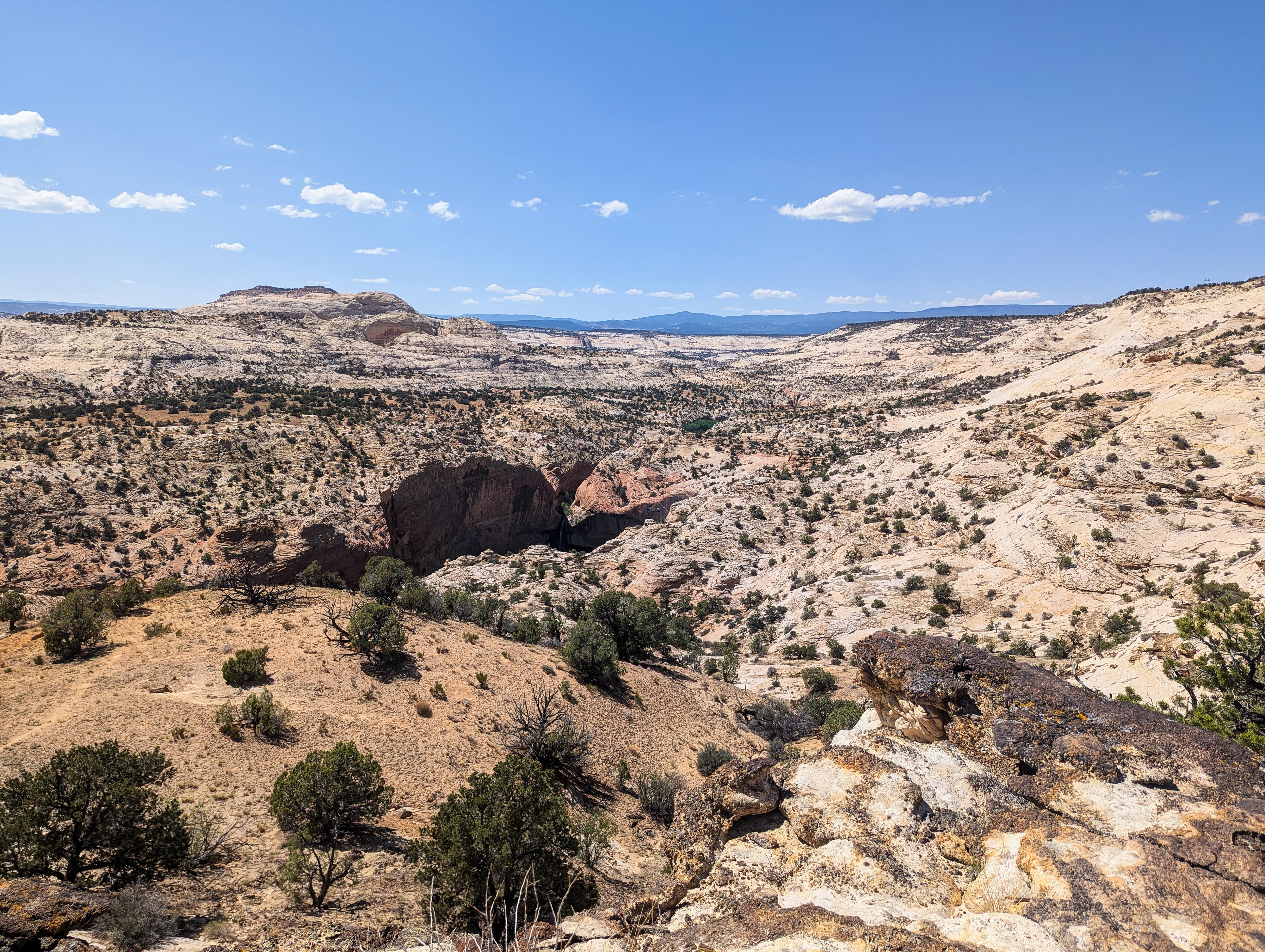
Lower Calf Creek Falls is one of the most iconic water falls in Utah. You see its image everywhere! The contrast of slickrock and flowing water is dramatic and stunning.
I've hiked the trail to Lower Calf Creek Falls many times over the years. It is always spectacular. I had heard rumors of a short overlook trail from the highway that gives a different perspective on the falls. Finally, in 2025, I had a little extra time to stop and check it out.
This short hike meanders down from the highway to an overlook of Lower Calf Creek Falls from a distance. It is a really neat overlook. I visited in mid-to-late afternoon, and the falls were in deep shade. The view was still spectacular but difficult to photograph. I would recommend a morning visit for hopefully better lighting.
Getting There
The trailhead is about halfway between mileposts 78 and 79 on Highway 12. There is a small pullout on the east side of the highway here. This is about 11 miles south of Boulder on Highway 12, or about 18 miles north of Escalante, also on Highway 12.
Route Description
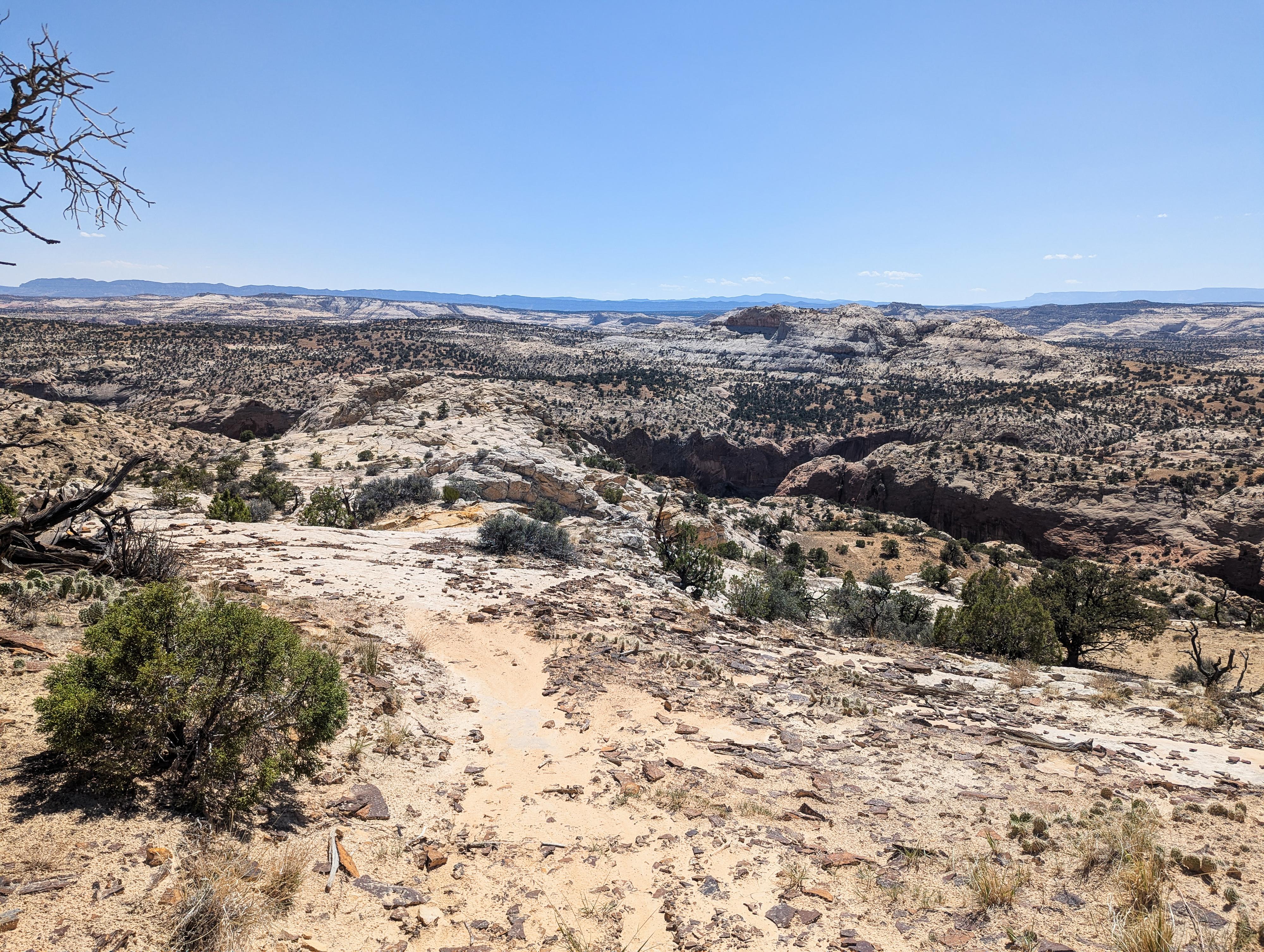
From the parking spot, cross the road. Initially, a dirt use trail is easy to follow that heads over to slickrock.
Once on the slickrock, head south and west. You can see Calf Creek to the west and a social trail at the bottom of the slickrock on the west in the dirt that heads toward Calf Creek.
Head west from the bottom of the slickrock on the most used social trail. On my visit, after recent rains, there appeared to be a few trails. The trails all seem to go west to the rim and views of Lower Calf Creek Falls to the north.
Return the same way.
Maps

12S 463776E 4186710N
37°49'38"N 111°24'42"W
12S 463533E 4186549N
37°49'32"N 111°24'52"W
12S 463384E 4186591N
37°49'34"N 111°24'58"W