 Canyoneering
Great White Icicle
Canyoneering
Great White Icicle
Little Cottonwood Canyon
Overview
I have put off doing the Great White Icicle for years for no particular reason other than I just never seemed to get around to it. Finally in 2015, we decided to do the mighty Great White Icicle canyoneering.. err.. cascading route on a hot summer day. The route is fun, with a bit of a grunt to the top, then 5 spectacular rappels down a big face back to the start. Did I mention the grunt to the top? It’s steep, loose, tree sap and sticker filled, and steep. Did I mention the approach is steep?
This is a fun route I recommend, but only for intermediate or better canyoneers. The approach, though only about an hour, is tough and requires a little bit of navigation. Once up, the rappels are straightforward, but with small stances at a couple of the anchors. As a group of 4, we were pretty cramped at one particular semi-hanging station. I would not recommend a group size any larger than 4, or you will be quite slow and cramped at the rappel stations.
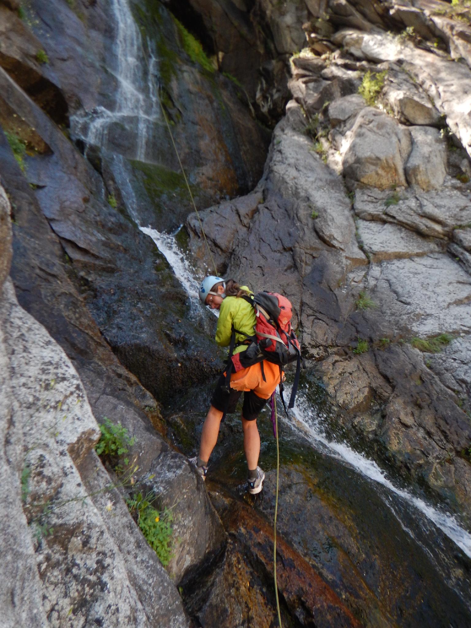
Though a flowing canyon, the route described here involves some waterfall spray, but generally isn't a dousing. Wetsuit only required in high flows and/or cold temperatures. On an 80 degree day, we wore rain jackets for the spray on the first few rappels and were pleasantly warm. The falls will get the most sun in the afternoon.
Getting There
Little Cottonwood Canyon is on the east side of the Salt Lake City Valley. Get there by following I-215 to the east, taking exit 6 off the interstate and heading east toward the mountains.
Follow 6200 South which becomes Wasatch Blvd for 1.8 miles to the stop light and signs for Big Cottonwood Canyon. Continue south (straight) through the light an additional 2.3 miles to a junction and light. Stay left here, reaching the mouth of Little Cottonwood Canyon in an additional 1.6 miles.
From the mouth of Little Cottonwood, travel up the canyon 1.85 miles to just before a building and small dam on the right side of the road. Park BEFORE the building on the shoulder of the road where parking is allowed. There is no trespassing or parking right at the building.
Route Description
Approach (1 hour)
From where you park your car, cross the river. It is trespassing to cross at the Power Plant, so cross down stream where you can hop rocks. If the stream is too high for hopping rocks, there is a bridge about 1/2 mile upstream from the parking area. (Though if the stream is too high to hop rocks, the Great White Icicle rappel route might be at to high of a flow anyway) Once across, find a social trail that heads due south for a minute to intersect the wide and well traveled Little Cottonwood Trail.
From where you hit the Little Cottonwood Trail, go left (east) and look for a social trail leaving the Little Cottonwood Trail on the right (south) side. If you reach the Power Plant, you have gone too far, turn around and the social trail should be 1-2 minutes down canyon. This is the GWI Trail waypoint.
The social trail heads south, passes a small campsite (go left here if you notice a junction) and follow it up to the base of a cliff with bolts going up its face. Where it reaches the granite cliff, follow the social trail right along the base of the cliff. (Alternatively, go left for 1 minute to the base of the Great White Icicle. If the falls look high, or intimidating, call it a day. )
The social trail follows the cliff west as it ascends, then reaches the next gully west of the Great White and begins climbing in earnest. Stay on the social trail when you can find it, and work up the gully. About 2/3 of the way up, you may notice a side trail going up and to the right. Don't go that way! Stay in the gully bottom, wading in spots, until a social trail leads off to the left (east) near the top. The social trail is at the bottom of a cliff band. Follow it as it contours around and descends into the top of the Great White Icicle. If in doubt, work up. Once in the Great White Icicle drainage bottom, head down canyon to the first rappel.
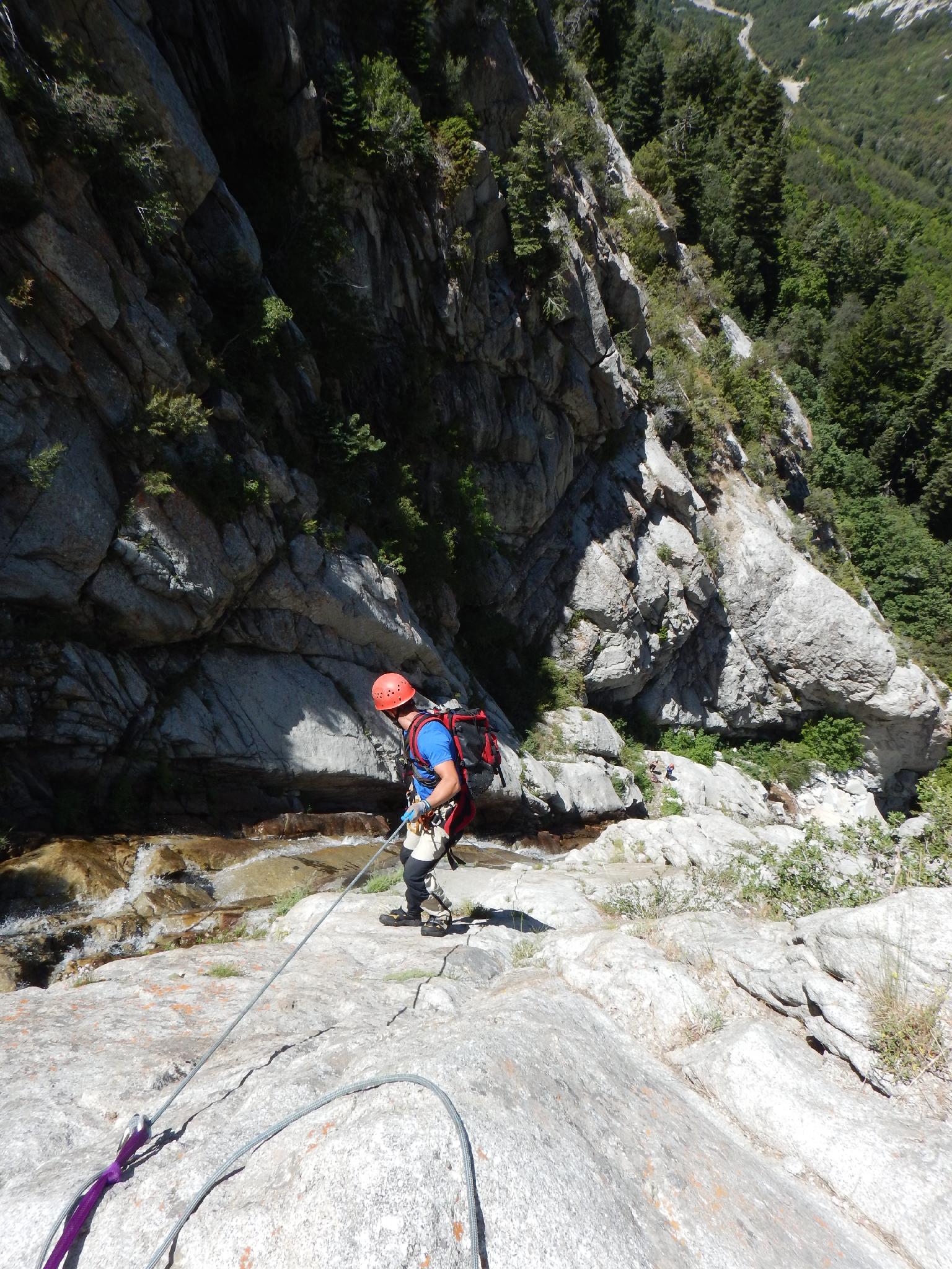
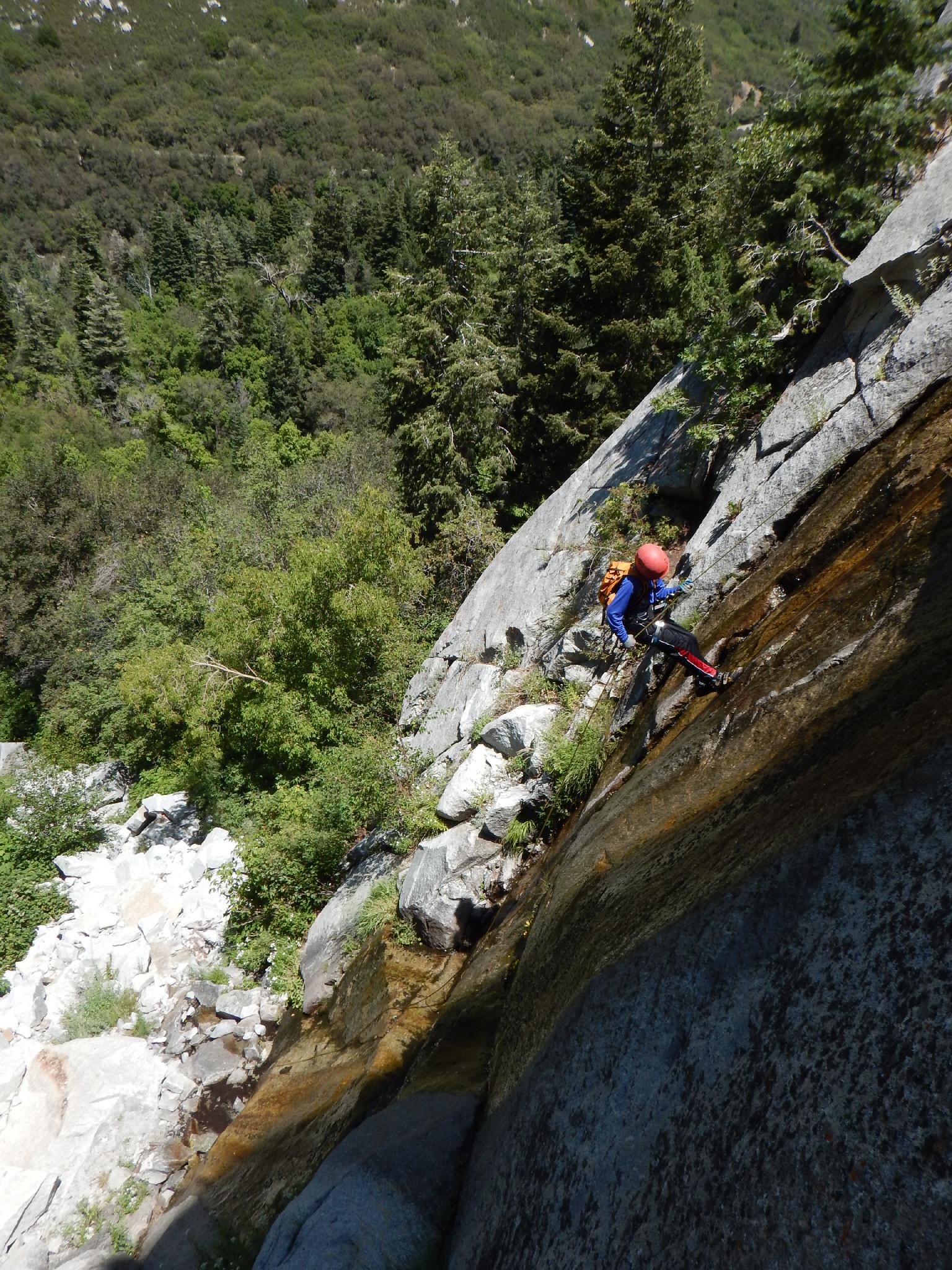
Once at the first rappel, the drops come in immediate succession. Gear up here. There are anchors dotting the face on both sides of the falls. The cleanest line is described below, and all anchors are on the east side of the falls. Be sure not to rappel past an anchor!
Canyon (2-3 hours)
The drainage steepens and you can either make a short rap or downclimb to a small tree that is rappel 1.
Rap 1- About 15 m ( 50 ft. ) to a small stance at a tree.
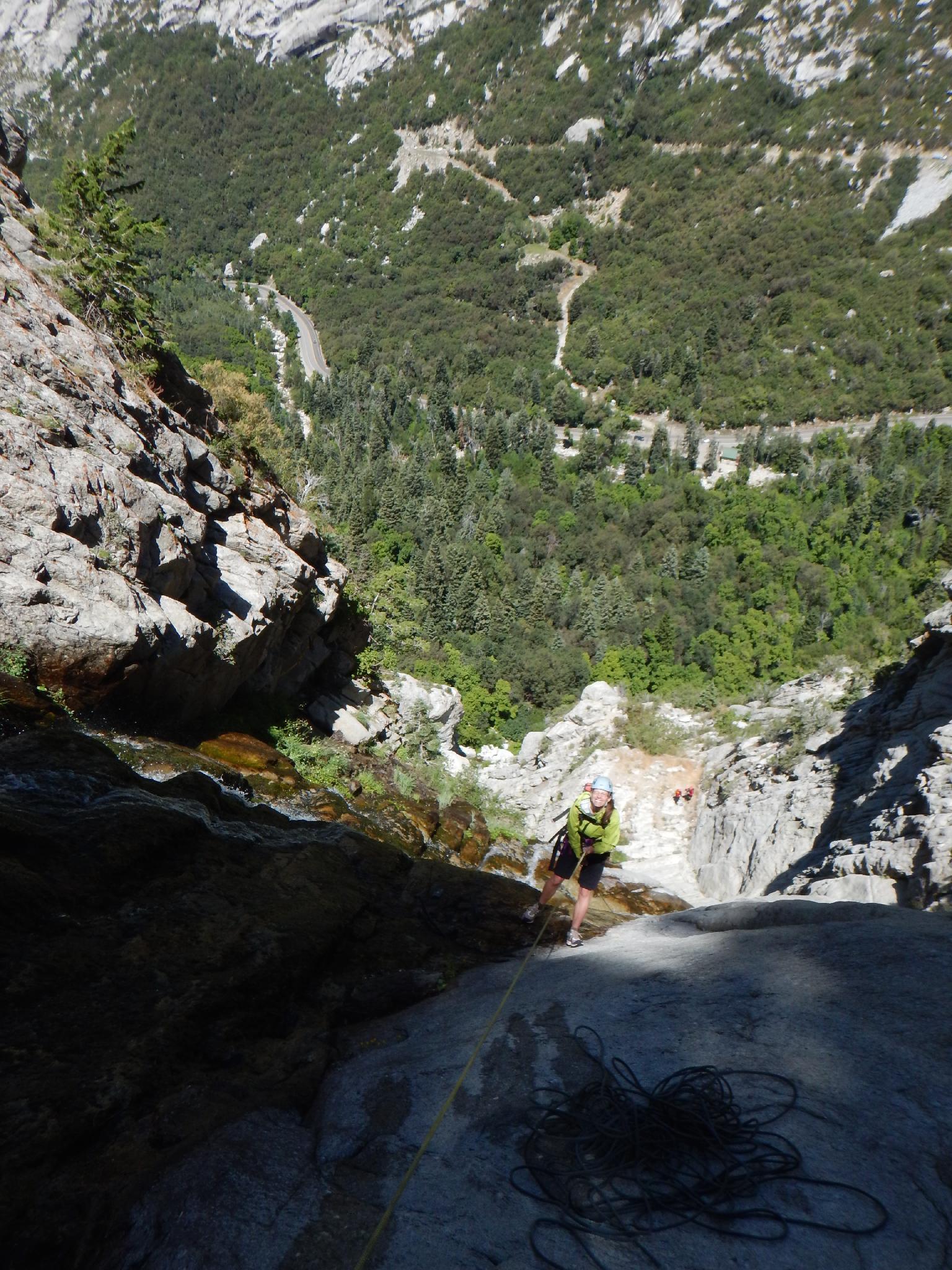
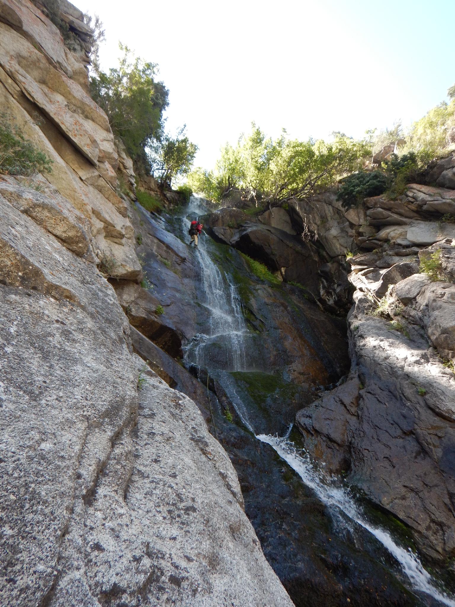
Rap 2 - The waterfall drops off at rappel 2, and the big rappels ahead come into view. Rappel about 57 m ( 188 ft. ), down to bolts on the east (rappeller’s left) side. This is a small stance, suitable for 4 if squeezed in. Semi-hanging for more than 2.
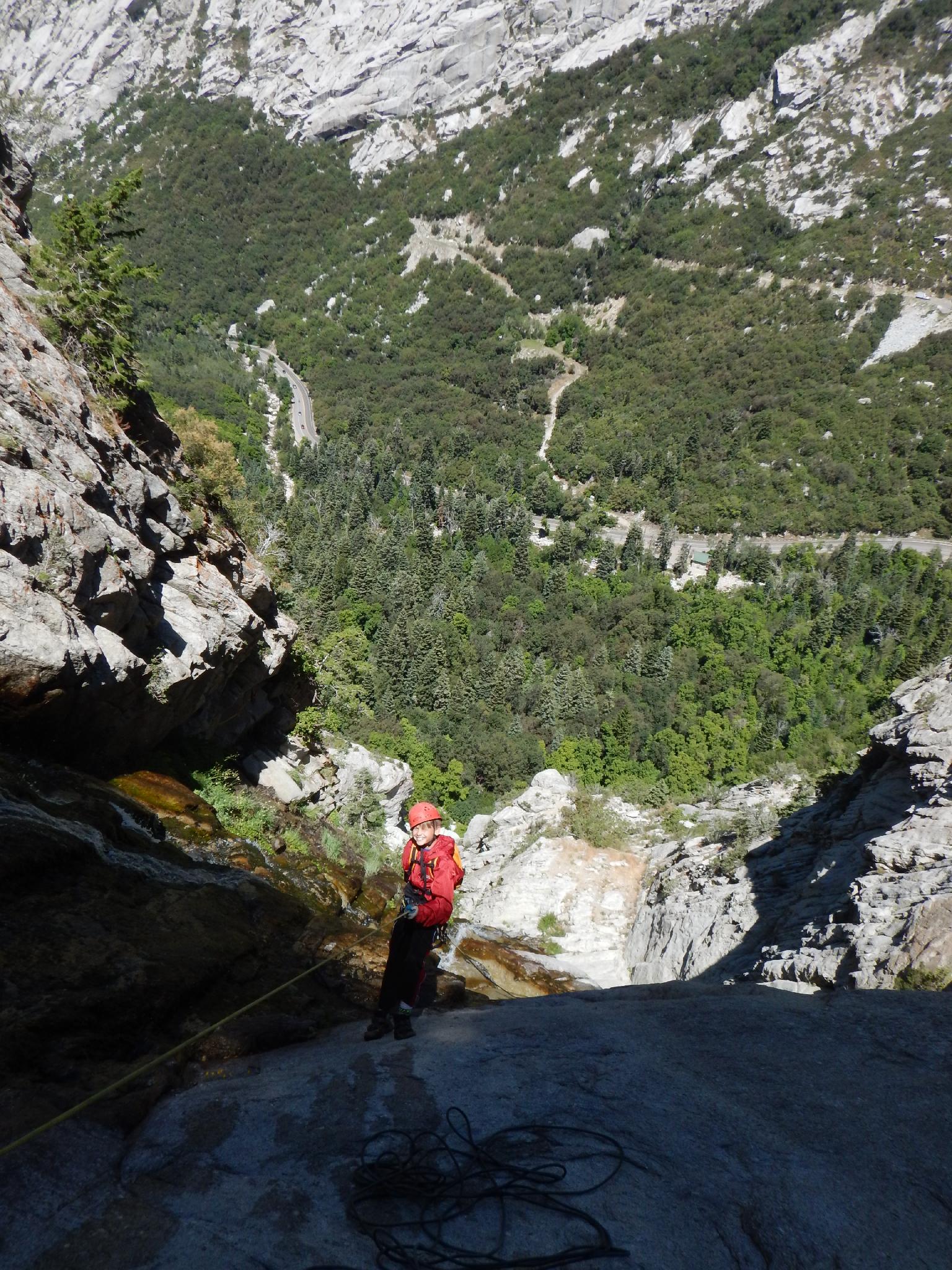
Rap 3 - A rope stretching 60 m ( 197 ft. ) rappel down to a flat section. There are 2 bolts on the rappeller’s left (east) side here, though most will be comfortable un-roping and walking a short distance to 2 bolts with long webbing over the edge on the right (looking down canyon) side of the watercourse. This is a great break spot.
Rap 4 - Another 60 m ( 197 ft. ) rappel puts you on a ledge on the west side of the falls. Easy scrambling leads down a minute to the final drop.
Rap 5 - 2 bolts on the right (looking down canyon / east side) allow for a full 30 m ( 99 ft. ) rappel to the bottom.
Follow the bottom of the cliff west one minute to re-intersect the approach trail.
Maps
12T 437073E 4491401N
40°34'16"N 111°44'36"W
12T 437154E 4491367N
40°34'15"N 111°44'33"W
12T 437225E 4490991N
40°34'02"N 111°44'30"W
12T 437280E 4491002N
40°34'03"N 111°44'27"W
12T 437221E 4491169N
40°34'08"N 111°44'30"W