 Roadside Attraction
Skyline Drive
Roadside Attraction
Skyline Drive
Sanpete
Overview
One of the highest road in Utah, the Skyline Drive is an incredibly scenic dirt road traversing the spine of the Wasatch Plateau. The route has many options, with many opportunities for shorter outings. The route described here clocks in at just over 100 miles with all but a few of those miles on dirt.
There are 2 sections to the Skyline Drive, North Skyline and South Skyline.
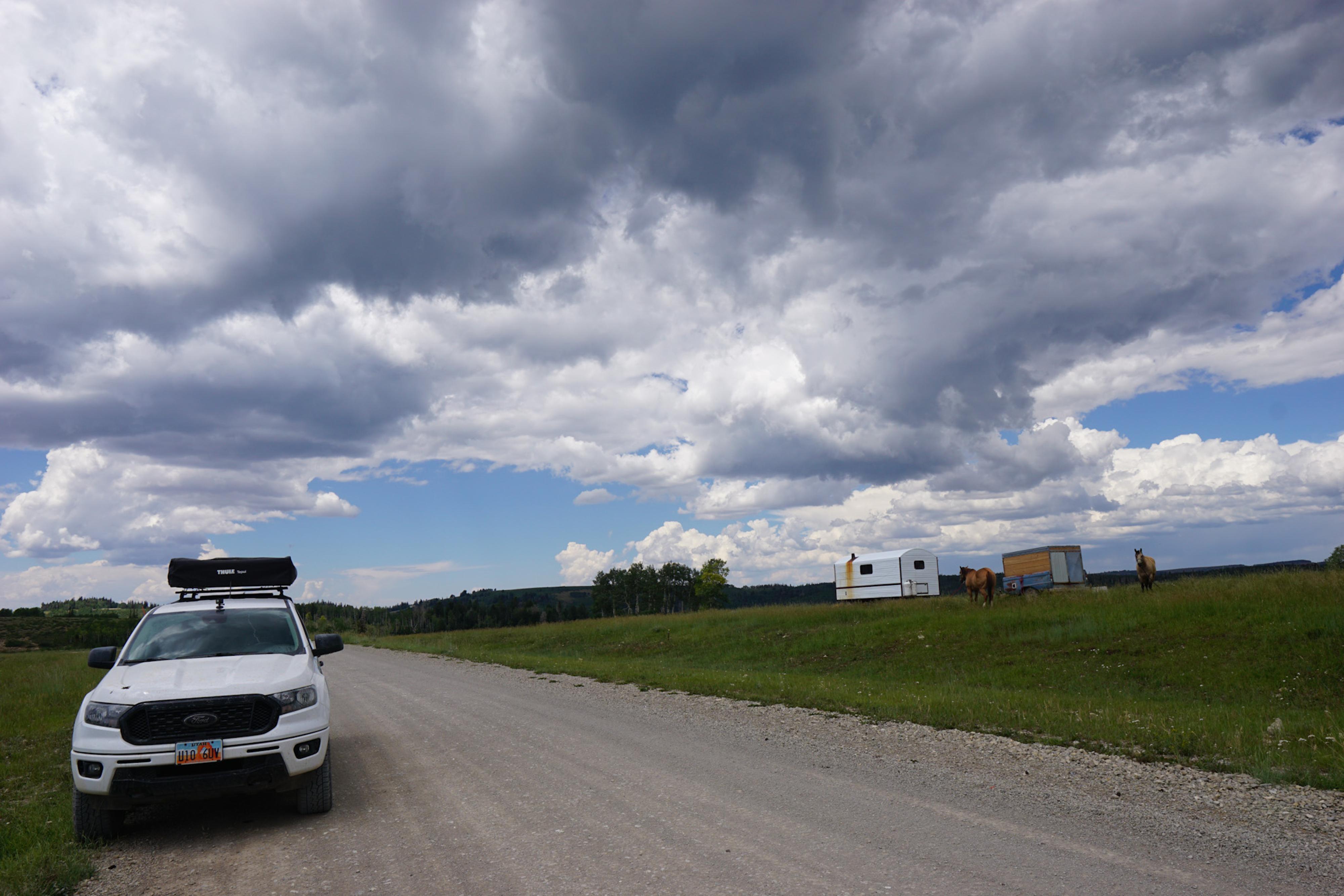
The north section, from Tucker in Spanish Fork Canyon to UT-264, is a little lower in elevation at about 9,000 ft and a more maintained gravel road. This north section sees more traffic and is busier than the south section. People drive low clearance vehicles on the north section, but I would still recommend high clearance. The few low clearance vehicles I saw were moving slowly. There are many camping options, but also many people camping on this section.
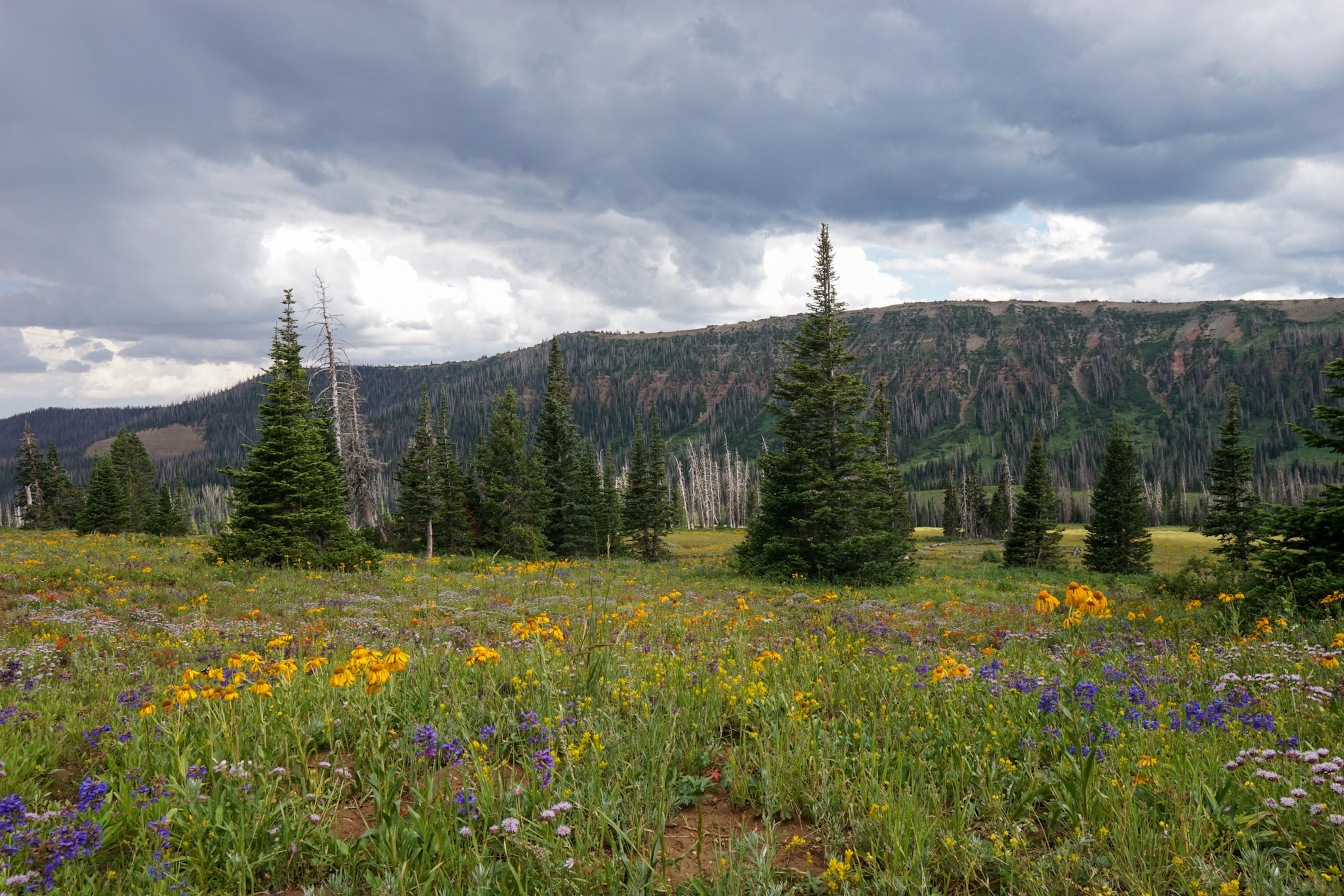
From UT-31 south is the southern section of the Skyline. This section, after a few miles of good dirt road, becomes a “native soil” road that is prone to mud and ruts. It is longer, higher in elevation, and more dramatic than the northern section. Because of the elevation and mud/ruts, this section requires high clearance 4-wheel drive and is only passable from mid-to-late July through about September when snow free. If you are camping, I think the southern Skyline has the most scenic spots, particularly the area south of Ephraim Junction. It also has far fewer people visiting it.
The Civilian Conservation Corps completed The Skyline Drive in the 1930s by linking several existing roads and trails. It was the site of the highest elevation CCC camp.
Getting There
The North End
The northern end of Skyline Drive starts in Spanish Fork Canyon at mile post 203.6 on the south side of highway 6. This is about 30 miles from the city of Spanish Fork when heading on highway 6 toward Price. The road is signed Skyline Drive and is also Forest Service Road (FR) 150.
The South End
The south end, for this description, ends at I-70 at exit 73. This is about 19 miles east of Salina.
Route Description
North Skyline (28 miles)
From Tucker, turn south on the Skyline Drive (Forest Road 150). The road here is generally a good, graded gravel road that quickly begins climbing. The first 13 or so miles are all about the climb up to the ridgeline. Pretty, but not with big views. Once on top, the views open up.
At about 14.5 miles is the Fish Creek Warming Hut on the east side of the road. This old cabin was transported from near Huntington Reservoir, in one piece, to be used as a warming hut for snowmobilers and other winter recreationists. There is a pit toilet here.
Continue on, staying on the main road to the junction with UT-264 about 28 miles from Highway 6/Tucker. There are many spur roads that can be used for primitive camp spots.
To South Skyline
From the junction with UT-264, there are two options for getting to the southern section. The first is to go right on UT-264, then immediately left on UT-31. Follow UT-31 south for 5 miles to where the Skyline South section leaves the highway on the right (south) side of the road at a large parking area and pit toilet.
The second option is to turn left on UT-264. Follow it for about 2 miles to where the Skyline Drive leaves on the right (south side). Follow the dirt Skyline Drive 3.5 miles to where it intersects UT-31. Go right on UT-31 for 0.5 miles to where the Skyline Drive on the south side at a large parking area and pit toilet.
South Skyline (UT-31 to I-70) (75 miles total)
From UT-31, the road is good for a bit before a sign shows it is now “Native Soil Surface”. Most junctions are obvious or signed. I describe mileages between major junctions and marked a couple of junction on the map you might find confusing. If weather or motivation is flagging, the major junctions allow dropping off the Skyline Drive to either the east or west fairly quickly down to pavement.
UT-31 to Mt. Pleasant Junction (8.25 miles)
Mt. Pleasant is on the west side of the range.
Mt. Pleasant Junction to Potters Junction (3.7 miles)
Side Trip: The road to the east at Potters Junction drops down to the Potters Ponds area. It isn’t a quick exit from the Skyline, but Potters Pond area and Upper Joe’s Valley just beyond have great camping. It is about 5.5 miles from Skyline down to Potters Pond.
Potters Junction to Spring City Jct (5 miles)
Spring City is on the west side of the range.
Spring City Junction to Orangeville Junction (11.75 miles)
This is a lovely section, but also can be more muddy and rutted than other sections. The road passes near North and South Tent Mountains. The Sanpete County highpoint is South Tent Mountain and an easy hike if peak bagging is your thing. There are some great camping options from this section on continuing south. Orangeville is on the east side of the range near Joe’s Valley.
Orangeville Junction to Ephraim Junction (1 mile)
Ephraim is on the west side of the range, and the largest city in the area.
Ephraim Junction to Manti Junction (8.5 miles)
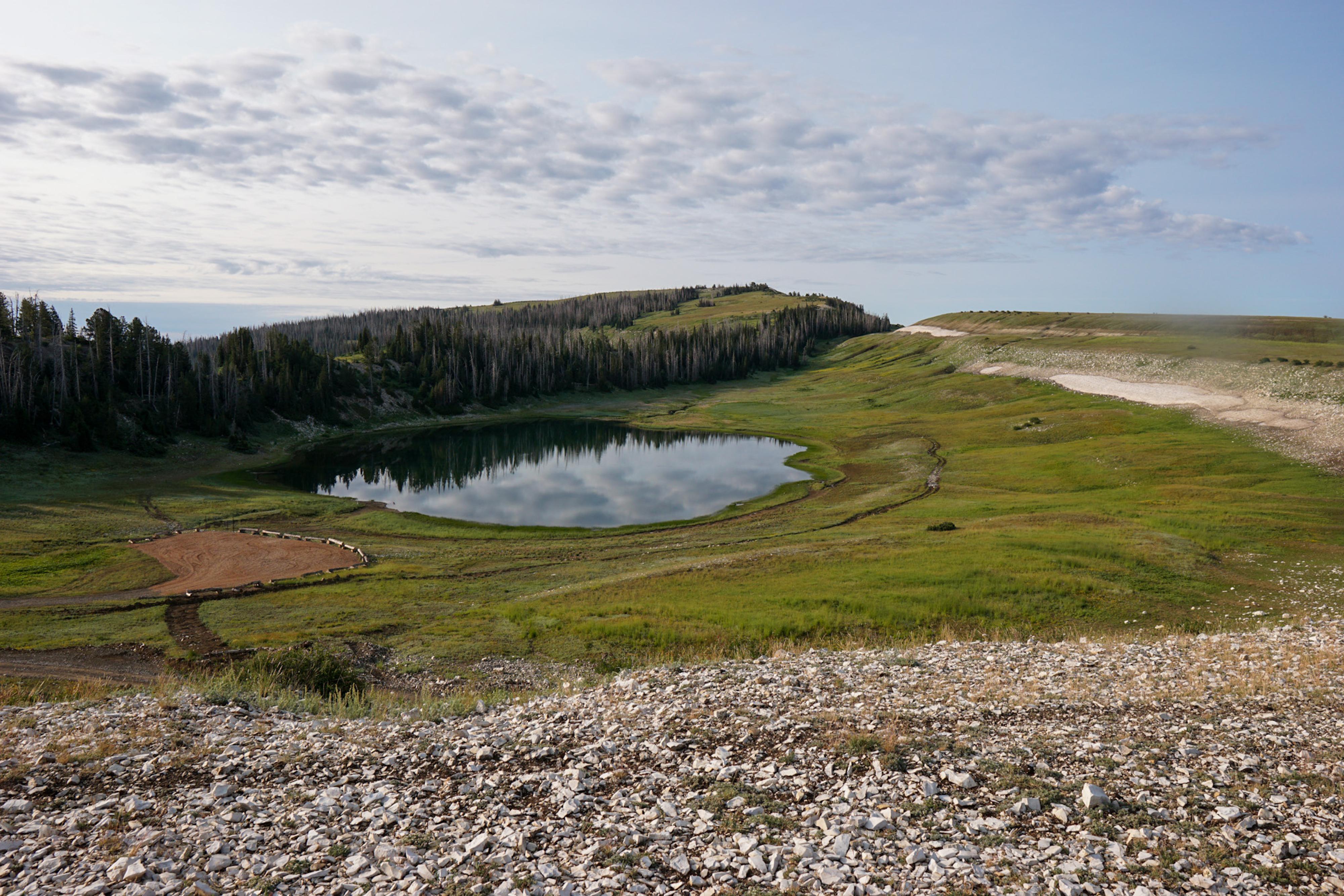
This lovely section is high elevation with very wide open views. It passes by the very shallow but scenic Snow Lake. There were many fish jumping in the lake the morning we stopped by. Manti is on the west side of the range.
Manti Junction to Ferron Junction (6.5 miles)
This is the highest section of the Skyline Drive, topping out at 10,897 feet. There is a large sign at the high point. From the high point, on a clear day, you can see Window Blind Peak in the Swell and many of the northern Swells features and the La Sal Mountains near Moab. Ferron is on the east side of the range.
Ferron Junction to Mayfield Junction (1.4 miles)
Mayfield is on the west side of the range. There is a campground at the Mayfield Junction, Twelve Mile Flat campground. It has pit toilets. There are many other primitive campsites in the area not in the campground.
Mayfield Junction to Emerald Lake Junction (3.1 miles)
Emerald Lake is about a mile drive off the Skyline Drive with several small, but picturesque campsites. Though a small lake, there were lots of fish jumping on our visit. I think it is a very worthwhile side trip.
Emerald Lake Junction to Redmond Junction (13 miles)
About 1.65 miles south of the Emerald Lake Junction is a side road on the right (west) that goes to a small parking area about a 1/4 of a mile from Island Lake. There is no trail to Island Lake, but the 1/4 of mile is a pretty simple walk across a meadow, then a short steep downhill section to the lake. We didn’t see any signs of fish, but deer, dragonflies, wildflowers, and solitude made the hike a worthwhile destination.
It is about 1 mile from the Island Lake side road to a side road on the left (east) that goes to Blue Lake. Though pretty, Blue Lake is small and seemed crowded and overused on our visit. To visit, drive down from Skyline Drive about a mile and take the first left. It is about 1.6 miles total from Skyline Drive to the lake.
After Blue Lake Junction, the road descends, curving down past the east side of Marys Nipple and on to Redmond Junction. Going right on Forest Road 001 at Redmond Junction to Redmond makes for a alternative end to the trip and a little shorter if you are heading back north after finishing the Skyline Drive.
Redmond Junction To I-70 (13 miles)
The road continues a steady and steep descent, passing from high mountain terrain down to the more desert ecosystem as it reaches Salina Creek and continues to pavement at the Frontage Road along I-70. There are a few major junctions along the way, stay on FR009/Salina Creek at them.
Once at the frontage road, go right to reach the nearest I-70 ramp. What a trip!
Photos
Videos
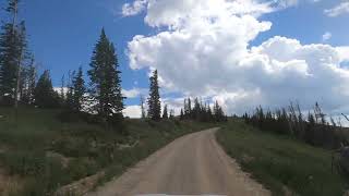
Video of the drive on Skyline Drive
Maps
")
")
")
12S 482951E 4420651N
39°56'09"N 111°11'58"W
12S 469477E 4408035N
39°49'18"N 111°21'24"W
12S 473149E 4392050N
39°40'40"N 111°18'47"W
12S 474586E 4389553N
39°39'19"N 111°17'46"W
12S 474000E 4385145N
39°36'56"N 111°18'10"W
12S 473305E 4385335N
39°37'02"N 111°18'40"W
12S 473945E 4374198N
39°31'01"N 111°18'11"W
12S 472143E 4369619N
39°28'33"N 111°19'26"W
12S 472443E 4367870N
39°27'36"N 111°19'13"W
12S 469261E 4364585N
39°25'49"N 111°21'26"W
12S 461838E 4352652N
39°19'21"N 111°26'34"W
12S 461518E 4351323N
39°18'38"N 111°26'47"W
12S 460656E 4344167N
39°14'45"N 111°27'21"W
12S 458180E 4340295N
39°12'39"N 111°29'04"W
12S 457933E 4333798N
39°09'09"N 111°29'13"W
12S 458297E 4333166N
39°08'48"N 111°28'57"W
12S 458122E 4332432N
39°08'24"N 111°29'04"W
12S 457996E 4330621N
39°07'26"N 111°29'09"W
12S 457772E 4328947N
39°06'31"N 111°29'18"W
12S 456739E 4326581N
39°05'14"N 111°30'01"W
12S 457051E 4325236N
39°04'31"N 111°29'47"W
12S 456495E 4324067N
39°03'53"N 111°30'10"W
12S 456188E 4324010N
39°03'51"N 111°30'23"W
12S 455686E 4323041N
39°03'19"N 111°30'44"W
12S 456631E 4322587N
39°03'05"N 111°30'04"W
12S 449242E 4318018N
39°00'35"N 111°35'11"W
12S 451040E 4303520N
38°52'45"N 111°33'52"W