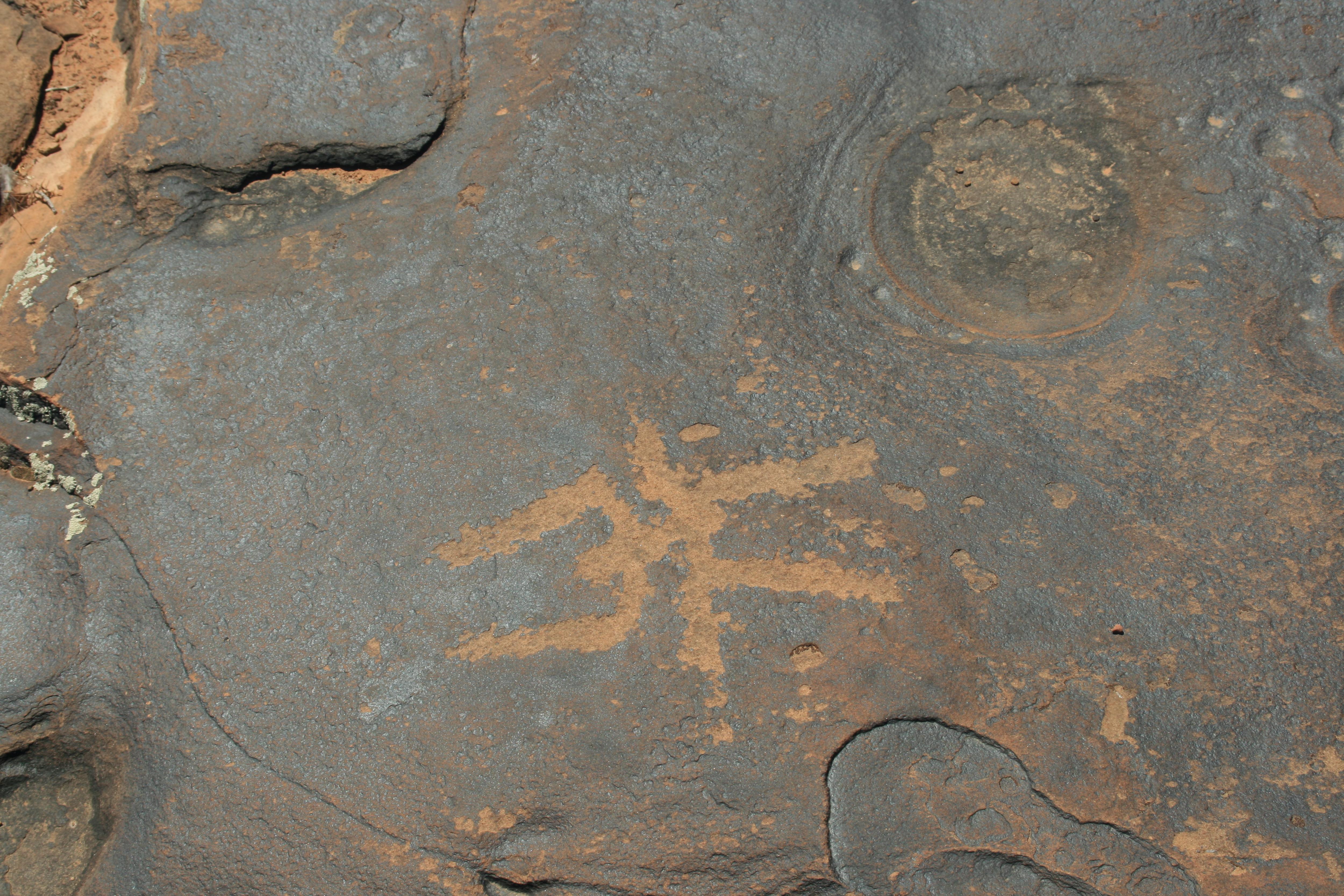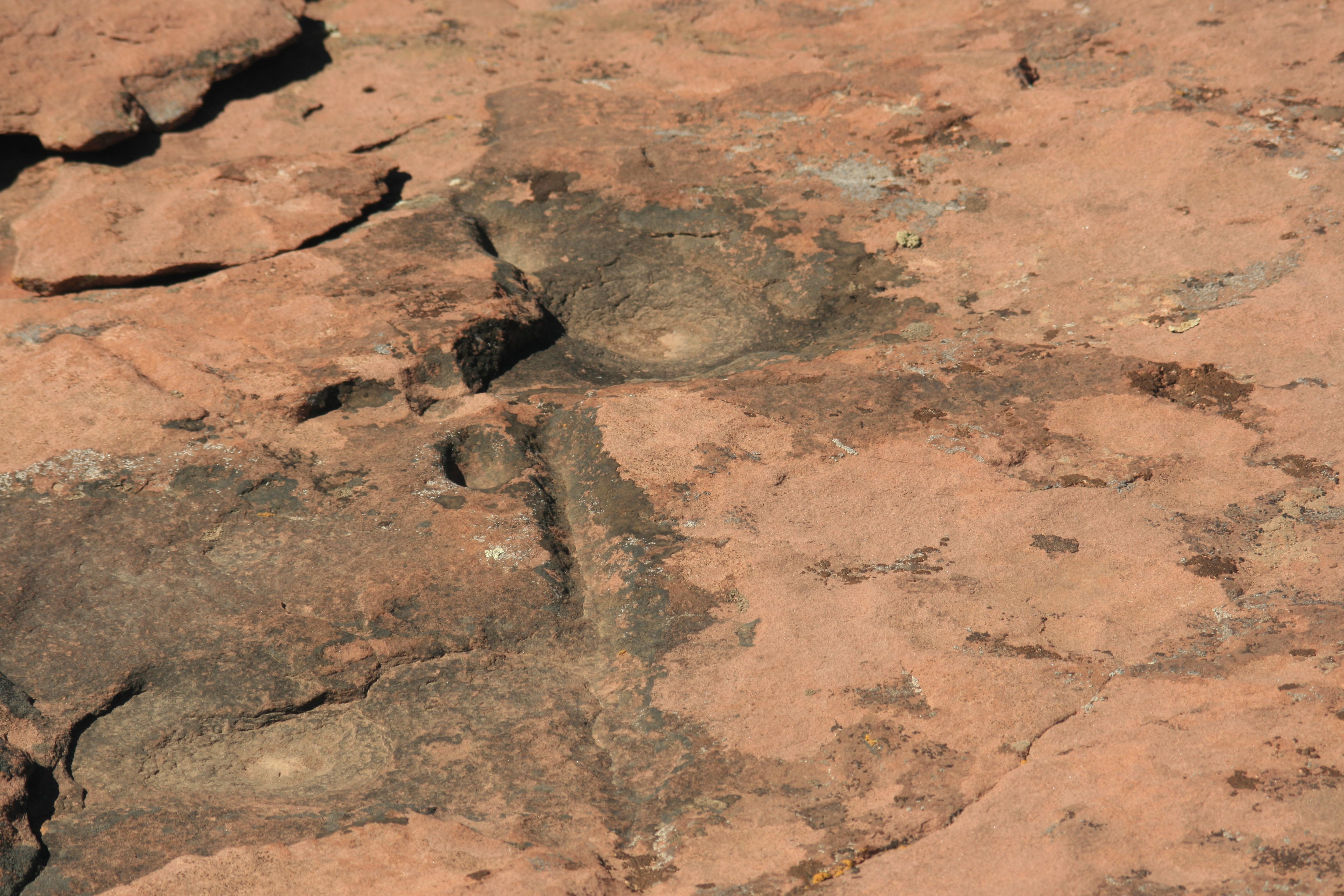
FINALLY! Found the waterglyph on Little Creek Mesa after 4 trips and some sketchy info. The glyph is on a rock outcrop on a diving board like rock. Some climbing is needed but this fat old man made it OK. Had to slide down on butt to get down. Waterglyphs are a rarity and mostly found in the Arizona Strip. You can go online to get what they are supposed to mean. You get there by driving to Apple Valley and turning right on 400 N. Follow the road around until you see a sign that says Little Creek Mesa road to the right. Follow it to the site staying to the right on all splits.
Petroglyphs at the lake are at coordinates 37° 2'32.72"N 113°12'27.13"W this is on the way to the waterglyph.
Waterglyph coordinates are 37° 2'36.49"N 113°14'35.44"W
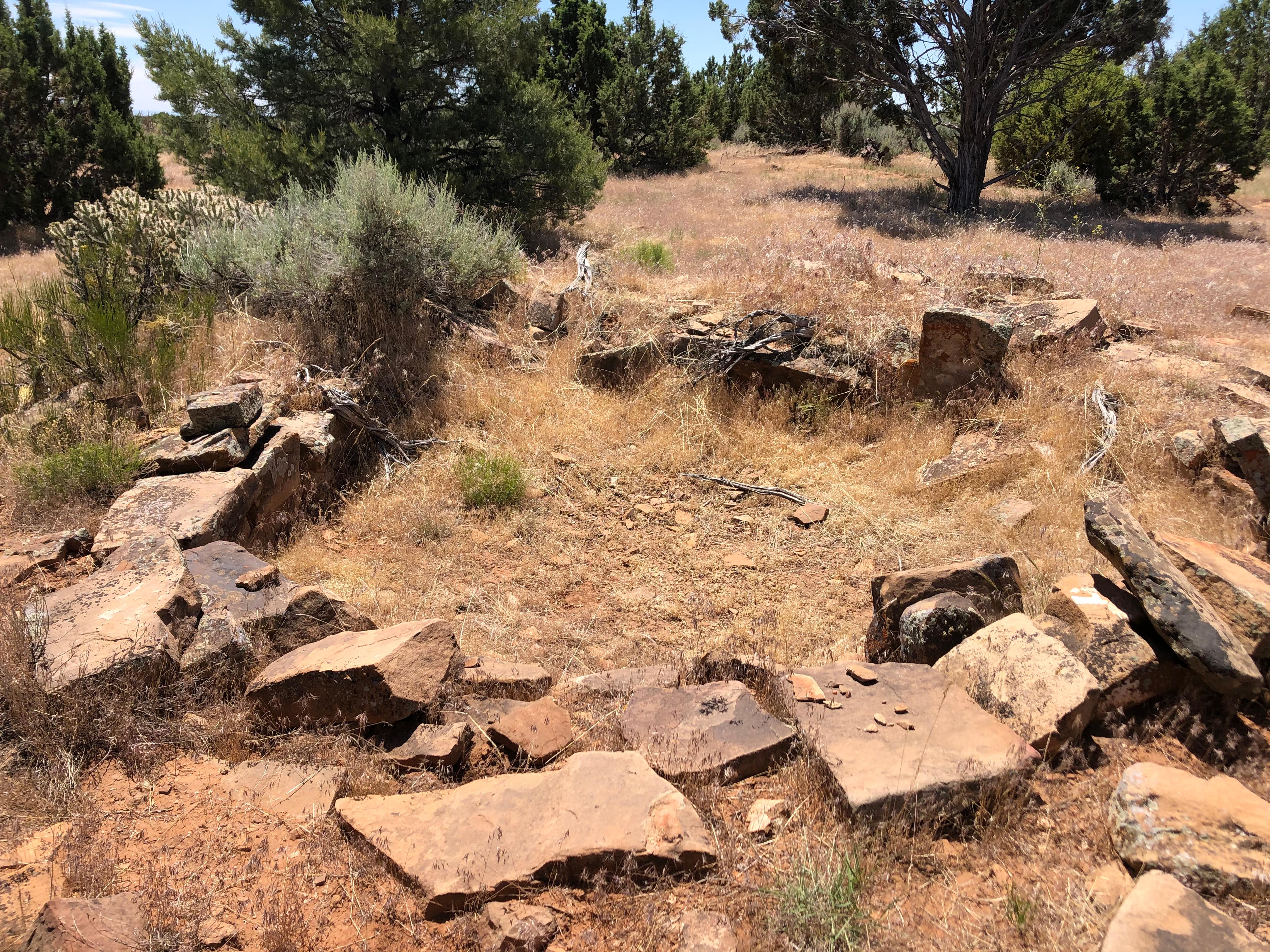
We have also found an area that is covered with pithouses just North of the waterglyph if you park at 37° 2'57.29"N 113°14'49.41"W and hike on a heading between 146 and 94 degrees you will find pottery and tool flakes in the whole area.
You do not need a high clearance vehicle but good tires are a must. Good Luck contact me for more info if needed.
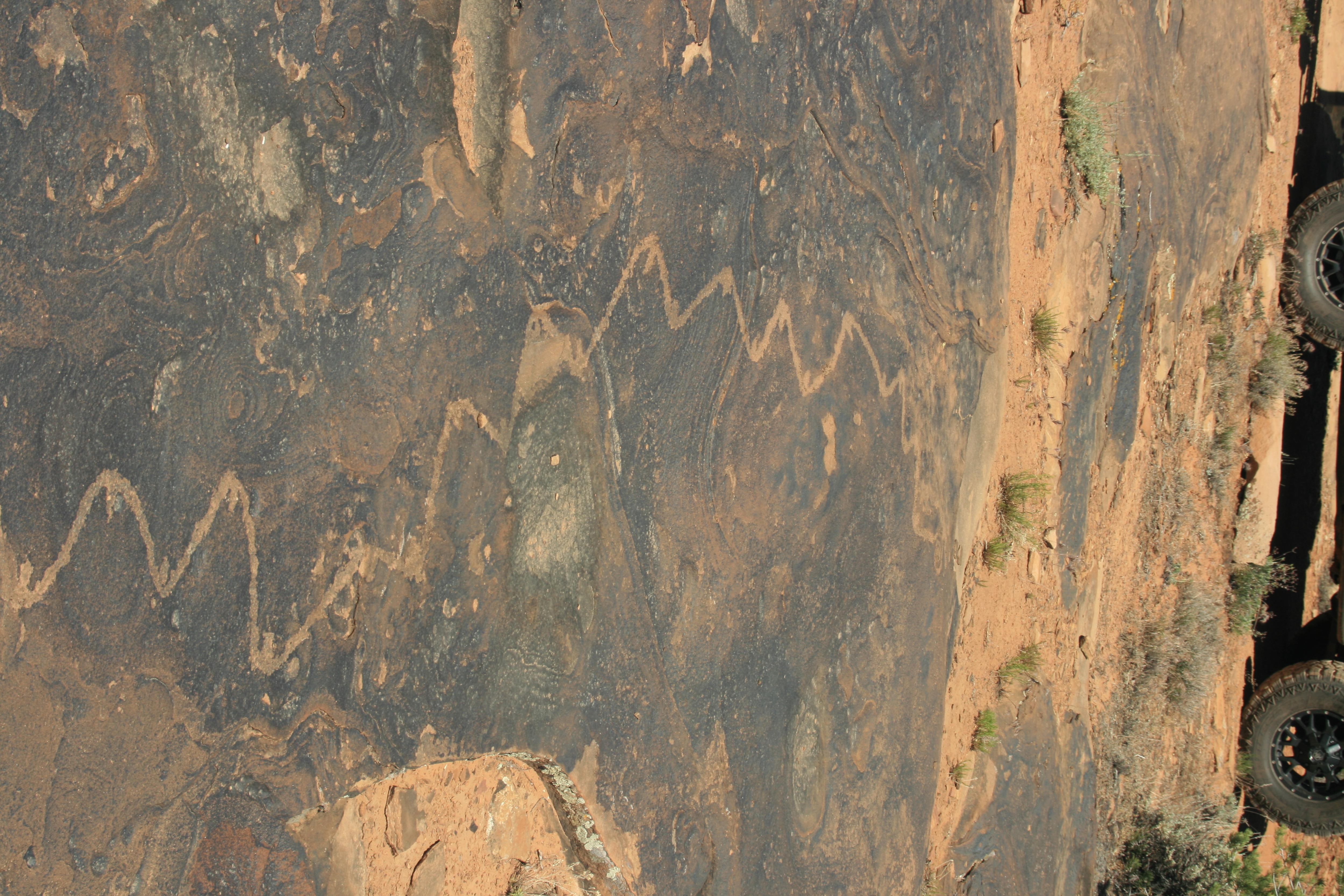
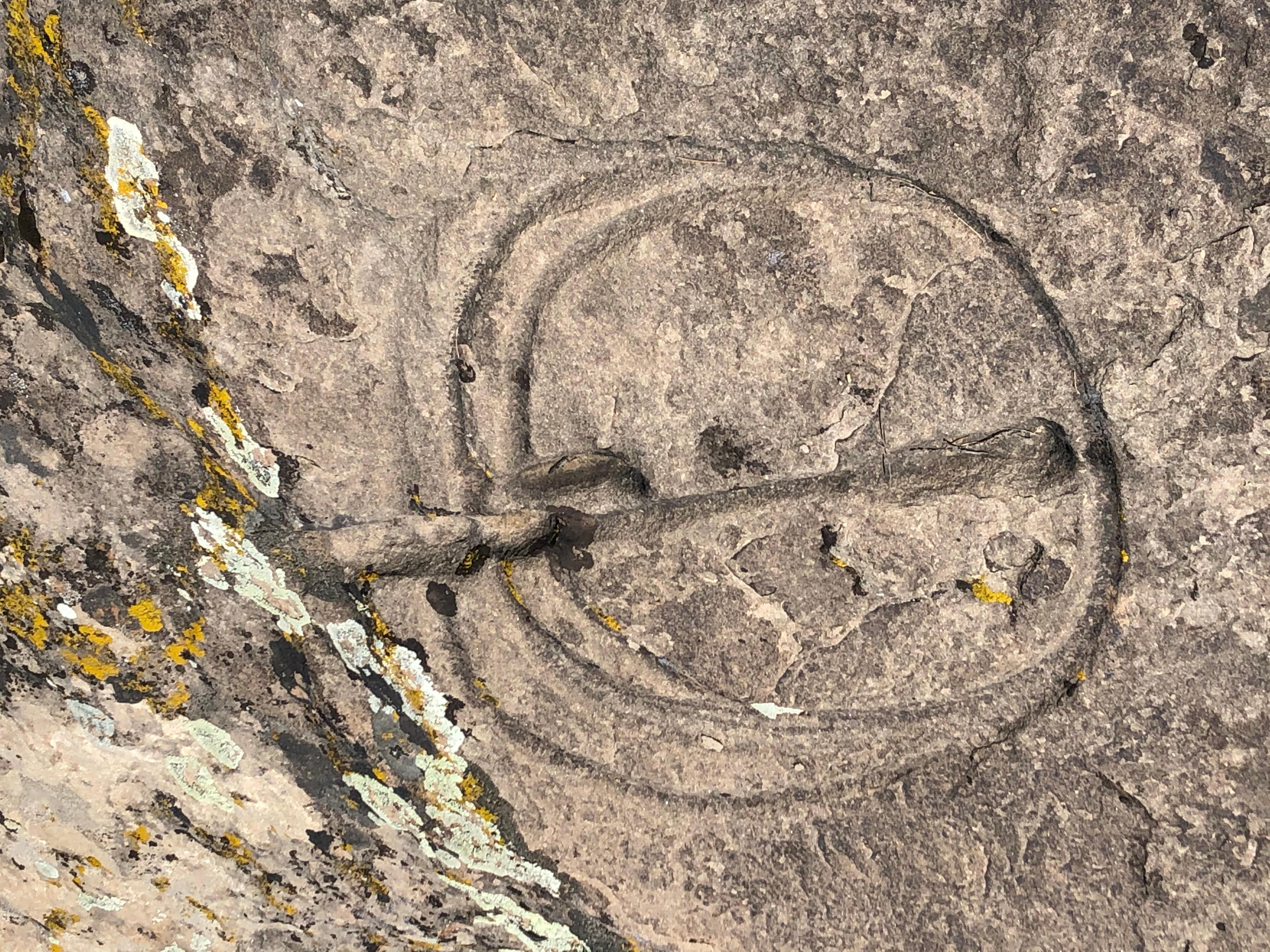
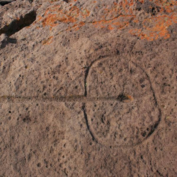
UPDATE: We found the remaining two waterglyphs and in addition we found a ruin and some more petroglyphs. Coordinates are as follows:
Waterglyph 2: N37° 01.998' W113° 13.237'
Waterglyph 3: N37° 04.534' W113° 11.398'
Ruins: N37° 04.087' W113° 12.203'
Petroglyphs: N37° 03.802' W113° 13.792'
Good hunting!