 Canyoneering
Deer Creek
Canyoneering
Deer Creek
North Rim Grand Canyon
Overview
I am often asked what I think the "best" canyon is that I have done. It depends on how you determine "best". There are narrow canyons, canyons with big rappels, climbing canyons, pothole canyons, etc.. I will admit though, when pressed, Deer Creek is usually my pick for best canyon I have done. It is a stunning section of canyon tucked at the bottom of the overwhelmingly immense and beautiful Grand Canyon. Deer Creek left a smile on my face that lasted way beyond the actual canyon day. Had we not been pressed for time, I would have likely done another lap or two of the short technical slot just because it was so beautiful.
Beauty often has a price, however, and Deer Creek is no exception. The easiest (physically) way to do it is from a river trip through the Grand Canyon. Doing it from the river makes this a few hour lark, but getting a permit to raft the Grand Canyon and dealing with the logistics to spend a few weeks on the river makes this no easy task. The second option, and most common, is to hike in from Monument Point on the Bill Hall trail. Approaching from here requires a little over 20 mile round trip distance. That would be considered long, but also requires a leg humbling 5200' loss from the trailhead to the river and 5200' gain back up to the trailhead. Some groups do it in a day, as we did when we did it, but most groups will need to backpack in and camp at least one night. Backpacking is a bit tricky, because it requires carrying water. No water is available until near the river.
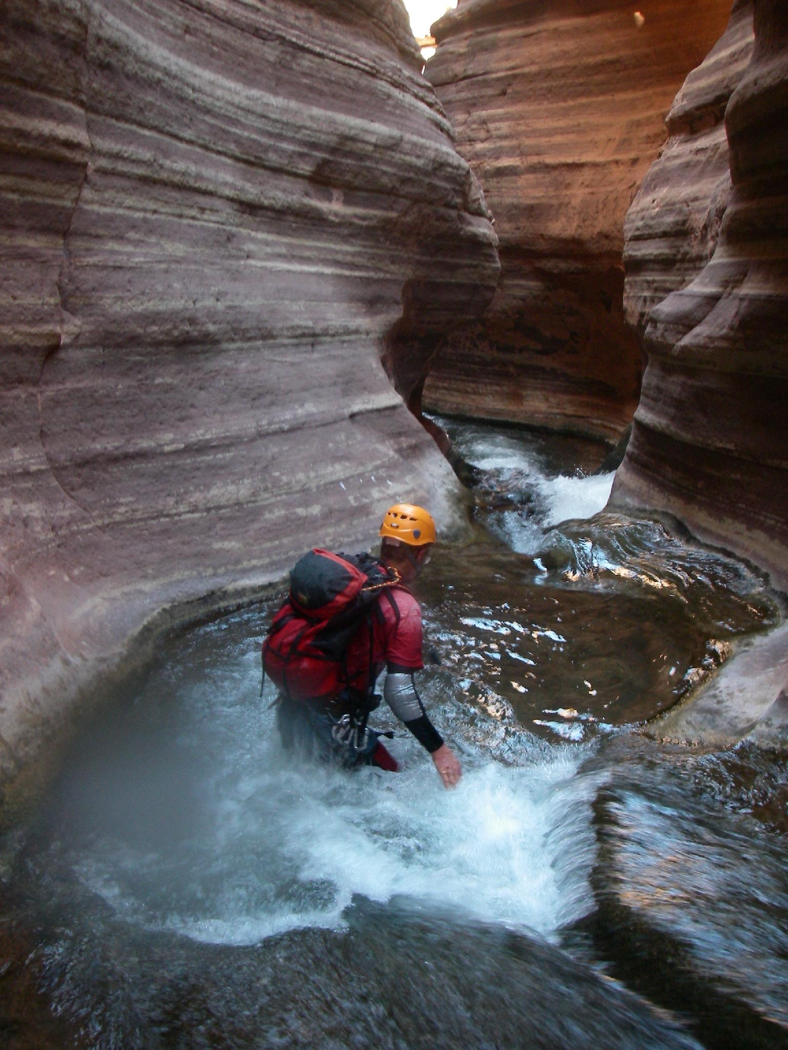
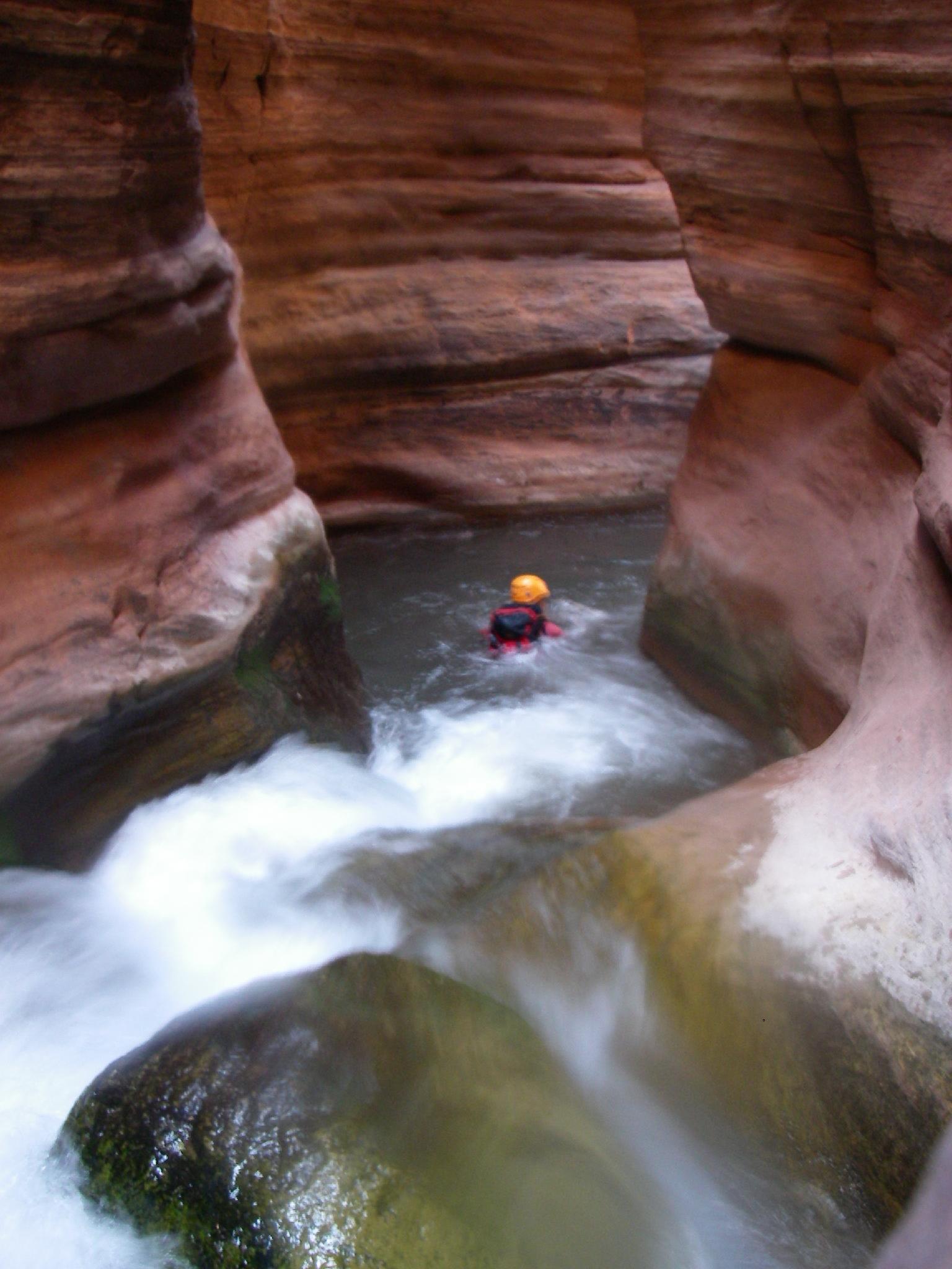
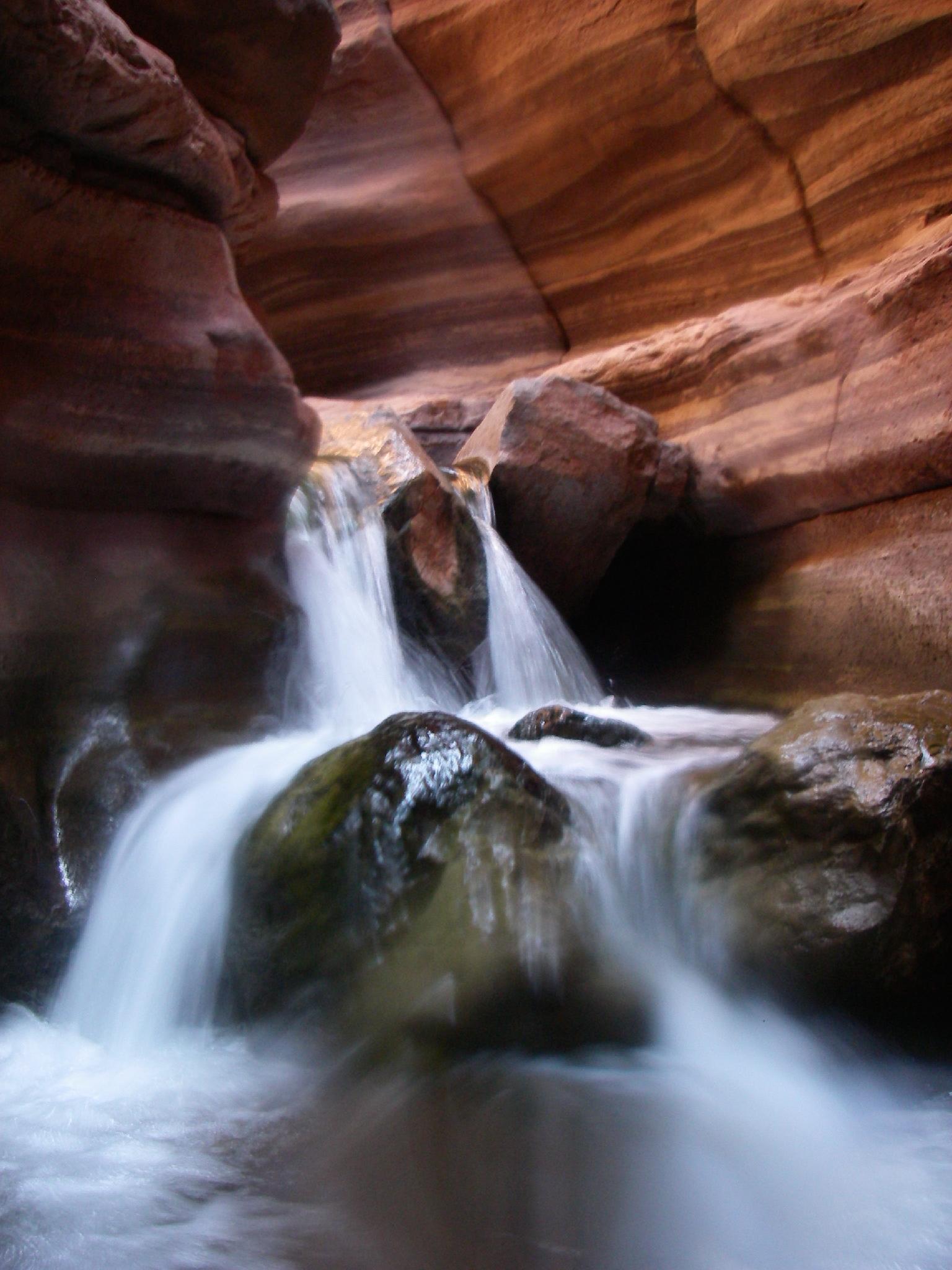
Once you make the arduous journey to Deer Creek by raft or foot, the canyon is a short and sublime flowing water wonderland. The creek is spring fed, and requires a full and heavy wetsuit at all times. On our trip is was north of 110 degrees at the river, and I was cold in a 3mm full wetsuit. Anchors can be high and out of the water flow, requiring some skill to climb up to, especially with flowing water and wet slippery rock. This is a wild day deep in the backcountry, advanced canyoneers with flowing water canyon experience only!
Our times: About 4 hours on the approach, 3 hours in the slot, 6 hours back up. This was with relatively light packs moving very quickly.
Getting There
Reaching the trailhead means first reaching Fredonia, AZ, just south of Kanab, UT.
From Fredonia, head south on highway 89A a few miles to between mile posts 607/608 (12S 366035mE 4088610mN). Turn right here, on Forest Road 22. Follow this road for 12 miles to its junction with Forest Road 425 (12S 380258mE 4044201mN). Go right, onto 425, and follow this 11.7 miles to a 4-way junction (12S 374186mE 4032587mN). Go straight to the roads end at Monument Point and the Bill Hall Trail in 1.7 miles. There is good camping at the trailhead.
Route Description
Logistical Notes
If doing this as a backpack, I would recommend packing water and stashing it and camping gear at the edge of the esplanade before descending into Surprise Valley. This would make a stunning camp site. After doing the canyon, replenish water at Deer Creek Spring before hiking back to camp.
If doing this as a day hike, stash water and possibly some snacks at the bottom of the Bill Hall trail when you reach the esplanade, and possibly another stash before dropping off the esplanade into Surprise Valley. Doing it in a day is very difficult and not recommended except for very strong canyoneers.
To The Esplanade (2.5 miles / 1800' loss)
From the trailhead, follow the well defined Bill Hall trail along the rim a 1/2 mile to where it begins descending steeply to the esplanade. At the esplanade, the Thunder River Trail is reached. Go LEFT here, following the easy and flat trail 2.5 miles to its edge where it drops steeply again off the Esplanade into Surprise Valley.
To Surprise Valley (1000' loss from the Esplanade)
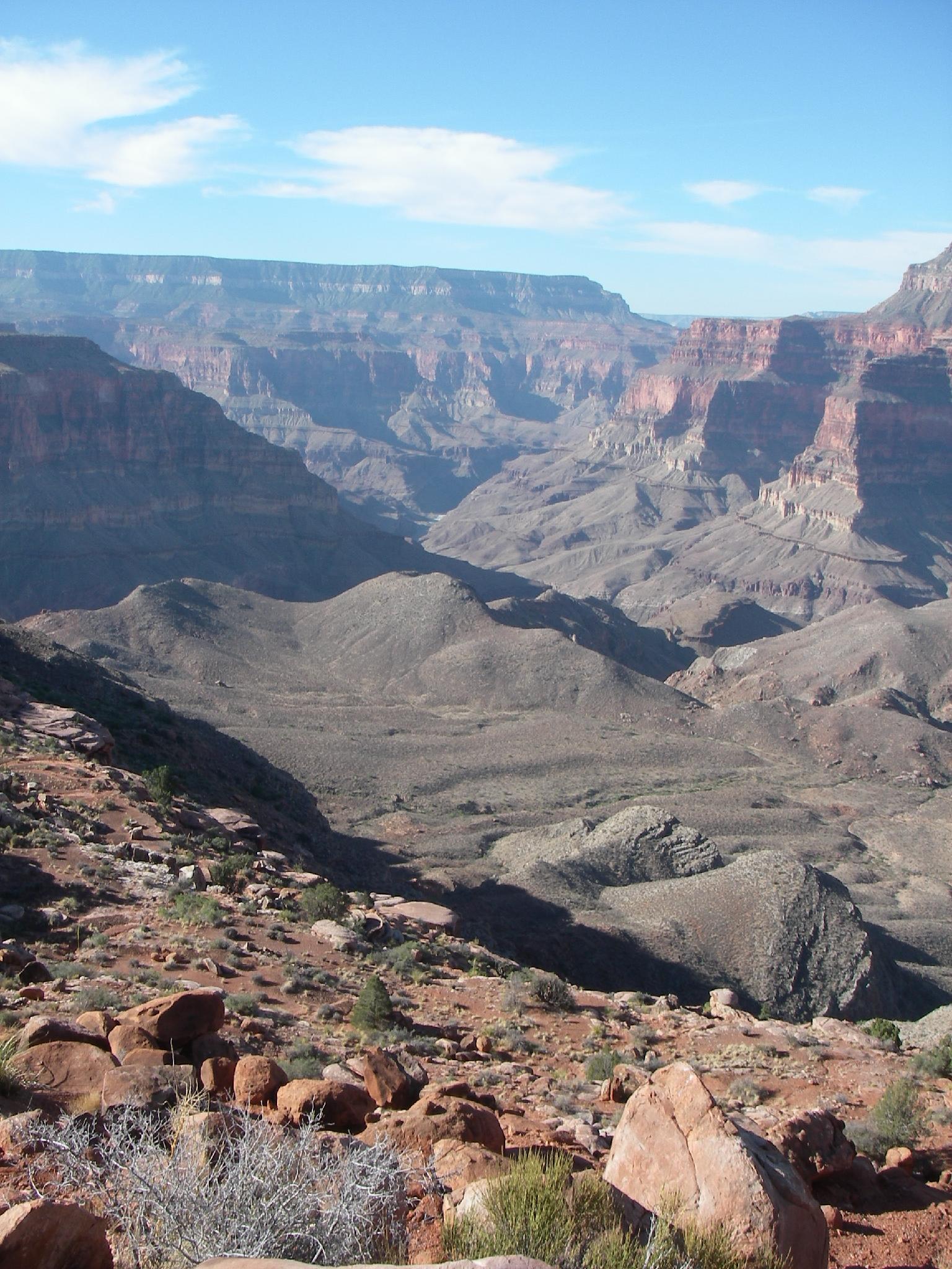
At the bottom of the second descent is Surprise Valley. The enormous task of getting down to the river and back to the trailhead begins to sink in here. Once in Surprise Valley, go right at the trail junction at the bottom of the hill, then right again on the Deer Creek Trail junction 10 or so minutes later.
To Deer Creek Spring (1600' loss from Surprise Valley / 9 miles from the trailhead)
Follow the rocky trail as is it descends a little, then up a bit before beginning its descends to Deer Creek Spring. The spring comes in on the left, and is the first reliable water. At this point, the approach is almost over. Be sure to tank up on water here on the return trip, then make the final descend to Deer Creek proper.
Heading down Deer Creek proper, follow the trail until the canyon begins to slot up on the left and the trail follows the rim on the right. This is the start of the technical section, and is known as the Patio. Suit up here.
The Technical Section
Once in the canyon, the rappels come in short order. Suit up before the first rappel.
Rappel 1 - Some downclimb into the slot, though I strongly recommend making a short rappel off the left side of the canyon just down canyon. (10 m ( 33 ft. )) Retrieve your webbing on the return trip to leave the are clean.
Let the fun begin. Rappel 2 is just down canyon, and a short 5 m ( 17 ft. ).
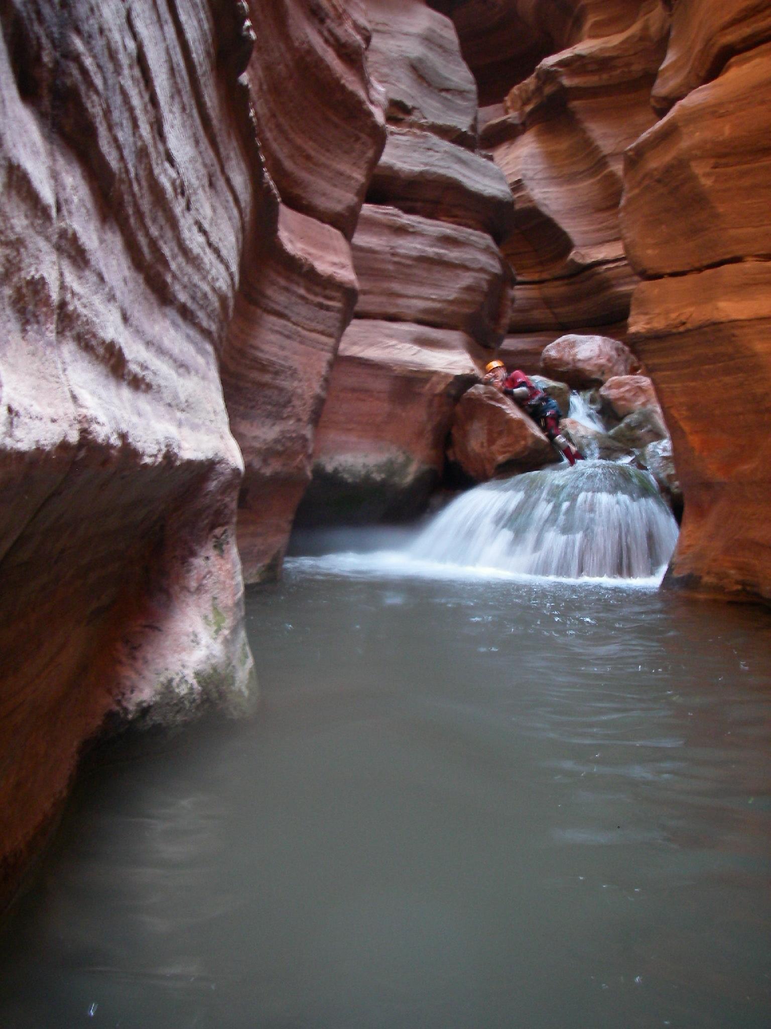
Rappel 3 - Reaching the anchor can be tricky! Be careful climbing up to it, having a belay is a good idea. The rappel is over 2 stages and about 30 m ( 99 ft. ) total. Stunning!
Rappel 4 - A short 5 m ( 17 ft. ) drop that lands you at the pearch for the final big rappel. BE VERY CAREFUL HERE TO CLIP INTO ANCHORS. A SLIP WOULD BE FATAL!
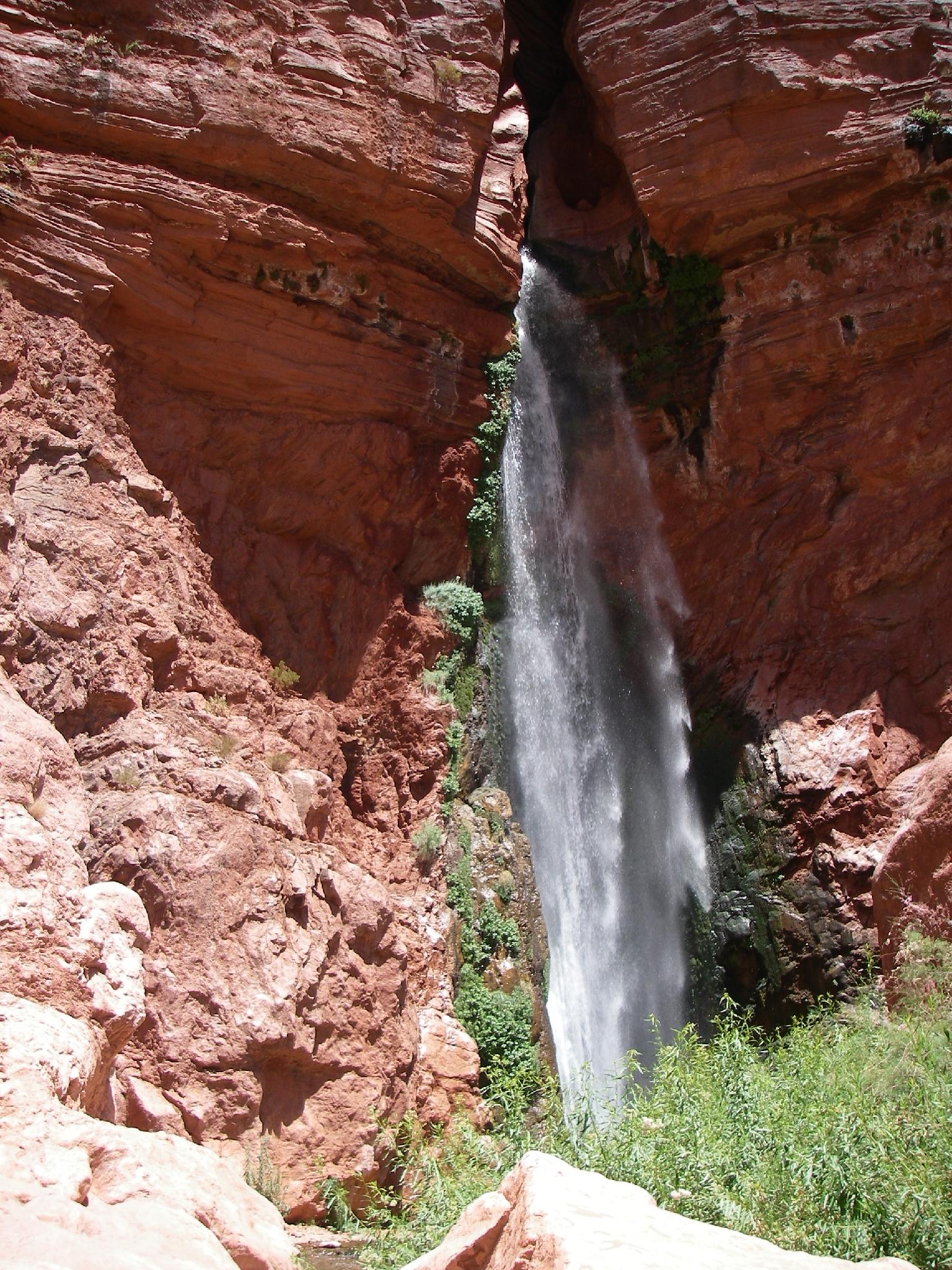
Rappel 5 - The final 60 m ( 197 ft. ) rappel is mostly in the water flow. Be sure to rig appropriately and test the pull to insure the rope will pull easily. At least one group has stuck a rope here, which causes tension between the NPS and canyoneering community.
The return
The return is straightforward. Go down river a few minutes until the Deer Creek trail ascends out on the right. Follow it back up and out of the river bottom to the top of the technical slot, then return the same as the approach. Don't forget to stock up on water at Deer Creek Spring.
Maps


12S 371839E 4033111N
36°26'05"N 112°25'47"W
12S 369522E 4032260N
36°25'36"N 112°27'20"W
12S 367647E 4029437N
36°24'04"N 112°28'33"W
12S 367113E 4029089N
36°23'52"N 112°28'55"W
12S 365320E 4029335N
36°23'59"N 112°30'07"W
12S 364724E 4028115N
36°23'19"N 112°30'30"W
12S 367809E 4030287N
36°24'31"N 112°28'27"W