 Hiking
Naturalist Basin
Hiking
Naturalist Basin
Western Uintas
Overview
Growing up near the North Slope of the Uinta Mountains I had always heard Naturalist Basin was one of the crown jewels of the area, but had never actually taken the time to visit. When I finally did visit in 2015, the area lived up to its reputation. This is a gem of an area, and very popular. This is not a place to come for solitude, but is a place to come for big views, stunning high mountain lakes, and an amazing hike. That said, the trailhead parking was near capacity when I was there, but, though we ran into a few people on the trail, it never felt crowded. This hike visits Scudder Lake, Jordan Lake, Shaler Lake, Faxon Lake, Le Conte Lake, Walcott Lake, Blue Lake, and Morat Lakes. An anglers dream, there are lots of options for wetting a lure.
Though the basin is only 5.3 miles from the trailhead, that is just the start of the good stuff. Plan on about 15 miles round trip to see the full basin. Most do this as an overnight backpack. If doing it as a backpack, practice minimum impact camping techniques, and be aware fires are not permitted within 1/4 of a mile of any lake in Naturalist Basin. For my money, this makes a great long day hike for those fit enough to put in the miles. Start early if doing it as a day hike, afternoon thundershowers are common and the highest lakes in the basin are exposed and not a good place to be during a lightning storm. For camping, staying a 1/4 or 1/2 mile back from any of the lake shores will help insure more solitude. There are a lot of lakes and a lot of great places to camp, so you may be able to find a secluded spot.
Getting There
The trailhead is the Highline Trail trailhead/Hayden Pass off the Mirror Lake highway. This is at mile post 34.2, which is 34.2 miles from Kamas Utah on highway 150, or about 43 miles south of Evanston Wyoming on highway 150. The trail will likely be very snowy until late June in most years.
Route Description
To Natural Basin (5.3 miles)
Follow the Highline trail. After 0.75 miles, a side trail comes in from Mirror Lake, stay left as the trail descends southeast along the base of the high Uintas.
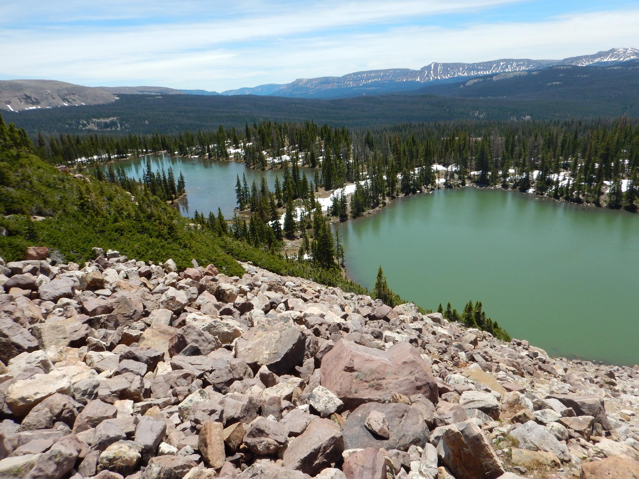
Continuing on, a junction is reached with right going to Scudder Lake and left bypassing Scudder Lake. Either way is fine, but I recommend right to see the lake close up. Just after the lake, the trail re-joins the main trail.
Next up is Packard Lake junction. Stay left here, as the trail meanders up and down to a final junction to Naturalist Basin (left) or Rocky Sea Pass (right). Go left as the trail begins climbing up into Naturalist Basin.
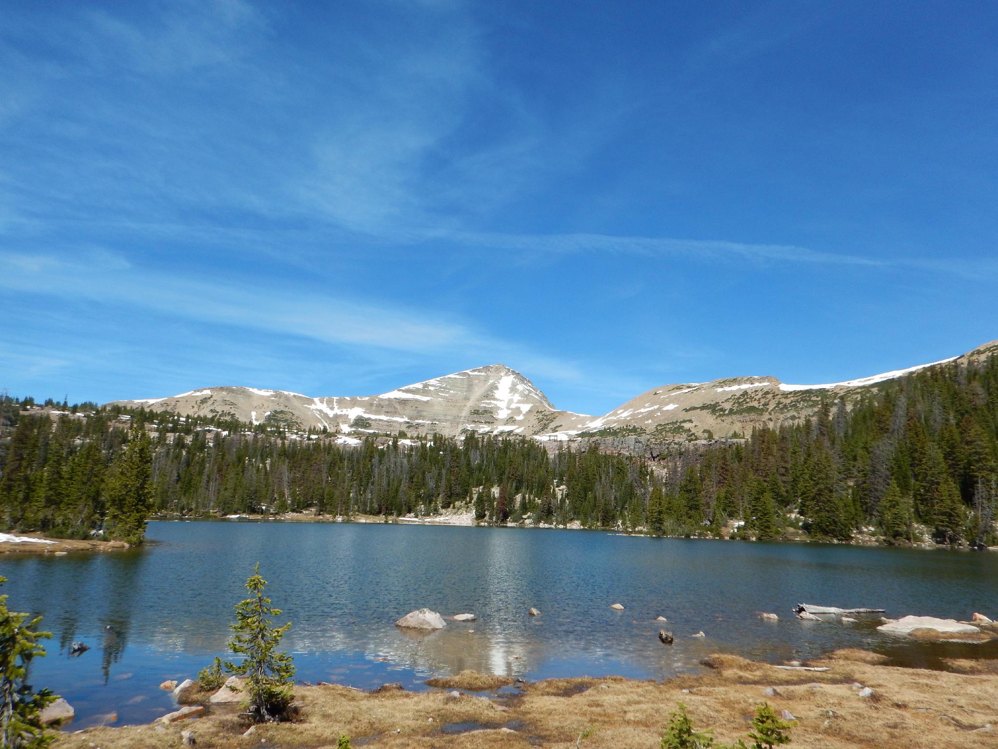
The scenery is stunning as you enter Naturalist Basin. A final junction occurs where the views open and Mt. Agassiz is prominent to the left. The peak towers to 12,428 feet over the northwest side of the basin. To the northeast of the basin is Spread Eagle Peak, and at 12,540 feet, is slightly higher than Agassiz.
Jordan / Blue Lake Loop (about 5 miles)
Though this loop adds 5 miles to the hike, it visits the best part of the basin. HIGHLY RECOMMENDED. From the Jordan Lake Junction, I suggest doing the loop in a counter clockwise direction. Go right, crossing the stream and following a meadow before the trail climbs briefly to the picturesque Jordan Lake.
Continuing past Jordan Lake, the trail once again climbs a step, this time to above tree line and Shaler Lake that is nestled below Spread Eagle Peak. This stunning spot makes a great destination.
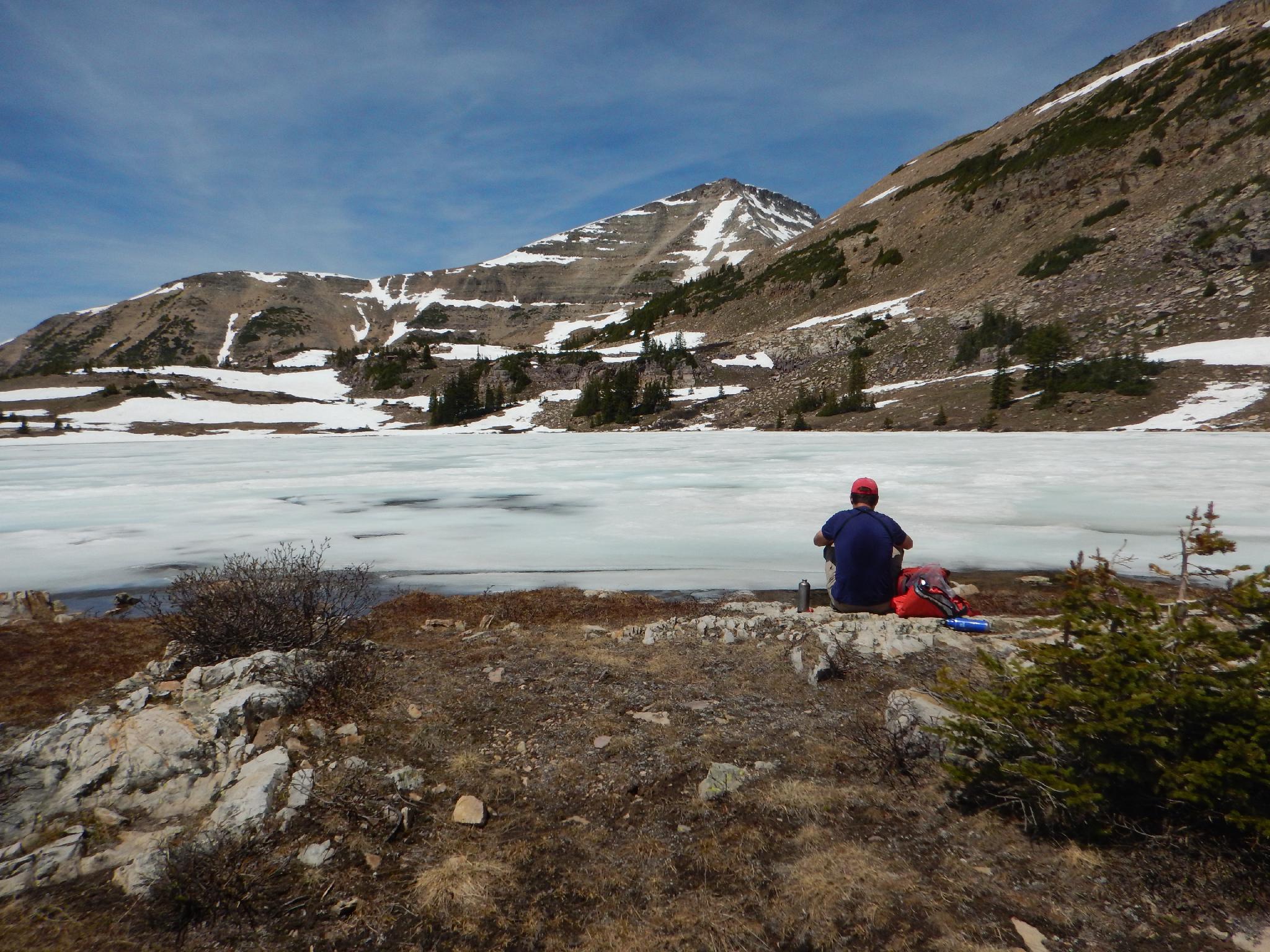
Want more scenery and some easy off trail hiking? Continue the loop by hiking north to near the base of the mountains, and heading west along the flats. En route you will quickly visit Faxon Lake, Le Conte Lake, and Walcott Lakes before reaching the large Blue Lake that is nestled below Mt. Agassiz. Absolutely stunning!
At the south side of Blue Lake are two ponds. The original trail descended between these two ponds (shown on the map). This has a little boulder hoping. Going to the east side of the ponds is a better and more used trail these days. Either way, the hike descends steeply to Morat Lakes.
Go east around Morat Lakes on the trail as it circles around the south side of the lake, then descends steeply and crosses back to Jordan Lake Junction.
Maps


12T 511493E 4507894N
40°43'19"N 110°51'50"W
12T 511617E 4507153N
40°42'55"N 110°51'45"W
12T 513404E 4504908N
40°41'42"N 110°50'29"W
12T 515146E 4504130N
40°41'17"N 110°49'15"W
12T 516169E 4505101N
40°41'48"N 110°48'31"W
12T 517706E 4506686N
40°42'39"N 110°47'25"W
12T 515782E 4505933N
40°42'15"N 110°48'47"W