 Hiking
Liberty Lake and Wines Peak
Hiking
Liberty Lake and Wines Peak
Elko Nevada
Overview
A continuation of the Lamoille Lake hike, Liberty Lake offers a bit of a gateway to the heart of the Ruby Mountains. A day hike is worth doing, but if you have time, I would highly recommend staying a night or two at Liberty Lake and using it as a springboard to Favre Lake, Wines Peak, and Furlong Lake as day hikes from a base camp at Liberty Lake.
Getting There
From downtown Elko, take 5th Street south, which becomes state road 227. This is well signed for Lamoille Canyon. From Elko, stay on 227 for about 19 miles to the signed Forest Road 660 on the right. Signed for Lamoille. Follow the road to its ends in 12 miles. This is the exit trailhead. There is a toilet at the trailhead, but no camping. Thompson Canyon Campround is part way up the canyon, but can fill up on weekends. See Reserve America for reservations.
Route Description
To Liberty Lake (4 miles one way)
From the trailhead, follow the main trail. It climbs in the wash bottom, then begins a series of wide, sweeping switchbacks climbing up to the next layer of the canyon. Once up a layer, the trail flattens out a bit and offers great views of Lamoille Canyon.
The first few lakes passed are called Dollar Lakes. Continuing past Dollar Lakes, it is a short distance to the junction for Lamoille Lake on the right. The lake is within sight of this junction and offers quite a few good primitive campsites along its shore.
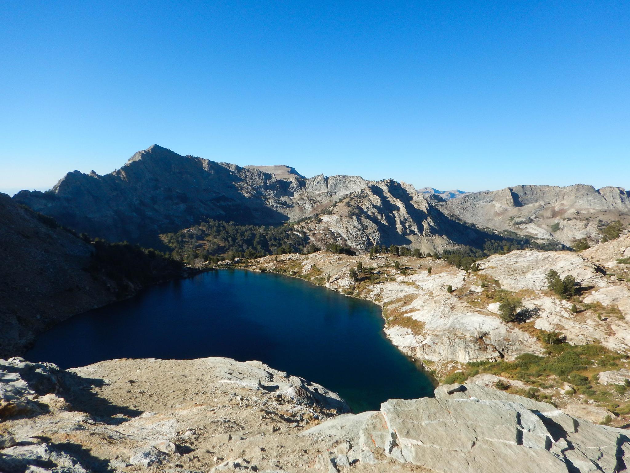
Past Lamoille Lake junction, the main trail climbs steeply to Liberty Pass and the first views south to Liberty Lake and Lake Peak/Wines Peak in the distance. The pass is a stunning spot to take in the sights from.
Liberty Lake is a short 15-20 minutes south, down from the pass. Primitive sites on the east side of the lake seemed the most scenic.
Side Trip: Favre Lake and Wines Peak (1.5 miles to Favre one way, 5.1 miles one way to Wines Summit)
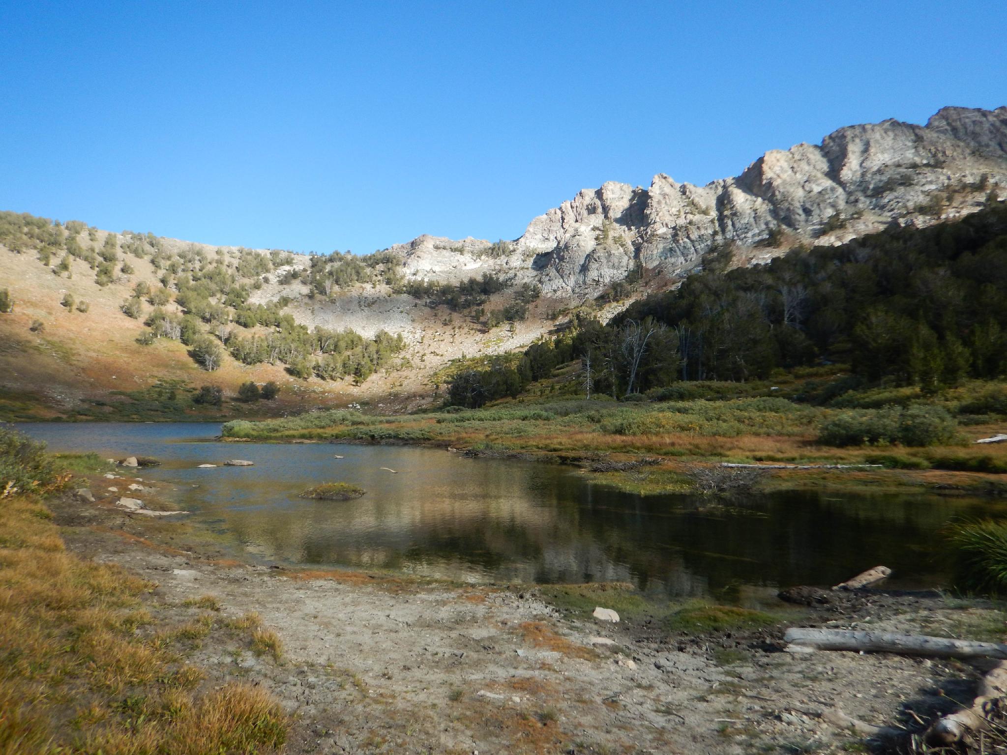
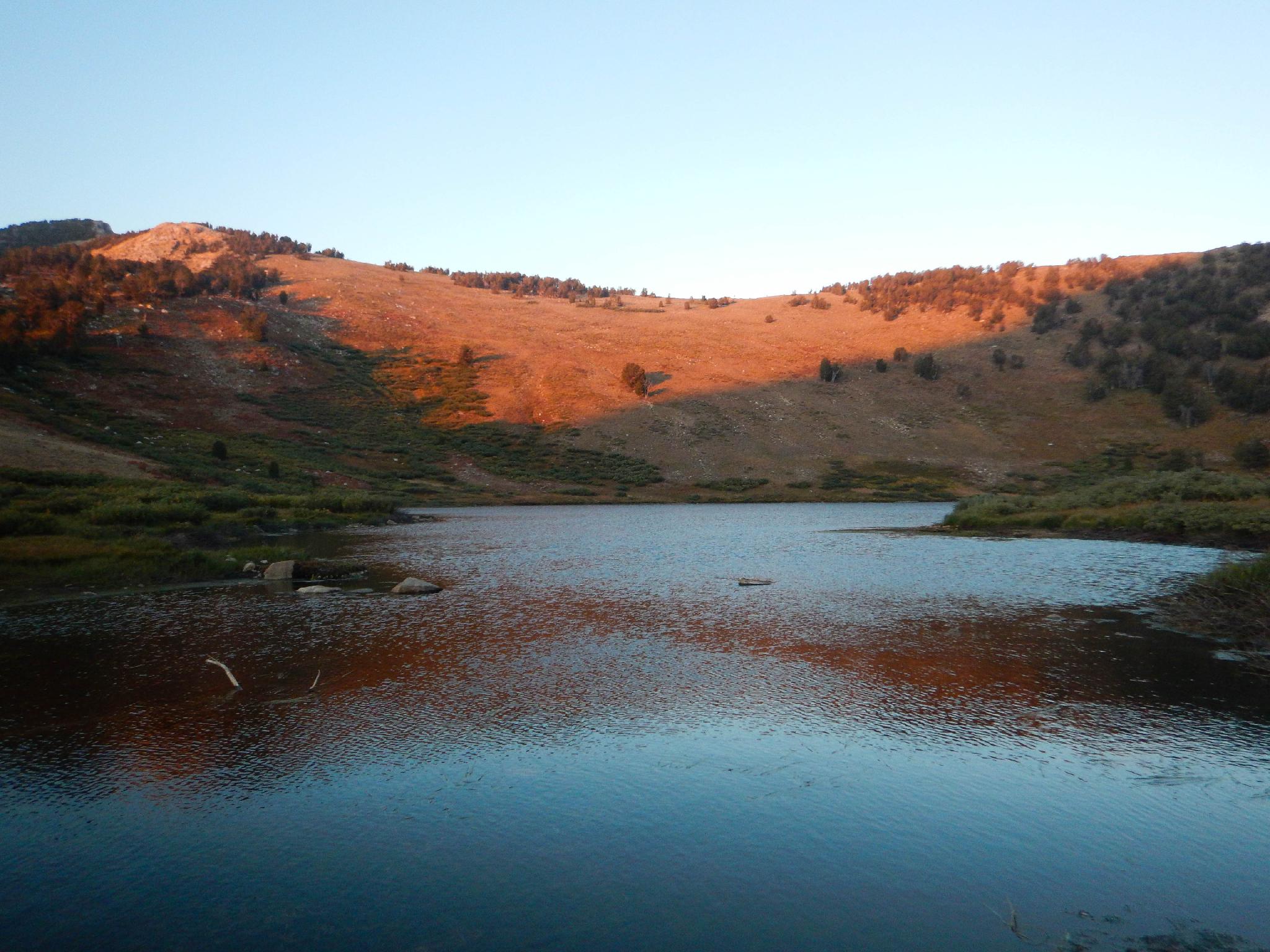
From Liberty Lake, it is a short 30 minutes or so down to Favre Lake and Castle Lake. Both are popular with fisherman and make a good short side trip from Liberty Lake. Castle Lake is smaller and offers good, isolated camping.
For the more motivated, a day hike to Wines Peak makes for a good and bigger outing. From Liberty Lake follow the trail to the junction with Favre Lake. Go right, soon crossing the stream and reaching the junction to Kletchner Lake. Go left here. The trail meanders around the mountain side to a valley then climbs up and over a pass and reaches the junction to North Furlong Lake. North Furlong Lake is 20 minutes or so down this trail.
Go left again at the North Furlong/Wines Peak junction. Wines Peak looms directly to the south. The trail climbs steeply up to the pass of the peak. The true summit is a short distance to the west and worth the 10-minute side trip from the pass. From its summit, you can see the Ruby Crest trail as it continues south along the crest of the range.
Maps
")
")
11T 637422E 4496080N
40°36'15"N 115°22'33"W
11T 636470E 4494865N
40°35'36"N 115°23'14"W
11T 636122E 4494825N
40°35'35"N 115°23'29"W
11T 636071E 4494801N
40°35'34"N 115°23'31"W
11T 635913E 4494075N
40°35'11"N 115°23'38"W
11T 635934E 4493977N
40°35'08"N 115°23'37"W
11T 635795E 4493362N
40°34'48"N 115°23'44"W
11T 635369E 4492885N
40°34'32"N 115°24'02"W
11T 635023E 4492729N
40°34'28"N 115°24'17"W
11T 634554E 4492458N
40°34'19"N 115°24'37"W
11T 635147E 4491250N
40°33'40"N 115°24'13"W
11T 634817E 4490003N
40°32'59"N 115°24'28"W