 Hiking
McDonald Creek
Hiking
McDonald Creek
Grand Junction
Overview
McDonald Creek, part of the McInnis Canyon National Conservation Area, is a lovely hike that meanders down to the Colorado River. This is a fairly diverse hike, starting up in the open flats and slowly working down through sandstone layers before reaching the Colorado River in the picturesque Ruby Canyon. En route, a very short slot and a couple of rock art sites, adding cherries to the top of an already great hike.
Getting There
The trailhead is reached by taking exit 2 (Rabbit Valley) off I-70 just inside the Colorado boarder. This is about 25 miles west of Grand Junction.
Once off the highway, head south. Stay on the main dirt road heading south. It has a few side roads branching off to camping areas, but is generally easy to follow the main road. It turns a bit southwest, and dips down to the McDonald Creek trailhead at 3 miles from the highway. The trailhead has a pit toilet and parking area.
Route Description
Rock art and historic sites are fragile, non-renewable cultural resources that, once damaged, can never be replaced. To ensure they are protected, please:
- Avoid Touching the Petroglyphs: Look and observe, BUT DO NOT TOUCH!
- Stay on the Trails: Stay on the most used trails when visiting sites, and don't create new trails or trample vegetation.
- Photography and Sketching is Allowed: Do not introduce any foreign substance to enhance the carved and pecked images for photographic or drawing purposes. Altering, defacing, or damaging the petroglyphs is against the law -- even if the damage is unintentional.
- Pets: Keep pets on a leash and clean up after them.
- Artifacts: If you happen to come across sherds (broken pottery) or lithics (flakes of stone tools), leave them where you see them. Once they are moved or removed, a piece of the past is forever lost.
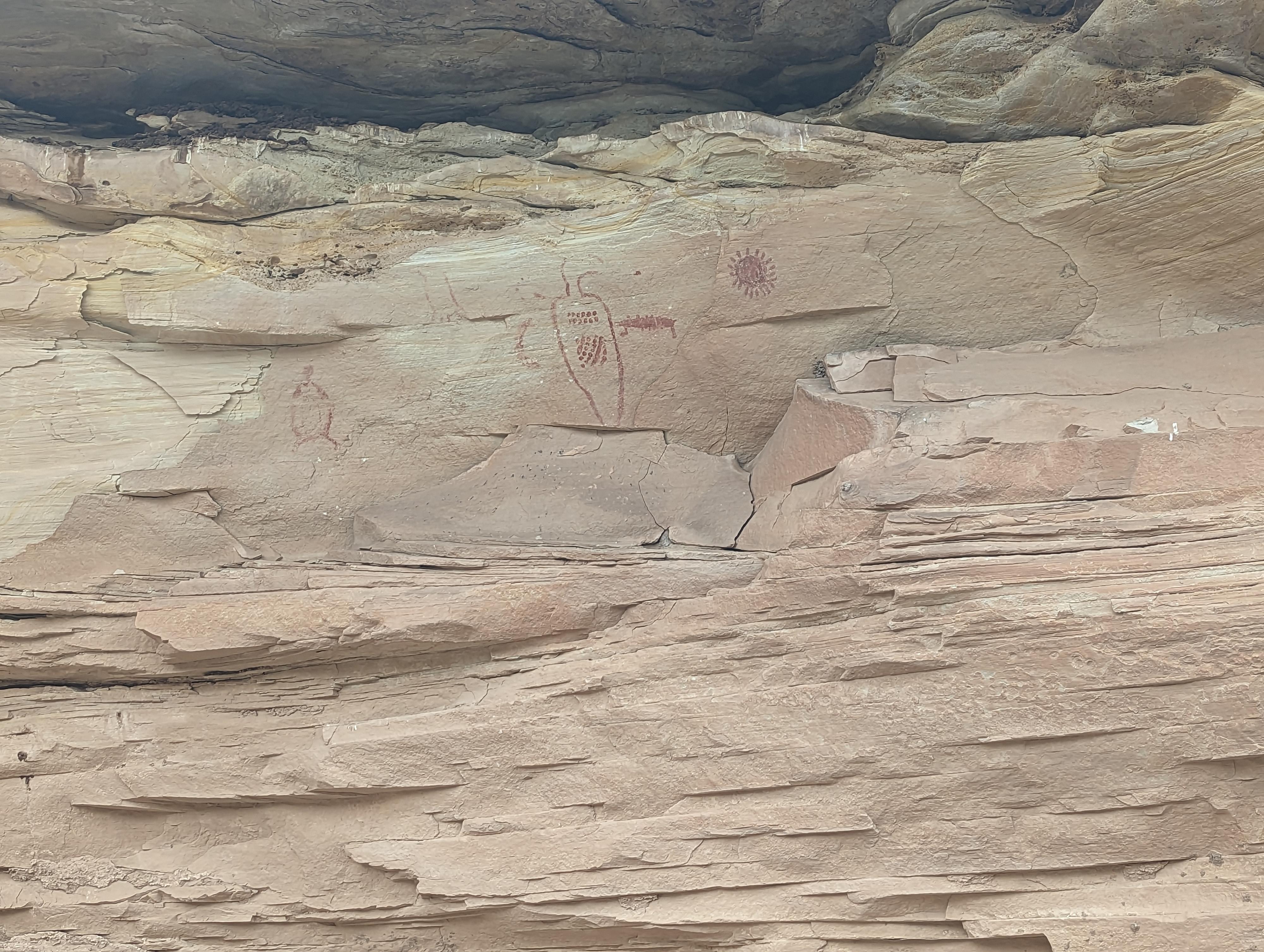
From the trailhead, head down canyon on the well-worn social trail. It is easy to find and follow. It cuts corners where shorter. About 0.35 miles from the trailhead (less than 10 minutes), look for a pictograph on the left (looking down canyon) side of the canyon. Part of this pictograph looks like a sun. The panel is where the canyon curves right and begins to deepen, easy to spot from the trail.
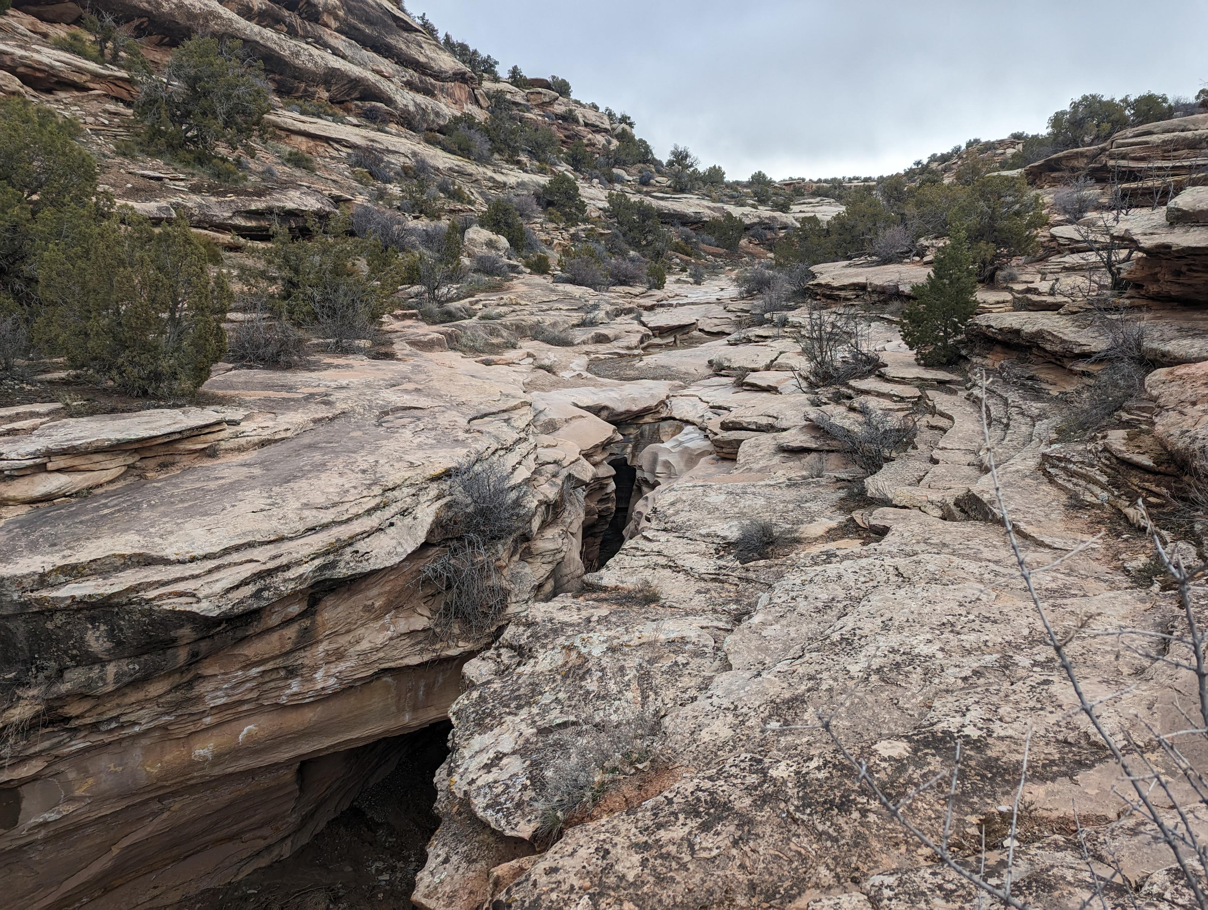
Continuing down from the panel just a few minutes, the floor of the canyon cuts into the sandstone and a dry fall and short slot section. The very short slot is easily bypassed on the left, and fun to hike back up from the bottom.
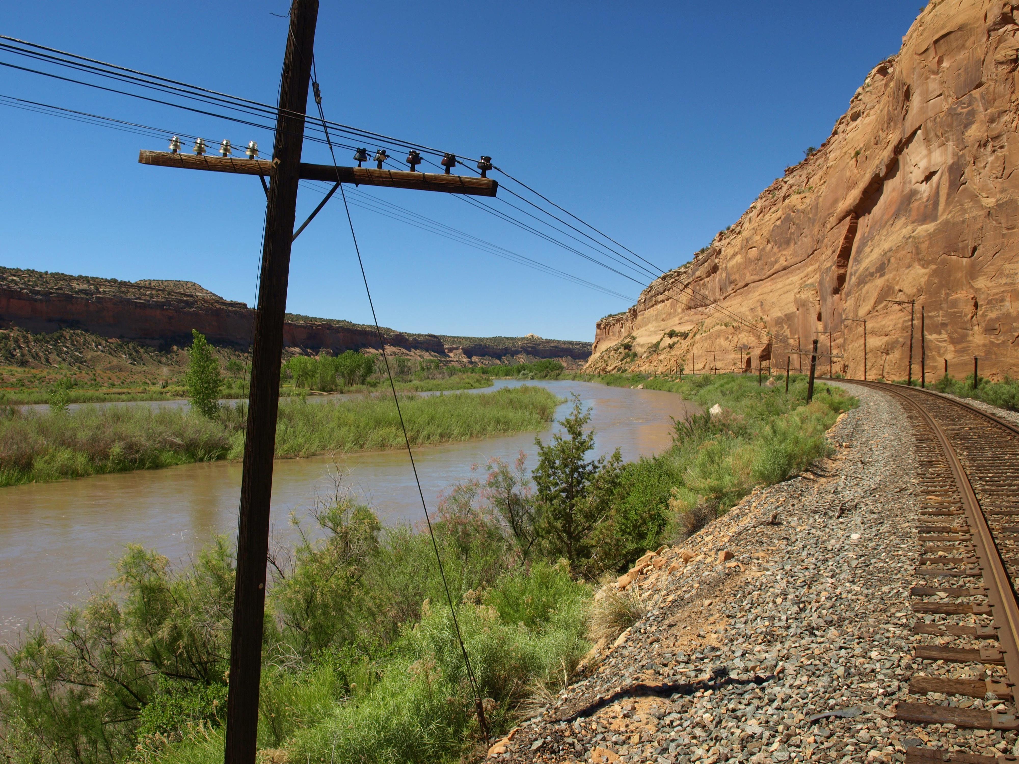
Below the slot, the canyon is wide and continues to deepen with great scenery. It is about 2 miles to where McDonald Creek reaches the Colorado River in Ruby Canyon. Easily spotted by both the river and the railroad tracks that cross the bottom of McDonald Creek and continue along the Colorado River.
From the bottom of McDonald Creek, as you head back up the canyon, keep an eye out on the right side of the canyon (lookup up canyon). Less than 10 minutes up from the river is a short side canyon with a large dry fall at the top. Just up this on the left (looking up canyon) is a small pictograph panel.
Return the way you came.
Photos
Maps

12S 669857E 4336207N
39°09'31"N 109°02'03"W
12S 670359E 4335972N
39°09'23"N 109°01'42"W
12S 670395E 4335719N
39°09'14"N 109°01'41"W
12S 670787E 4334295N
39°08'28"N 109°01'26"W