 Canyoneering
Offshore Canyon
Canyoneering
Offshore Canyon
Ticaboo
Overview
Offshore Canyon is one of those canyons that people either seem to love, or to be ambivalent about! Several friends have spoken with great enthusiasm about the beauty and fun of this short outing. A few acquaintances have said it was a canyon to do when you had absolutely NOTHING else to do and were right in the area.
I think the difference is in personality and expectation. If you are a hardcore canyoneer looking for tight slots, hard downclimbs, or difficult anchor challenges, you will likely be disappointed. If, on the other hand, you are looking for a pretty amble with a few up climbs and down climb challenges in an Entrada sandstone canyon, this might be a favorite.
We chose this as a good opportunity for our 6-year-old to get some scrambling experience going up the north fork, and some short lowering experience coming down the south fork. It was perfect, and everyone in the family enjoyed the beauty and small challenges of the canyon.
Getting There
From Hanksville, head south on UT-95 for about 27 miles to the junction of UT-95 and UT-276. Go right on UT-276 toward Bullfrog/Ticaboo for 31.25 miles. This is just south and across the highway from JNB Marine gas station, and just south of the houseboat storage facility. There is not a pullout, apart from the side of the highway.
Alternatively, this is about 9 miles north of Bullfrog on UT-276.
Route Description
Approach (1 mile, 20-30 minutes)
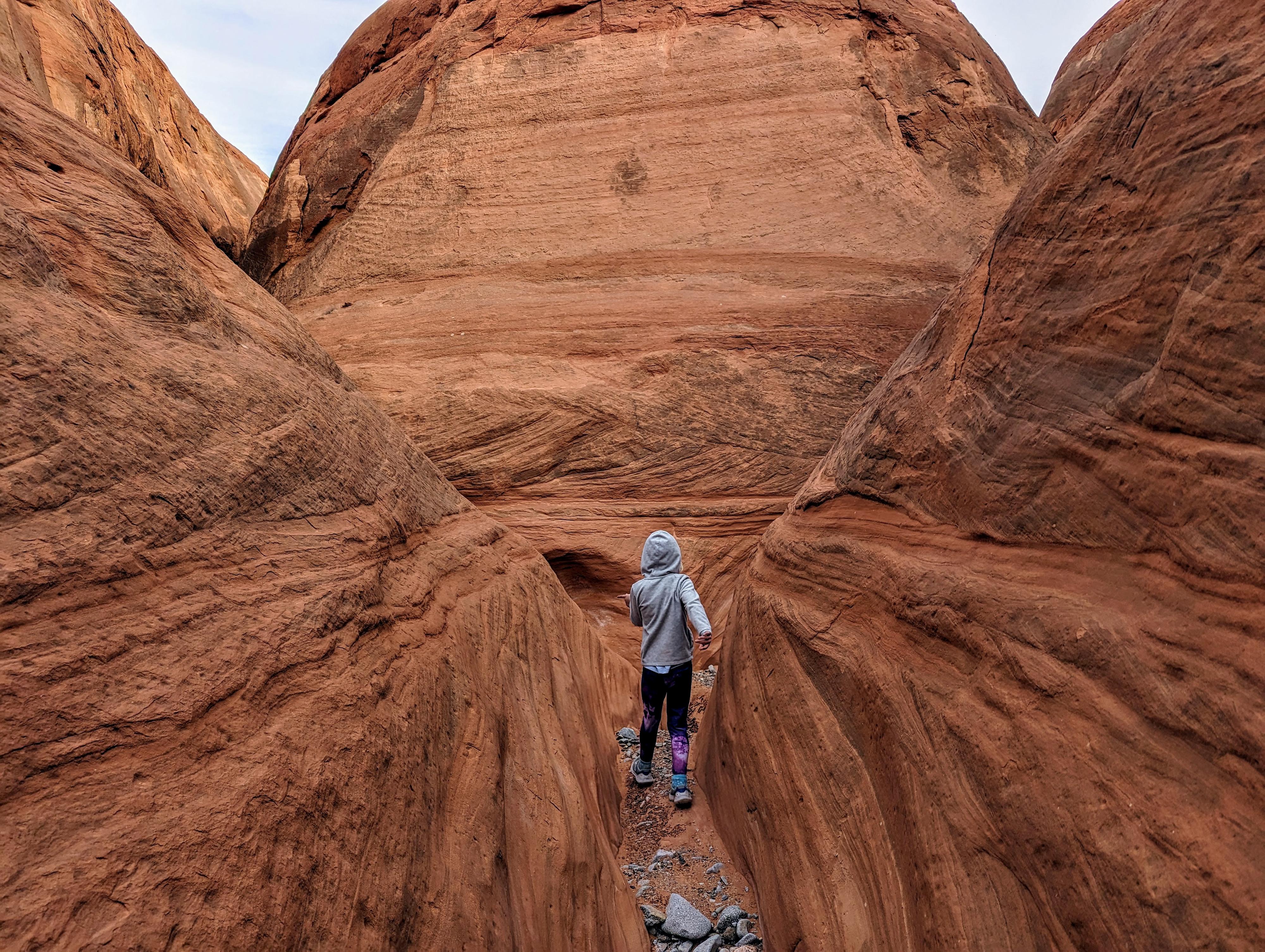
From the trailhead, hike east along the property line that soon has a fence line. In just a few minutes, a wide wash (Hansen Creek) is crossed. After crossing it, head up the canyon directly to the east. It is wide at the bottom. This is Offshore Canyon.
A few minutes up Offshore Canyon is a junction with a canyon coming in on the left. Stay right here, with the canyon becoming more entrenched and more narrow.
About 1 mile from the trailhead, the canyon divides again. This is the north and south fork junction. Go left here, heading up the north fork.
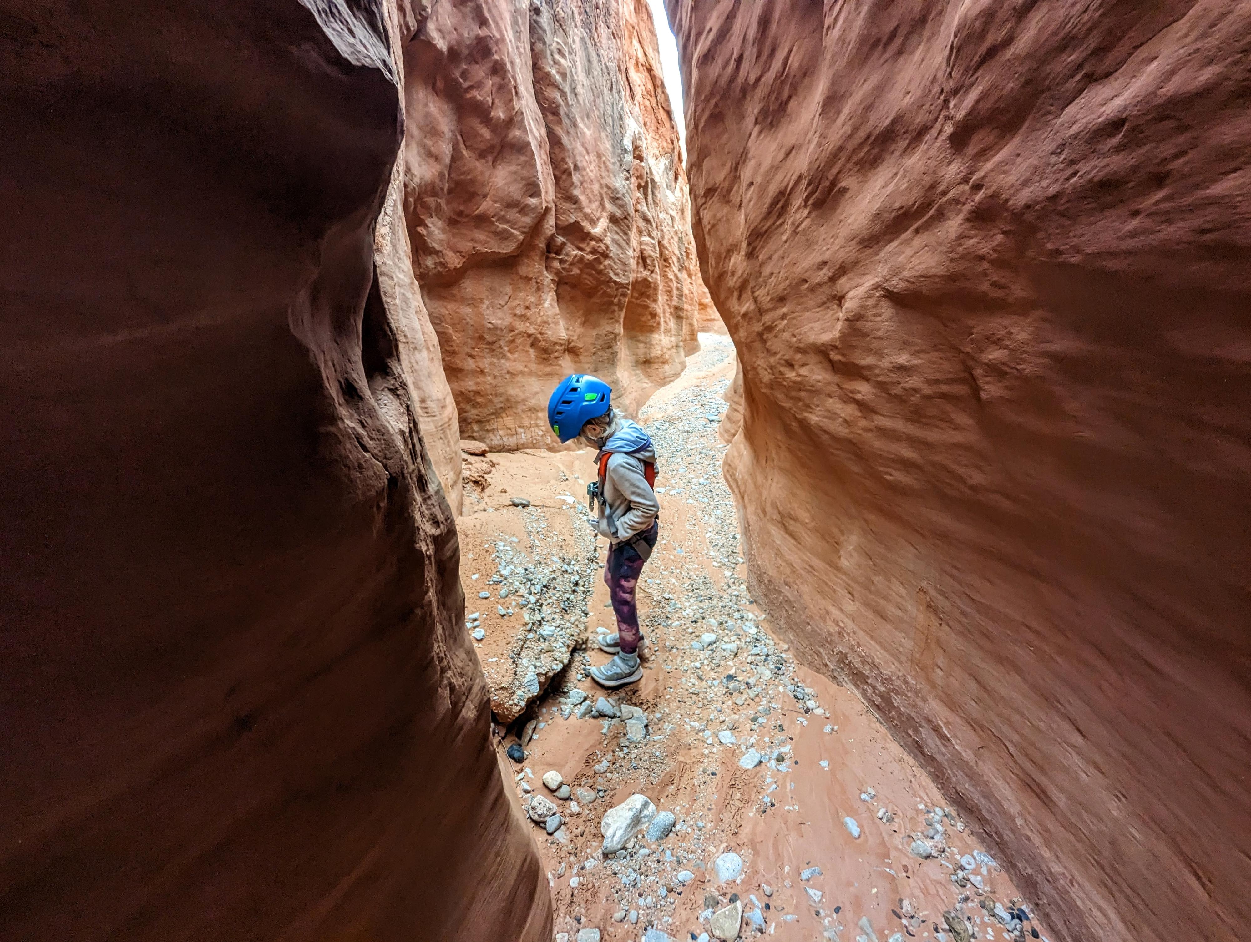
North Fork
The north fork has a few up climbs. They can be a bit strenuous because of their width, but are straightforward with some persistence. It begins to open up fairly shortly. Look for the second side canyon coming in on the right (looking up canyon). This is the recommended exit. I would recommend leaving packs at the exit and exploring up the left fork a bit, then returning. There are a couple of more narrow sections and an up climb or two. You can exit the north fork higher, but the exit shown makes for an easier route across to the south fork, in my opinion.
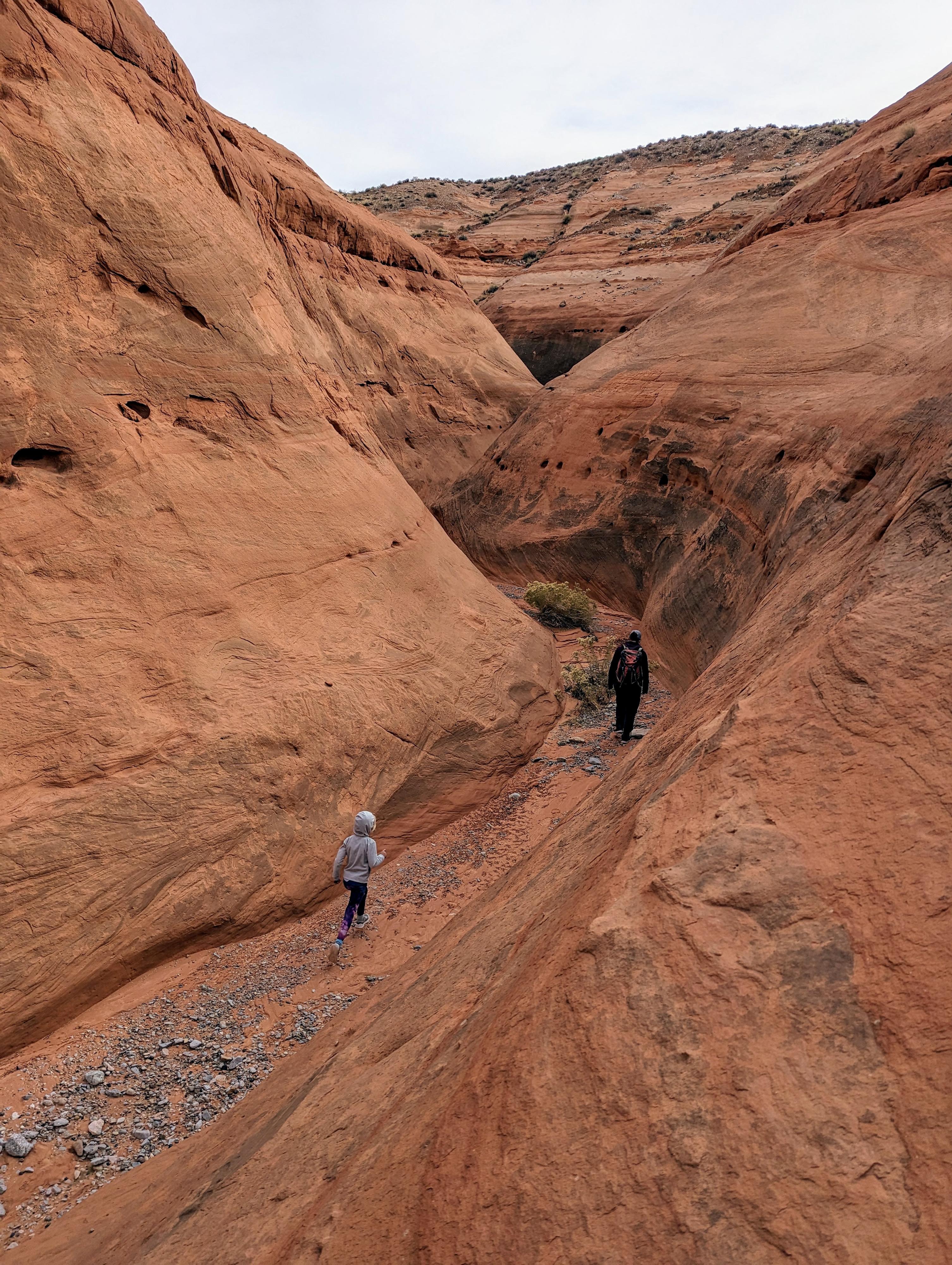
To the South Fork (10-20 minutes)
Climb up the exit canyon, cutting up steep slick rock on the right whenever it seems reasonable. Navigation is a bit tricky, so a GPS or good eye on the map recommended. Once on the ridge, follow it east until it is easy to cross the side canyon to the south. Once across the side canyon to the south, trend mostly east and a touch south.
You want to intersect the south fork high enough that it is reasonably shallow and easy to get into. This is just above a major split in the south fork. Getting to the bottom of the south fork requires a bit of route finding, There are some areas of steep dirt, find a reasonable spot to descend to the floor of the south fork. The spot showed on the map comes down a gully/wash. On our visit, we followed a mix of old human and animal prints from the north to south fork, but there was not much of a use trail anywhere we could find.
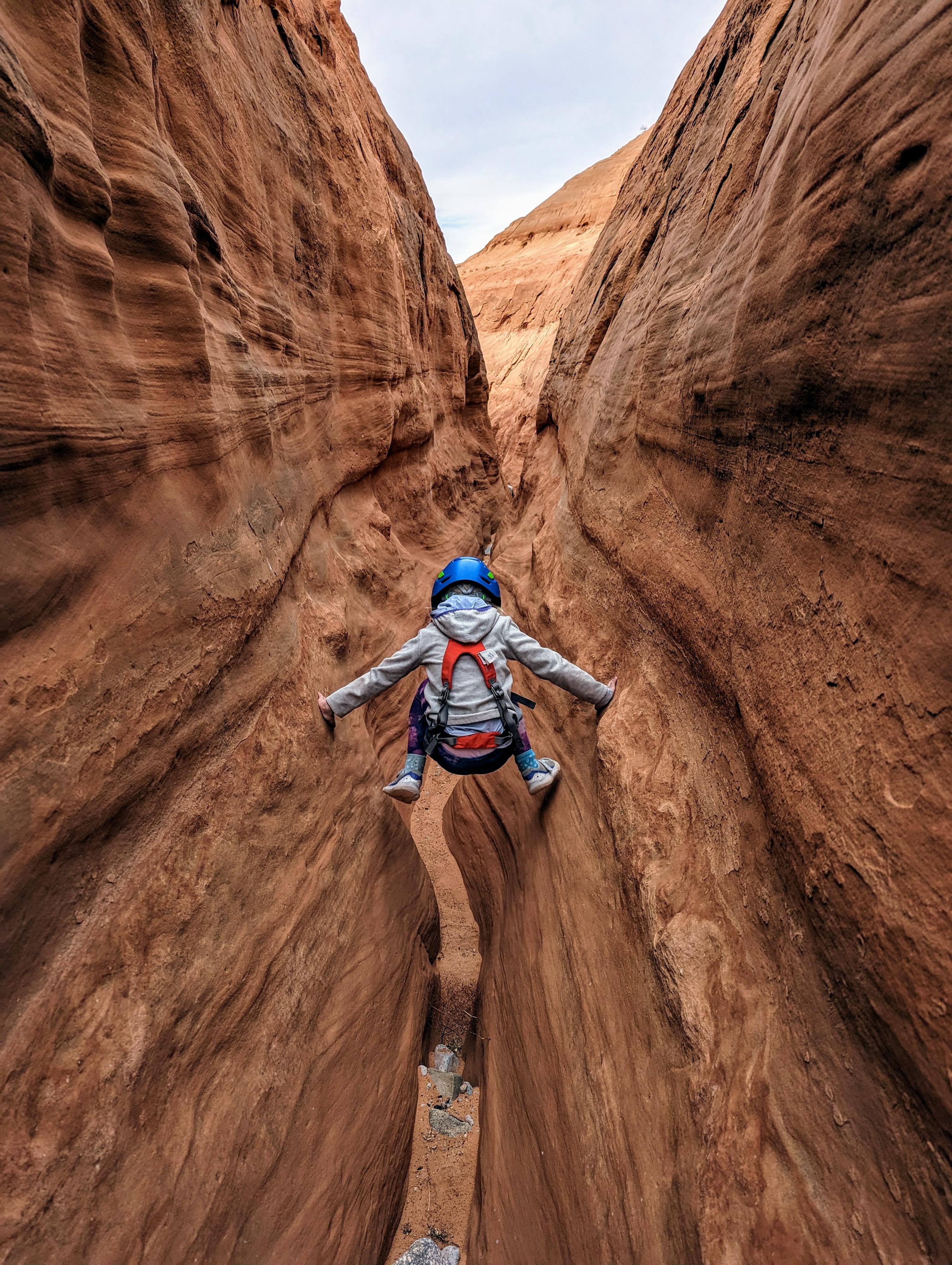
South Fork
Let the fun begin! The south fork was my favorite. It is mostly easy walking with one small obstacle before coming to a first drop, the shortest of the three you will encounter in the south fork. Beyond is a mix of easy ambling with minor obstacles and 2 drops when the canyon deepens.
Both of these drops are narrow chimney style down climbs. I thought both were easier than they appeared from the top. After the second of these two drops, it is an easy walk to where the north fork joins on the right.
Exit (1 mile, 20-30 minutes)
Return via the approach route from the north/south fork junction.
Photos
Maps

12S 524539E 4164518N
37°37'39"N 110°43'19"W
12S 524920E 4164592N
37°37'41"N 110°43'03"W
12S 525108E 4164735N
37°37'46"N 110°42'56"W
12S 525488E 4164763N
37°37'47"N 110°42'40"W
12S 525726E 4164958N
37°37'53"N 110°42'30"W
12S 526009E 4164884N
37°37'51"N 110°42'19"W
12S 526039E 4164870N
37°37'50"N 110°42'18"W