 Hiking
Stairmaster Trail
Hiking
Stairmaster Trail
Kane Creek
Overview
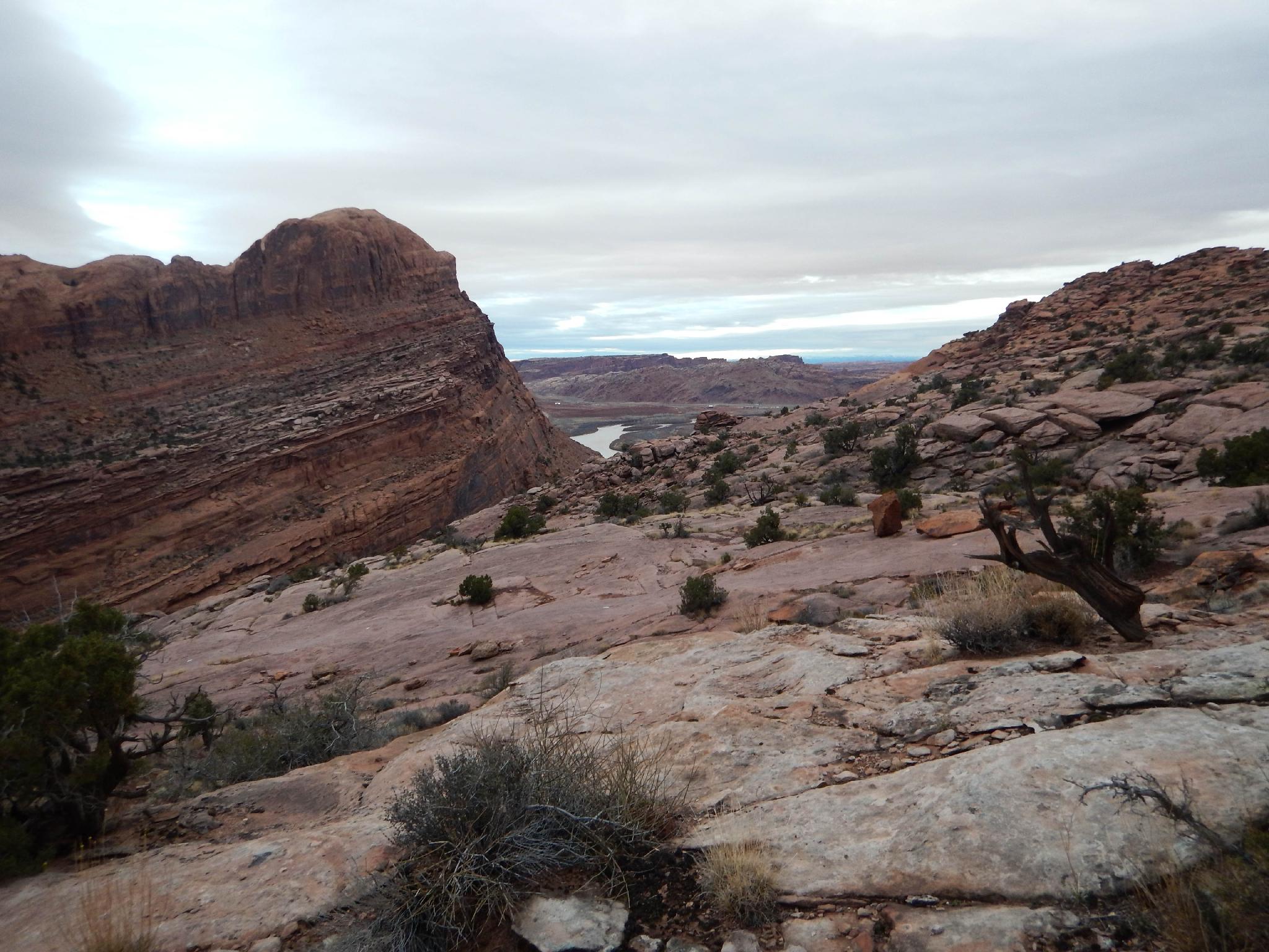
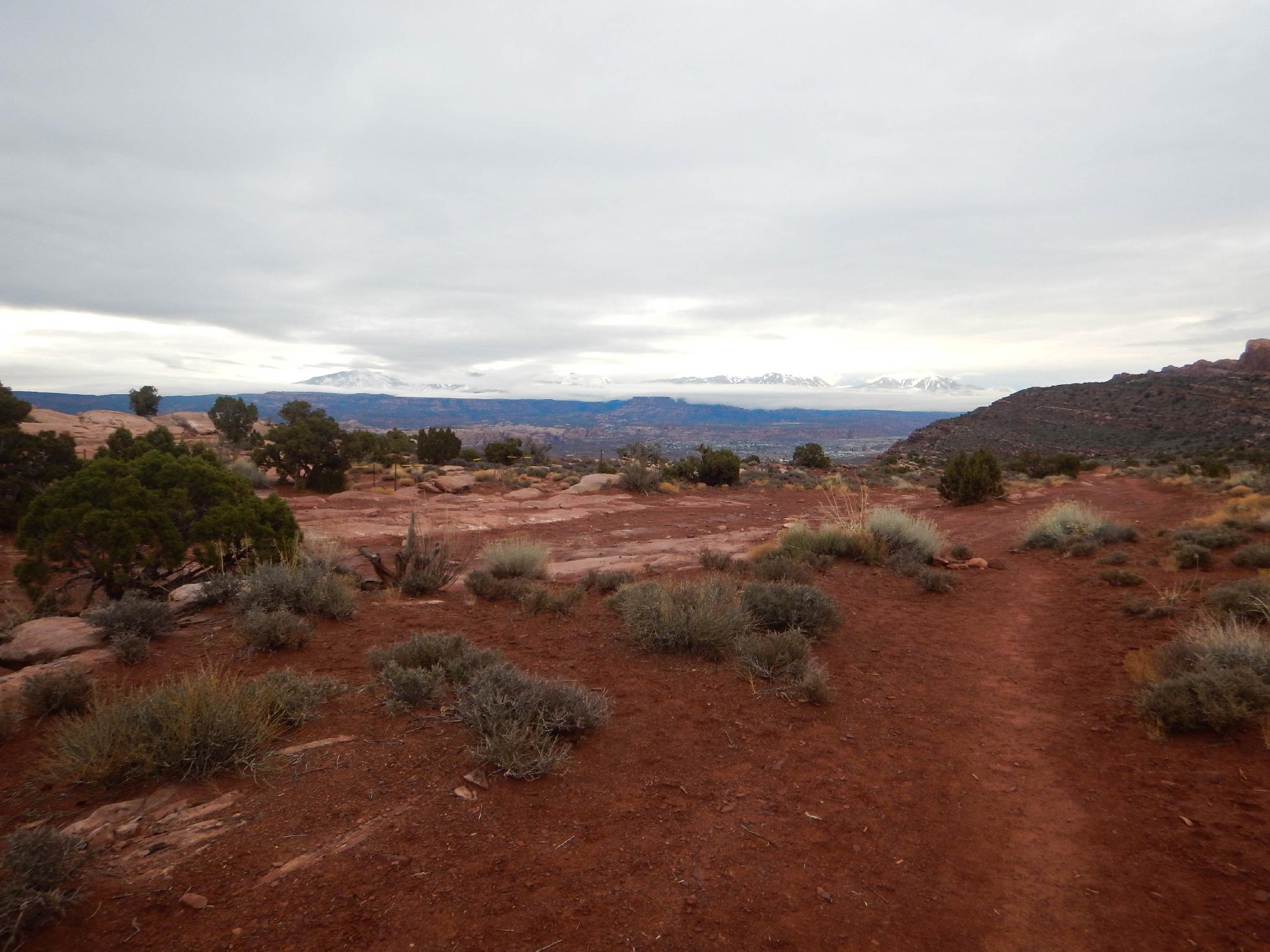
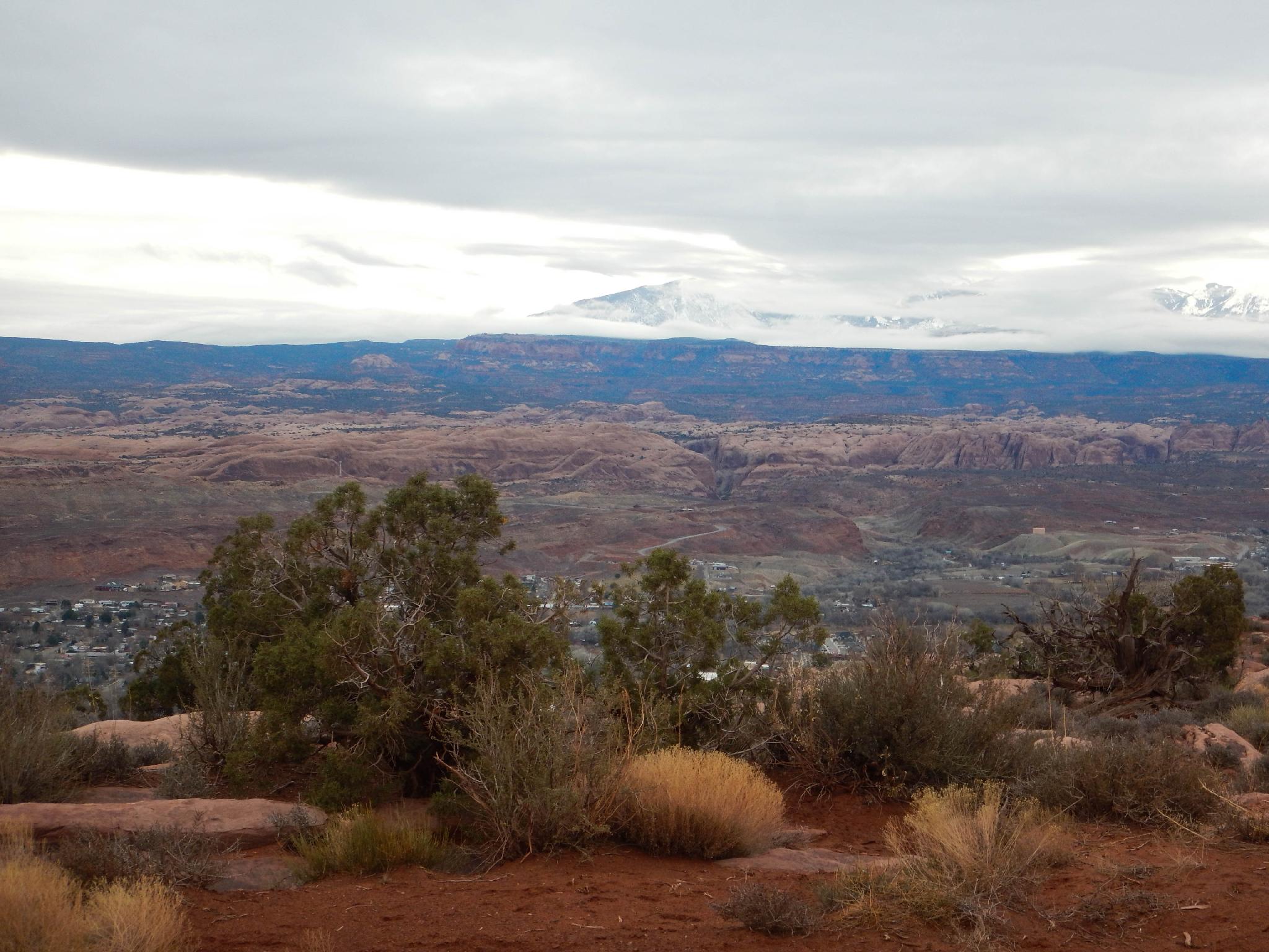
If you are hoping someone ironically named the Stairmaster trail, prepare to be disappointed. This trail lives up to its name, gaining over 900 feet in the first mile. Feel the burn! The reward from the top, once you catch your breath, is excellent views of the Moab valley, La Sal Mountains, and even Arches National Park in the distance.
This is a good winter outing or other cooler times of the year. The elevation gain will generate some heat! If doing this hike in the summer, get an early start.
Getting There
From downtown Moab, head to south to Kane Creek Blvd. Turn right on Kane Creek Blvd. (This is currently where the McDonald's and Burger King are.)
Route Description
From the trailhead, either hike up the Moab Rim Jeep Trail, or the Stairmaster Trail that parallels it. For my money, the Stairmaster is a bit better. After 0.8 miles, the jeep road and hiking trail merge near the top of the mesa. There are many great vantage points for taking in the amazing views of Moab, the La Sal Mountains, and even Arches National Park off in the far distance to the northeast.
This a good destination, but if you have more energy, consider continuing on the Moab Rim Trail and making a loop. The Moab Rim Trail meanders to a junction. Go right at the junction. The trail descends, crosses the head of Moonflower Canyon, then ascends up and over a dome. At the next junction go left, descending to a wash, then go left again to complete the loop.
There is much to see and many areas to wander on the mesa top.
Maps

12S 623474E 4268774N
38°33'32"N 109°34'58"W
12S 623495E 4268833N
38°33'34"N 109°34'57"W
12S 624456E 4269615N
38°33'59"N 109°34'17"W
12S 624482E 4268655N
38°33'27"N 109°34'17"W
12S 624129E 4268338N
38°33'17"N 109°34'31"W
12S 624917E 4267645N
38°32'54"N 109°33'59"W