Wahclella Falls | Columbia River Gorge Oregon

Hiking Wahclella Falls - Columbia River Gorge Oregon Hiking Wahclella Falls

Columbia River Gorge Oregon

Overview

Sun Rain showers likely. Mostly cloudy. High near 60, with temperatures falling to around 58 in the afternoon. West southwest wind around 10 mph, with gusts as high as 24 mph. Chance of precipitation is 70%. New rainfall amounts less than a tenth of an inch possible.
60° | 48°
Mon A chance of rain showers. Mostly cloudy, with a high near 60. West southwest wind around 8 mph, with gusts as high as 22 mph. Chance of precipitation is 50%.
60° | 48°
Tue A chance of rain showers before 5pm. Partly sunny, with a high near 61.
61° | 49°
Wed A slight chance of rain before 5pm. Partly sunny, with a high near 62.
62° | 48°
Thu A chance of rain after 11am. Partly sunny, with a high near 63.
63° | 47°
RATING: Easy Hiking
MAPS: Bonneville Dam, OR; Tanner Butte, OR;
SEASON: Any
GEAR: Standard Hiking Gear
Sun Rain showers likely. Mostly cloudy. High near 60, with temperatures falling to around 58 in the afternoon. West southwest wind around 10 mph, with gusts as high as 24 mph. Chance of precipitation is 70%. New rainfall amounts less than a tenth of an inch possible.
60° | 48°
Mon A chance of rain showers. Mostly cloudy, with a high near 60. West southwest wind around 8 mph, with gusts as high as 22 mph. Chance of precipitation is 50%.
60° | 48°
Tue A chance of rain showers before 5pm. Partly sunny, with a high near 61.
61° | 49°
Wed A slight chance of rain before 5pm. Partly sunny, with a high near 62.
62° | 48°
Thu A chance of rain after 11am. Partly sunny, with a high near 63.
63° | 47°
Wahclella Falls
Wahclella Falls

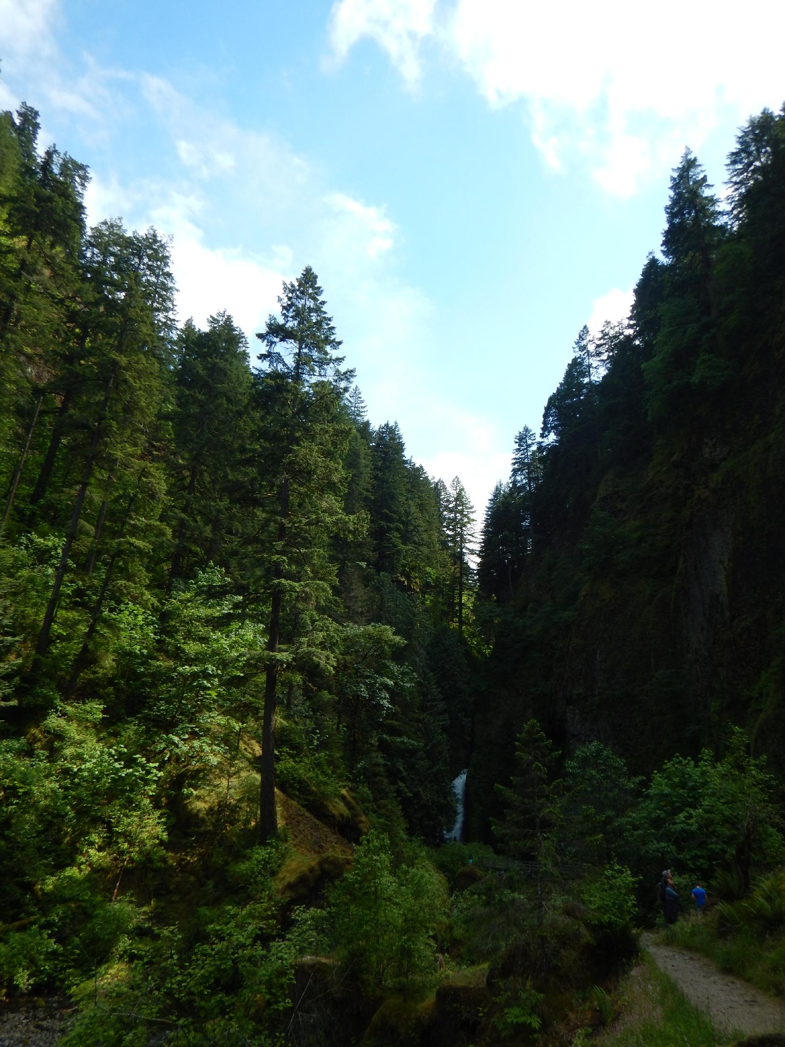
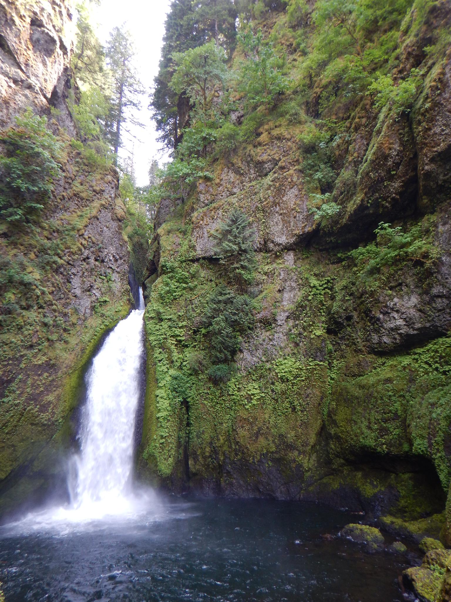
Wahclella Falls offers an excellent family friendly hike to two stunning waterfalls in the Columbia River Gorge. The hike is very popular, but (in my opinion) offers an excellent hike that is just far enough to not see the swarms of people the closer falls see.

The path is well travelled and easy, this is a very family friendly hike. Be sure to bring a camera, the scenery is exquisite!

Lower Munra Falls
Lower Munra Falls
The Falls from a distance

Getting There

The trailhead is reached from exit 40 on I-84 in the Columbia River Gorge. This is about 35 miles east of Portland. Take exit 40, and go south. Just after the highway, the road forks. Right goes into the Yeon State Park / Wahclella Falls trailhead. There is a fee to park at the trailhead.

The stunning lower Tanner Creek
Wahclella Falls
Wahclella Falls

Route Description

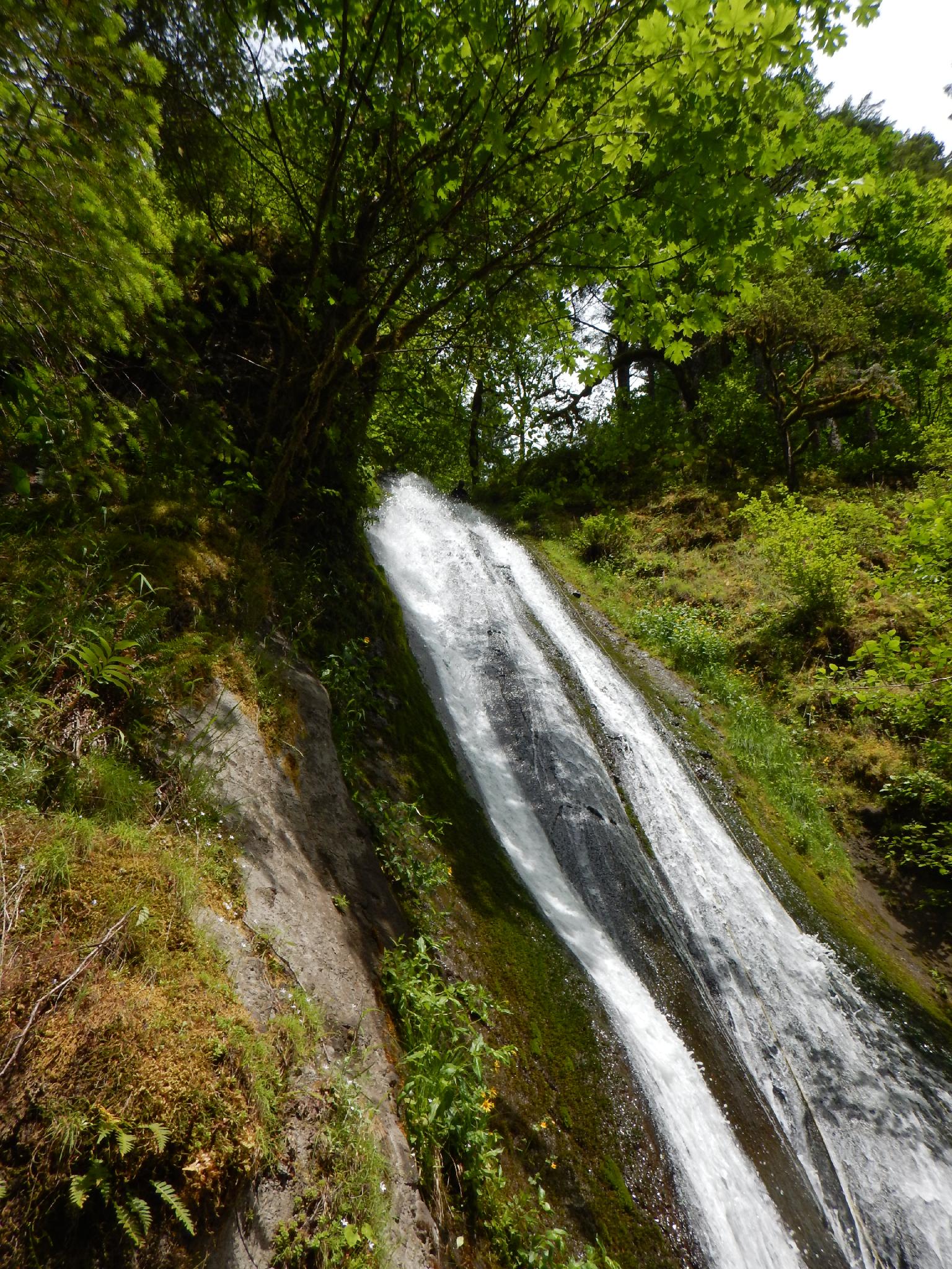
To Munra Falls (0.3 miles)
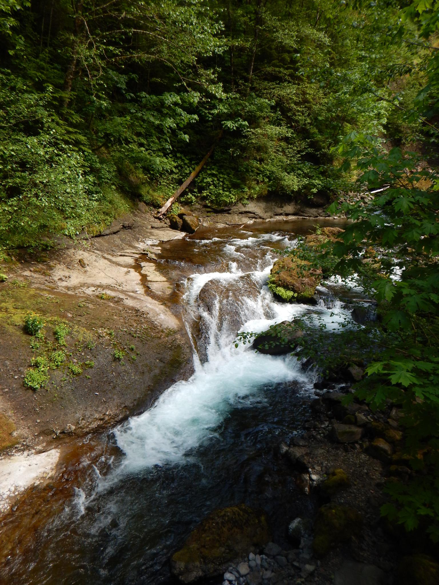
From the trailhead, follow the well used trail south into Tanner Creek. After 0.3 miles (5 minutes), the Lower Munra Falls comes in on the left and is quite pretty and striking. The bridge on the path way goes right up near the falls.

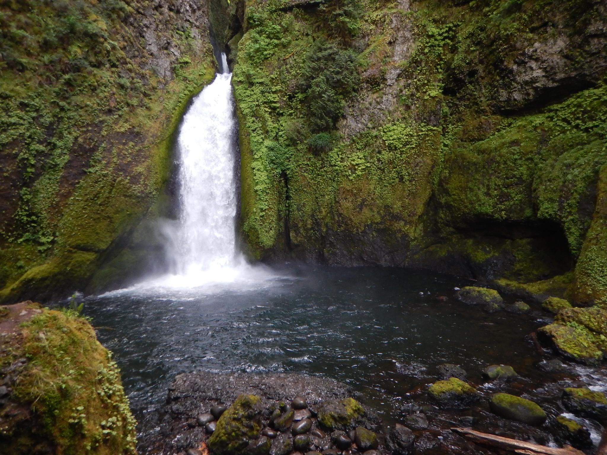
To Wahclella Falls (0.7 miles)
Continuing up from Munra, the trail climbs a litte, but never steeply. As it nears Wahclella, it splits. This split creates a loop, so either choice is fine, though I think going left offers the most dramatic view of the falls.

When it comes into view, the lower falls is about 20 m ( 66 ft. ), while a more hidden upper section is about 15 m ( 50 ft. ). This is a stunning place to have lunch and take in the scenery. I have not visited in the winter, but there is a third falls that is sometimes visible in the winter above the usual two that is actually higher than Wahclella.

Follow the loop around to the junction and the back to the trailhead.


Photos

Maps

Route / 1.73 miles / Elevation Range 78 - 290 ft.
Printable Maps:

Trailhead
10T 581524E 5053505N 45°37'49"N 121°57'15"W
Munra Falls
10T 581581E 5053057N 45°37'35"N 121°57'12"W
Wahclella Falls
10T 581762E 5052166N 45°37'06"N 121°57'05"W

Comments