
 Temple Mountain
Eastern Reef
Overview
The San Rafael Swell has a long history of mining. In the early 1900s, mining for uranium and other resources was taking place at Temple Mountain, one of the iconic peaks of the Southern Swell.
Demand for uranium faded, and most of the mines were left dormant from the 1920s until demand grew again after World War II. In the late 1940s, mining in the area boomed a second time. Between the late 1940s and the 1960s, the area was overrun with miners and associated works trying to find their mother lode. This second boom is what led to many of the roads in the San Rafael Swell that we use today. Miners carved roads into any desolate corner they thought might hold uranium.
Today, Temple Mountain is no longer actively mined, though mining claims in the area are still kept current in case another boom comes. These days the area has become popular with the ATV, motorcycle, mountain bike, and hiking crowds.
Getting There
Reach the trailhead by going west from Green River Utah on I-70 to the junction with highway 24 that goes to Hanksville. Go toward Hanksville for about 25 miles to Mile Post 135.
A signed road goes off to the west signed Goblin Valley. Turn onto this and reset your odometer.
5.1 miles to a junction. Go straight.
6.1 miles, two roads go off on the right to an old drill hole and the large panel. This is a nice quick side trip to the exquisite Temple Mountain Panel.
7.3 miles - Large Temple Mountain Campground on the right. This is the trailhead.
Route Description
Roads criss-cross and circle the mountain in all directions. My recommended route is to go counter-clockwise, especially if starting in the morning. This gives good lighting for photos.
From the campground, walk down the wash a couple of minutes to where a road crosses the wash and heads toward Temple Mountain. This is a popular camping area as well. Follow the road, which quickly turns to a rocky ATV track as it begins to climb toward Temple Mountain. At a junction, the road to the left goes to a major mine site. Stay right, climbing to the shoulder of Temple Mountain.
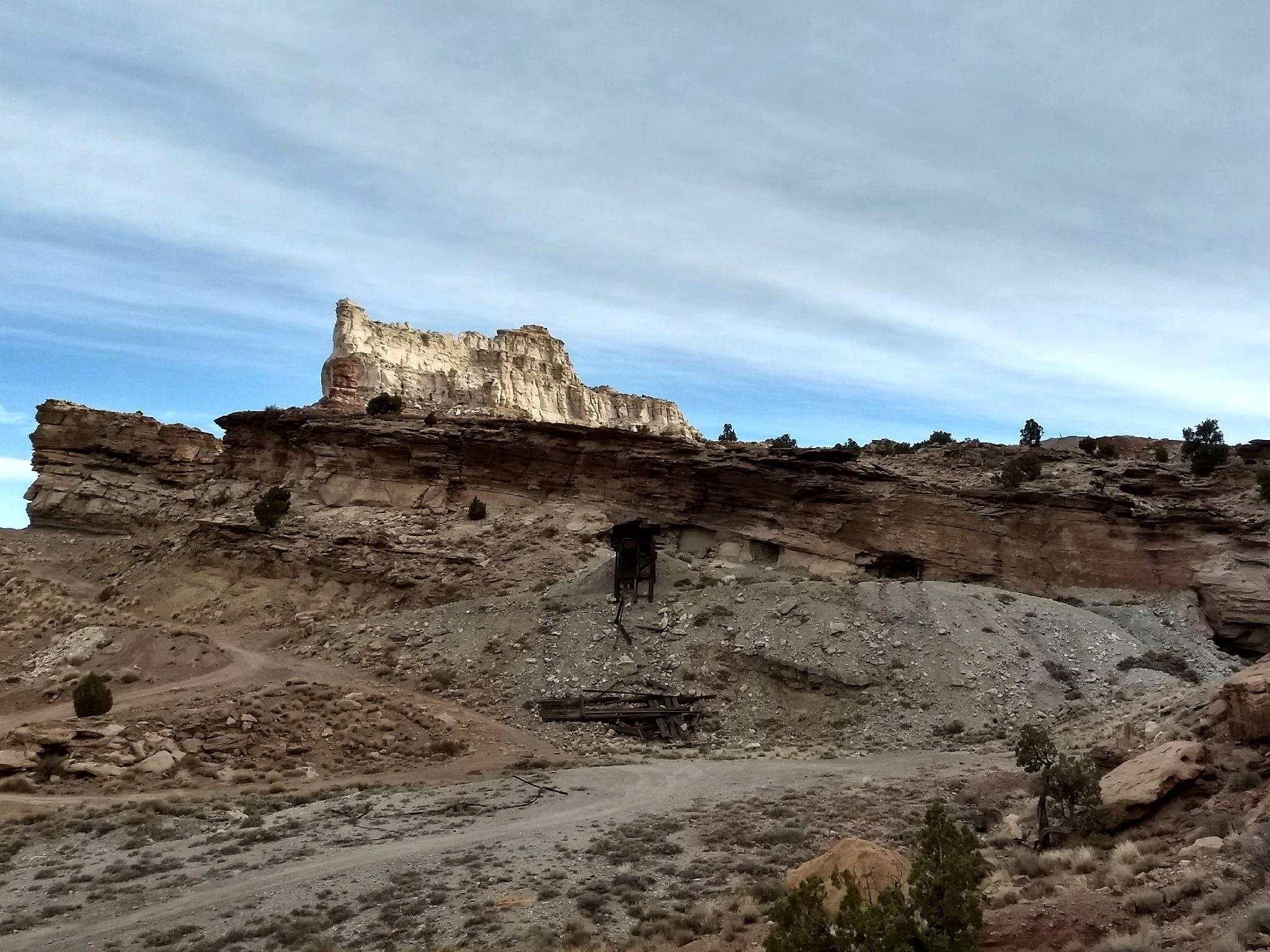
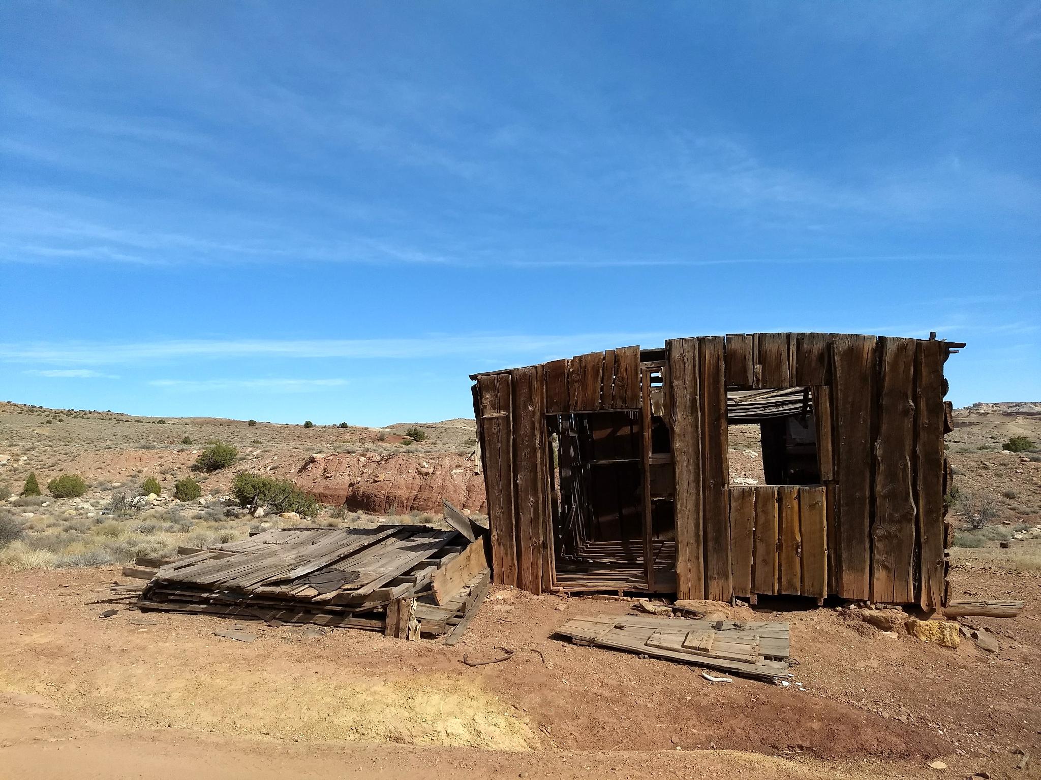
Once at the shoulder, stay on the most used road as it meanders across the small valley. The valley is littered with mining ruins worth short side trips to visit. Across the valley, the road reaches a notch with broad views of the summit of Temple Mountain high above.
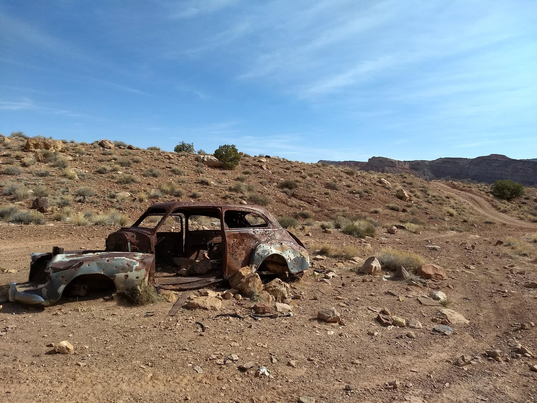
From the notch, the road heads east and descends to the valley floor at an old house and car ruin. Continue on the well-traveled ATV trail north-west to the north side of Temple Mountain. Many smaller mining roads leave the main road. Ignore these until you are north of Temple Mountain and the side road is a very well traveled road.
Go left, as the road goes west, then south along Temple Mountain and back to the trailhead.
Maps

12S 527434E 4279919N
38°40'03"N 110°41'05"W
12S 527836E 4279685N
38°39'55"N 110°40'48"W
12S 528000E 4280510N
38°40'22"N 110°40'41"W
12S 528026E 4281508N
38°40'54"N 110°40'40"W
12S 528890E 4281844N
38°41'05"N 110°40'04"W
12S 528147E 4282751N
38°41'35"N 110°40'35"W