 Hiking
Pioneer Trail
Hiking
Pioneer Trail
Little Emigration Canyon
Overview
The wherewithal of the early pioneers astounds me! In the summer of 1846, the Donner Party set off for California. En route, they learned of Hastings Cutoff, a supposed easier route to California that would make for a shorter trip. Nevermind Hastings himself had only traversed the route once of the same year and without wagons! His enthusiasm for California and the fact it was a shorter route convinced the Donner Party to take the new course.
They chose the route over Big Mountain Pass after scouting determined Weber Canyon was not a viable route. From Henefer, they built a road to Big Mountain Pass, then continued down from the pass to the Salt Lake Valley below. This feat took them 13 days of hard labor.
The party was destined to be stuck in the Sierra Nevada Mountains and become part of an American legend. It is hard to fathom looking down from Big Mountain Pass and seeing no choice but to build a road! Had they not lost two weeks building that section of trail, they may not have been stranded in the Sierra Nevada Mountain and have faded into history.
The Mormon Pioneers used the same route the following year as they began making their way to the Salt Lake Valley.
The hike can be done in several sections. Most do a shorter piece at a time, but if you have two vehicles, hiking or biking the whole trail for a full-day outing. The history of the trail makes this a delightful excursion. I would strongly recommend this in the early summer when wildflowers are in bloom or fall when the leaves are changing color. Summer can be hot.
Getting There
Morman Flats Trailhead
Note: Reaching this trailhead is on a good dirt road. This trailhead is a 30+ minute drive to the other trailheads because of the circuitous route needed to reach the other trailheads.
From I-80 from Salt Lake City about 15 miles to exit 141 (Jeremy Ranch). Exit 141 is about 2 miles west of Kimball Junction if coming from the east. Once off the highway, go north and take the first left. Take the next right (Jeremy Ranch Road).
Follow Jeremy Ranch Road for 5.2 miles. Just after the golf course, the road turns to dirt but is well-graded and suitable for most vehicles when dry. The trailhead is on the left, with a side road to a parking and picnic area. The trail starts from the picnic area.
Little Dell
From Salt Lake City, travel east about 6 miles on I-80 to exit 134 (East Canyon / Little Dell). From exit 134, travel north on UT-65 for 2.9 miles. Little Dell Reservoir is on the right. Parking in the parking lot requires a fee.
Affleck Park
Continue from Little Dell an additional 2.4 miles to Affleck Park on the left. Affleck Park is a great camping area. Reservations required in advance, contact Salt Lake County ( https://www.slc.gov/utilities/watershed/affleck-park-campground/ ) for more information. The trail passes through the park on the west side of the stream. You can park on the road and walk-in.
Big Mountain Pass
Continue past Affleck Park an additional 3 miles to the pass. There is a large parking area here. The trail comes up from Mormon Flats on the north side of the parking. It continues down to Affleck Park on the south side. The south side is well signed. The north, on my trip, was a single track heading down from the parking lot without any signs.
Route Description
Morman Flats to Big Mountain Pass
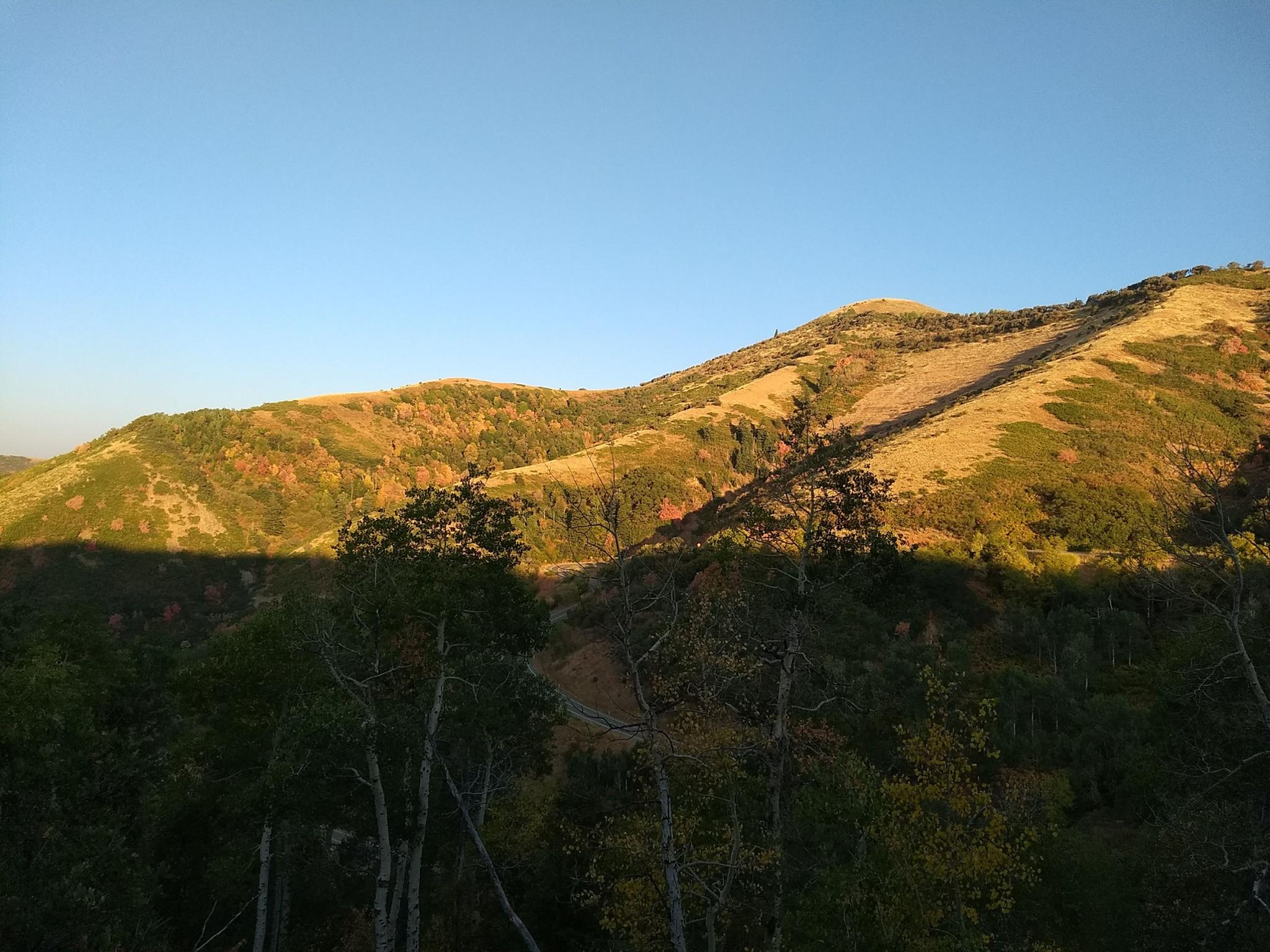
This section of the trail is probably my favorite. From Mormon Flats, the trail crosses a bridge over the river and enters Little Emigration Canyon. As it enters the canyon, there are two rock walls, one on each side of the canyon. The Mormon Militia built the walls in 1857 as a defensive structure in case a war between the Mormon pioneers and the US government broke out.
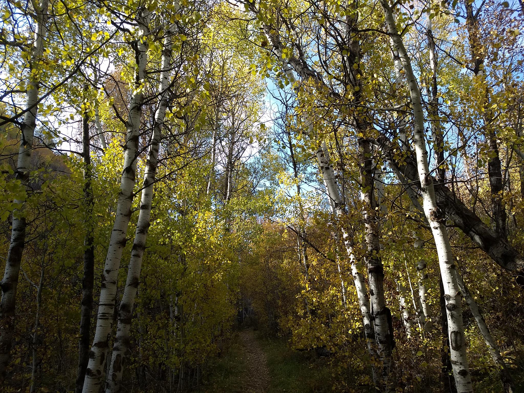
The trail continues up through aspen trees along a small stream. Pioneer Camp, a luscious wetland area is passed before the trail climbs more steeply to Big Mountain Pass. Once under the power lines, the trail braids. Follow any of the trails that follow under the power lines up to the pass. The trail I took, shown on the map, passes a lovely small pond with a bench.
Big Mountain Pass to Affleck Park
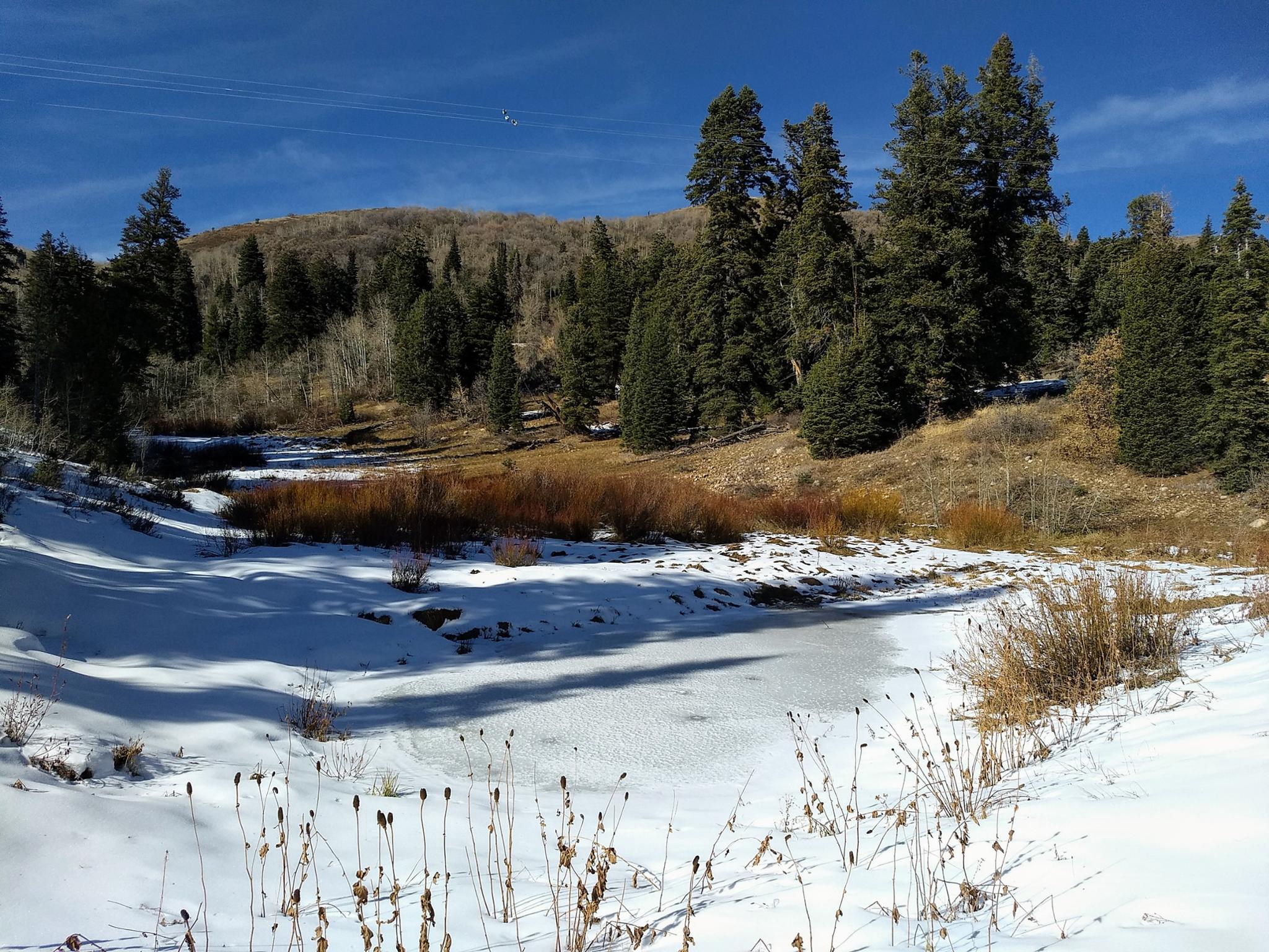
From the pass, find the wide, well-marked trail descending to the west, toward the Salt Lake Valley. The trail traverses the hillside, then descends to the stream bottom. It is lovely in the fall when leaves are changing!
Once in the stream bottom, the trail crosses UT-65 at milepost 6.5. Continue across the road, then steeply down to a junction just before Affleck Park.
If exiting at Affleck Park, go left. The trail goes down to Affleck Park, then follow the campground road up the hill.
Affleck Park to Little Dell
If continuing to Little Dell, go right. The trail meanders around, crosses the stream, the merges with the campground road. Follow the campground road, straight, through the campground. On the south side of the campground, the trail picks up again. It continues down along the west side of the stream, then reaches UT-65. Cross UT-65, then go across the bridge and pick up the trail again on the east side of the stream.
From this last road crossing, the trail meanders down, crosses the stream, and continues to Little Dell Reservoir.
Photos
Maps
")
")
")
12T 450676E 4518441N
40°48'56"N 111°35'05"W
12T 445463E 4520283N
40°49'54"N 111°38'49"W
12T 444868E 4519849N
40°49'40"N 111°39'14"W
12T 443768E 4518984N
40°49'12"N 111°40'00"W
12T 442858E 4518276N
40°48'49"N 111°40'39"W
12T 442577E 4518454N
40°48'54"N 111°40'51"W
12T 442798E 4517810N
40°48'34"N 111°40'41"W
12T 442699E 4516776N
40°47'60"N 111°40'45"W
12T 442244E 4514488N
40°46'46"N 111°41'04"W
12T 441859E 4514371N
40°46'42"N 111°41'20"W