
 Leprechaun Canyon
North Wash
Overview
The Leprechaun Canyons are many people's first canyons. Easy access, and relatively straight forward, they are a good choice. Even a few scenes from the movie 127 Hours were filmed here, just below the confluence of the fork, in a stunning cathedral type section. This is one not to miss, and one of my favorites in the area. Choose your fork wisely if you are a beginner, the middle fork is tight and harder than the left or right.
Getting There
From Hanksville, head south on Highway 95 towards Hite. About milepost 28.1, just after a culvert, is a spur road on the left going a short distance and ending next to a sandstone wall. This is the trail head.
Route Description
I recommend doing the three forks in the following order: East Fork, Left Fork, then Middle Fork. East Fork is the most straight forward in my opinion, and a good introduction, left can have a bit of tricky anchor work, and middle is the most difficult.
Approach (Hikers)
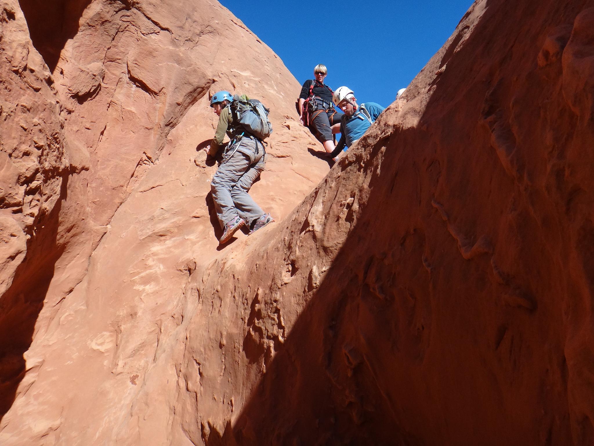
If just hiking up the bottom without doing any of the technical canyon forks, simply follow the social trail up the bottom of the canyon. As slickrock walls begin to close in, a small narrow slot section can be upclimbed directly (a little tricky) or bypassed on either left or right with some teamwork.
Once up the minor obstacle, the canyon deepens and narrows dramatically. Just beyond where the East Fork comes in on the right, the canyon narrows tight enough most will have to turn sideways to fit. This is the turn around for most hikers, though some continue up with increasingly difficult obstacles.
Approach (All forks)
From the trailhead, hike up the canyon until a major side canyon comes in on the left (LUC). This is about 20 or so minutes from the trailhead, and not long after a mini-narrows. Hike up the rib between the side canyon and main canyon to reach the rim. If you use good route finding, nothing is over 4th class. Once on the rim, follow an emerging trail around to the head of the three forks. Orientate yourself carefully, this is complex terrain to navigate, and you want to make sure you are dropping into the fork you are expecting. The West Fork, in particular, is relatively small and easy to overlook. Follow the rim around to the fork you wish to descend.
East Fork (aka Right Fork)
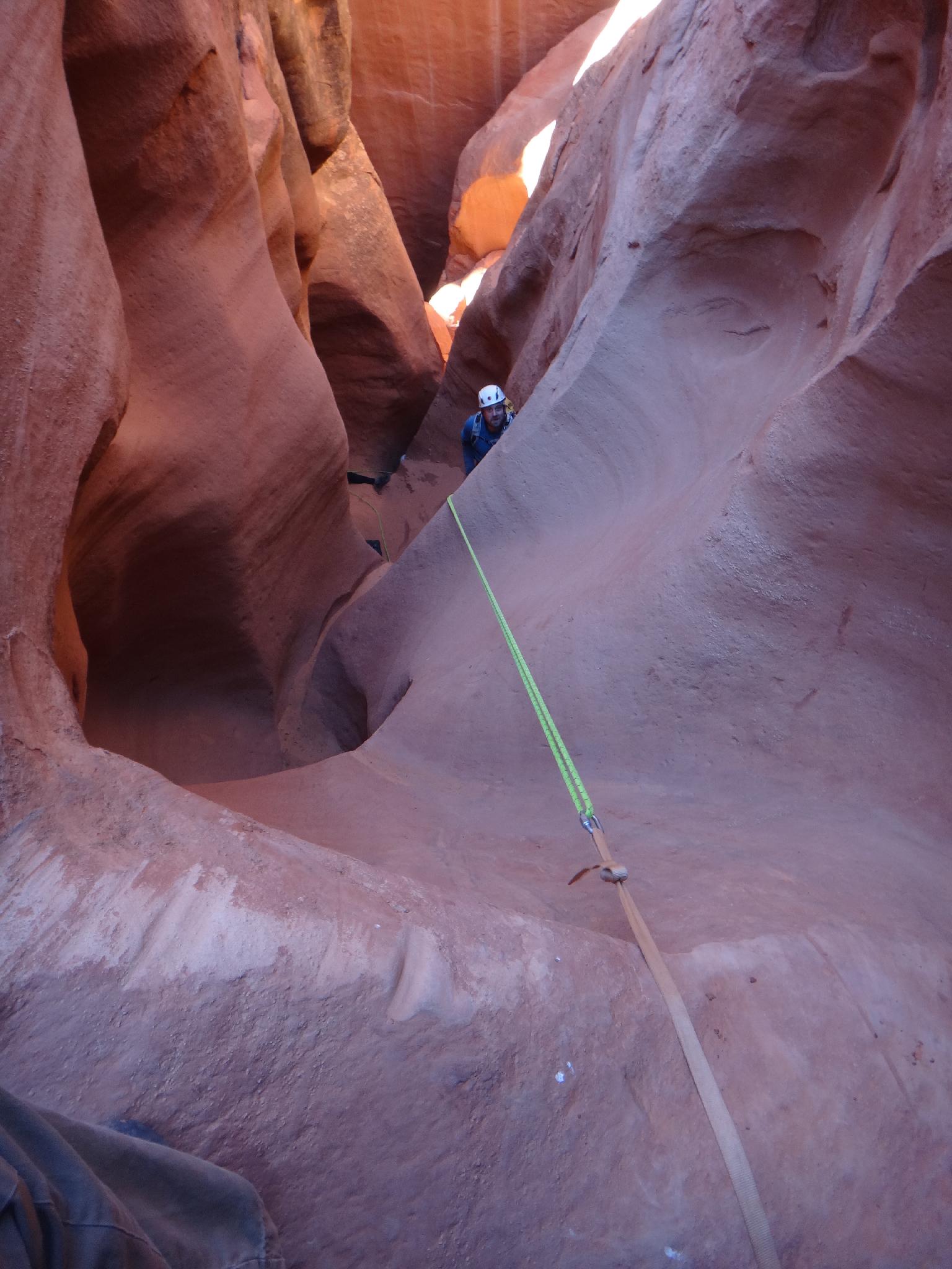
As soon as you descend off the dirt to the slickrock layer, you will come to a 15 m ( 50 ft. ) drop. Rappel this off a natural anchor. From here down, you will find several short drops that can be negotiated with partner assists, or short rappels. The canyon will open and close several times, with a couple of sections that may require climbing up and over a few feet to descend. None of the climbing is difficult if you look around for the best route. As you near the confluence with the Main Fork, you see the varnished wall of the Main Fork as you reach the final obstacle, a 10 m ( 33 ft. ) rappel. Inspect this anchor carefully. Once down, you may want to hike up the Middle Fork a ways. It is deep, dark, and beautiful. When finished, simply hike down canyon to the trailhead. The section just below the East and Middle Fork confluence is very nice, and photogenic in afternoon light.
West Fork (aka Left Fork)
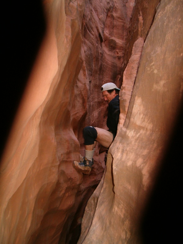
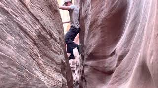
From the rim, contour down slick rock to the head of the left fork. Many options will work, but generally stay to the left. The fork starts with an 8 m ( 27 ft. ) drop with no obvious anchor. The usual anchor of choice is a wedged rock in a pothole back from the edge. Inspect this anchor carefully (which can be hard to do if the pothole is full). After this rappel, the canyon gets deeper and very interesting. Several drops in this section can be downclimbed, or rappelled off natural anchors. This fork is quite short, and you will reach the junction with the Middle Fork in no time. From the junction, head down canyon through an amazing deep, dark section of slot. You will have to climb over and under boulders in this section. It is narrow! A headlamp can be a good idea. Once you reach the junction with the East Fork, the canyon opens a bit, and it is an easy walk back to your car.
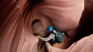
Middle Fork
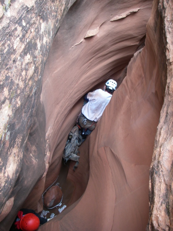
Middle fork actually starts with 2 small forks at the top. You want the left (east) fork (looking down canyon). A downclimb or two will lead you to the first drop, a 6 m ( 20 ft. ) low angle rappel. Once down this drop, you may choose to take off your harness. The rest of the canyon is narrow, and tends to wear out gear. Head down canyon, squeezing, climbing and enjoying as you go. About 1/2 way through, you will reach a 4 m ( 14 ft. ) drop into a (sometimes) pool. Use a natural anchor here to rappel. This is the final rappel in the canyon.
Just when you don't think it can get any narrower, it does! After the rappel is where (for me), the crux narrows lies. It involves a short section I have to stem over, then squeeze through. Shortly after this, the canyon begins to widen a bit. Right after a downclimb around a pothole the West Fork joins up. From the West Fork junction, head down canyon through an amazing deep, dark section of slot. You will have to climb over and under boulders in this section. It is narrow! A headlamp can be a good idea. Once the East Fork joins in, breath a sigh of relief, the rest of the canyon is straightforward and wide in comparison.
Photos
Videos
Leprechaun, Blarney, Shillelagh, and Hogwarts canyons
Leprechain Middle Fork

Leprechaun Canyon
Left Fork Leprechaun Canyon 2023
Maps

12S 540636E 4208003N
38°01'08"N 110°32'13"W
12S 541912E 4210034N
38°02'13"N 110°31'21"W
12S 541373E 4209636N
38°02'01"N 110°31'43"W
12S 542229E 4210021N
38°02'13"N 110°31'08"W