Ghost Rider Canyon | Virgin River Gorge

Canyoneering Ghost Rider Canyon - Virgin River Gorge Canyoneering Ghost Rider Canyon

Virgin River Gorge

Overview

Tue Sunny. High near 84, with temperatures falling to around 82 in the afternoon. South wind 6 to 25 mph, with gusts as high as 36 mph.
84° | 59°
Wed Sunny, with a high near 70. West southwest wind 13 to 22 mph, with gusts as high as 30 mph.
70° | 53°
Thu Sunny, with a high near 75.
75° | 49°
Fri Mostly sunny, with a high near 78.
78° | 54°
Sat A slight chance of rain showers after 11am. Mostly sunny, with a high near 77.
77° | 54°
RATING: 3A
MAPS: MOUNTAIN SHEEP SPRING, AZ
SEASON: Any, though summers can be hot.
RAPPELS: 3-4 to 24 m ( 79 ft. )
WATER: None
FLASHFLOOD: Moderate
Tue Sunny. High near 84, with temperatures falling to around 82 in the afternoon. South wind 6 to 25 mph, with gusts as high as 36 mph.
84° | 59°
Wed Sunny, with a high near 70. West southwest wind 13 to 22 mph, with gusts as high as 30 mph.
70° | 53°
Thu Sunny, with a high near 75.
75° | 49°
Fri Mostly sunny, with a high near 78.
78° | 54°
Sat A slight chance of rain showers after 11am. Mostly sunny, with a high near 77.
77° | 54°
Bottom of the canyon before the exit.

Ghost Rider makes for an excellent evening canyon or beginner friendly canyon. Though not touted as a destination canyon, I must say I enjoyed it immensely as a way to break up a long drive while passing through. Ghost Rider has a short approach with 3-4 rappels in relatively rapid succession, followed by a casual exit. A mile and an hour are all the canyon takes.

Ghost Rider is also an excellent choice for rounding out a Cherry Canyon day as well, as it is very nearby. As of 2018, all anchors were bolts and chains.

Joshua trees on the exit.

Getting There

Note: The road is generally pretty good. High clearance helps, but a carefully driven car should make it as well.

The trailhead is off the Cedar Pockets road in the Virgin River Gorge. This is exit 18 from I-15 about 17 miles west of St. George or 20 miles east of Mesquite NV. This is the same exit for the Virgin River Gorge Campground,

Reset your odometer on the north side of the freeway and head north of the dirt Cedar Pocket Road. There are a few primitive campsites next to the road a short distance from the freeway. 12S 250884E 4093502N / 36°57'17"N 113°47'52"W
1.6 miles - Cedar Pocket Wash Trailhead on the right. This is the exit point, and the recommended trailhead. 12S 250867E 4095450N / 36°58'20"N 113°47'55"W
1.8 miles - Ghost Rider Canyon on the right. Limited parking. 12S 250887E 4095635N / 36°58'26"N 113°47'55"W
Big rappel in Ghost Rider
Getting started in Ghost Rider

Route Description

Approach (5 minutes)
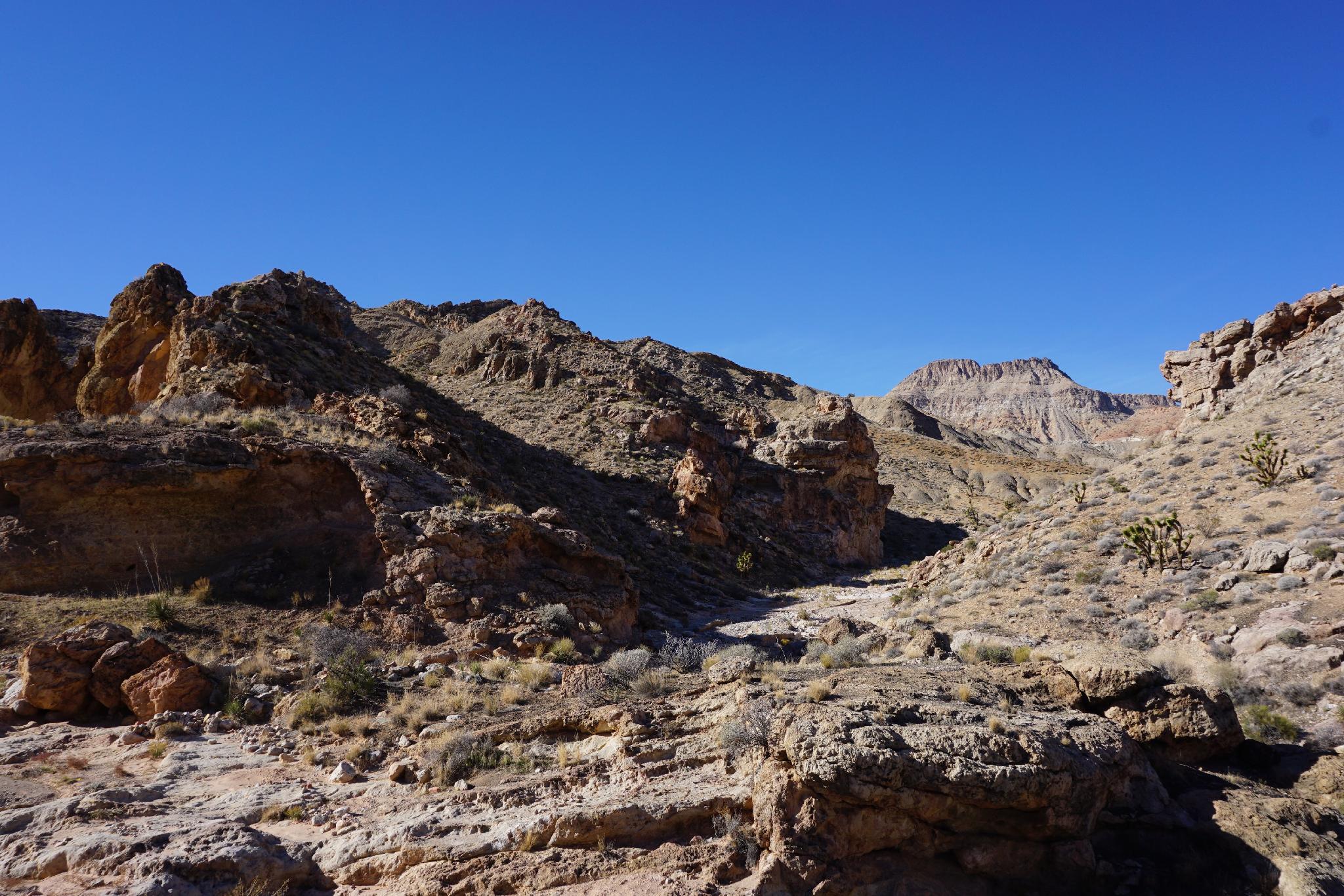
From the trailhead, follow the road a minute or so to the wash, then turn right and head down the wash. The wash is Ghost Rider Canyon.

Canyon
R1 - 2 m ( 7 ft. ) - This is a downclimb for most, but someone has installed a bolted anchor if needed.
R2 - 8 m ( 27 ft. ) - A few minutes down from R1, the canyon drops at the first "real" rappel.
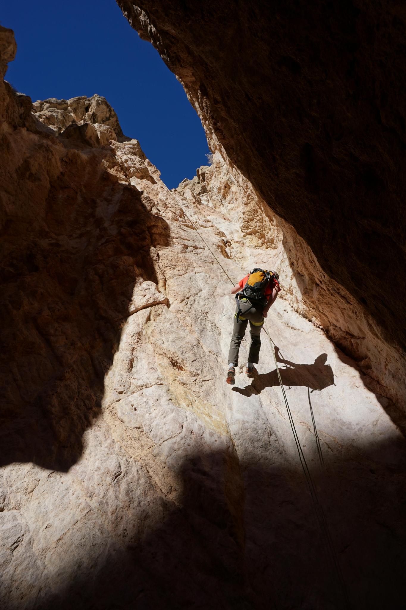
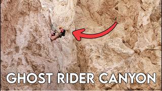
R3 - 24 m ( 79 ft. ) -The big rappel in the canyon, and most photogenic in my opinion.

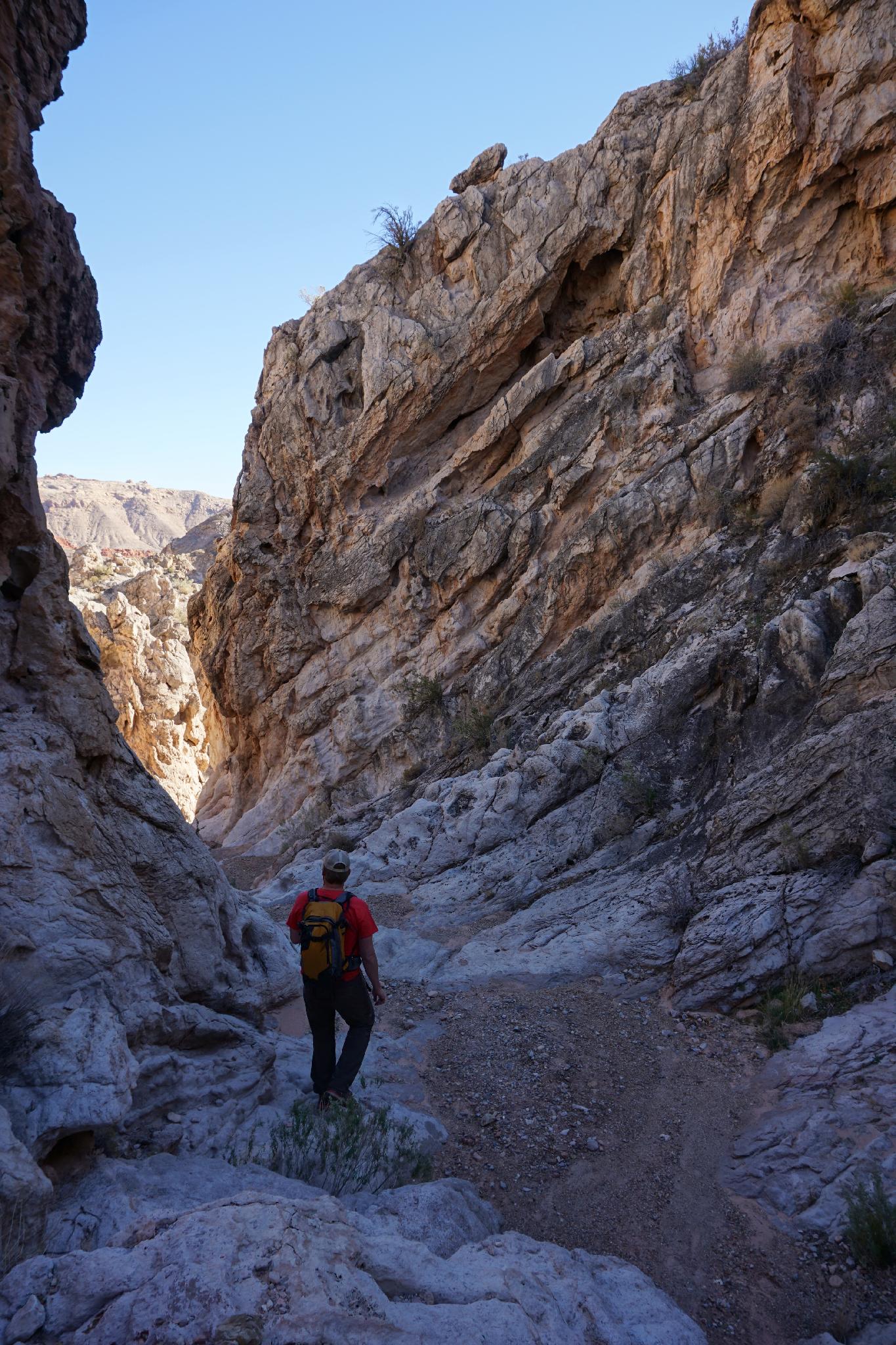
After R3, it is a short walk to R4.

R4 - 8 m ( 27 ft. ) - A final short rappel, then the canyon open and join a large wash.

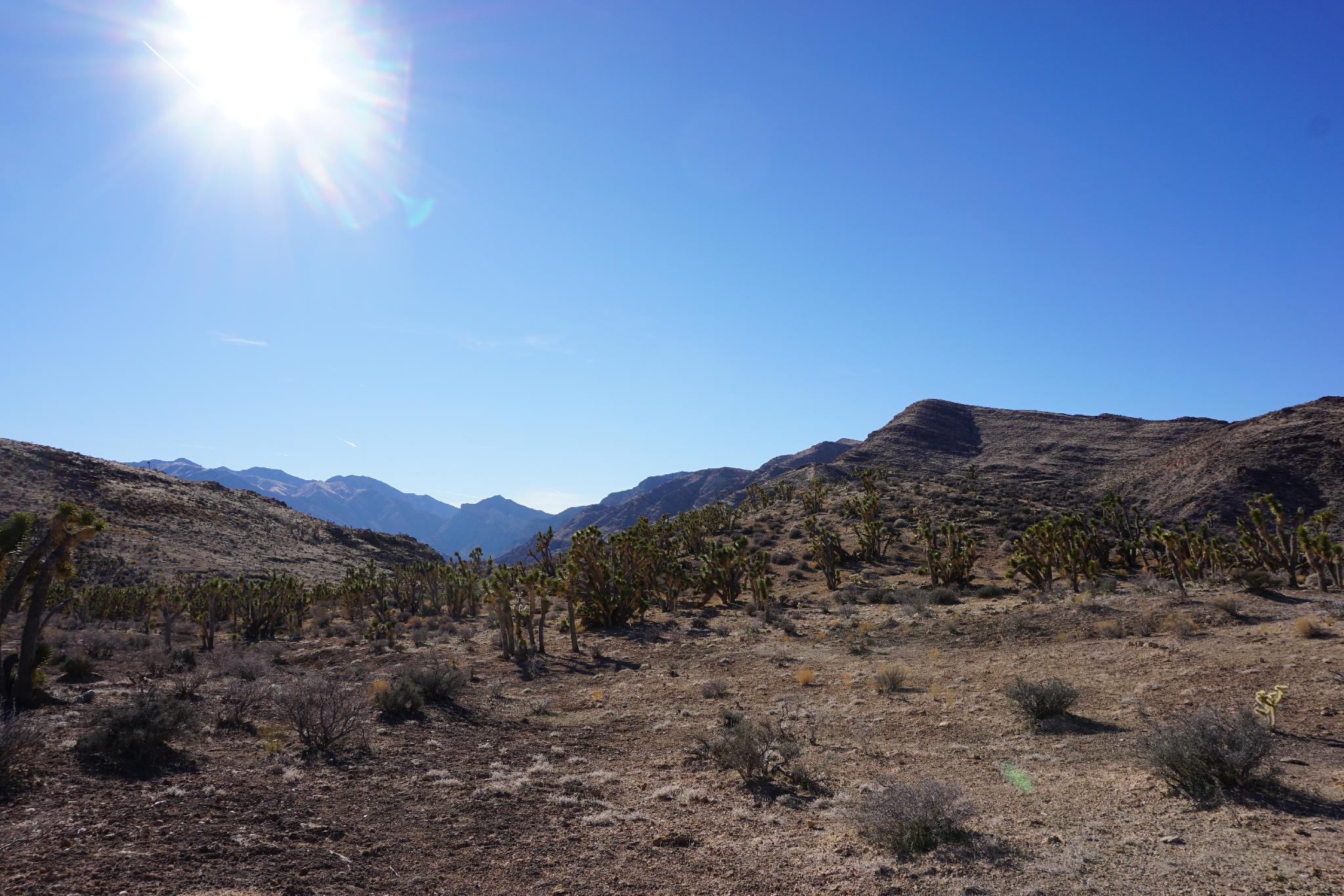
Exit - 15-20 minutes
Just before Ghost Rider joins the large wash, look for a social trail leaving on the right. This well worn social trail climbs to the ridge, then follows a side road back to the main road right near the trailhead.

Side Trip: The Cedar Pocket Narrows are about 5 minutes down from the exit, and a nice side trip. To visit, continue down the wash about 5 minutes. On your return, look for a small sign indicating the Cedar Pocket Narrows trail leaves on the left. This alternate return joins the standard exit about 3/4 of the way up the hillside.

Photos

Videos

Maps

Printable Maps:

Parking
12S 250914E 4095590N 36°58'25"N 113°47'53"W
Drop In
12S 250877E 4095636N 36°58'26"N 113°47'55"W
Rappel 1
12S 250968E 4095609N 36°58'25"N 113°47'51"W
Rappel 4
12S 251133E 4095598N 36°58'25"N 113°47'45"W
Exit
12S 251251E 4095645N 36°58'27"N 113°47'40"W
Main Trail
12S 251255E 4095572N 36°58'24"N 113°47'40"W

Comments