Buried Forest Concretions Trail | Price

Hiking Buried Forest Concretions Trail - Price Hiking Buried Forest Concretions Trail

Price

Overview

RATING: Easy Hike
MAPS: MOUNDS, UT

Sat

Sunny, with a high near 96. Northwest wind 6 to 10 mph.

96 | 60

Sun

Sunny, with a high near 98. West northwest wind 3 to 9 mph.

98 | 61

Mon

Sunny, with a high near 99.

99 | 64

Tue

Sunny, with a high near 98.

98 | 63

Wed

A slight chance of showers and thunderstorms after noon. Sunny, with a high near 95.

95 | 63

View Full Weather Details
SEASON: Any when roads are dry. Very hot in the summer. Fall, Winter, Spring preferred.
GEAR: Standard Hiking Gear
WATER: None.

Sat

Sunny, with a high near 96. Northwest wind 6 to 10 mph.

96 | 60

Sun

Sunny, with a high near 98. West northwest wind 3 to 9 mph.

98 | 61

Mon

Sunny, with a high near 99.

99 | 64

Tue

Sunny, with a high near 98.

98 | 63

Wed

A slight chance of showers and thunderstorms after noon. Sunny, with a high near 95.

95 | 63

View Full Weather Details
Close up of the concretions in the cliff band.

Close up of the concretions in the cliff band.

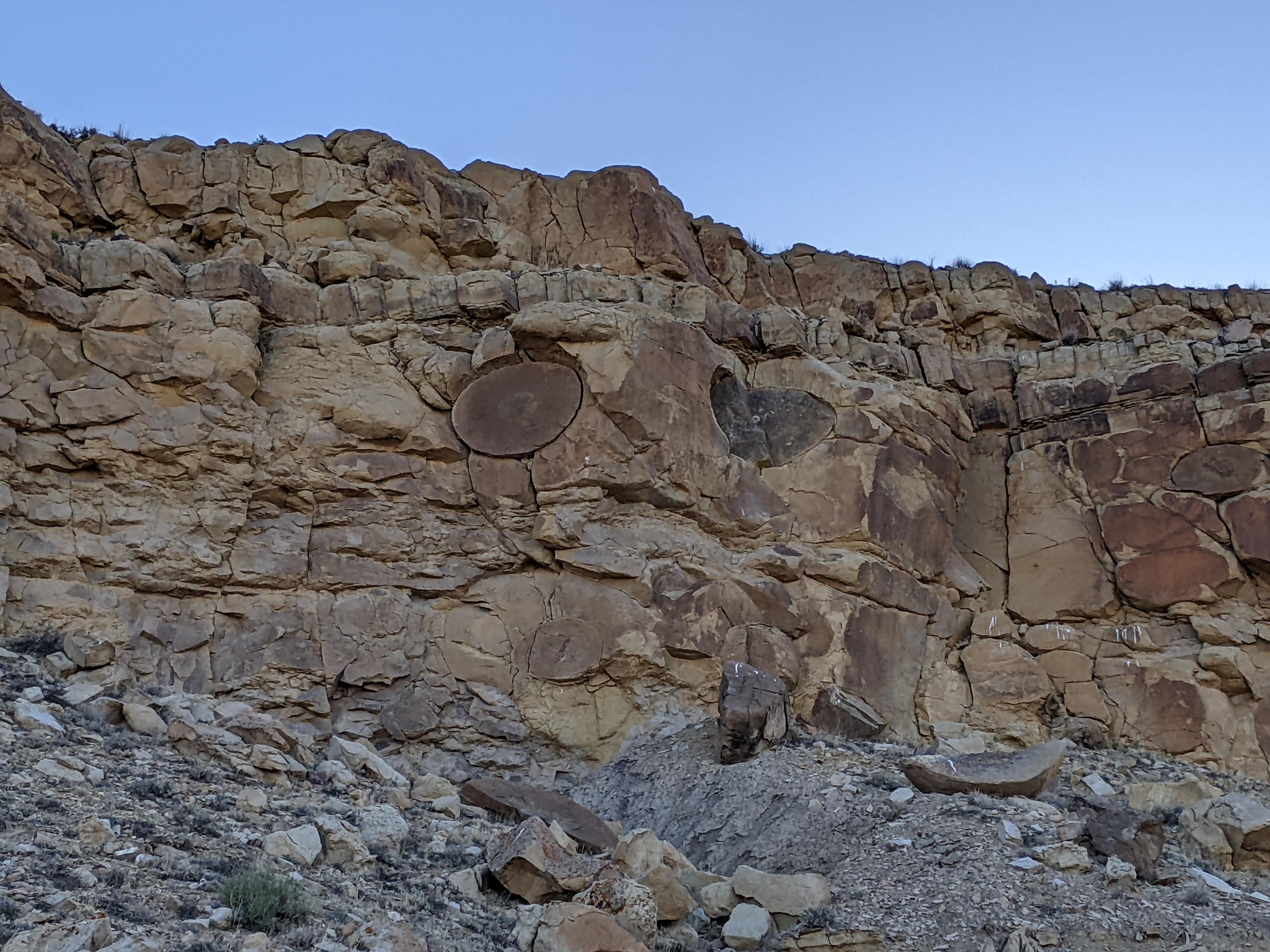
It is easy to see how the Buried Forest got its name! The cliff band, full of concretions, doesn’t require much imagination to see the split balls and features in the cliff as old tree stumps.

The concretions, though they may look like a tree stump, are actually balls created by the cementation of minerals, usually around an organic center. Concretions are actually fairly common, and found in many places in the world.

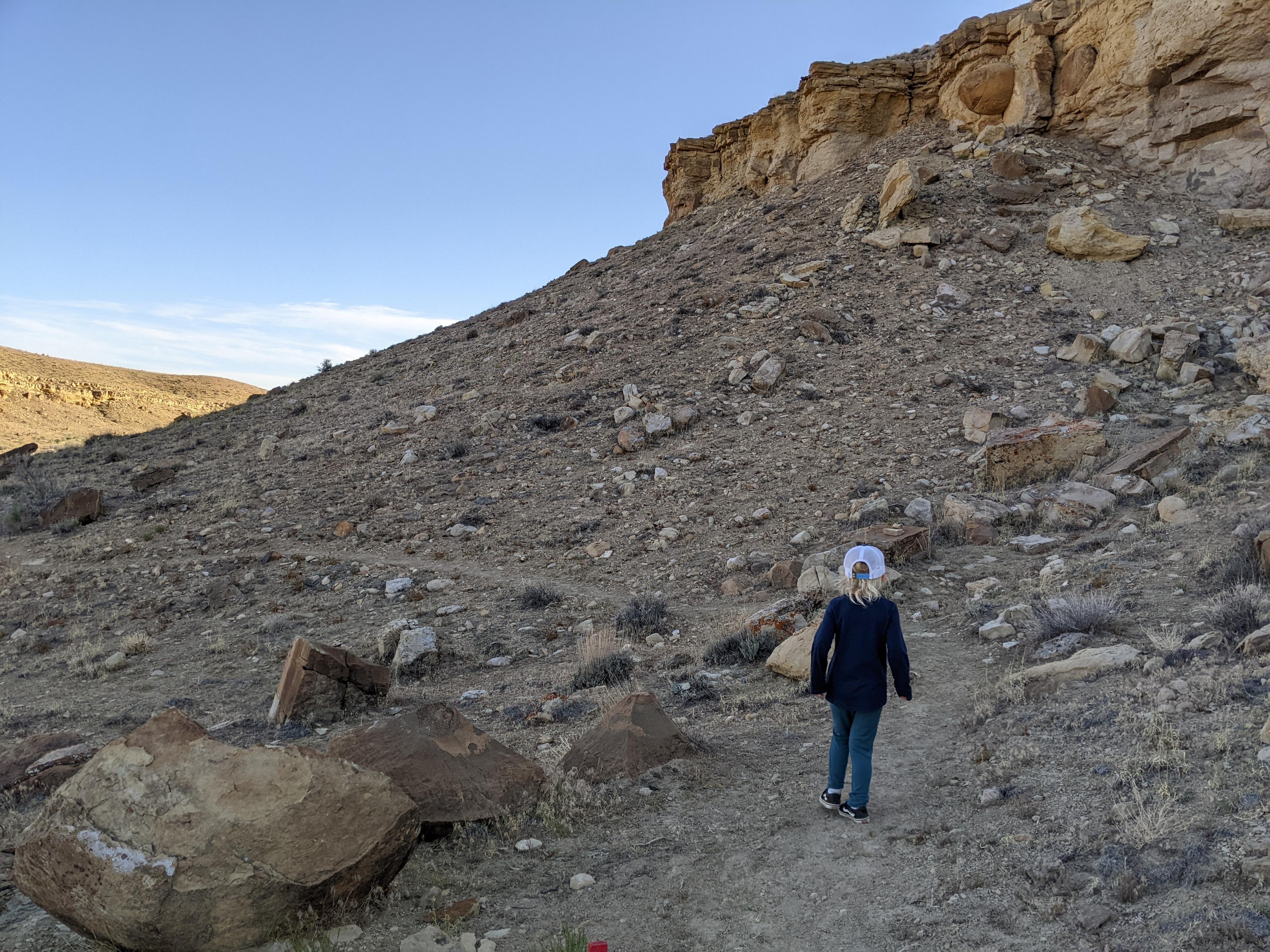
The hike, about 1.8 miles round trip, is fairly easy with little elevation change. My 5-year-old enjoyed the hike immensely, spending most of the hike loudly postulating that the concretions were really dinosaur eggs.

Ruby enjoying the easy hiking along the trail. A great family outing.

Ruby enjoying the easy hiking along the trail. A great family outing.

Getting There

Reaching the traihead starts from highway 6 that runs between Price and I-70/Green River. From Price, head south toward I-70/Green River for about 17 miles to mile post 258.7 where a road leaves the highway on the south (right) side.

  • MP 258.7 - Turn off highway 6 on the right (south) side of the road and reset your odometer. ( 12S 540036E 4373216N / 39°30'28"N 110°32'03"W )
  • Almost immediately go left when the road splits. Stay on the main dirt road from here. ( 12S 540007E 4373187N / 39°30'27"N 110°32'05"W )
  • 2.0 miles - Jct - Go left. ( 12S 540378E 4370187N / 39°28'49"N 110°31'50"W )
  • 2.75 miles - Jct - Go right. ( 12S 539798E 4369243N / 39°28'19"N 110°32'14"W )
  • 3.1 miles - Trailhead ( 12S 539325E 4368902N / 39°28'08"N 110°32'34"W )
Ruby heading to the concretions.

Ruby heading to the concretions.

Route

From the trailhead, the trail heads north, then west on a single track along the rim of a small cliff. Soon, the trail turns south and descends off the top of the cliff band. This is the steepest part of the hike, but very manageable for even a 5-year-old. As the trail descends, you will see your first concretions both in the cliff band, and the ones that have eroded out of the cliff and rolled down the hill.

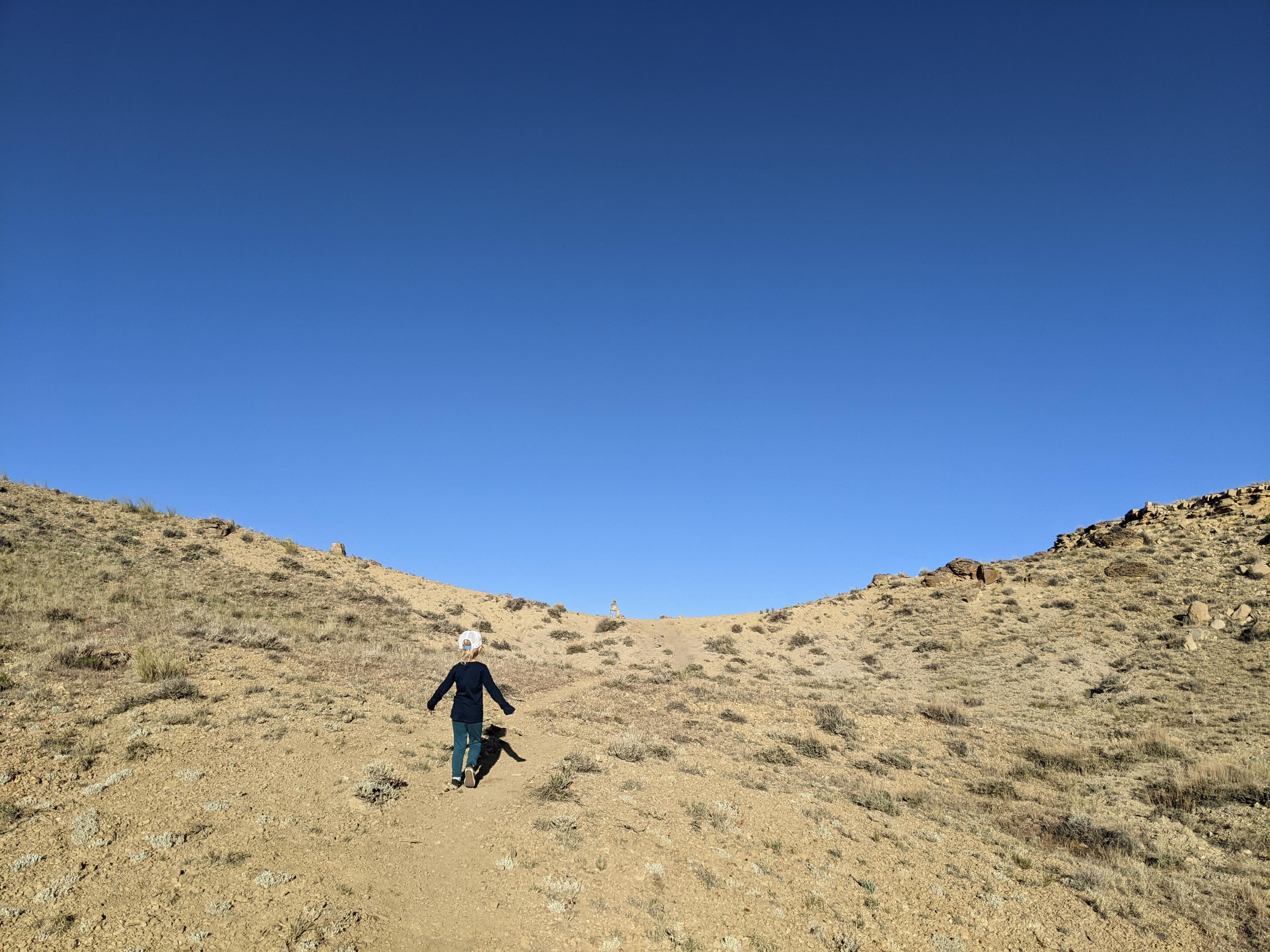
The trail continues, crossing a dry wash, then climbing a small hill to a saddle. From the saddle, the trail descends. The cliff to the right (north) has many large concretions dotting its face. When the trail splits, go either way for a short loop. There is an informational sign in the middle of the loop with details on the site.

Return the same way when you came.


Maps

Route / 1.89 miles / Elevation Range 5,385 - 5,527 ft.
Printable Maps:

Buried Forest Concreations Trail

12S 539325E 4368898N

39°28'08"N 110°32'34"W

First Concretions

12S 539099E 4369123N

39°28'15"N 110°32'44"W

Loop

12S 538519E 4369058N

39°28'13"N 110°33'08"W

End of Trail

12S 538323E 4369240N

39°28'19"N 110°33'16"W

Comments

Want to make a comment? Login and let yourself be heard.