 Roadside Attraction
Arch Canyon Ruin
Roadside Attraction
Arch Canyon Ruin
Cedar Mesa
Overview
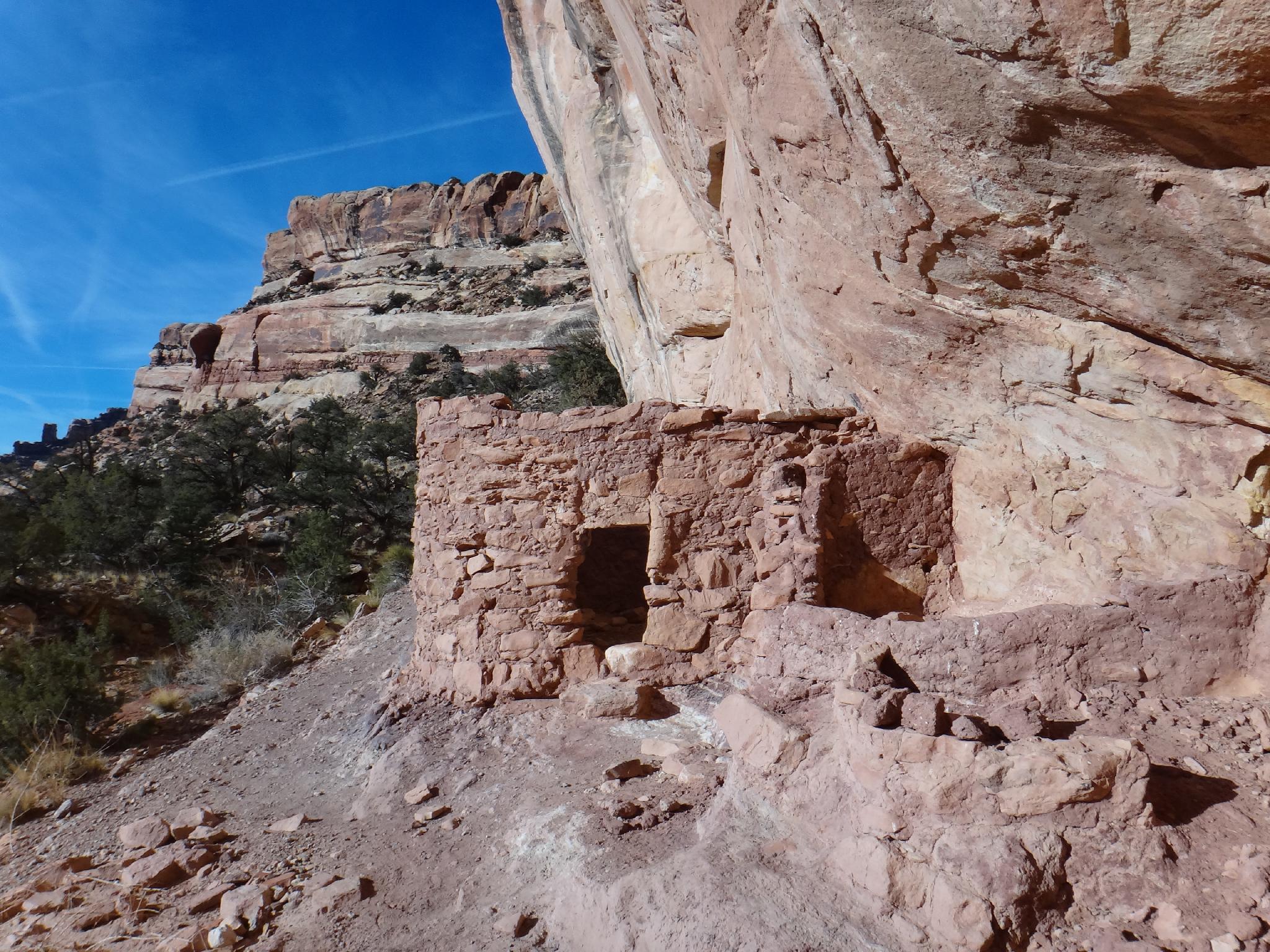
Arch Canyon Ruin is a family friendly roadside attraction. Most vehicles can drive within 100 feet of the ruin, others may need to walk the last 1/4 mile. The ruin itself is somewhat vandalized, but still an interesting visit. The views in all directions for the ruin are magnificent. This is a good stop if in the area, or passing through.
On my first visit, I stopped at the first ruins. Good, but not great. After, I had several people e-mail me that better ruins were to be seen, just up the canyon. Alas, I finally got back to check them out. From the Fenced Ruins, there are several other ruins within a short hike that are very good and well worth seeing. Some are calling these "Beaver Pond Ruins", but the locals refer to all three sets on the map simply as the Arch Canyon ruins. A great place to spend an afternoon.
Good camping at the mouth of Arch Canyon makes this a great place to spend a weekend. If in the area, Hotel Rock and the Walnut Knob Panel are great to visit as well.
Getting There
Begin at mile post 107 on highway 95. This is 107 miles south east of Hanksville, or about 18 miles south west of Blanding. To reach the area from Blanding, travel south out of Blanding about 3.5 miles to the junction with highway 95. Go right onto 95 about 14 miles to mile post 107.
Route Description
Rock art and historic sites are fragile, non-renewable cultural resources that, once damaged, can never be replaced. To ensure they are protected, please:
- Avoid Touching the Petroglyphs: Look and observe, BUT DO NOT TOUCH!
- Stay on the Trails: Stay on the most used trails when visiting sites, and don't create new trails or trample vegetation.
- Photography and Sketching is Allowed: Do not introduce any foreign substance to enhance the carved and pecked images for photographic or drawing purposes. Altering, defacing, or damaging the petroglyphs is against the law -- even if the damage is unintentional.
- Pets: Keep pets on a leash and clean up after them.
- Artifacts: If you happen to come across sherds (broken pottery) or lithics (flakes of stone tools), leave them where you see them. Once they are moved or removed, a piece of the past is forever lost.
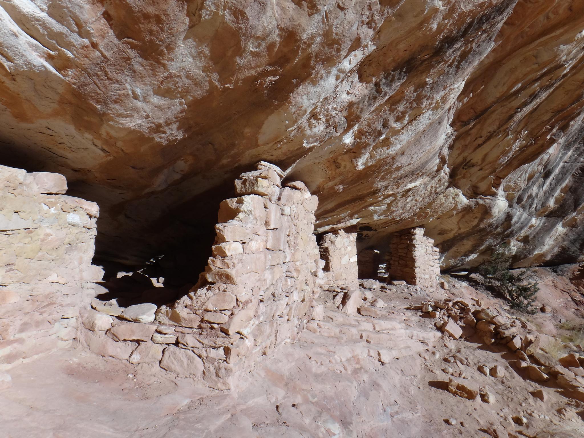
Above the fenced ruins are two other ruins and panels just up the canyon. The easiest way to visit them is to hug the bank and walk upstream from the fenced ruins, escaping out to the right onto slickrock slopes as soon as you can.
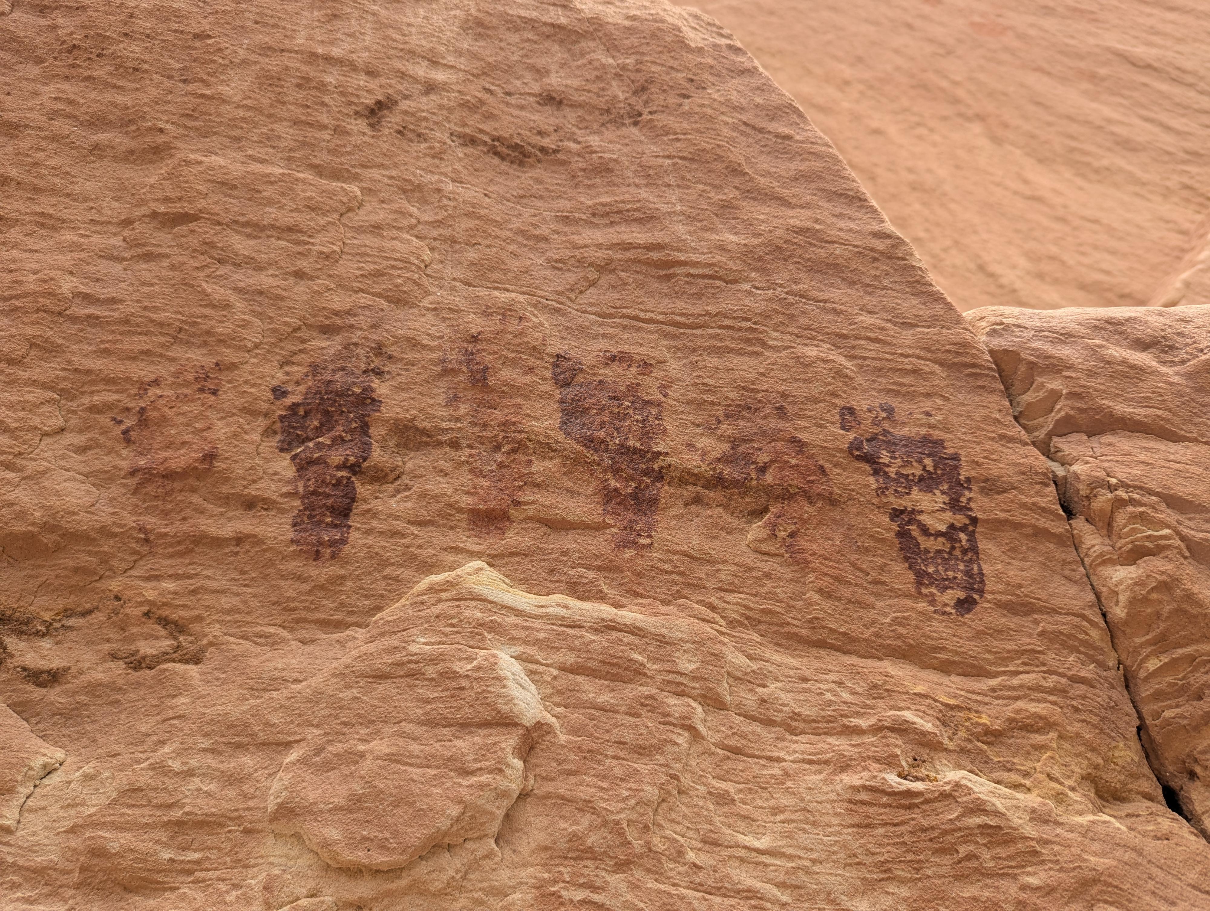
This used to be quite the thrash, but as of 2026, the social trail is getting fairly well defined. It is still a bit of a thrash, but not terrible, and very short-lived. The first set of ruins is obvious and has a great panel. I think the children's footprints are particularly striking. For the next set, follow the social trail northwest along the cliff to the somewhat hidden ruins.
Still have more energy? Go up the 4x4 track 10-15 minutes to the second place the road makes a left-hand bend. There are ruins here on the right a short distance off the road. Follow the social trail.
Photos
Maps

12S 617342E 4156322N
37°32'47"N 109°40'18"W
12S 617206E 4156446N
37°32'51"N 109°40'23"W
12S 617122E 4156572N
37°32'55"N 109°40'27"W
12S 616215E 4156800N
37°33'03"N 109°41'04"W