 Hiking
Cave Spring
Hiking
Cave Spring
Needles District
Overview
Cave Spring is a short hike with a LOT going on! The trail, at one of the traditional water sources in the area, visits a cowboy camp, Native American rock art, and climbs a ladder to make a loop around the site.
The site was much more fascinating than I expected.
From the NPS informational sign:
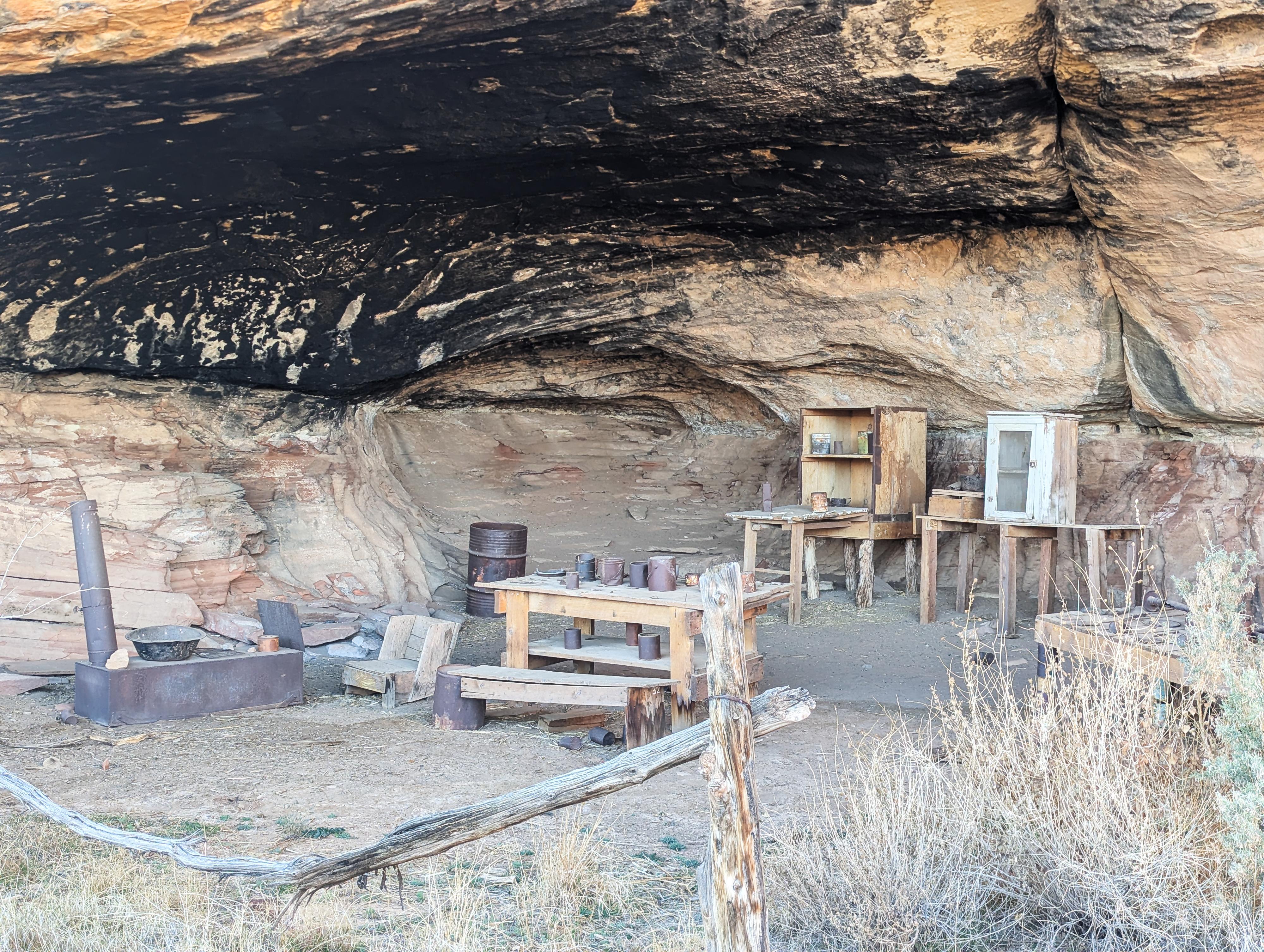
This short trail passes Cave Spring, one of the area's few year-round water sources. An excellent natural campsite, this location contains evidence of almost 1,000 years of human use. You can see remnants of a cowboy camp in the first alcove, which served as an open-air bunkhouse. Cowboys lived in isolated camps like these from the 1890s until 1975, when cattle ranching was discontinued in Canyonlands.
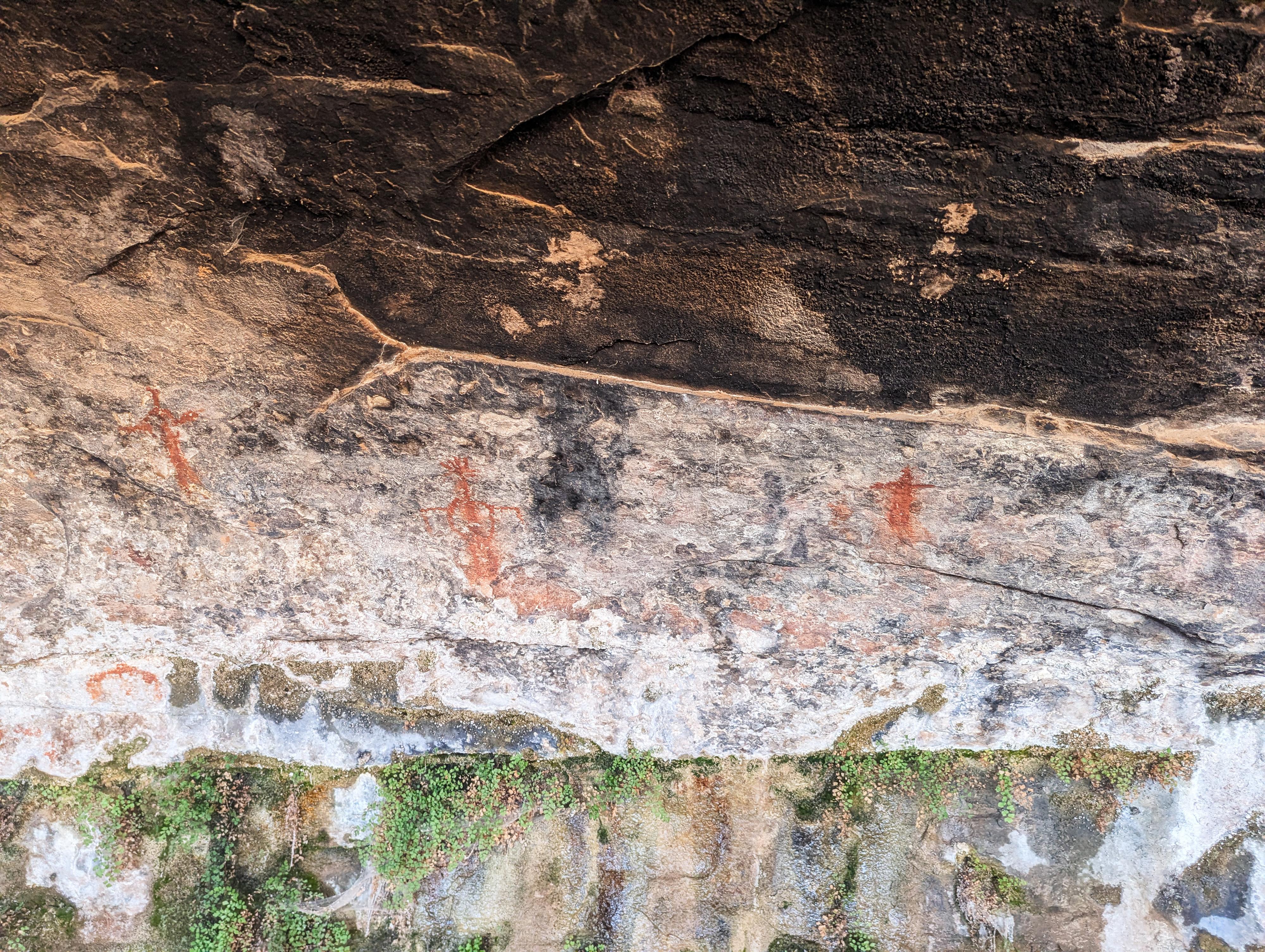
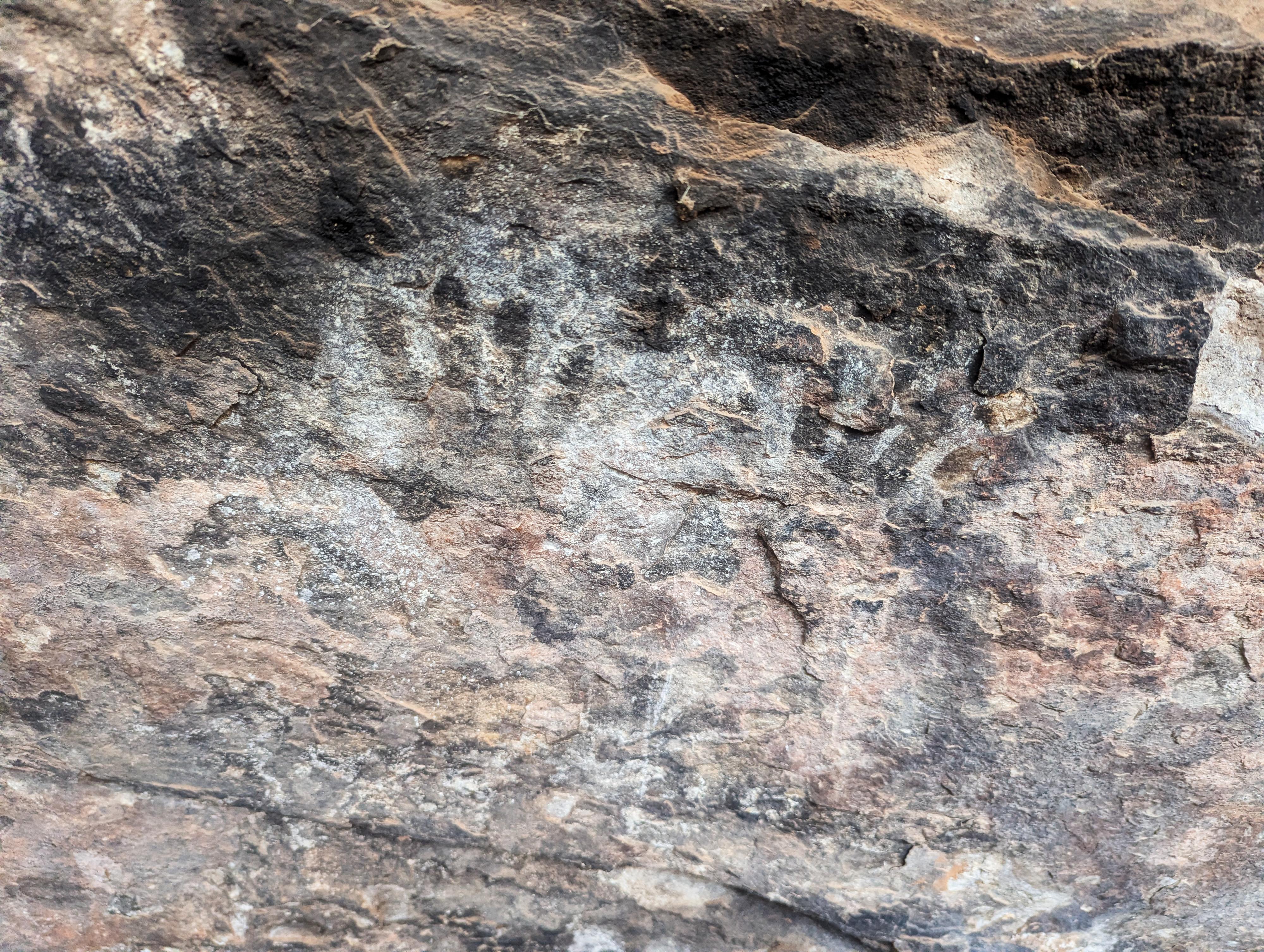
Beyond the cowboy camp, there is evidence of earlier human use, including rock markings, grinding slicks, and a smoke-blackened ceiling. Help protect the human history of this area. Do not enter the cowboy camp, touch the rock markings, or disturb the sacred spring.
Getting There
The two closest towns to the Needles District are Monticello and Moab. Monticello is closer, but Moab is larger and has more services.
From Moab to the Visitor Center - Total Drive Time: Approx. 1 hour 15 minutes and ~75 miles from Moab
- From Moab, head South on US-191 S (Main Street).
- Stay on US-191 S for 39.6 miles. Keep an eye out for the junction with UT-211.
- Turn Right onto UT-211 W. This is the scenic road that leads directly into the Canyonlands area.
- Follow UT-211 W for 34.4 miles.
- As you approach the park entrance, follow the signs and turn Right into the Needles Visitor Center parking area.
From Monticello to the Visitor Center - Total Drive Time: Approx. 1 hour and ~50 miles
- Head North on US-191 N (Main Street) toward Moab.
- Follow US-191 N for 14.4 miles.
- Turn Left onto UT-211 W. You’ll see signs for Canyonlands National Park.
- Stay on UT-211 W for 34.4 miles.
- As you approach the park entrance, follow the signs and turn Right into the Needles Visitor Center parking area.
From the Visitor Center
- Head into the park on the main road.
- Drive for 0.7 miles, then turn Left onto Wooden Shoe Loop (County Rd 1301).
- Follow the road for about 0.7 miles, then bear Left at the fork (following signs for Cave Spring).
- Continue 1.05 miles to the end of the road and The Cave Spring Trailhead parking lot.
Route Description
Rock art and historic sites are fragile, non-renewable cultural resources that, once damaged, can never be replaced. To ensure they are protected, please:
- Avoid Touching the Petroglyphs: Look and observe, BUT DO NOT TOUCH!
- Stay on the Trails: Stay on the most used trails when visiting sites, and don't create new trails or trample vegetation.
- Photography and Sketching is Allowed: Do not introduce any foreign substance to enhance the carved and pecked images for photographic or drawing purposes. Altering, defacing, or damaging the petroglyphs is against the law -- even if the damage is unintentional.
- Pets: Keep pets on a leash and clean up after them.
- Artifacts: If you happen to come across sherds (broken pottery) or lithics (flakes of stone tools), leave them where you see them. Once they are moved or removed, a piece of the past is forever lost.
From the trailhead, the path branches almost immediately. I recommend heading left (clockwise). This allows you to explore the historic sites first and—more importantly—climb up the ladders rather than down them, which most hikers find a bit easier and safer.
- The Cowboy Camp: Shortly after starting, you’ll encounter a well-preserved historic cowboy camp tucked under a massive rock alcove. Look for old equipment and "Class B" relics from the area's ranching history.
- Just past the camp is an old storage bin.
- Cave Spring & Pictographs: Continuing past an old storage bin, you’ll reach Cave Spring. This shaded oasis stays refreshingly cool even in the summer heat. Take a moment to look at the rock walls here; you’ll find ancient pictographs and handprints left by the ancestral Puebloans.
- The Ladders: Just past the spring, you’ll reach the first (and tallest) ladder. Once you crest the top, a second, much shorter ladder follows.
- The Slickrock Plateau: Now on the "flats" above the alcove, the trail opens up to expansive, 360-degree views. You can see the La Sal Mountains to the north and the iconic "needles" formations in the distance.
The trail ambles across the open slickrock (follow the rock cairns!) before descending gently back to the parking lot.
Maps

12S 609371E 4223994N
38°09'26"N 109°45'06"W