 Hiking
Wolfman Panel
Hiking
Wolfman Panel
Cedar Mesa
Overview
Wolfman Panel is a unique petroglyph panel in Butler Wash, about a mile from the highway. The panel is unique and well-defined in the dark sandstone patina, with several other figures near the main panel. I would say it is one of the iconic and more often visited sites in the area.
If you can overlook the bullet holes, the panel is well worth visiting if you are in the area. There are some ruins just upstream and downstream from the panel in Butler Wash as well and are fairly easy to visit at the same time. All-in-all, this is an outing with easy access and a lot of bang for your time!
Getting There
Leave Bluff heading west toward Mexican Hat on US191, which becomes US163 shortly.
Route Description
Rock art and historic sites are fragile, non-renewable cultural resources that, once damaged, can never be replaced. To ensure they are protected, please:
- Avoid Touching the Petroglyphs: Look and observe, BUT DO NOT TOUCH!
- Stay on the Trails: Stay on the most used trails when visiting sites, and don't create new trails or trample vegetation.
- Photography and Sketching is Allowed: Do not introduce any foreign substance to enhance the carved and pecked images for photographic or drawing purposes. Altering, defacing, or damaging the petroglyphs is against the law -- even if the damage is unintentional.
- Pets: Keep pets on a leash and clean up after them.
- Artifacts: If you happen to come across sherds (broken pottery) or lithics (flakes of stone tools), leave them where you see them. Once they are moved or removed, a piece of the past is forever lost.
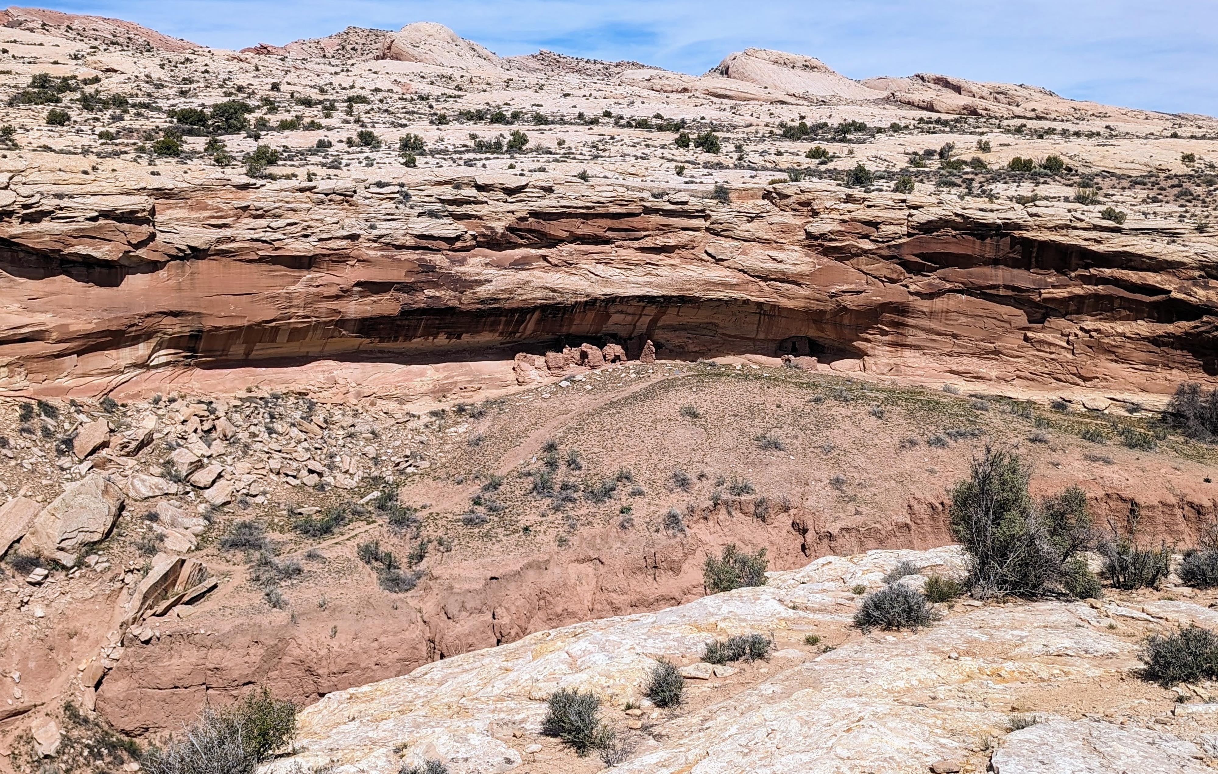
Follow the old road and occasional cairns across the slickrock, heading west, slightly southwest. As you near the rim, it is worth taking a minute to walk north to the edge and look down. From here, you can see one of the ruins from above.
The cairns lead to a slick rock ramp that has been improved and angles down into Butler Wash. The ramp has one boulder to climb over, but is not particularly difficult. At the bottom of the ramp, a panel is on the left. Continue on the social trail another 2 minutes down canyon to the main Wolfman Panel, also on the left (east) side of Butler Wash.
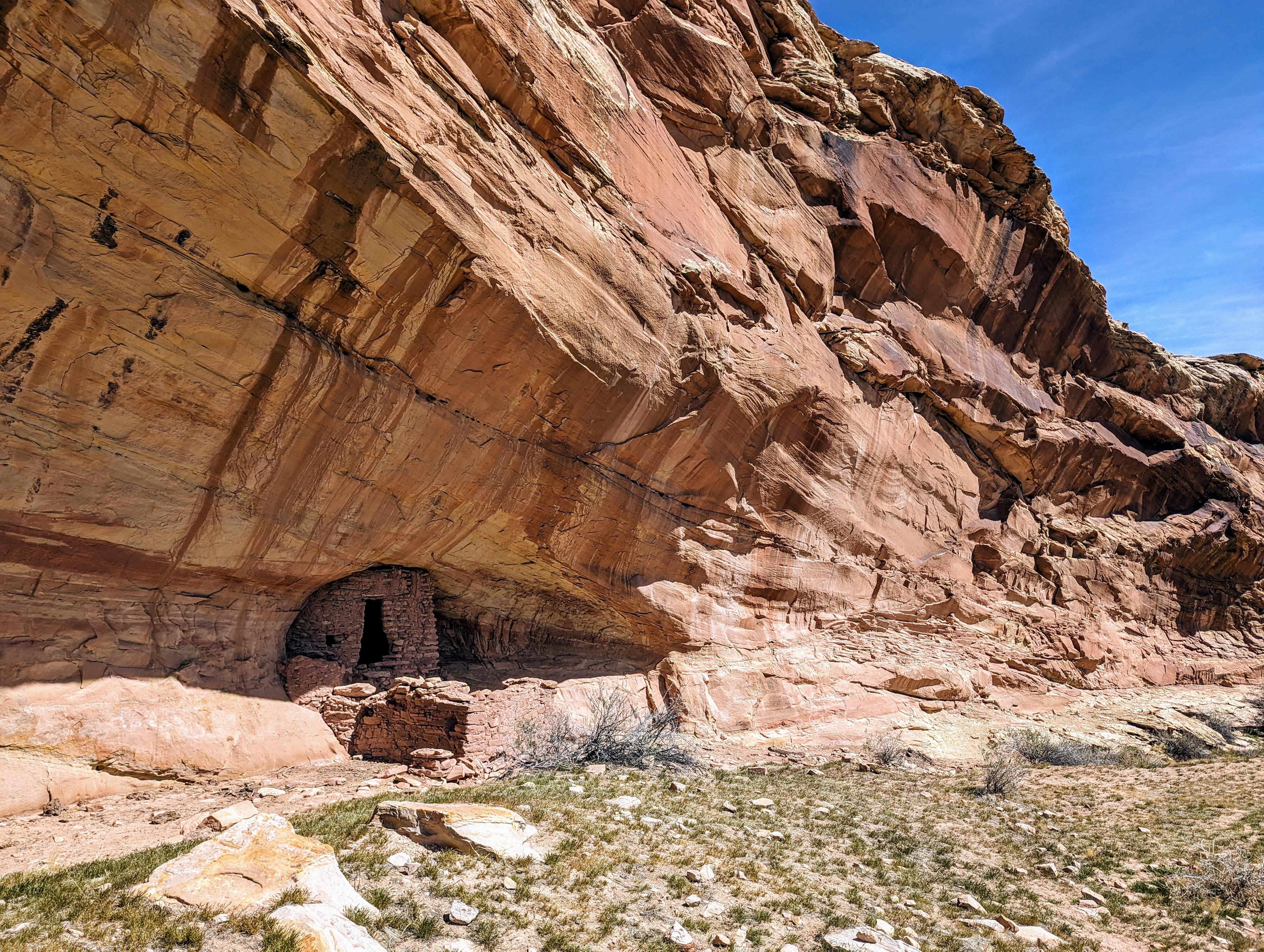
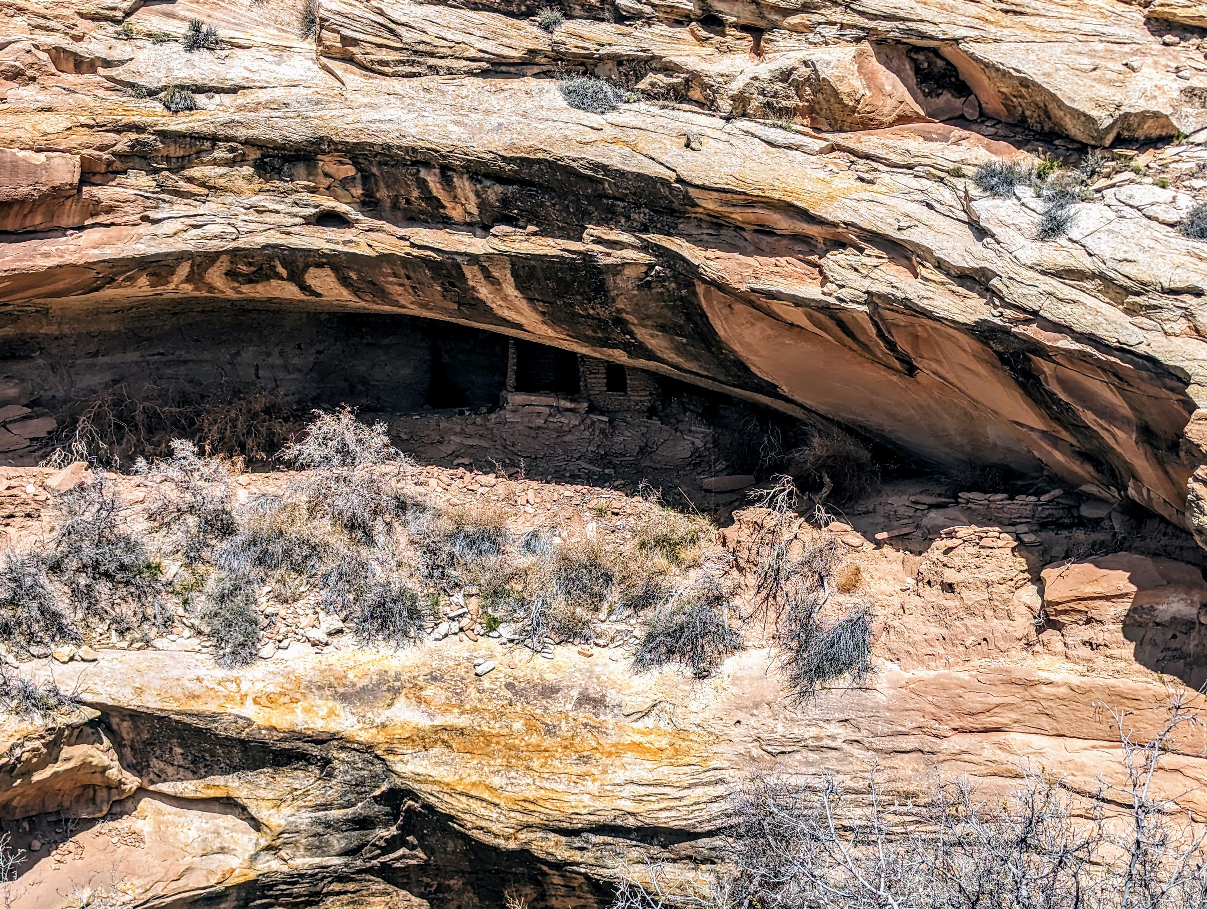
Upstream Ruin
From where the trail reaches the first panel, follow the well-worn social trail north as it goes up Butler Wash on the sandy bench above the bottom of the wash proper. The trail descends steeply to Butler Wash, crosses it, then climbs steeply to the ruin. The ruin on the right, in particular, is really neat to see. Return back the same way.
Downstream Ruin
At the first panel, a deep gully goes down to Butler Wash. You will want to follow the gully down, cross Butler Wash, and climb a steep dirt cow/human trail on the other side. The climb out is almost directly opposite from where you drop in. Before going down the gully, it is worth taking a minute to walk west on the bank to see where the trail climbs back out of Butler Wash. A word of warning, there is a little bush waking in the bottom as you cross Butler Wash, but only a minute or two.
Once up on the west side of Butler Wash, continue west up on the slickrock just high enough to traverse south and avoid the deep gully. The ruin is just around the next corner. The views of the ruin are good from the high bank you are on. To actually visit the ruin will require steep dirt and is not recommended.
Photos
Maps

12S 620304E 4126425N
37°16'36"N 109°38'35"W
12S 620448E 4126387N
37°16'35"N 109°38'29"W
12S 620018E 4126376N
37°16'34"N 109°38'46"W
12S 620025E 4126198N
37°16'29"N 109°38'46"W
12S 619994E 4126496N
37°16'38"N 109°38'47"W
12S 619970E 4126202N
37°16'29"N 109°38'49"W
12S 619880E 4126161N
37°16'28"N 109°38'52"W