 Hiking
The Box (Pine Creek)
Hiking
The Box (Pine Creek)
Escalante
Overview
The Box in Escalante is the name of the canyon Pine Creek descends through on its way to join the Escalante River and, in my opinion, one of the best short backpacks in the area. Unlike many Escalante hikes, this one descends from high forest to the desert that Grand Staircase Escalante National Monument is famous for. The hike follows Pine Creek for its length, making it suitable in warmer temps when the drier regions of Escalante would be too hot to hike.
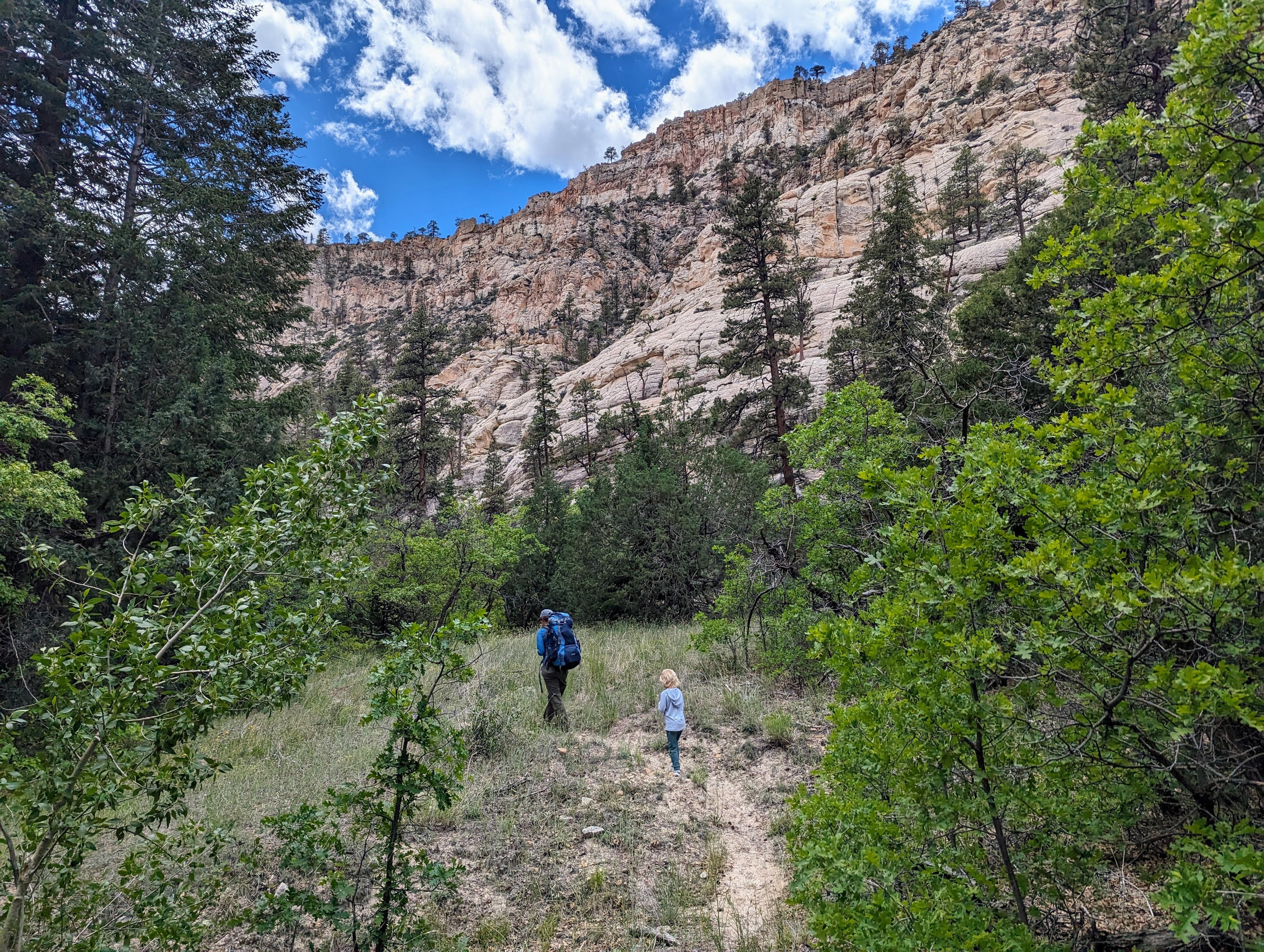
The 10-ish mile through hike is very do-able in a day (5-7 hours for most), but with scenery this good, I recommend a one night backpack. We did the trip as an overnight with our 6-year-old, and she loved it! She thought the scenery was good, the stream really fun to explore, and the two mostly downhill 5 mile days suited her well. I am not generally one who enjoys backpacking, but thought the leisurely pace was nice in The Box. Sunrise and sunset are spectacular, and the camping spot options excellent.
I had heard that hiking The Box required 50 stream crossings and to plan to get your feet wet. I had dismissed this as hyperbole. Well, by our count, there are 55 stream crossings if you count stepping over Deep Creek. Though Diane put in a pretty valiant effort, even she had wet feet by the end of each day. Be prepared to get your feet wet. For our daughter, I simply lifted her over the stream to keep her feet dry, and over, and over, and over. In spring runoff the flow might be a problem, but at about 3.5 CFS, most of our crossings were ankle deep. The deepest was about knee-deep due to a misstep. You can check current flow on the USGS Site: https://waterdata.usgs.gov/monitoring-location/09337000/#parameterCode=00060&period=P7D
Getting There
Lower Box Trailhead
From UT-12 that runs through the town of Escalante, turn north on 300 East. Follow 300 East 0.6 miles to a T-Junction. Go right here, heading east, then the road curves and heads north. Follow this road 6.8 miles to where the Lower Box Trailhead is signed on the right side of the road. The trailhead has a large circular parking area, but no pit toilet.
Upper Box Trailhead
From the Lower Box Trailhead, reset your odometer, and continue heading north on the FR-153. The road heads north, then climbs up into the mountains. At 6.2 miles, a major junction is reached. Go right here, toward Hell's Bridge. There are a few side roads along this section, but stay on the main graded road. At 10.5 miles, the Upper Box Trailhead is on the right. In 2023, this was marked by a sign stating "Upper Box Access". Parking is on the shoulder wherever you can find a suitable wide spot.
Route Description
Upper Trailhead To Deep Creek (4.6-ish miles)
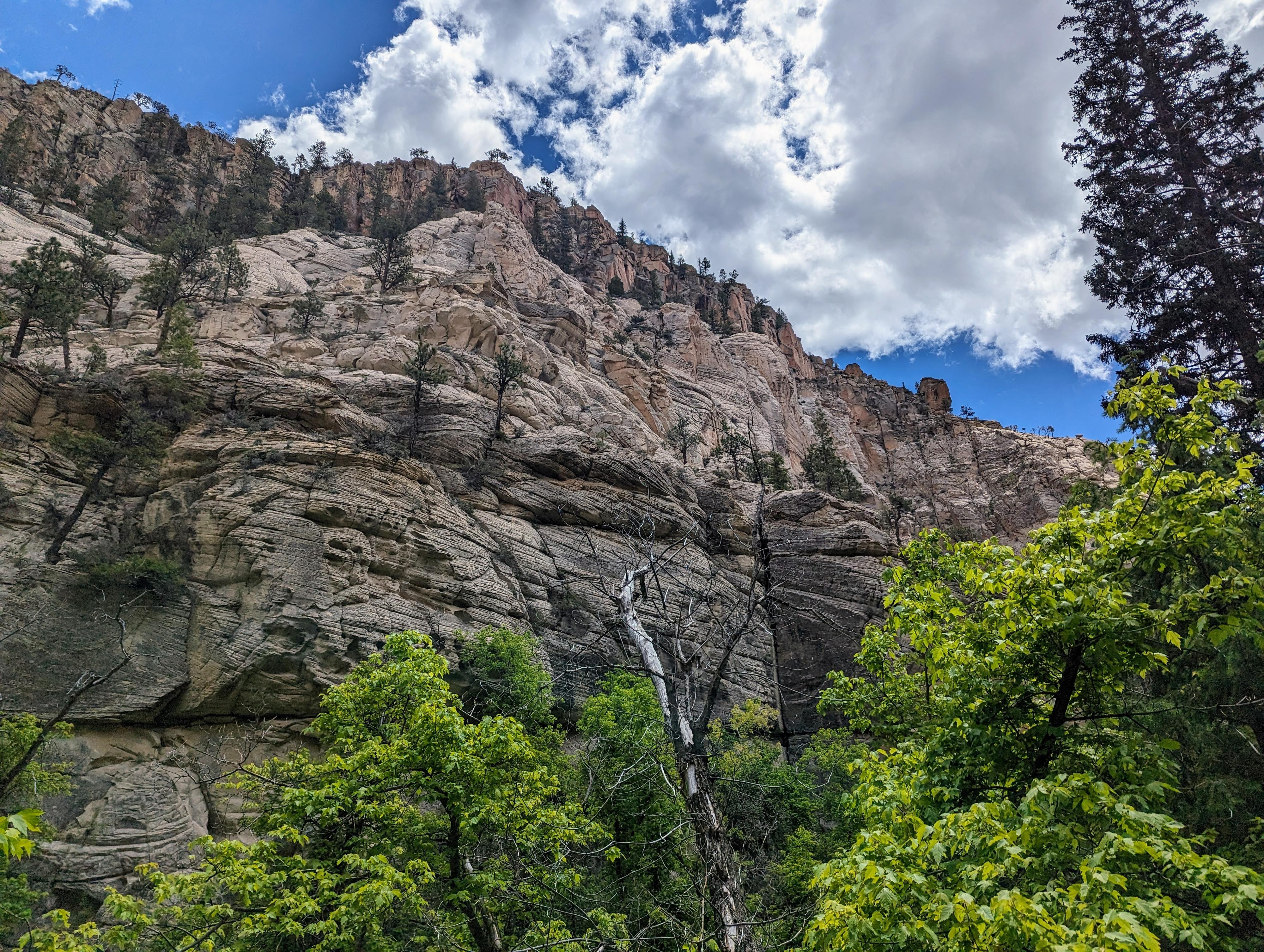
From the trailhead, follow the somewhat faint trail a short distance down to Pine Creek. Once at the creek, head down canyon on the right, west side. An informational sign and register are soon reached just a few minutes from the road, and a log fence to keep cattle out a few minutes past (0.3 miles from the road). Route finding is very straightforward, follow the trail down along Pine Creek! In this upper section, the trail crosses Pine Creek constantly. The trail does meander up above the river in places for easier passage, but again, should be easy to find and follow and usually quickly drops back down to the river.
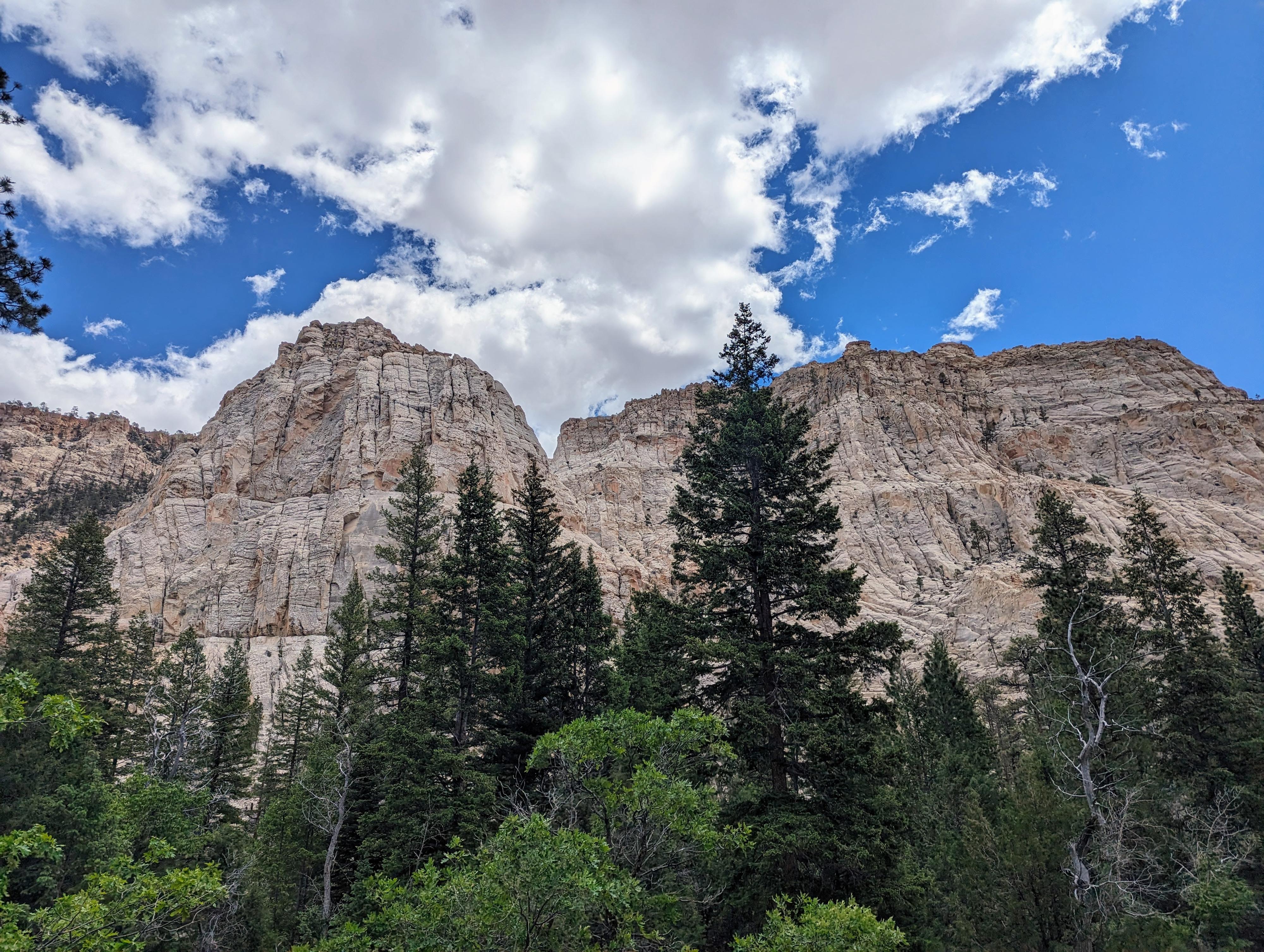
This upper section is more forested and narrow than the lower half, with very picturesque stripped sandstone escarpments lining the way. About 2 miles from the trailhead, a slick rock side canyon comes in on the left. It has an immense pothole at the bottom of it that is photogenic and a nice spot to stop for a break.
Continuing down, it is more of the same. Small spots are available throughout that would make good campsites for small groups. It is about 4.6 miles to where Deep Creek comes in on the right. The creek is an easy step over, and marks approximately the half-way point of the hike. This is also, to my eye, where the character of the hike changes. The canyon begins to be more open with broader views and less densely forested. From Deep Creek down, there are more and larger campsites available.
From Deep Creek to the Lower Trailhead (5-ish miles)
Heading down from Deep Creek, the canyon widens. About a mile below Deep Creek, just before a major slick rock side canyon comes in on the left, is a large area that is clearly used frequently as a campsite nestled among several trees. If you are curious, there are 34 stream crossings to this point! The slick rock side canyon is quite scenic and an excellent place to watch a sunset.
Continue down, still crossing the stream frequently, but not nearly as constantly as the upper section. The canyon is getting wider with fewer trees, and more slick rock/sand. Though the trail is becoming more well travelled from hikers coming up from the bottom, the sandy bottom surrounding the creek can make finding the trail, especially at a few of the crossings, a bit tricky. If you seem to lose the trail, take the time to hunt around and re-find it. Usually, this occurs when you missed a crossing. We had it happen twice, but both times it took only a minute or two to backtrack and find the missing crossing.
This section also starts to have larger and deeper pools as the gradient of Pine Creek relents a bit. On a hot day, there are several good swimming hole options. I was surprised to see many of the deeper holes teaming with good size fish.
About 4.5 miles from the campsite, The Box cuts through its finally slick rock slopes and reaches the lower cattle fence. Just a couple of minutes past the fence is the old trailhead that is now closed. From the old trailhead, follow the old road back to the current trailhead, just a few minutes south.
Photos
Maps
")
")
12S 442507E 4202119N
37°57'54"N 111°39'16"W
12S 442693E 4201938N
37°57'48"N 111°39'09"W
12S 442745E 4201822N
37°57'44"N 111°39'06"W
12S 442818E 4201358N
37°57'29"N 111°39'03"W
12S 443509E 4199783N
37°56'38"N 111°38'35"W
12S 443244E 4196835N
37°55'02"N 111°38'45"W
12S 443458E 4195993N
37°54'35"N 111°38'36"W
12S 444114E 4190921N
37°51'51"N 111°38'07"W
12S 444060E 4190552N
37°51'39"N 111°38'09"W