 Hiking
Shivwits Arch
Hiking
Shivwits Arch
Virgin River Gorge
Overview
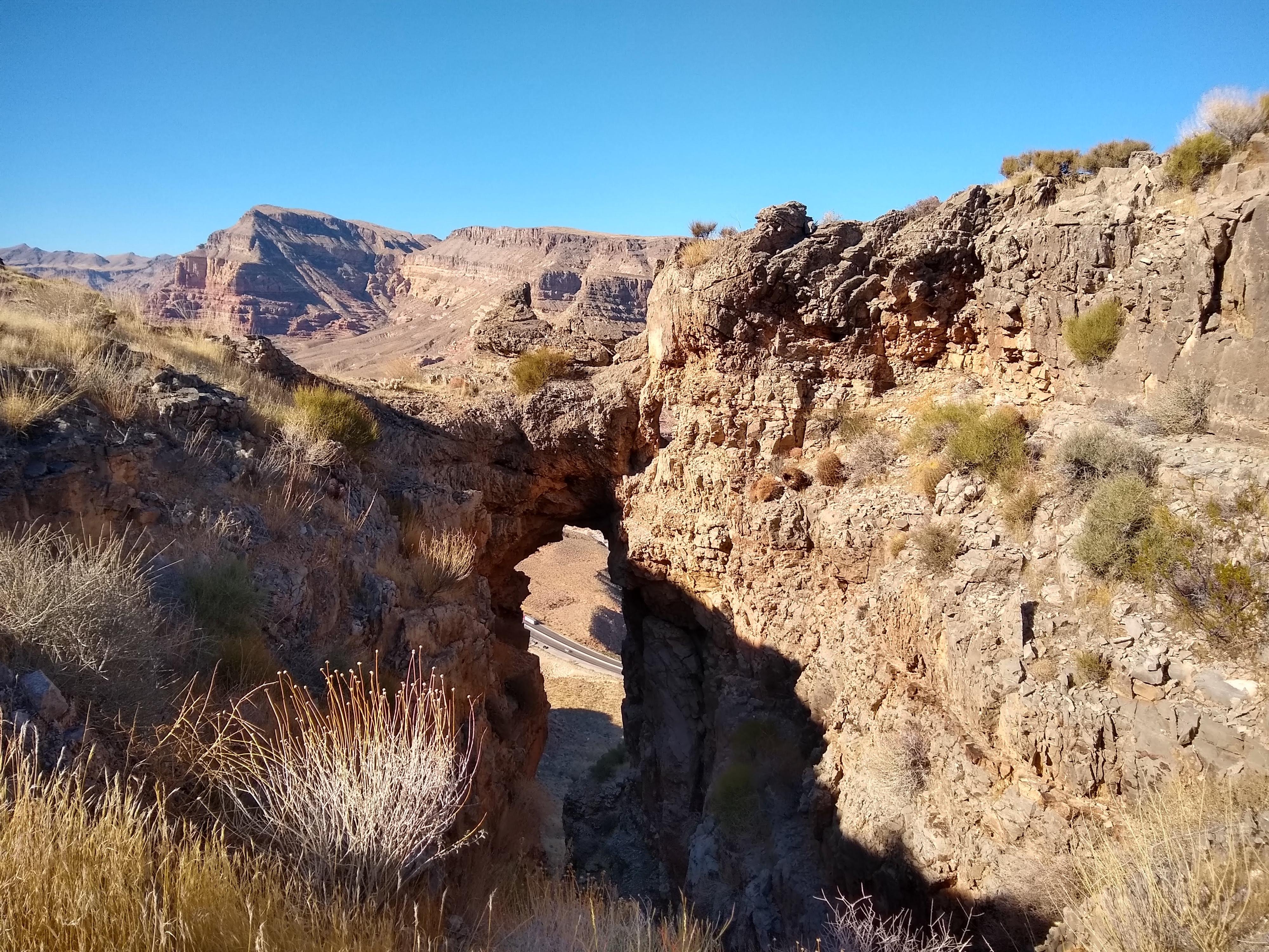
From I-15, Shivwits Arch looks like a tiny keyhole at the top of the ridge. This hike will take you right through the arch to a ridgeline with great views and the opportunity for a photo op on top of the arch. The route is quite steep in places and involves some route finding, scrambling, and a climbing move or two but if you are up for the adventure, you will enjoy this loop hike in the Virgin River Gorge.
The arch is named for the Shivwits Band of Paiutes, part of the Paiute Indian Tribe of Utah. The band currently refers to itself as See’veets eng, which means Whitish Earth People.
Getting There
The trailhead for this hike can only be reached while traveling north on Highway 15. If traveling south, exit at mile marker 18 at the Virgin River Canyon Recreation Area and do a u-turn.
Park in a large pullout at mile marker 23, shortly after the highway crosses the Virgin River.
Route Description
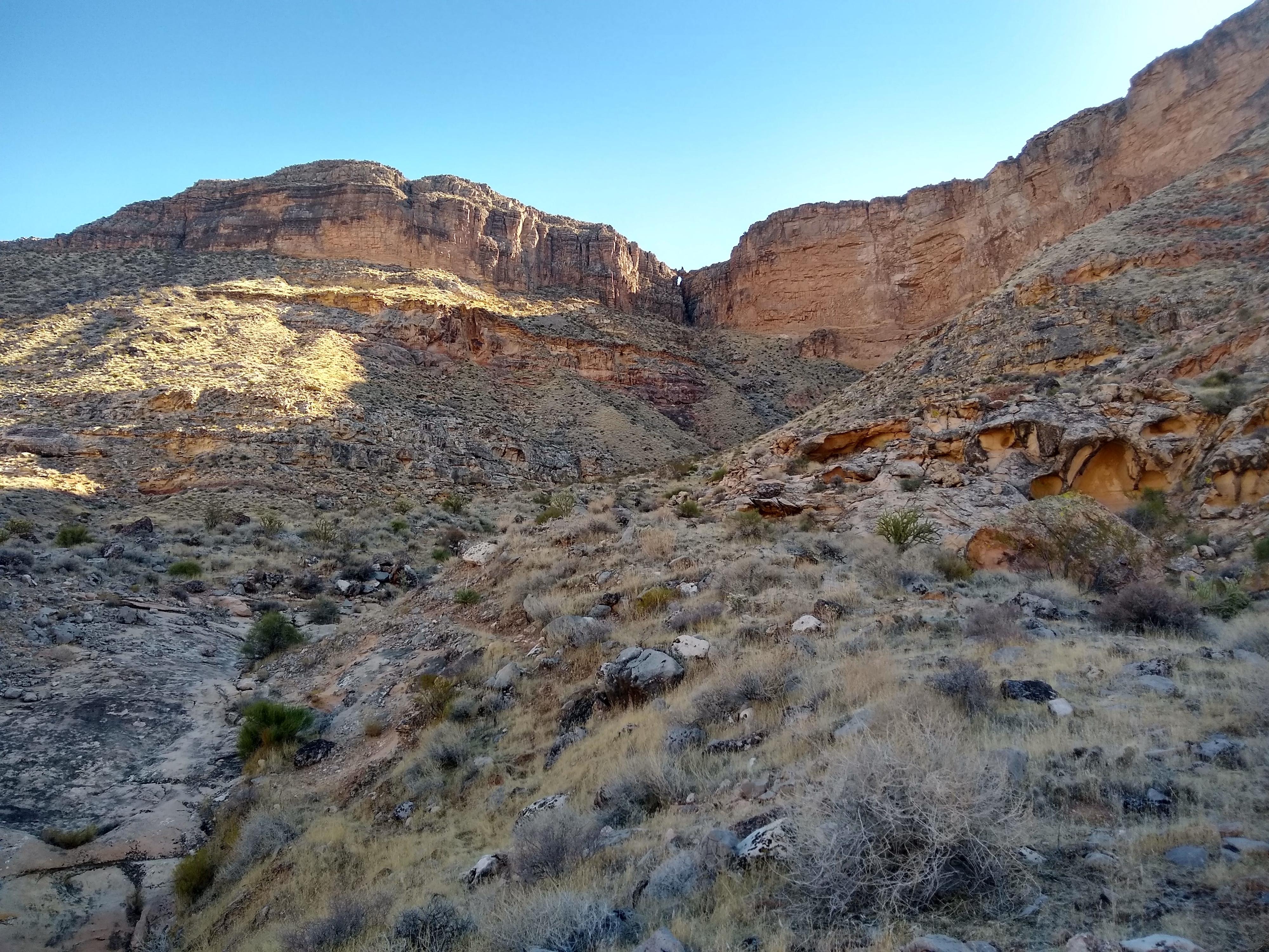
Find a place to crawl under the fence directly across from the parking area. Look up at the arch on the ridgeline and then make your way towards it. I stayed to the west of the wash most of the time, then dropped into the wash for a few minutes, and made my way onto some low angle boulders to the east of the wash in a bid to get onto more solid ground. I wouldn’t recommend the latter, though, because the boulders were flaky and covered in small loose rocks. As you get closer to the arch, you will be channeled into a shrubby gully that passes under the arch. Scramble up the gully, making easy climbing moves to get up one of the boulders in the way. Pass under the arch to reach the ridgeline. From here, climb onto the arch for a cool photo op or just enjoy the views all around.
The route up in December 2020 was not as loose as I had feared. Annual grasses interspersed with rocks and shrubs held the dirt together and there were few places with a beat-in trail. If the hike becomes more popular, the path up could become an unpleasant gravely chute.
Descent
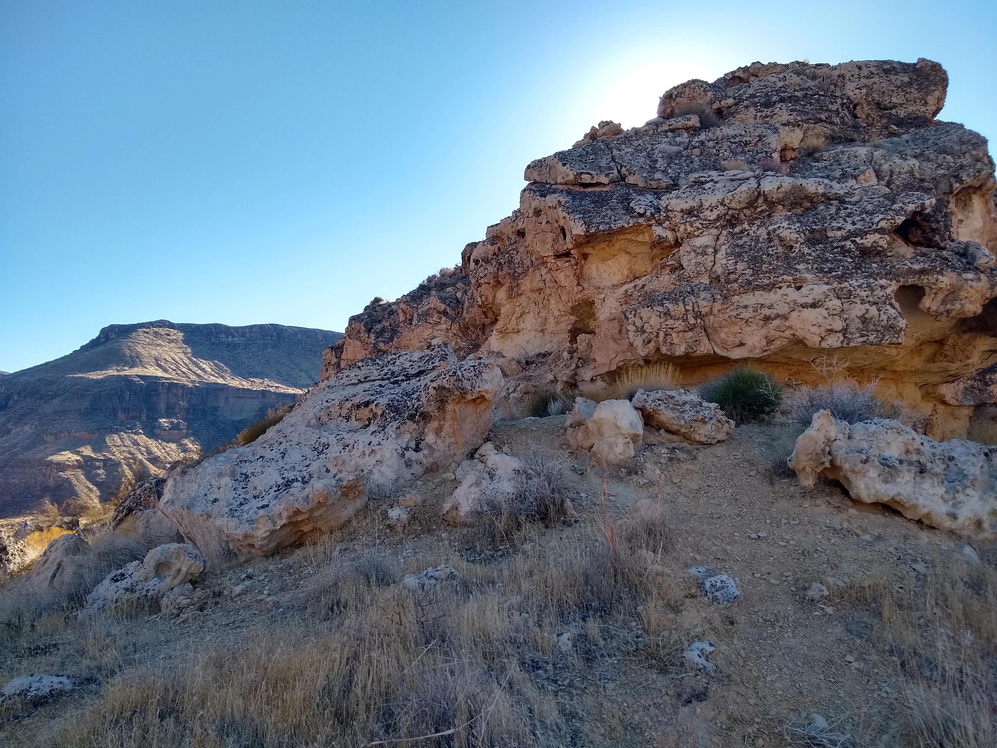
Head north on an obvious trail that goes across the ridgetop and then weaves down through boulders towards a saddle. Shortly before reaching the saddle, the trail will take you to a layer of rock where you need to find the right place to climb down. At the saddle, the trail becomes difficult to follow. I found a cairn on the western edge where I headed down and carefully made my way first south, then north and then south again along a series of rock ledges, taking care not to slip on the loose rocks and searching for safe places to descend. Cross a rocky drainage and then head back towards the parking area, either heading to the highway and walking on the shoulder (not recommended) or walking along uneven terrain until you get to the pullout, finding a new place to cross the fence or returning to the original crossing point.
Photos
Maps

12S 257788E 4095021N
36°58'13"N 113°43'15"W
12S 258309E 4094449N
36°57'55"N 113°42'53"W
12S 258489E 4094819N
36°58'07"N 113°42'47"W
12S 258540E 4095020N
36°58'13"N 113°42'45"W
12S 258182E 4095038N
36°58'13"N 113°42'59"W