 Hiking
Red Reef
Hiking
Red Reef
Leeds
Overview
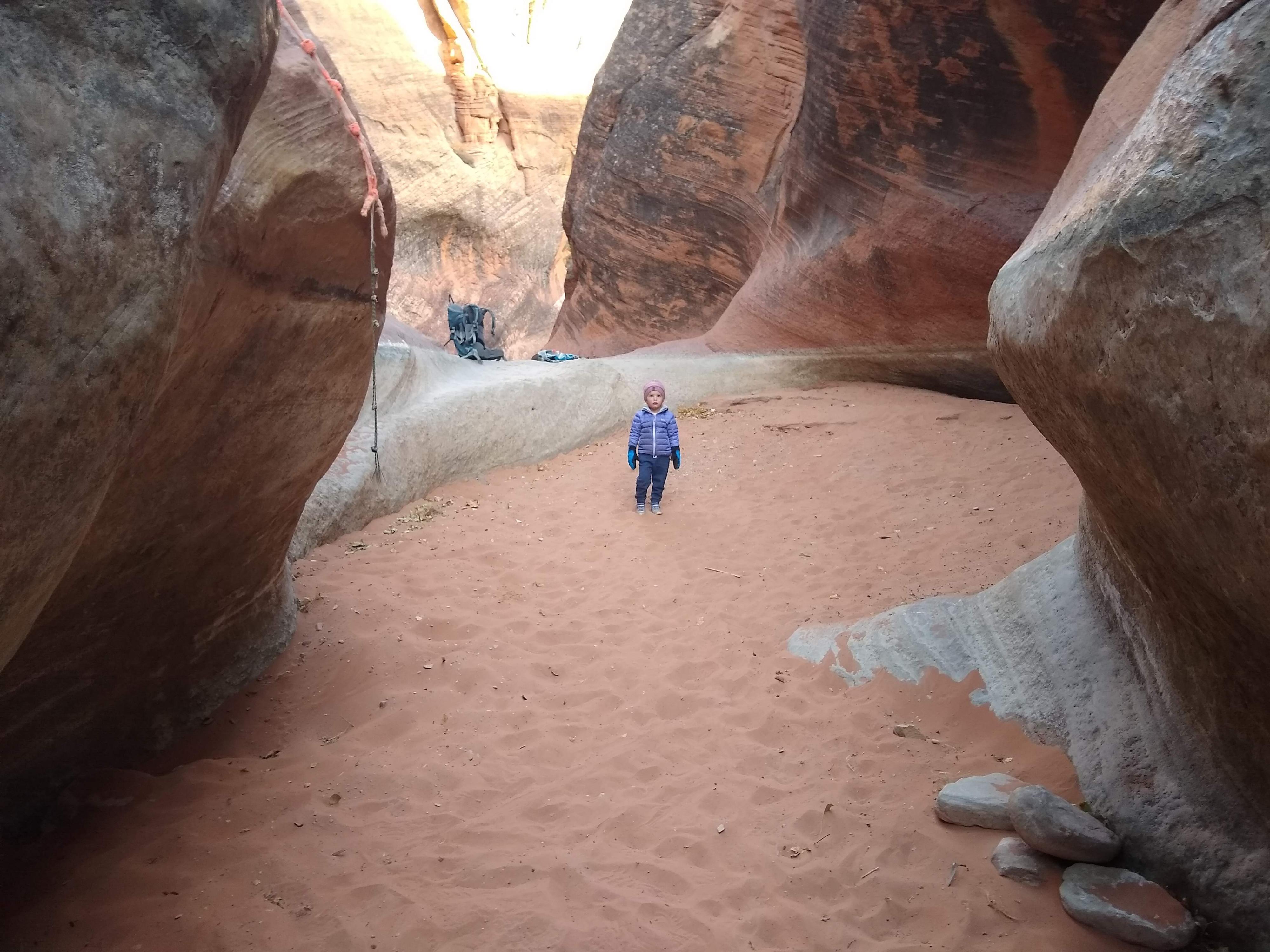
The Red Reef Trail from the Red Cliffs Campground is a great little hike that is fun for the whole family and has something neat to check out around just about every bend, including two waterfalls and an alcove with pictographs. I did this hike on a December day when the stream was frozen in places but still flowing well. In hotter weather, this hike is popular for swimming, but the stream often dries up by summer so swimming is probably best on a hot spring day.
Getting There
The trailhead is on the west side of I-15 near Leeds.
If coming from the north on I-15:
- Take exit 23 off I-15, go left under the freeway, then turn right on Main Street.
- Follow Main Street south through town and turn right at 3.5 miles. This is signed, and quickly goes under the freeway via a narrow tunnel. After the freeway, go left and follow the road 1.5 miles to the campground. The trailhead is signed at the very west side of the campground loop.
If coming from the south on I-15:
- Take exit 16, and travel toward Hurricane.
- A mile from the freeway, turn left onto 6300 W/Old Hwy 91.
- Follow Old Highway 91 for 4.1 miles. Turn left at 4.1 miles toward the signed Red Cliffs Campground.
- The road quickly goes under the freeway via a narrow tunnel. After the freeway, go left and follow the road 1.5 miles to the campground. The trailhead is signed at the very west side of the campground loop.
Route Description
Rock art and historic sites are fragile, non-renewable cultural resources that, once damaged, can never be replaced. To ensure they are protected, please:
- Avoid Touching the Petroglyphs: Look and observe, BUT DO NOT TOUCH!
- Stay on the Trails: Stay on the most used trails when visiting sites, and don't create new trails or trample vegetation.
- Photography and Sketching is Allowed: Do not introduce any foreign substance to enhance the carved and pecked images for photographic or drawing purposes. Altering, defacing, or damaging the petroglyphs is against the law -- even if the damage is unintentional.
- Pets: Keep pets on a leash and clean up after them.
- Artifacts: If you happen to come across sherds (broken pottery) or lithics (flakes of stone tools), leave them where you see them. Once they are moved or removed, a piece of the past is forever lost.
The hike begins by walking across a sandy sagebrush bench above Quail Creek. There are several braided paths and a social trail leading up a side canyon; try to stay on the main trail. The trail will soon drop down to the watercourse. Stay in the watercourse to the base of the first waterfall instead of following the trail when it heads out of the watercourse to the left. You can either backtrack to the trail after admiring the waterfall or, potentially, scramble up the red rock to the left of the pool below the falls.
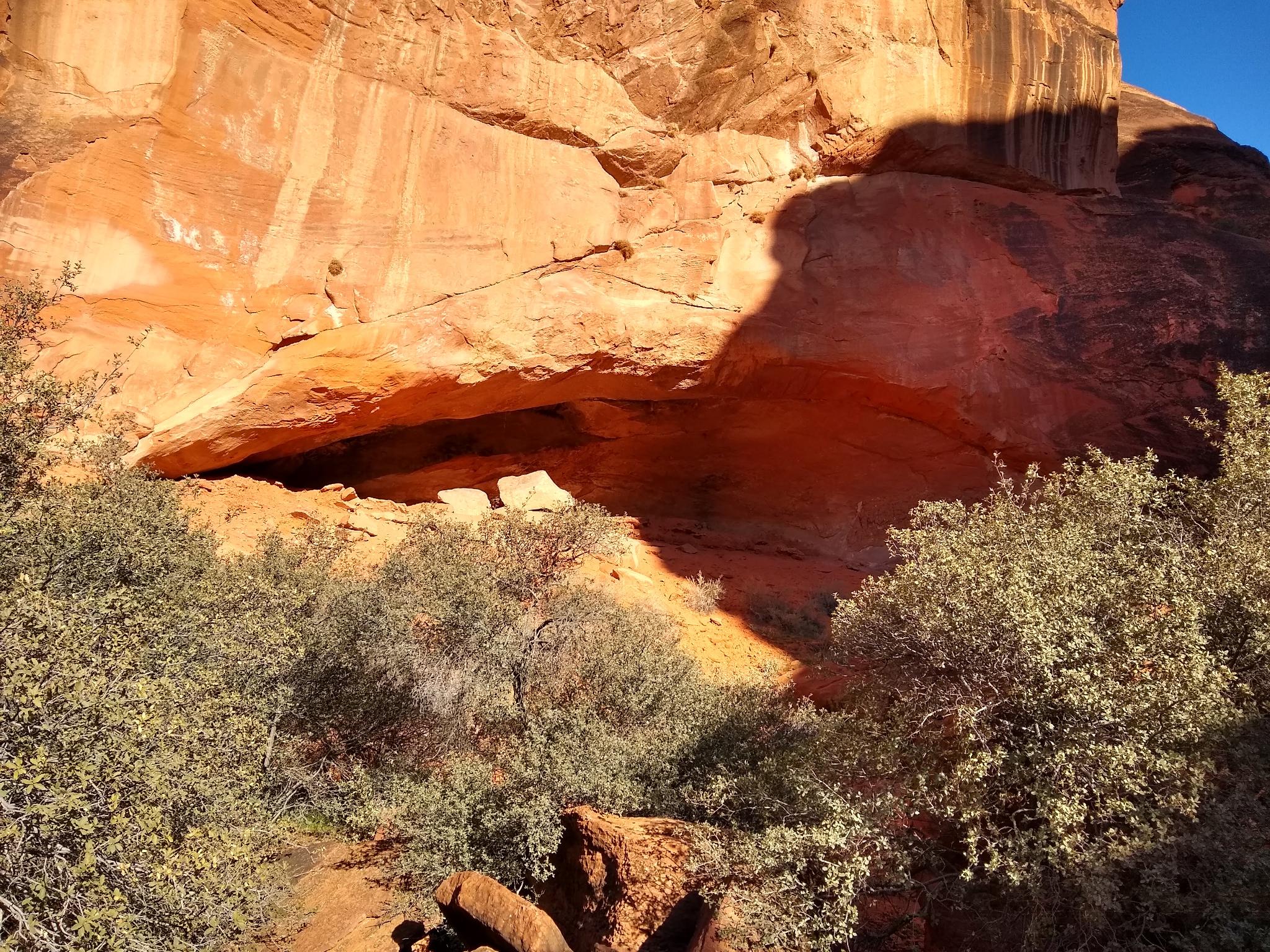
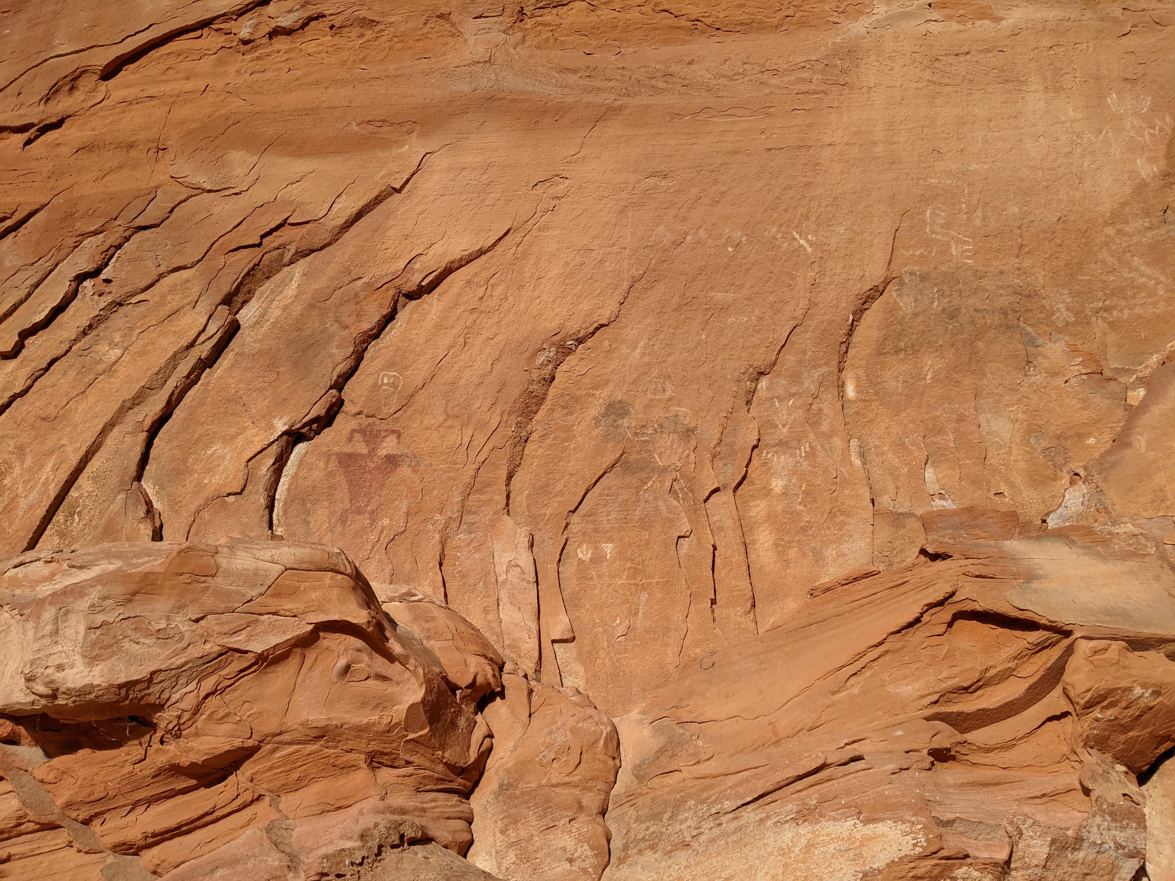
After bypassing the falls, you will soon notice a large alcove up canyon to the right. I followed a faint social trail across the creek, up a wash, and then cross country to the alcove. You’ll see some graffiti inside the alcove as well as a darkened roof from many past fires. Two pictographs in red can be seen outside the alcove to the left.
Follow the social trail back across the creek to the trail and continue up canyon. The canyon narrows and the trail crosses the creek, with rocks in place when I was there to hop across on. Soon you will come to two pools, each at the base of a small fall. I skirted the first pool on the left and scrambled up the side of the falls using moki steps and stopped at the base of the second falls. There are moki steps up the right side of these second falls and, when I was there, a fixed rope. I turned around here and headed back the way I came, making for a lovely 1.5 mile hike round trip.
Maps

12S 286523E 4122476N
37°13'28"N 113°24'22"W
12S 286147E 4122896N
37°13'41"N 113°24'38"W
12S 286116E 4122915N
37°13'42"N 113°24'39"W
12S 286118E 4122944N
37°13'43"N 113°24'39"W
12S 285989E 4122993N
37°13'44"N 113°24'44"W